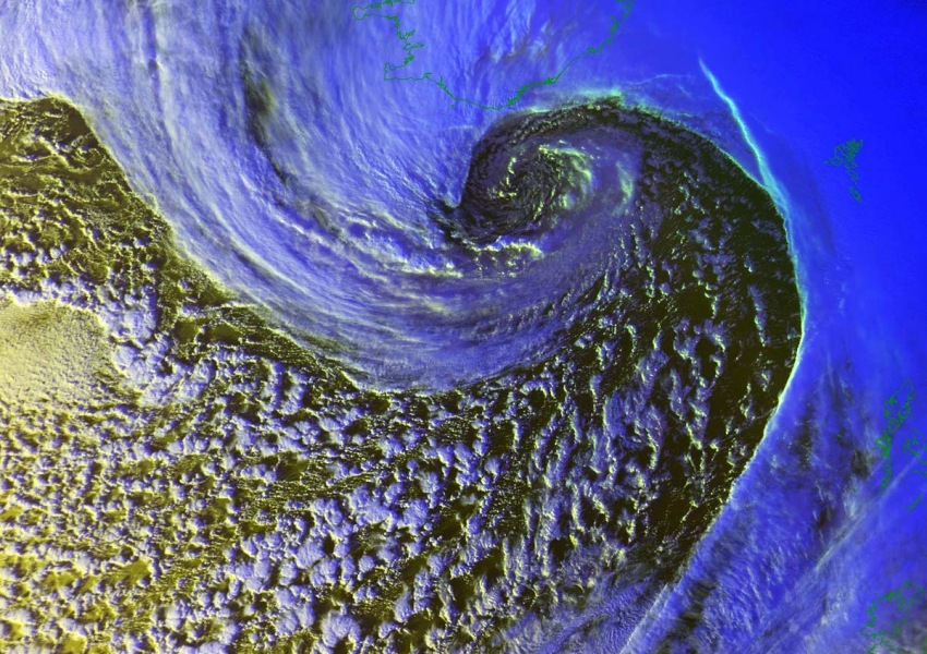
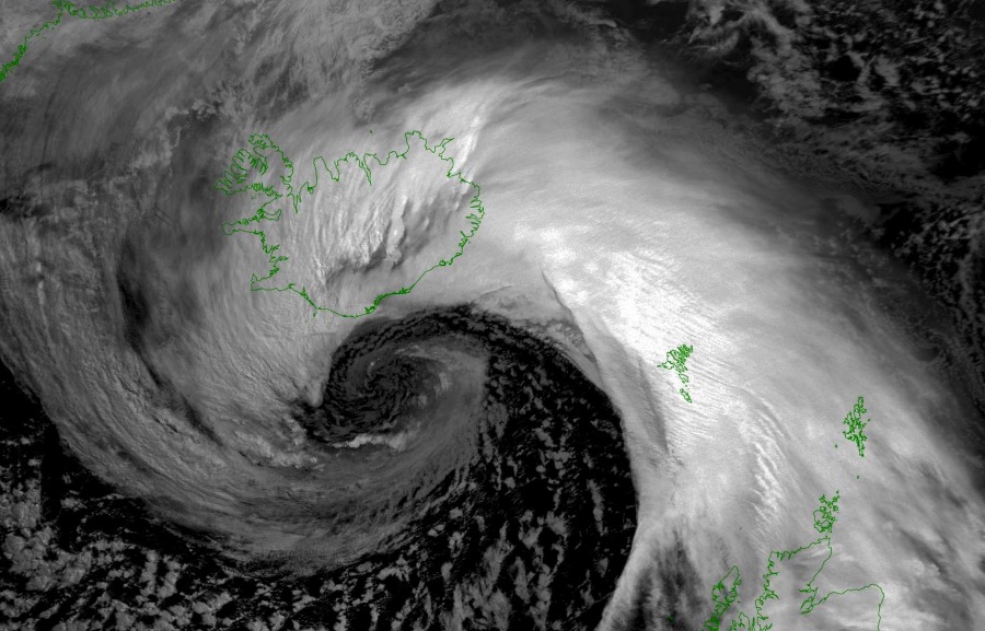
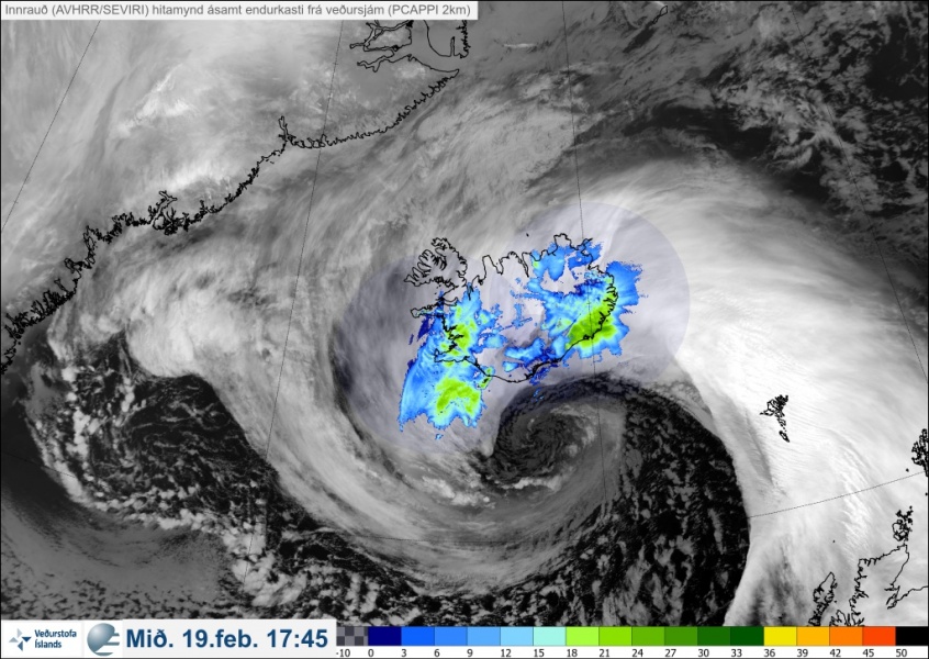
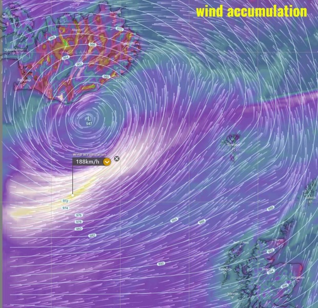
The intense extra-tropical (bomb) cyclone over the North Atlantic is now nearing Iceland, a violent windstorm is underway just south of its core. It will likely stay away from any land areas. What are these frontal systems producing this winter season is spectacular. The satellite presentation is exceptional! The system will be moving northeast tonight, while it begins gradually weakening tomorrow, nearing Northern Europe. In its wake, another rapid cyclogenesis is expected from eastern Canada towards the Labrador Sea tonight.
*********************************************
*********************************************
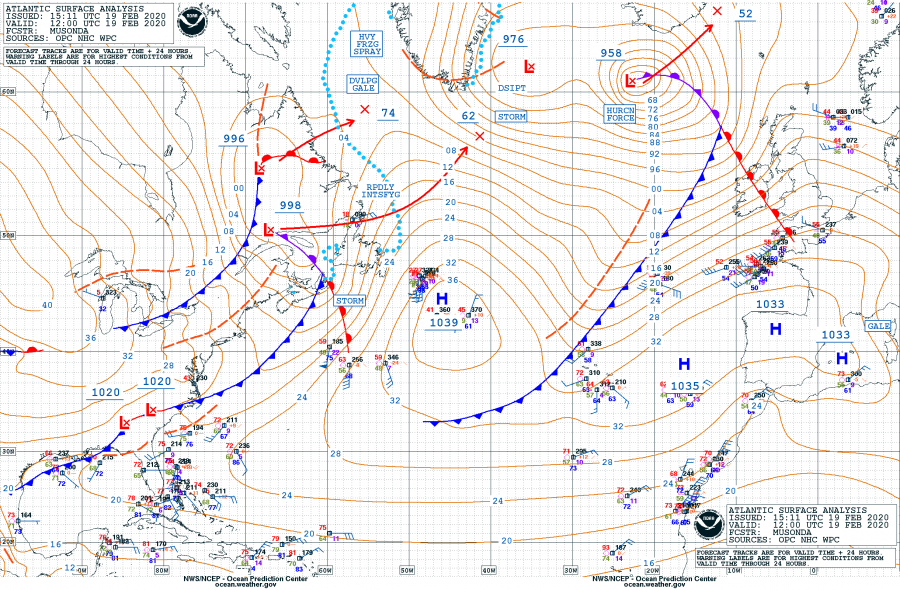
Here are the minimum pressure estimates (by NOAA OPC forecasters) in the center since cyclone’s birth on Feb 17th; the pressure was analyzed at 958 mbar at 12 UTC today, Wednesday, Feb 19th – this means the pressure drop during the past 12 hours was an incredible 23 mbar, while the change in the past 24 hours was 37 mbar, well beyond the threshold for a ‘bomb cyclone’ classification. The intensification rate has been remarkable since this morning! Notice there is also another 998 mbar depression over eastern Canada which is expected to rapidly intensify tonight and tomorrow morning, into a near 960 mbar cyclone. Centered south of Greenland around noon on Thursday.
- 958 mbar at 12 UTC, Feb 19th
- 972 mbar at 06 UTC, Feb 19th
- 981 mbar at 00 UTC, Feb 19th
- 984 mbar at 18 UTC, Feb 18th
- 995 mbar at 12 UTC, Feb 18th
- 1006 mbar at 06 UTC, Feb 18th
- 1012 mbar at 00 UTC, Feb 18th
- 1014 mbar at 18 UTC, Feb 17th
- 1019 mbar at 12 UTC, Feb 17th
Note: The explosive cyclogenesis/bombogenesis (bomb cyclone) occurs if the central pressure decreases by 24 mbar (hPa) or more in 24 hours period.
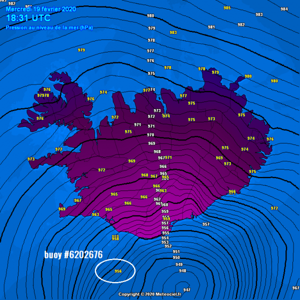
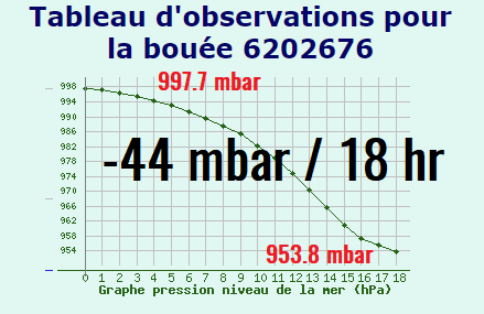
The system has been approaching Iceland today and its center is now just south of the island. Preliminary estimates suggest it’s minimum central pressure is already below 950 mbar! We have marked an Oceanic buoy #6202676 where an impressive 44 mbar pressure drop has occurred today, in 18 hours period. The cyclone’s center is passing to its east, so it didn’t even get the main pressure gradient and change:
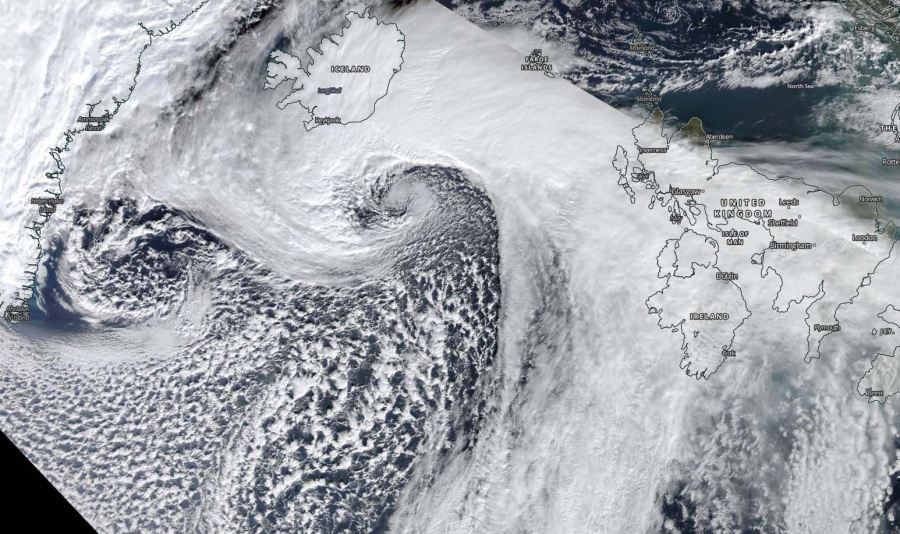
What an incredible satellite presentation once again, a textbook cyclonic structure with a massive dry conveyor belt wrapping into the core. Sting-jet wind maximum is also visible, likely (and thankfully) resulting is extremely intense winds in excess of 160 km/h (= 100 mph) just south of Iceland, to the immediate south of the cyclone’s center. Attached are Infrared, Visible and Water Vapour channels.
Here are high resolution close-up images of the cyclone’s center in Visible and Infrared channels:
The latest ICON-EU model peak gusts swath guidance until Friday. We can see the cyclone’s center is passing towards northeast just south of Iceland with its core around the mid 940s. A violent narrow swath of violent winds is spread between Iceland and the Faroe Islands, but severe winds are also pushed towards Faroes and Scotland.
Stay tuned for further updates! See the previous discussions:
*Update* on the new intense North Atlantic cyclone – explosive development underway!
