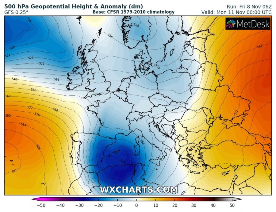
The progressive pattern across Europe will also bring a deep trough towards the SSW Europe early next week, with a deep long-wave trough pushing a deep core into the SW Mediterranean. Some models are hinting a development of a deep cyclone with the potential of the warm-core system in the western Mediterranean on Monday and then another even stronger warm-core cyclone over the Tyrrhenian sea on Tuesday. Let us take a look over some details on the models.
The pattern over the weekend into early next week supports a long-wave trough digging far south into SW Europe and into the Mediterranean. Based on the latest runs today, Friday, Nov 8th, the trough will likely transform into a large upper low with a deepening core on early Monday. Additionally, this will result in a rather rapidly deepening surface cyclone.
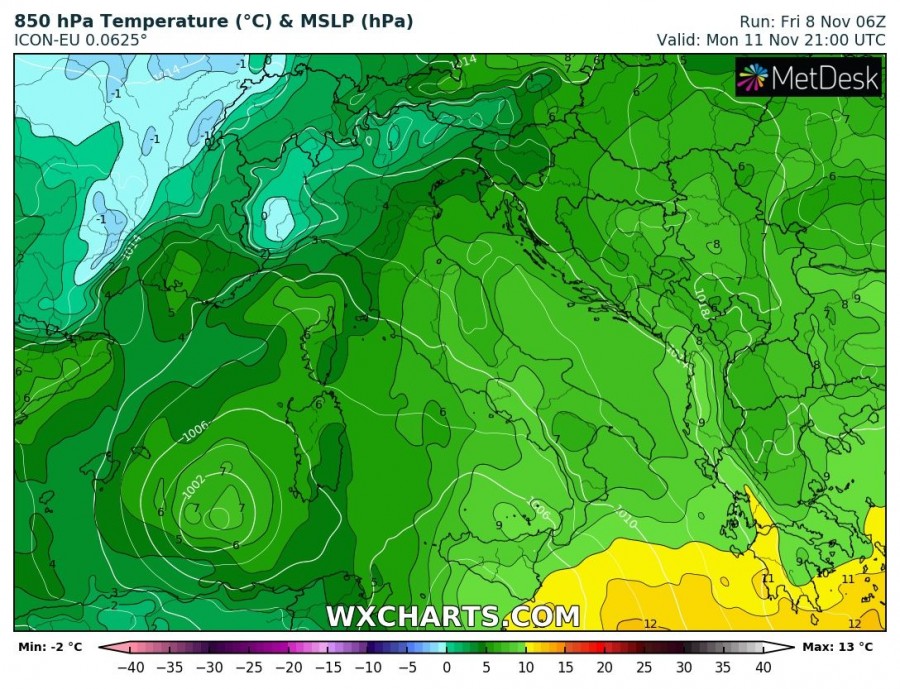
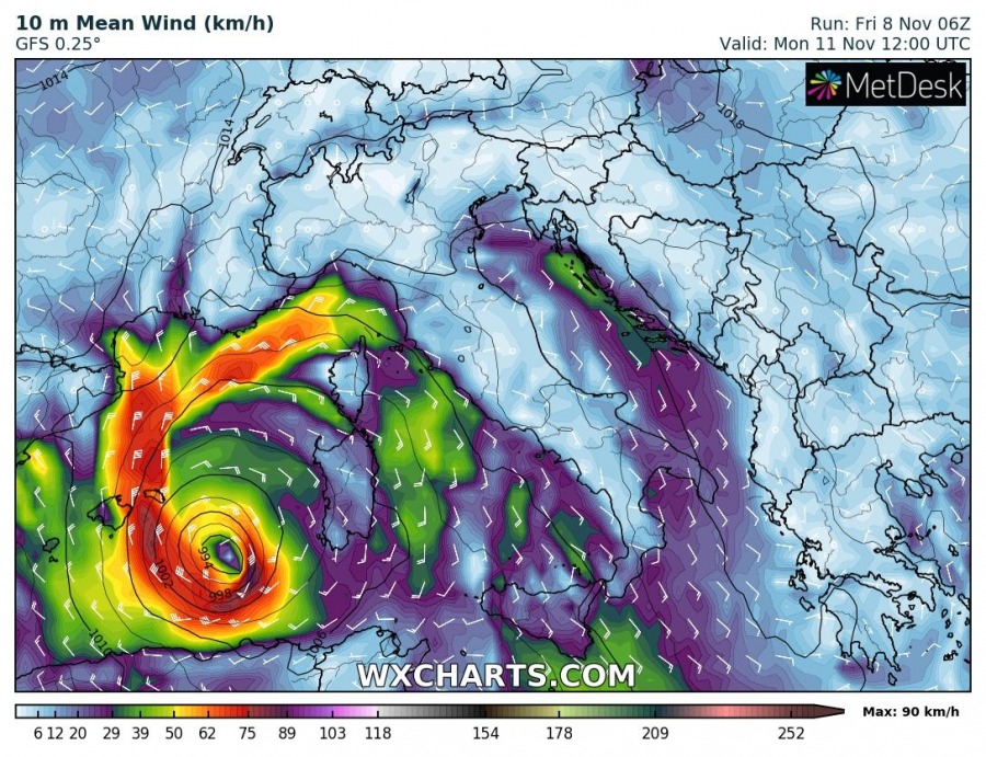
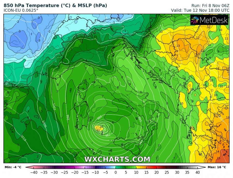
What models are hinting is the rising potential for the development of a warm-core cyclone sometime on Monday while the whole core / cyclone will be moving south towards Algeria. Looking over the 850 mbar temperature forecast, models are suggesting the warm-core. As a result, an intensifying wind field could occur as cyclone continues deepening further.
A cyclone then goes inland into Algeria and Tunisia overnight to Tuesday and recurves back north into the Mediterranean on Tuesday afternoon. As supported by the upper-level pattern, it will maintain a very deep cold upper core drifting east across the Mediterranean. At the surface, cyclone re-intensifies and soon forms a potentially strong warm-core / medicane system again.
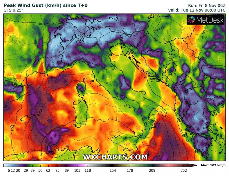
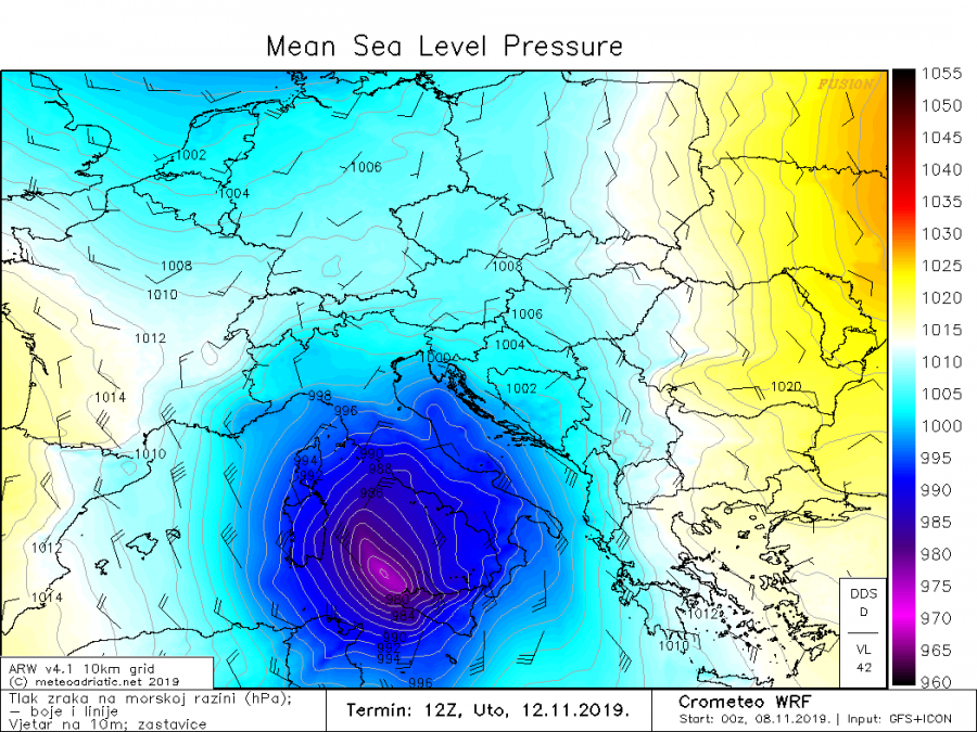
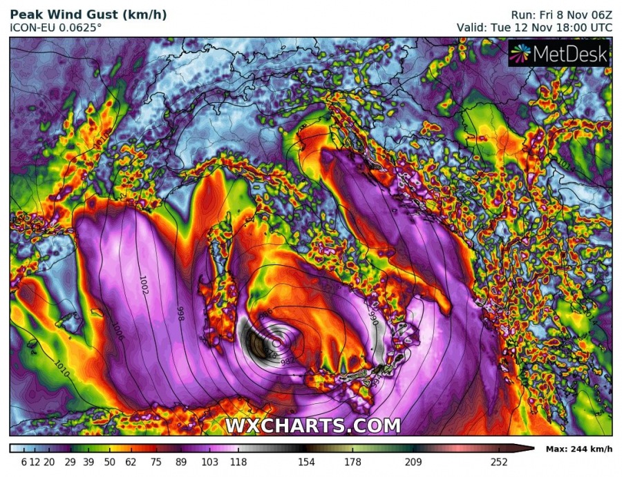
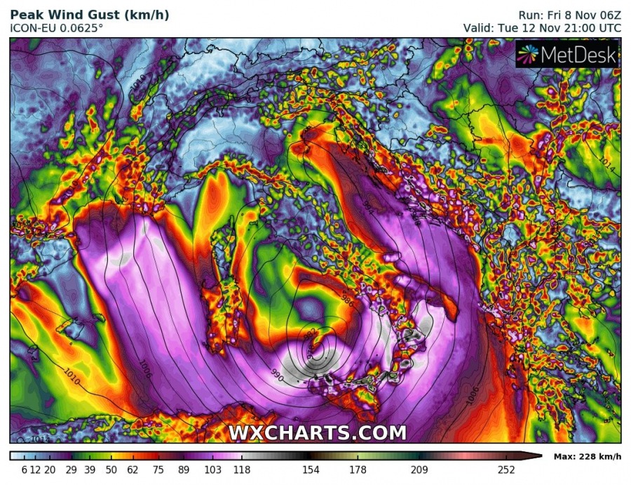
As for now (still 3 days out), the ARW model is very aggressive – attaching a couple of surface pressure maps of medicane moving across the Tyrrhenian sea. Associated with such intense cyclone, the wind field would result in damaging extremely severe winds in the region. Indeed too far in advance to provide more details, but the potential is there for a dangerous windstorm across Sicily, Sardinia or SW Italy – more details in the coming days!
Peak wind gusts associated with the second possible medicane over the Tyrrhenian sea – extremely severe winds in excess of 150 km/h would not be ruled out.
We are closely monitoring the evolution and will keep you updated – stay tuned this weekend!
Interested in our calendar? We are proud to present and promote the best weather photographers in Europe – see details:
