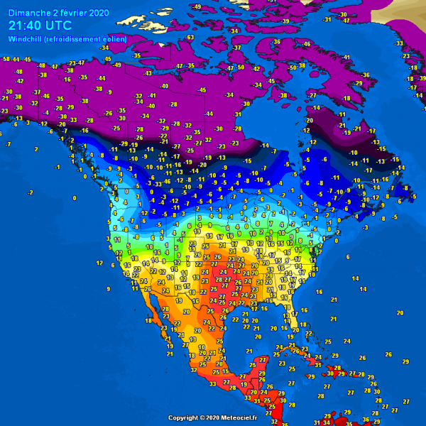
The developing Arctic cold outbreak over the Northwest USA today is expected to deliver some incredible temperature changes across parts of the south-central and southwest US in the next 48 hours. The current air mass with low 80s °F (= 27-28 °C) over Oklahoma and north Texas, or mid-70s over eastern Colorado, Nebraska and Kansas will be replaced with 50-60 degrees F lower temperatures by Wednesday. Winter cold weather will spread across the whole western half of US.
This is Sunday’s afternoon, Feb 2nd, temperature in °C – 28 °C over southern Oklahoma! That is 82 °F! Incredibly warm winter day also across Nebraska, eastern Colorado, Kansas and Texas.
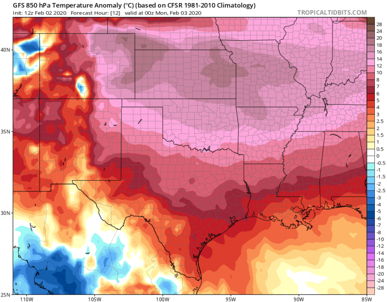
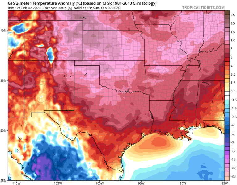
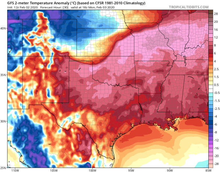
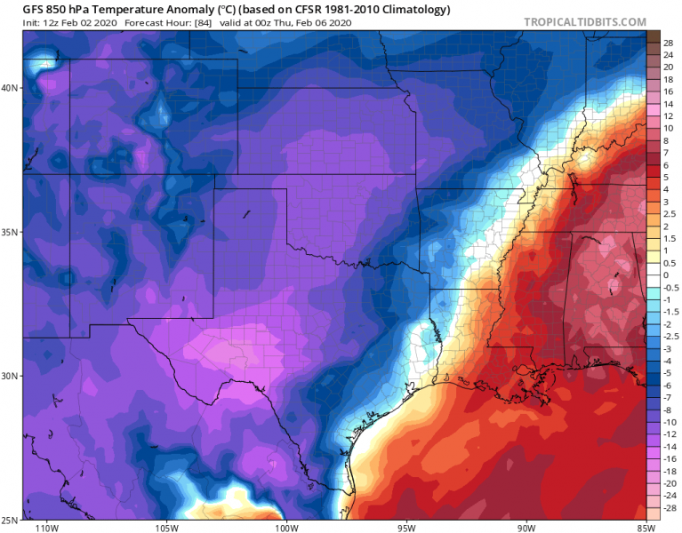
Here is an impressive forecast of the temperature anomaly across the south-central Plains in the coming days. Temperatures are *remarkably* warmer than early February normal with 15-20 °C above normal today. The intense cold advection starts during the Monday afternoon from the Rockies, spreads the much colder air mass towards the Plains. On Tuesday and Wednesday, the air mass will already be 15-20 °C colder than average – that means the change will be significant! Literally from summer (almost 85F / 30 °C today) into cold winter days with 20-25 F!
Sunday, Feb 2nd
Monday, Feb 3rd
Tuesday, Feb 4th
Wednesday, Feb 5th
Please refer to the primary forecast regarding the cold outbreak across the western CONUS:
A cold outbreak is also expected across parts of Europe this week:
