Models are in good agreement with potentially very dangerous Medicane’s landfall on Peloponnese tomorrow. A slightly more northerly track should have some effect on the intensity as stronger interaction with the land could weaken Medicane somewhat. It does, however, remain a well organized deep cylcone and it will bring severe to locally extremely severe winds and potentially life-threatening flash floods in to the region along its track towards the Aegean sea this weekend.
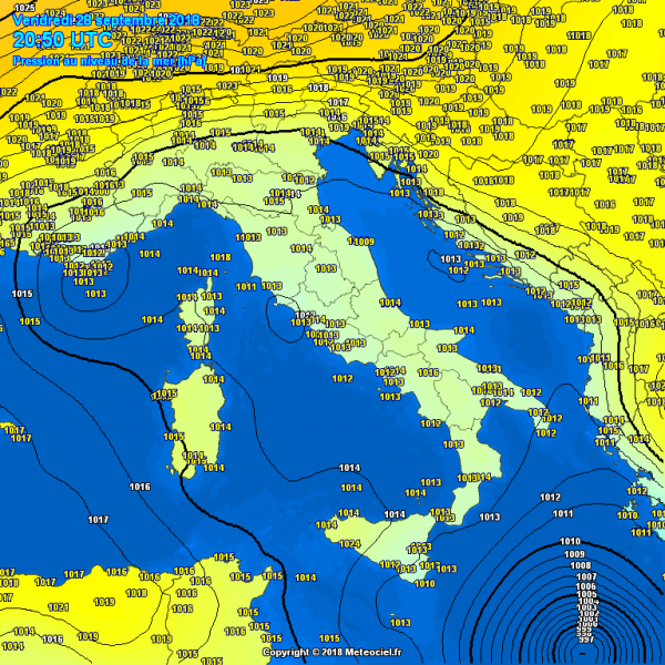
Evening pressure analysis and infrared satellite animation of Medicane:
An impressive MODIS visible satellite image in the afternoon hours.
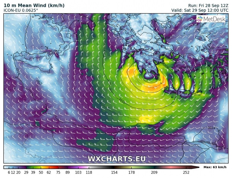
12 UTC ECMWF, ARPEGE and ICON-EU model runs, valid for midday tomorrow, indicate landfall in SW Peloponnese peninsula with sustained winds of around 70-90 km/h.
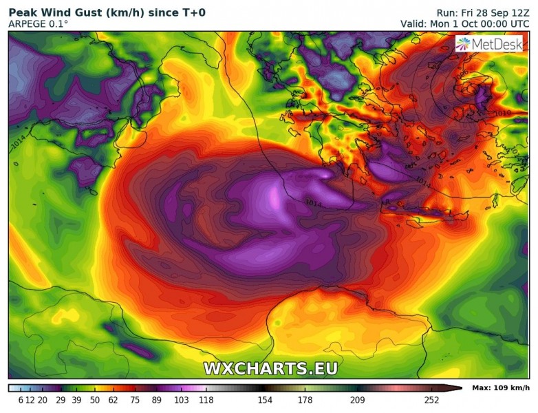
Peak wind gusts swath per ARPEGE and ICON-EU models: gusts of 110-140 km/h remain possible along the Medicane’s path. ICON-EU seems more aggressive with some re-intensification of the cyclone when it arrives back over the warm Aegean sea early Sunday morning. To be considered are also some severe storms possible outside the main convective bands where more shear and helicity is present – these storms can produce tornadoes or tornadic waterspouts!
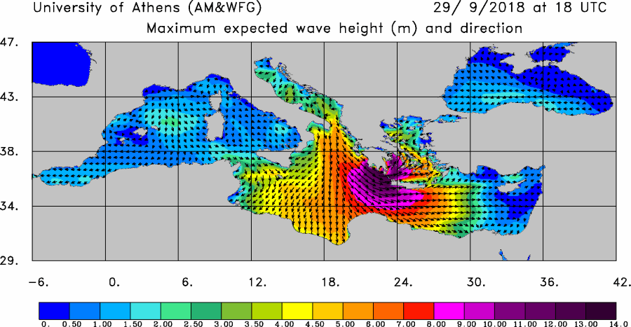
Here is the maximum wave height forecast for the whole day in 3-hour steps – the highest risk will be when Medicane will be prior to landfall around SW Greece and western Crete island. Maximum wave heights of 10-14 m are possible. Do note, however, that the majority of waves will be of somewhat lesser magnitude.
Expected rainfall accumulation has not changed much – a broad swath of excessive rainfall remains across the southern Greece into Aegean sea. 250-500 mm of rain within 48 hours period is expected locally! This will likely cause some sigificant damage where flash floods will occur.
The potential for damaging winds, high waves and extreme rainfall remains on track with previous outlooks – stay tuned for additional updates prior to landfall tomorrow!


