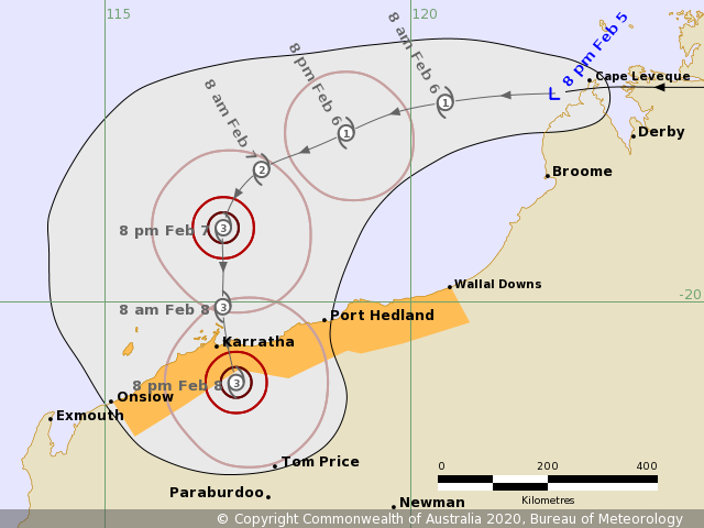
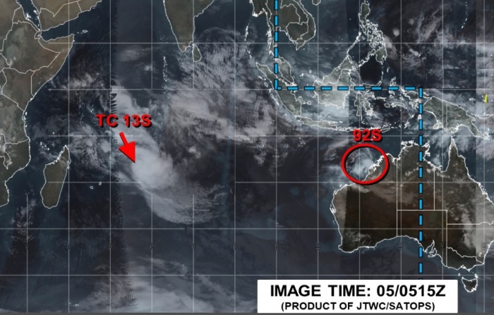
Tropical activity is back – there are two systems currently ongoing. A tropical cyclone Francisco over the South Indian Ocean and a newly born Invest #92S along the coast of Western Australia. This system is likely to intensify significantly in the coming days while moving north of the NW Australia coast and could potentially bring a dangerous landfall of this system as a severe tropical cyclone on Saturday!
*********************************************
*********************************************
Some Infrared and Visible satellite images today, quite a deep convection has been ongoing around the gradually forming system. Upper-level outflow is looking quite healthy – should support additional organizing convection in the coming days.
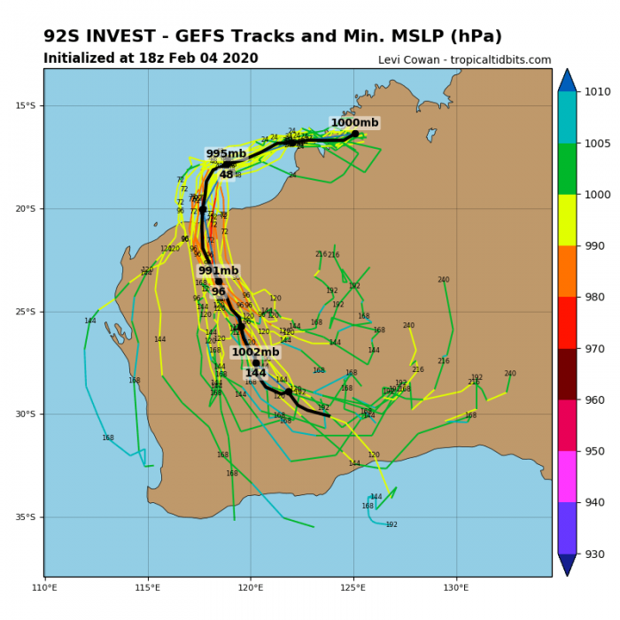
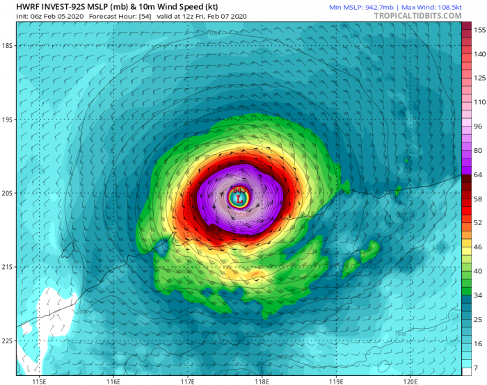
The future track of #92S will bring it due west-southwest for another 36-48 hours while it will be intensifying steadily. Then, it turns south and heads towards the potential dangerous landfall in NW Australia this weekend:
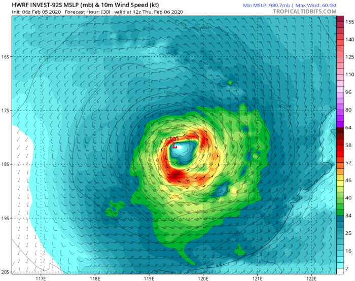
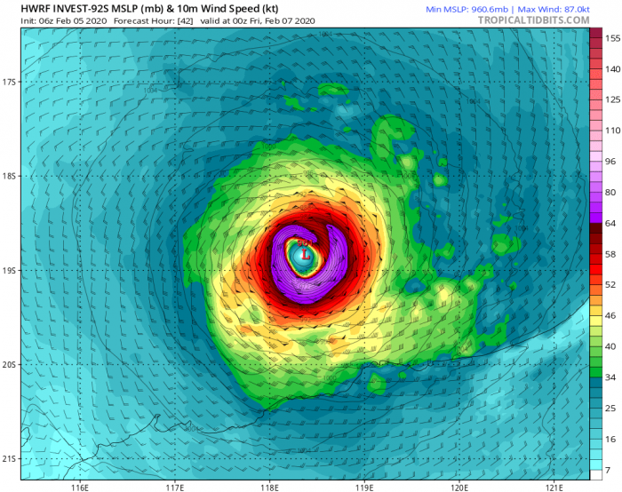
As simulated by the HWRF model, cyclone might actually go into rapid intensification during its last 24 hours prior to landfall. Very warm sea waters could support explosive development of the system while it is approaching the coast of NW Australia through late Friday and early Saturday. Indeed it is still quite some time for all the details, but the current trends are leaning this way.
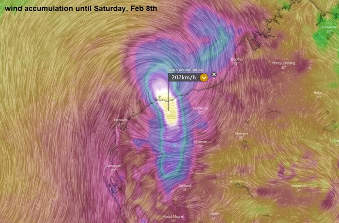
Close-up view of the wind gusts per ECMWF model; it is quite similar to the HWRF solution. Both are hinting a strong Category 3 tropical cyclone at landfall, with gusts above 200 km/h!
Models are also in quite a good agreement the system will deliver a lot of rain locally on the coast, significantly enhancing flooding potential. 300+ mm of total rainfall until Sunday! And indeed, rain is more than welcome for the drought relief as well there – notice also quite a lot of rainfall along the eastern parts of New South Wales where additional wildfires were raging lately.
There is currently another system ongoing in the tropics – the Tropical Cyclone #13S / Francisco – more on this shortly!
Stay tuned for further updates on #92S – we are closely monitoring its evolution.
See also – another tropical cyclone seems likely east of Australia, currently forming near Vanuatu:


