The latest July Weather forecast for Europe shows a brief break in the heatwave pattern with a low-pressure system and a cooler airmass next week. But another subtropical ridge pattern is currently forecast to return around mid-month with a low-pressure area locked to the north.
First, we will look at a strong June pattern, and how it shaped a very warm Summer start. Then we will focus on the week-by-week breakdown of the latest July forecast, and the shifting weather patterns over mid-summer.
STRONG SUMMER START
The meteorological summer covers the three warmest months of the year: June, July, and August. It is based on actual weather patterns and temperatures. June was the first summer month, and it can already bring strong heat waves across a large part of the continent.
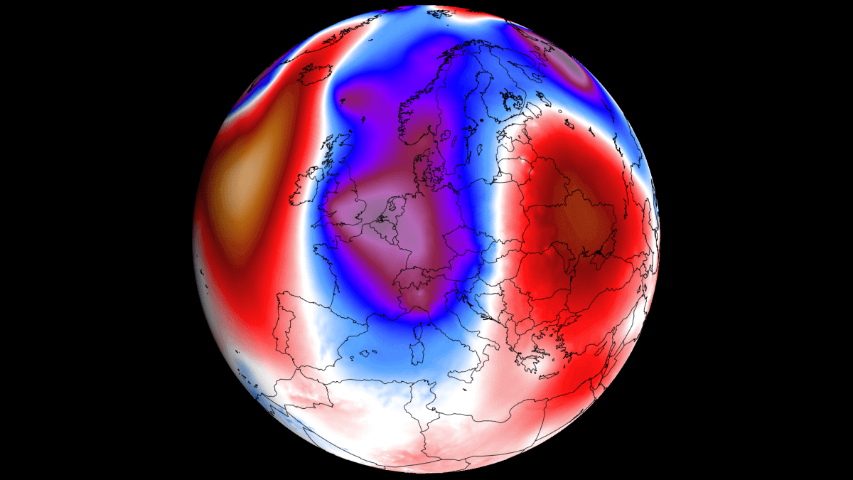
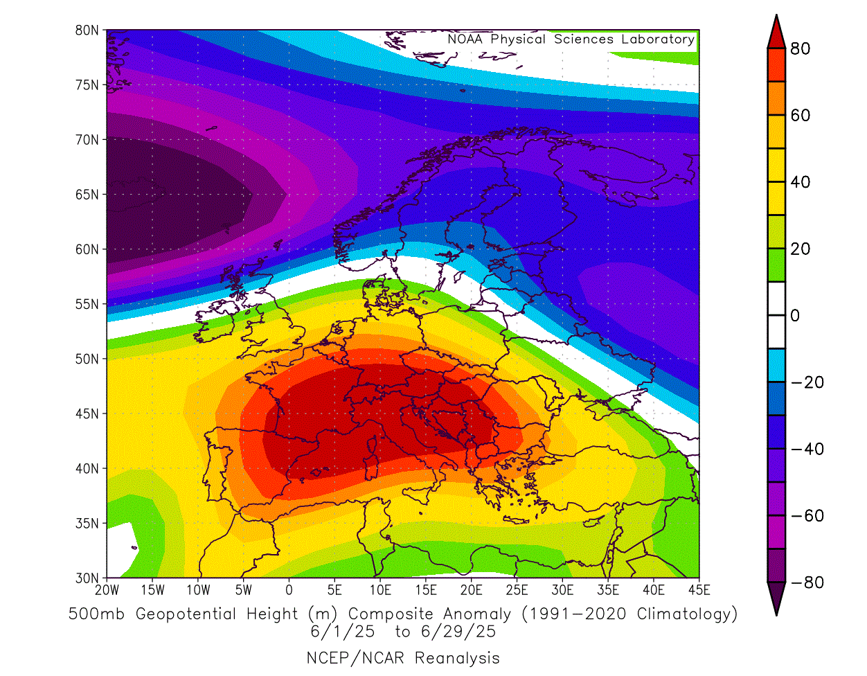
Below is the pressure analysis of the June weather pattern over Europe, and you can see a very strong pressure difference from north to south. A powerful subtropical ridge completely took over southern and central Europe, while a persistent low-pressure area locked down the northern parts.
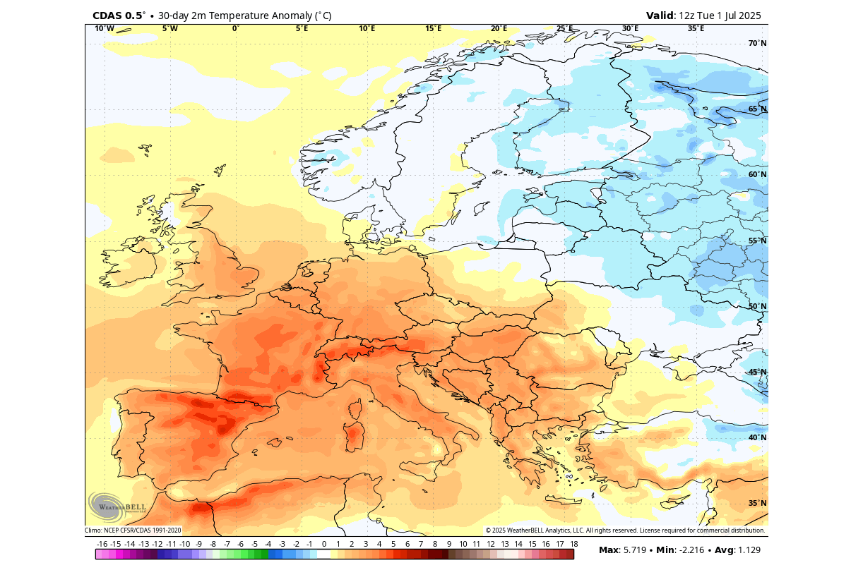
This brought an unseasonably warm airmass into a large part of Europe, with the exception of the far northern and eastern parts. The image below is a 30-day average, with the daily anomalies reaching far higher values over the west-central parts. There were several days with temperatures rising over 40°C in parts of southwestern and west-central Europe.
Below is the precipitation analysis for June, and you can see that a large part of southern and parts of central Europe received below 10-15% of the normal precipitation. An area over central Europe spanning from eastern France to Poland shows near-normal rainfall, which is a result of plenty of storm activity.
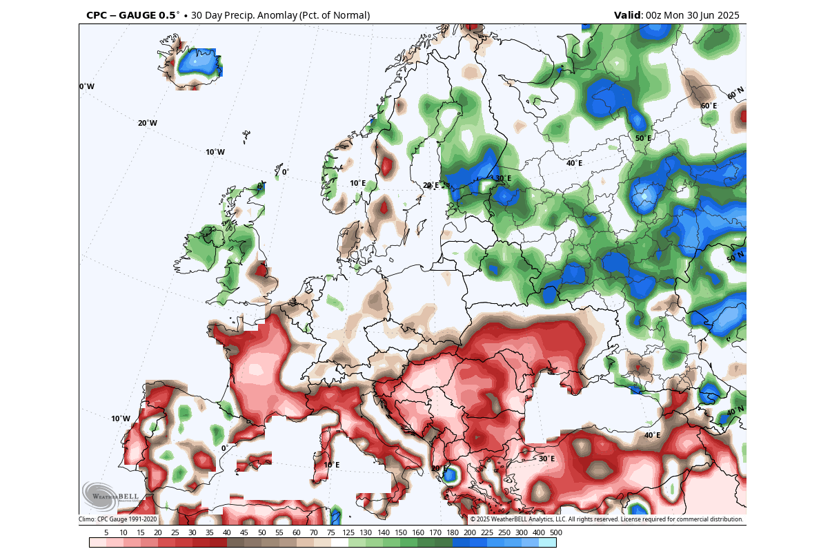
This is a significant drought pattern over the southern half of the continent. But there was more rainfall over the northern and eastern parts, under the influence of the low-pressure area. You can also see a spit pattern over the UK and Ireland, with more precipitation over the western parts and a rainfall deficit over the southeastern UK.
JULY PATTERN BEGINS
Below is the pressure anomaly forecast for the first week of July. You can see a strong low-pressure area developing over northern Europe, and a ridge rising over the Atlantic and the east-central parts. A low-pressure trough is starting to dive down from the UK into the central parts, bringing along a cooler northerly flow.
The temperature forecast for the same period shows warmer-than-normal weather over much of the central, southern, and western parts. A cooler airmass is spreading over the northern and eastern parts of Europe, with a cooler airmass already starting to engulf the UK.
The precipitation forecast for the first week of July shows more rainfall over the northern UK and parts of Scandinavia, associated with a cold front. Another area of rainfall is seen over the central parts around the Alps, as a weaker cold front is forecast to pass over the Alps in the coming days.
The rest of Europe is mostly drier than normal, with a stronger rainfall deficit over the Balkans.
A BREAK IN THE WARMTH
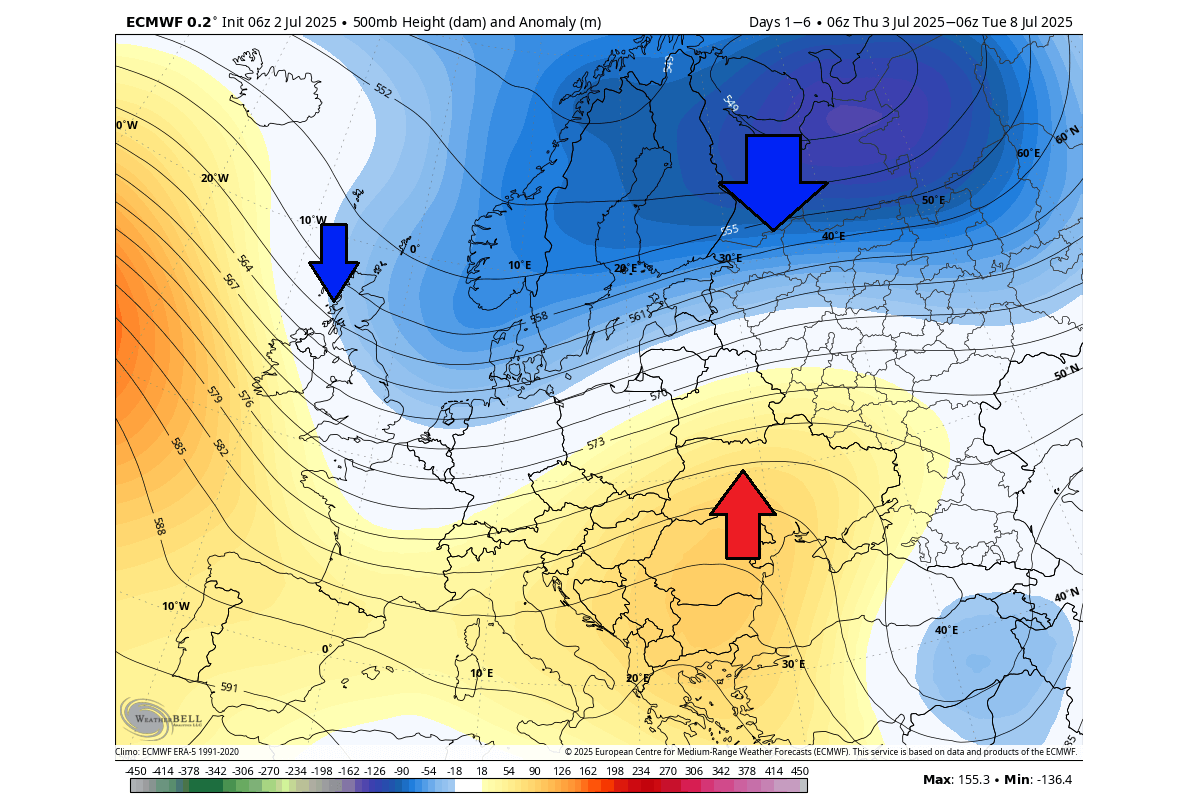
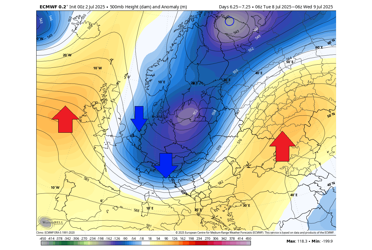
Looking at the latest pressure anomaly forecast for the second week of July, you can see a break of the usual pattern, and a transit of a low-pressure area, with a northerly flow into the western and central parts. This is a 5-day average, so it hides some of the details, but shows the average weekly pattern.
A ridge was pushed far to the east, with a new ridge starting to build behind the cold front over the west.
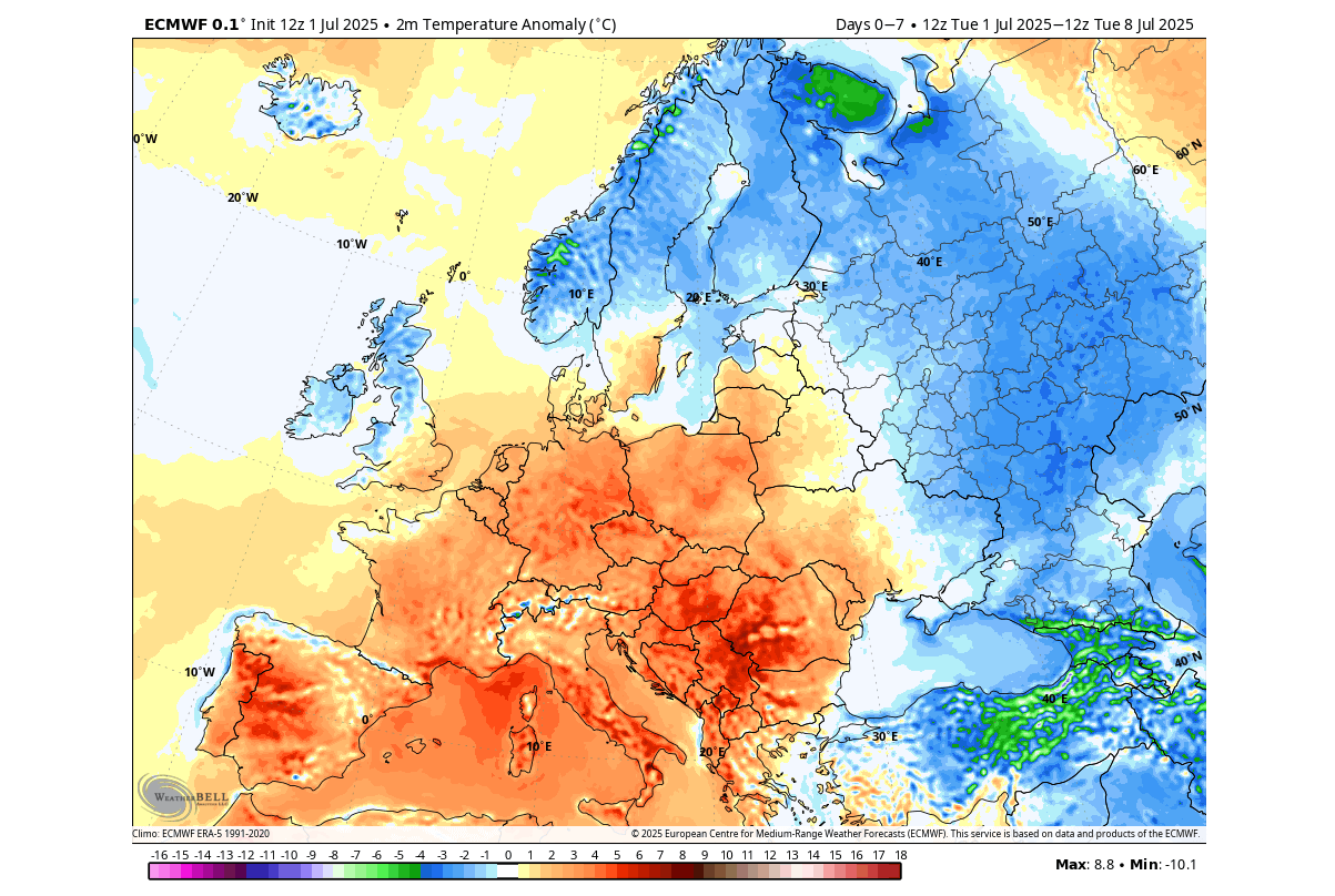
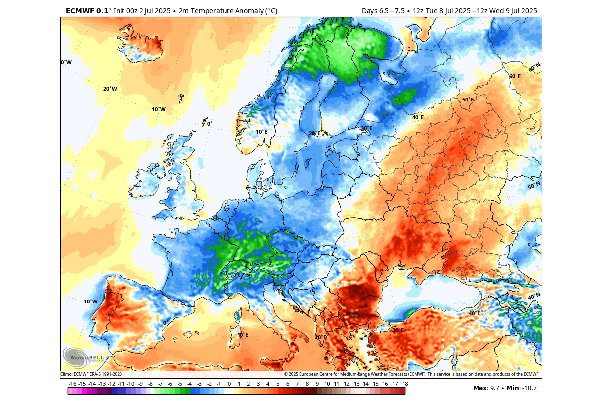
You can see the 5-day temperature forecast below for the same period. It shows the spread of the cooler air, bringing much-needed relief to the parts of central and west-central Europe. But as this is a 5-day average, it shows the anomaly over the whole period.
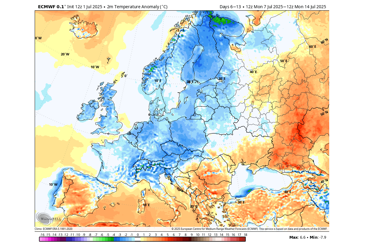
Looking closer at a single day forecast for mid-next week, you can see a pretty significant trough dropping down into central Europe. This brings a northerly airmass into the central and western parts, but also amplifies the warmer southerly flow towards the east.
This can be seen on the temperature anomaly forecast for the same day next week. Several areas over central Europe will see below normal temperatures during the passage of the front. A warmer airmass will rise over the east.
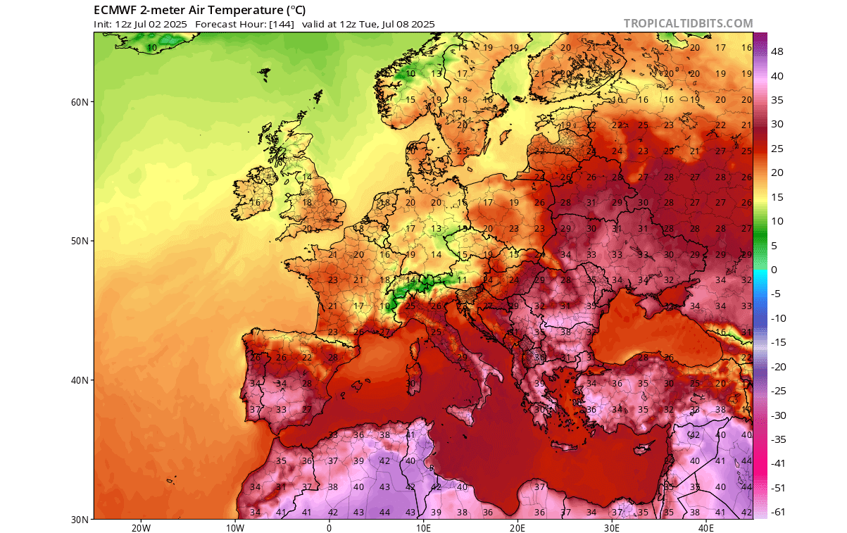
If we look at the latest forecast for actual surface temperatures, you can see temperatures from 15-20°C midday across a large part of central and west-central Europe. For many areas, these temperatures are almost or over 20°C lower than during the peak heatwave periods.
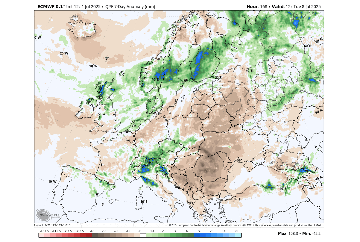
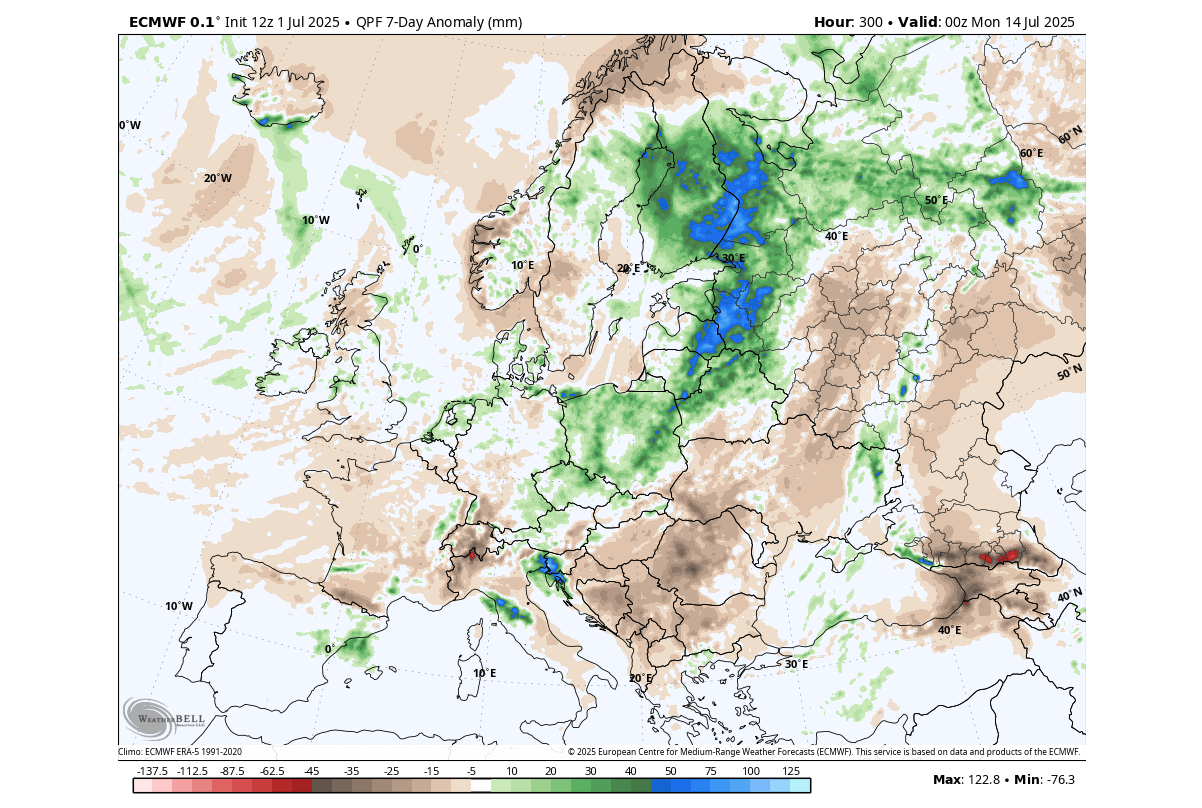
The precipitation forecast for this period shows the passage of a cold front over the central and northern parts of Europe. This also brings an increased severe weather potential from the northern Adriatic area towards the north. The rest of the continent is forecast to be mostly drier than normal.
As we go beyond this mid-July period, we shift to the “extended range” forecasting system of the ECMWF, which is basically a longer run of its ensemble forecast (EPS). It is good at revealing weather patterns and trends on a week-to-week basis.
A NEW SHIFT IN THE PATTERN
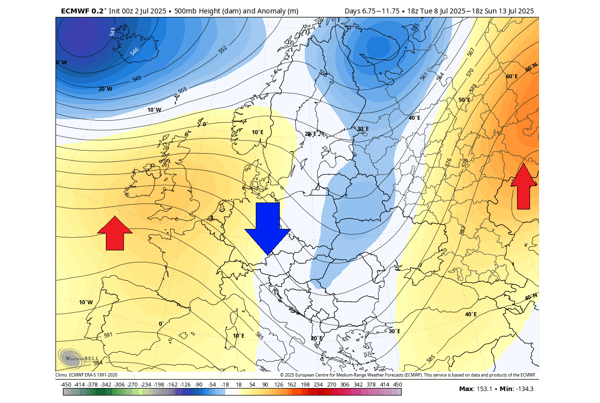
The third week of July will bring another pattern reset. The pressure forecast below shows another high-pressure area rising over western Europe, with a contrasting low-pressure area over the North Atlantic and over the far northeastern parts.
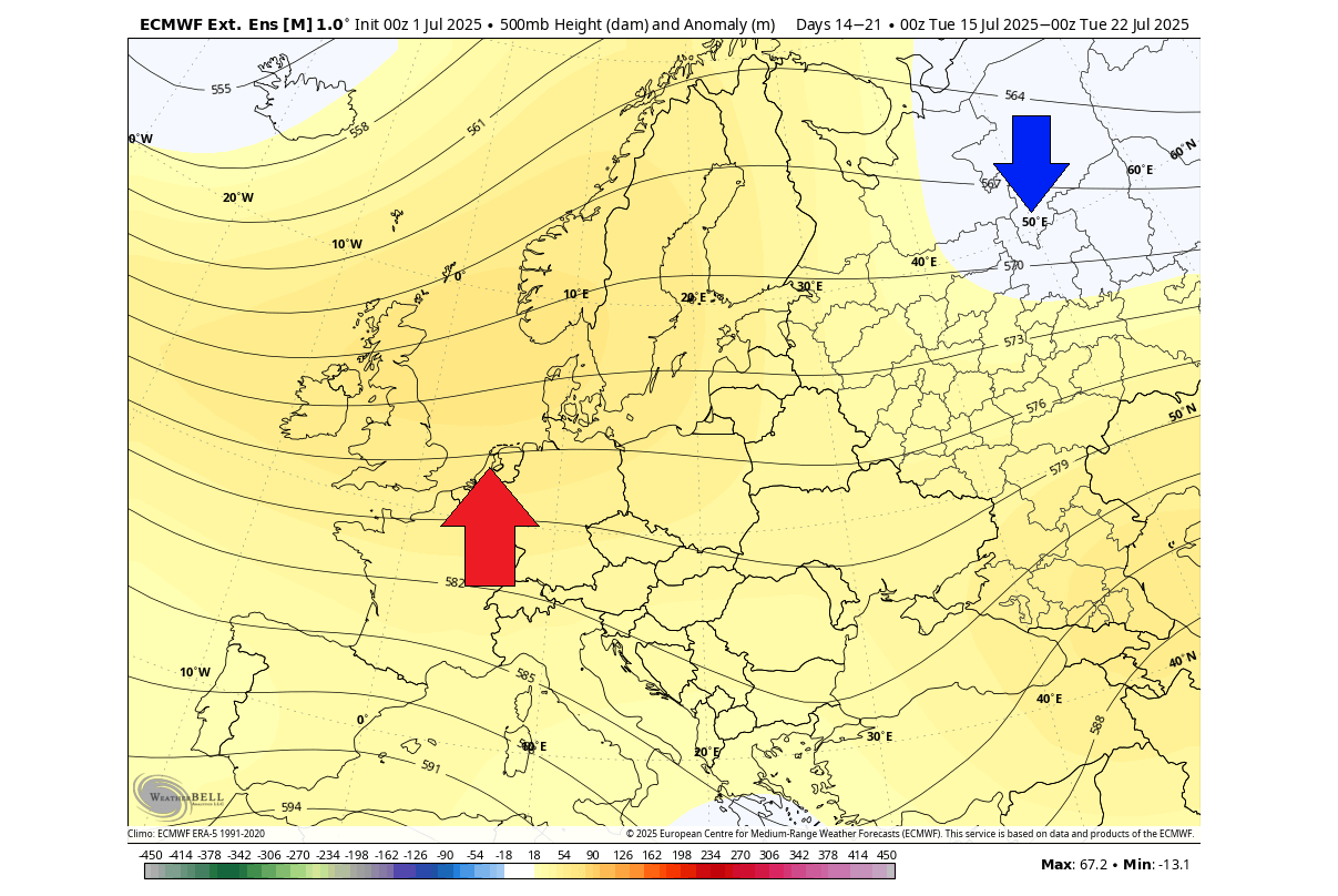
This means that a warmer airmass will return into western and central Europe, also reaching north into the UK. A cooler airmass will be over the north and northeast, but we are too far to indicate any breaches of the cold air into central parts.
This is just the latest forecast trend, which often understates the cooler anomalies. So as we get closer to this period, it is likely that the cooler anomalies will get stronger and expand over a larger area, if the pressure pattern persists.
The main rainfall area during this period is forecast to be pushed far to the north and northeast, limited to the main low-pressure areas. Most of the continent is forecast to receive less rainfall than normal in this period. This is an indication of another heat dome episode for a large part of western and central Europe.
The final week of July shows some change, in the sense that a low-pressure area from the north will expand and reach further down the continent. A high-pressure ridge is still seen to remain over western Europe.
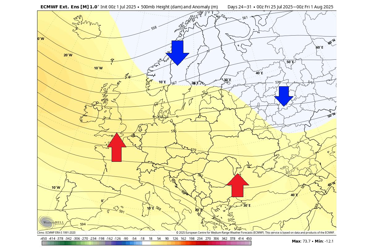
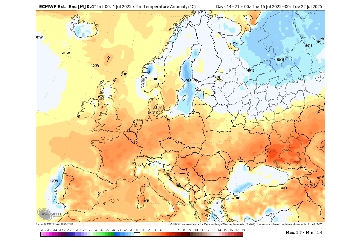
The temperature forecast is not much different from the previous week, still showing the strong heatwave signature over a large part of Europe. The exception is currently over the north, under the influence of a low-pressure area.
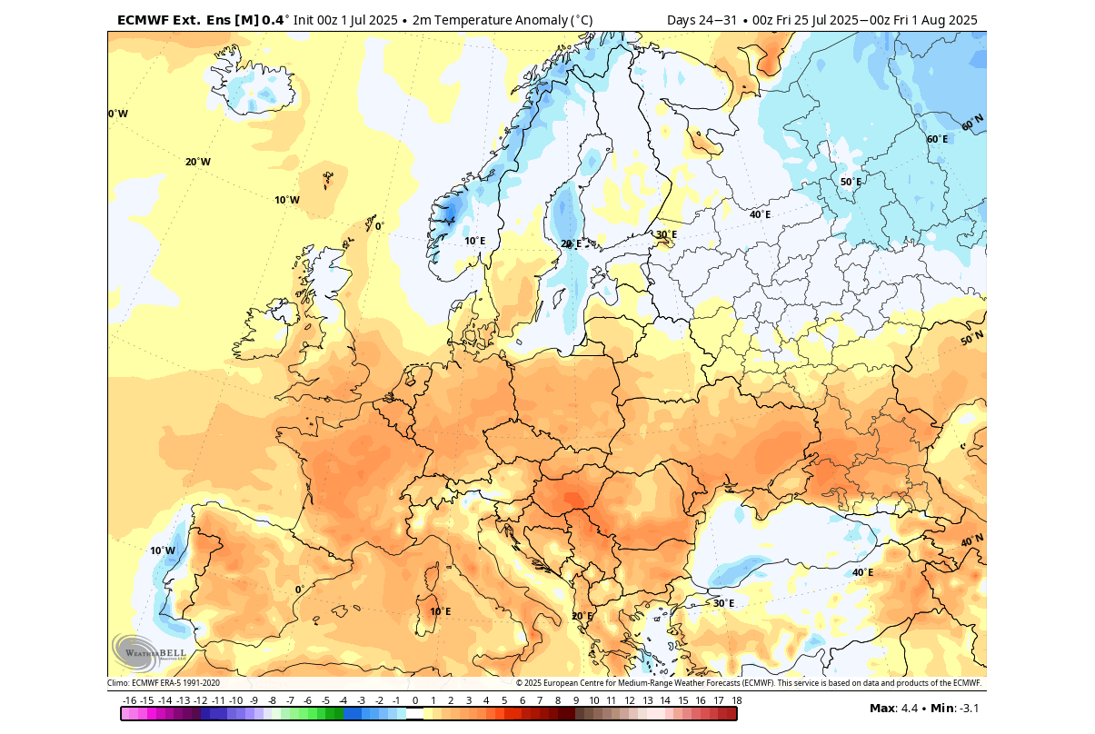
This pattern clearly brings an increased potential of another heat dome event over western and central Europe, reaching all the way into the southern UK.
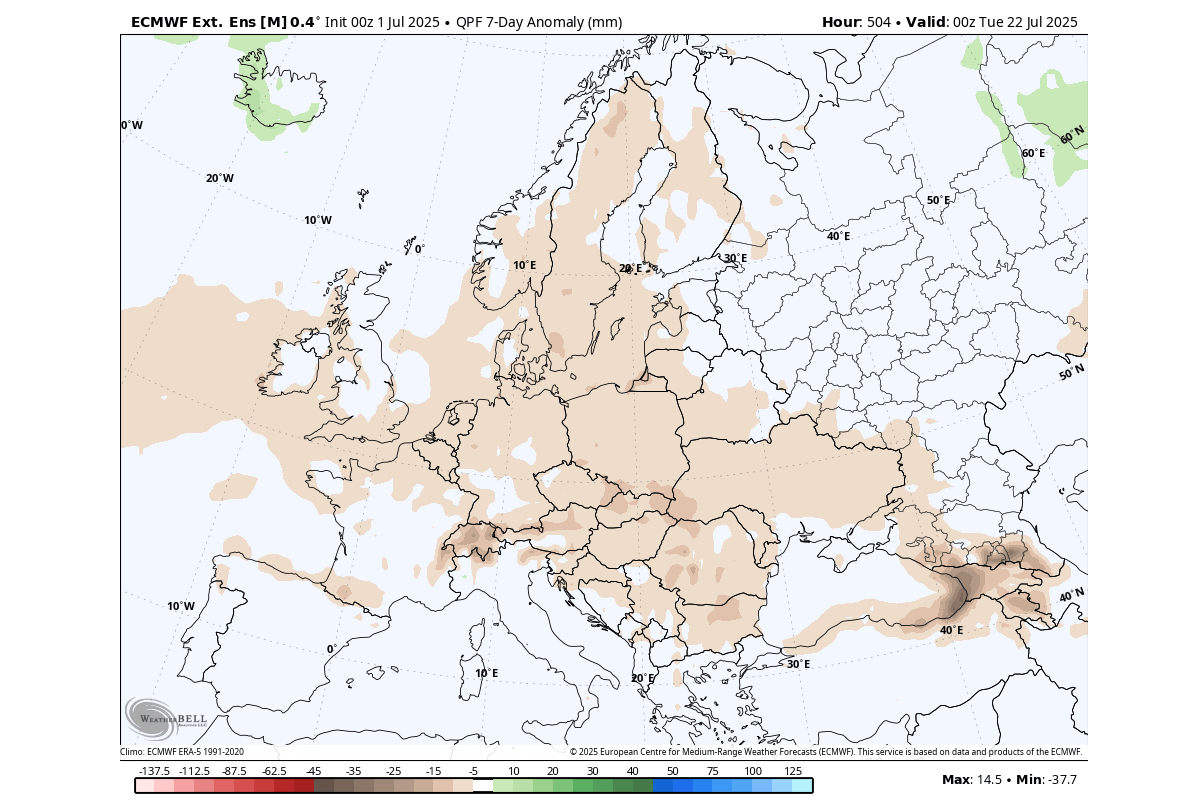
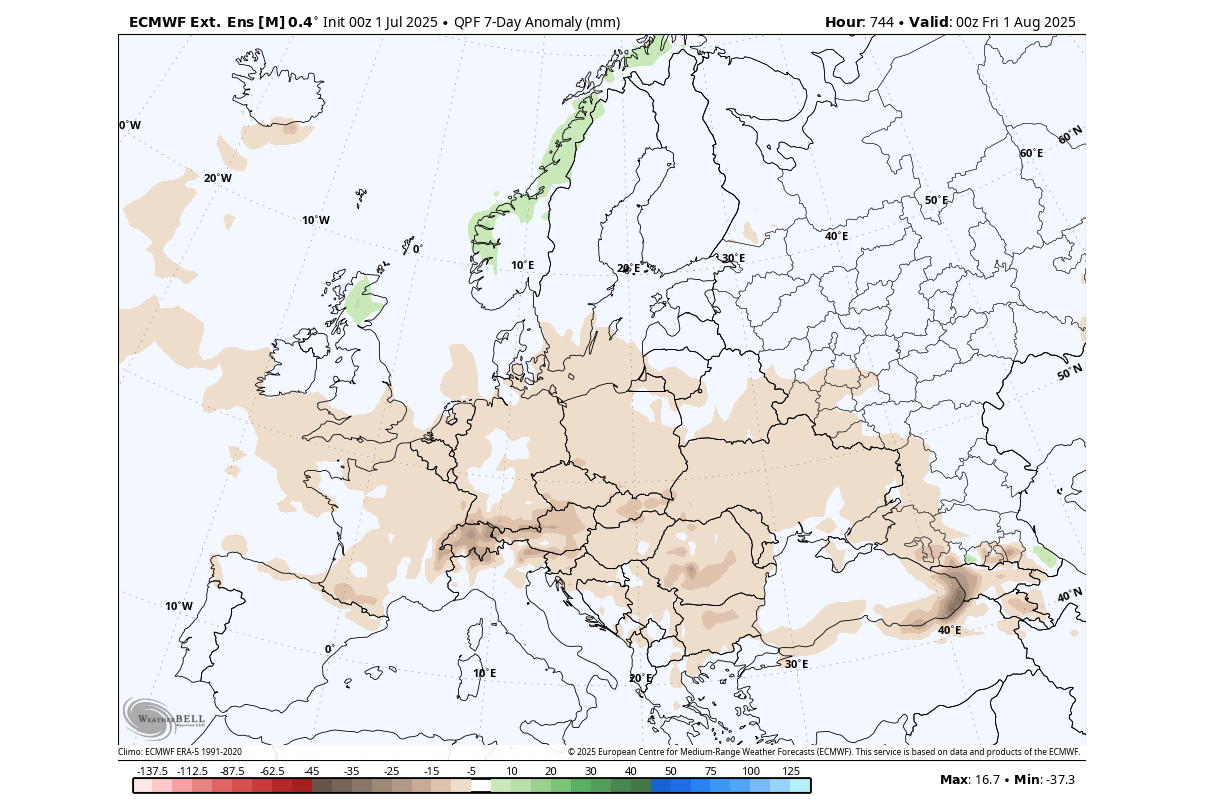
There are no major rainfall anomalies forecast over Europe in the final week of July. Most of the continent is forecast with less rainfall than usual, due to a persistent high-pressure anomaly and a stable pattern with the low-pressure systems staying to the north.
This overall shows a clear heatwave and drought signal for western and central Europe in the second half of July. These are just the latest extended range forecasts that can change. But it does usually show a rather accurate overall prevailing weather trend.
Forecast images in the article are from WeatherBell using a commercial license.
We will keep you updated on the global weather pattern development, so don’t forget to bookmark our page. Also, if you have seen this article in the Google App (Discover) feed, click the like button (♥) or a star there to see more of our latest articles and forecasts.