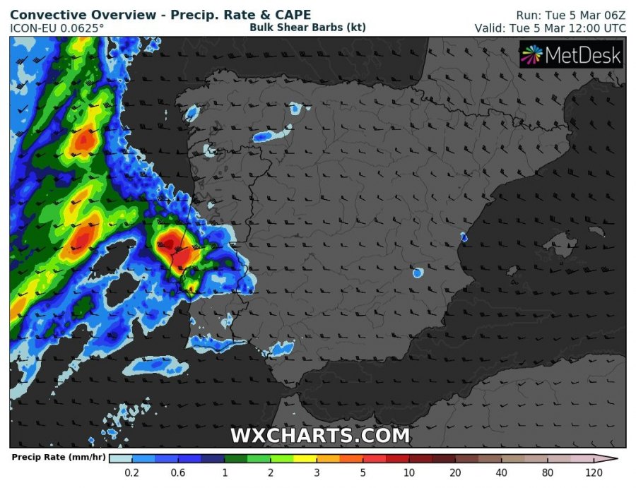
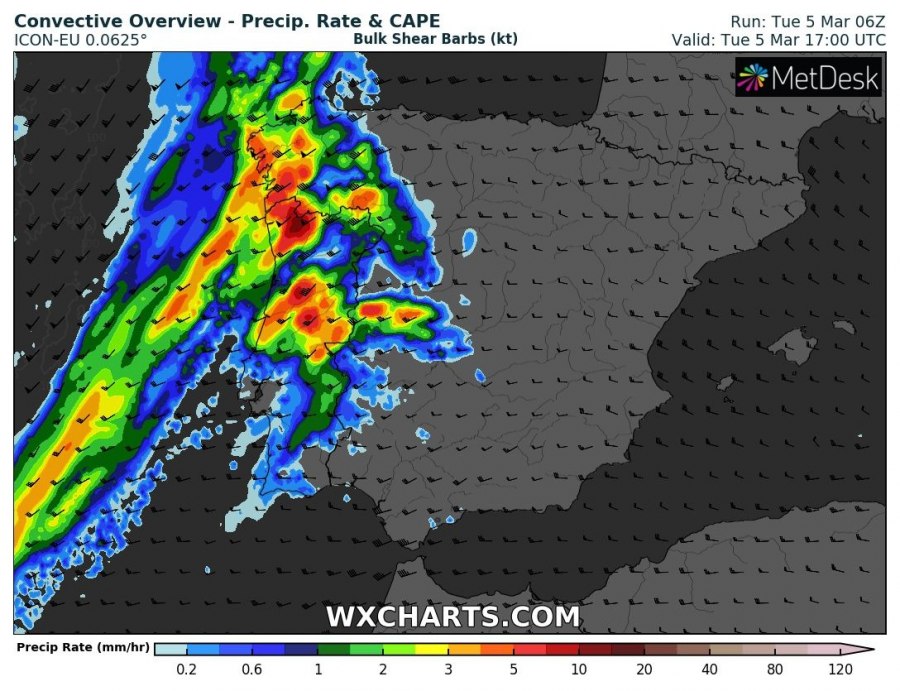
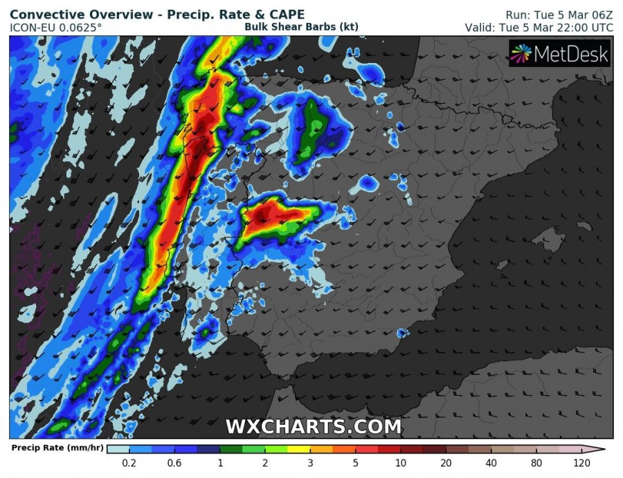
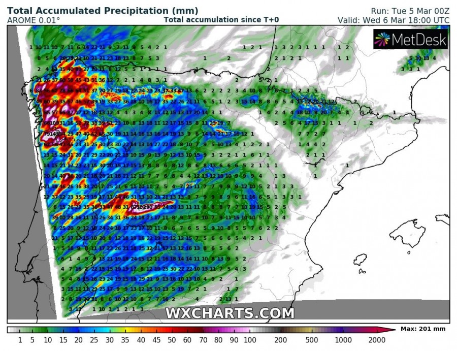
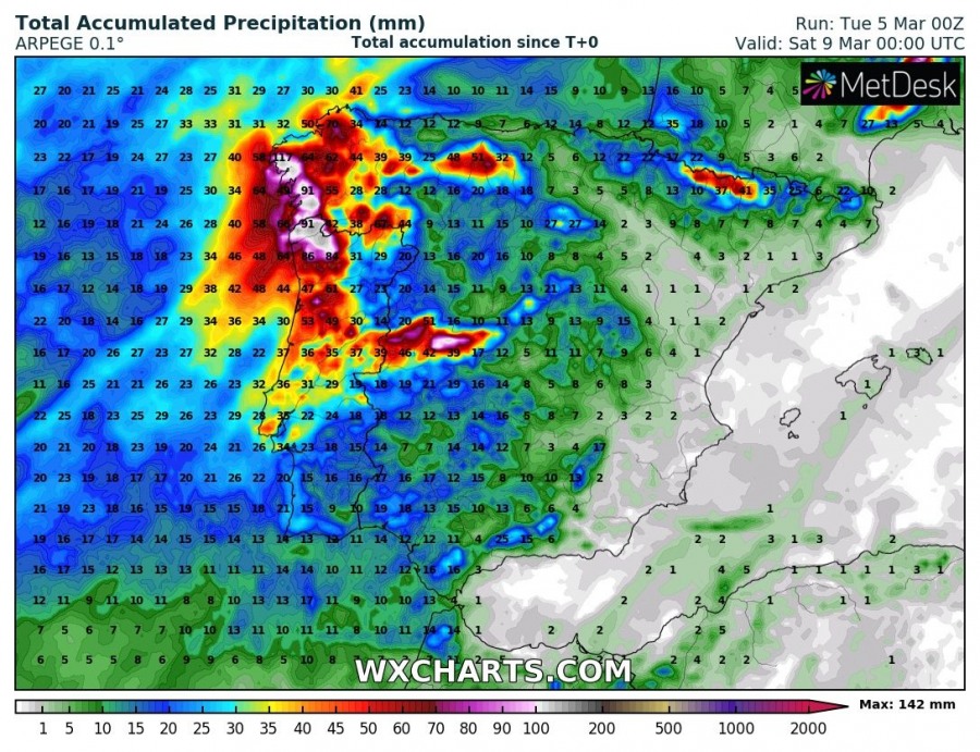
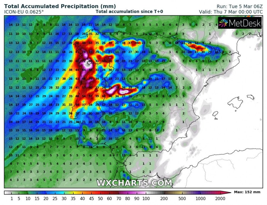
A deep longwave trough pushes into western Europe late on Tuesday and on Wednesday, bringing unsettled weather with storms and torrential rainfall. Major amounts of rain are expected for northwestern Spain and parts of Portugal. Flooding is likely.
Persistent southwesterly flow will produce combined convective and orographic rainfall ahead of the cold front in northern Portugal this afternoon. The slowly moving frontal line will push into the western Iberian peninsula in the evening hours and slowly pass by early morning.
While the forward motion of the frontal line is rather slow, the motion of storms along the line is quite rapid. This will result in training storms and persistent heavy convective and orographic rainfall along the coast and inland in N Portugal and NW Spain.
Over 100 mm of rainfall is expected in the region by late morning on Wednesday, locally possibly even up to 200 mm. Local flooding is expected, so exercise proper precautions.
Also see:
Weekly pattern for Europe – dynamic weather with cyclones across our continent, Mar 5-11th
