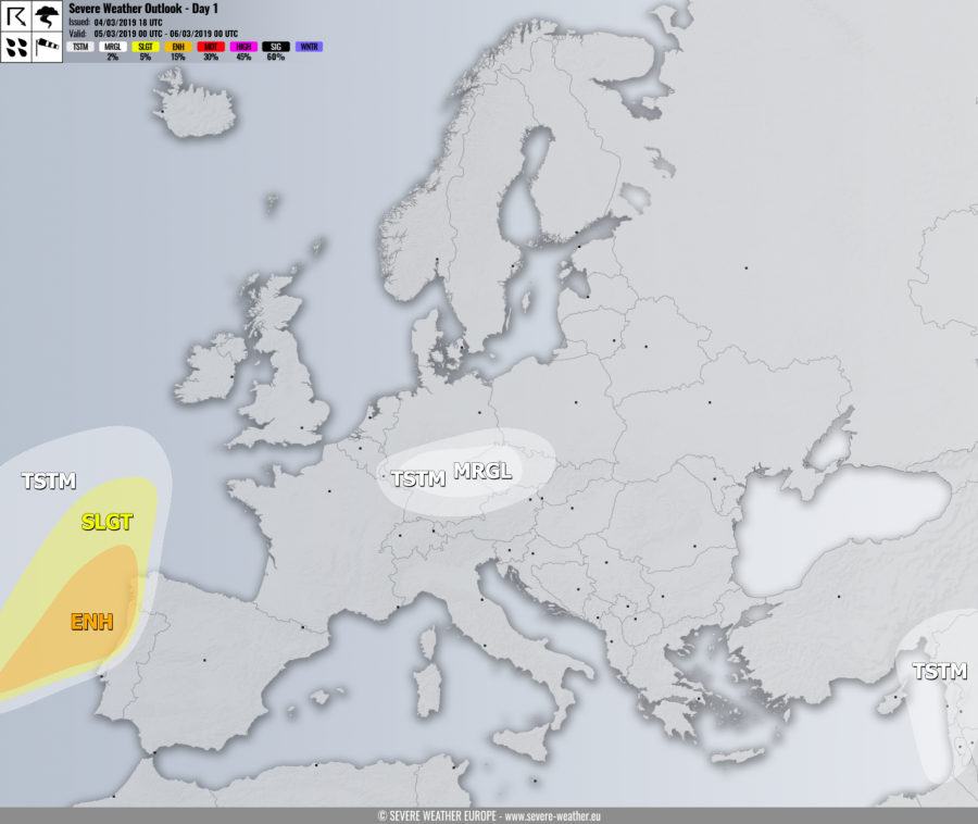
VALID FOR 05-03-2019
SYNOPSIS
A long-wave trough is located across north and central Europe while a deep low / trough nears the Bay of Biscay from the west. At surface level, a deep low with surface cold front is pushed towards the Iberian peninsula.
DISCUSSION
ENH risk has been issued for extreme west/northwest Portugal and northwest Spain with threat for severe storms capable of producing severe winds, torrential / excessive rainfall and tornadoes. Locally more than 100 mm could accumulate within 24 hours period. Marginal instability, but strong shear and favorable low-level helicity could support tornado threat.
SLGT risk has been issued for areas surrounding the ENH risk where more isolated threat for severe storms, mainly supporting severe winds and heavy rainfall threat.
MRGL risk has been issued for central Germany into western Czech Republic where isolated strong to severe storms are possible, capable of producing some marginal hail and severe winds.
TSTM risk area has been places across the Middle East region where mainly sub-severe storms are expected again
