An extremely severe thunderstorm hit Pescara (Abruzzo, central Italy) in the afternoon of July 10th, 2019. The thunderstorm produced very large to giant hail, with hailstones up to 15 cm in diameter, severe straight line winds and intense flash floods. The event was part of a 5-day severe weather outbreak over the northern and central Mediterranean.
The event was part of a 5-day severe weather outbreak across the entire northern and central Mediterranean region, also spreading into the Alpine region and the Balkans. A detailed analysis was also performed by the European Severe Storms Labolatory (ESSL).
Several high risk forecasts were issued, with day 5 – July 10th – being the most dangerous day. A HIGH/SIG risk was issued for parts of central and southern Italy for extremely severe thunderstorms.
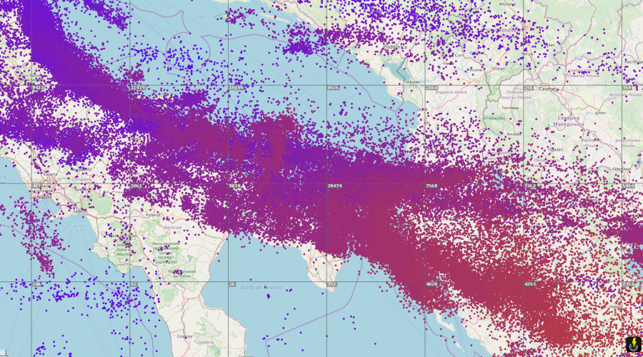
Lightning tracks across the severe weather outbreak zone. Note the long track along the coast of Abbruzzo – the severe thunderstorm in this article.
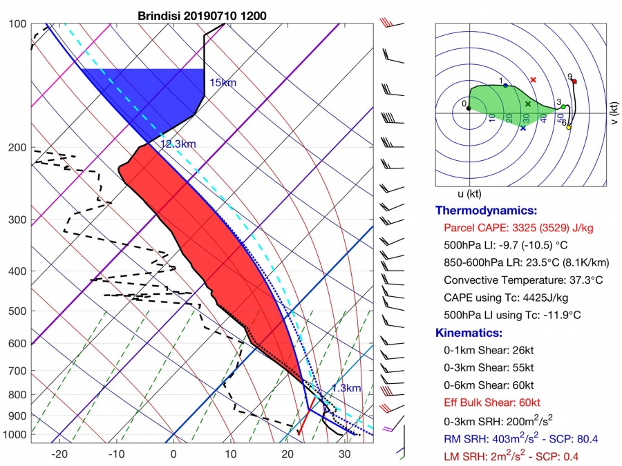
A short-wave trough pushed across the region, with the surface low tracking along the eastern coast of the Apennine peninsula. All ingredients were in place for persistent, long-lived supercell thunderstorms, capable of all types severe weather. The 12Z Brindisi sounding shows quite exceptional instability and shear parameters. Nearly 3500 J/kg MLCAPE in place, overlapping with 60 kt deep-layer shear and several hundreds m2/s2 0-3 km SRH. Such an environment is extremely supportive for severe supercells. Strong low layer (0-1 km) shear, over 25 kt and very strong veering vertical wind profile in the lowest kilometer are also highly supportive for tornadoes. Tornado potential was likely somewhat limited by only moderate low-level CAPE./p
Brindisi (Puglia, south Italy) sounding on July 10th, 2019 at 12Z (14h CEST). Skew-T plot by Michiel Baatsen.
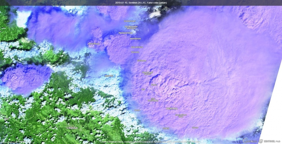
An exceptionally severe supercell developed in the late morning just off the northern coast of Abruzzo, slowly tracking towards and along the coast. Satellite imagery indicated a steady, large overshooting top.
Exceptional view of the severe thunderstorm by the Sentinel satellite (false color image). Note the enormous anvil and the large overshooting top, indicating a particularly strong updratf. Photo: Sentinel / Copernicus EU.
It produced an extremely severe, devastating hailstorm over Pescara and the vicinity. Giant hailstones up to 15 cm (6″) were reported, tying the European record! Widespread major hail damage was reported in Pescara and the vicinity. Additionally, severe straight line winds and flash flooding were reported in multiple locations.


