Outlook DAY 1 (valid: 20/07/2019)
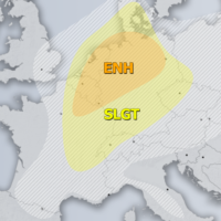
Severe Weather Outlooks FAQ SYNOPSIS A large trough is located over the N Atlantic and W Europe with a sharp short-wave crossing Benelux and NW …
Severe Weather Outlooks FAQ SYNOPSIS A large trough is located over the N Atlantic and W Europe with a sharp short-wave crossing Benelux and NW …
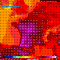
Most of the models have intensified the severity of the heat wave developing next week, trending into the potential for low 40s peak afternoon temperatures …
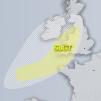
Severe Weather Outlooks FAQ SYNOPSIS A large trough is located over the N Atlantic with a wave pushed into the British Isles and Ireland. A …
Severe Weather Outlooks FAQ SYNOPSIS Low geopotential heights persist across much of Europe with several upper lows embedded. One is over N UK, the second …
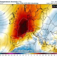
After a rather dynamic and quite cooler period through early July, a sharp flip in the pattern is shaping up on both global models. Yet …
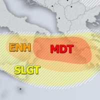
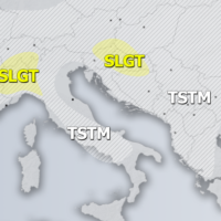
Severe Weather Outlooks FAQ SYNOPSIS A large trough persists across east-central Europe and part of Mediterranean but gradually weakening with an embedded deep low moving …
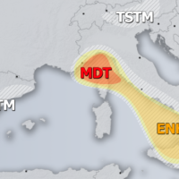
Severe Weather Outlooks FAQ SYNOPSIS Upper ridge over N Atlantic is weakening while a large trough persists across east-central Europe. An embedded deep low is …

An extremely severe thunderstorm hit Pescara (Abruzzo, central Italy) in the afternoon of July 10th, 2019. The thunderstorm produced very large to giant hail, with …