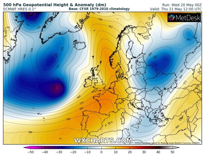
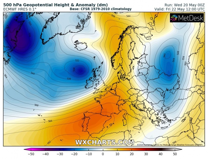
After quite some time, a change in the North Atlantic pattern is coming. A large long-wave trough will result in a deep cyclone, moving towards western Europe. It will introduce a deep surface cyclone and potentially a strong windstorm into Scotland and Ireland this Friday, May 22nd.
CHANGE IN PATTERN
A large trough with very deep core develops on Thursday and moves towards the north-northeast. It will pass to the west of the UK and Ireland. As a result, surface cyclogenesis forms.
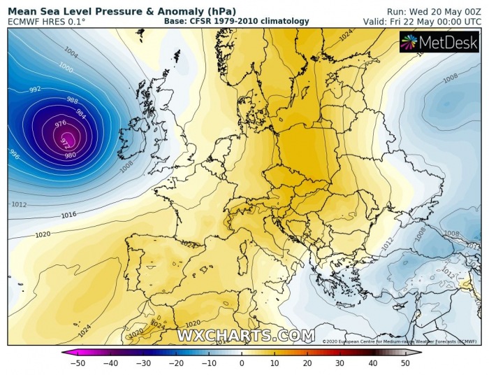
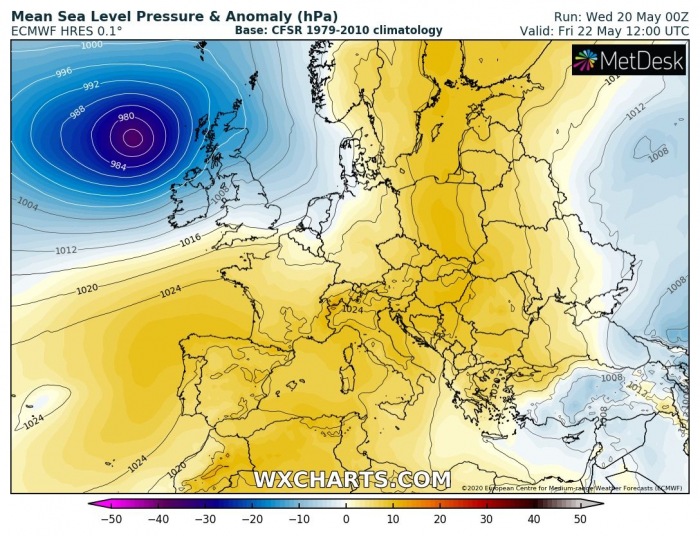
Here is the sequence of a surface low development tonight, deepening on Thursday while slowly drifting north-northeast and flyby near Ireland and Scotland towards Faroe Islands on Friday:
WINDSTORM POTENTIAL
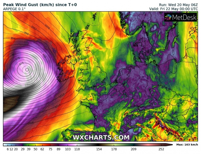
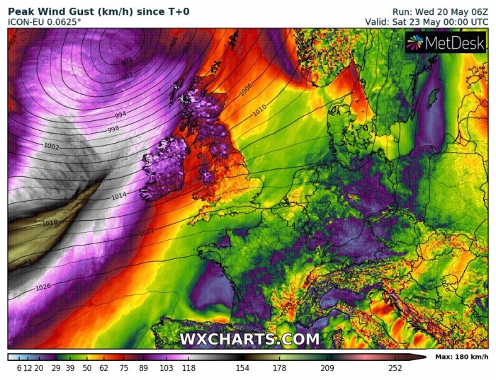
Looking over the 6-hour wind gusts sequence and surface pressure from Thursday through Friday. A surface low begins deepening early Thursday while moving northeast and pass west of Ireland. Severe to extremely severe winds will develop. Potentially even with hurricane-force speeds over the open sea.
Attached are the ICON-EU and ARPEGE model peak wind gust swaths along the cyclone’s track. Both are hinting the maximum speeds could exceed 160 km/h near the center of the low. This is a result of a strong pressure gradient with this system.
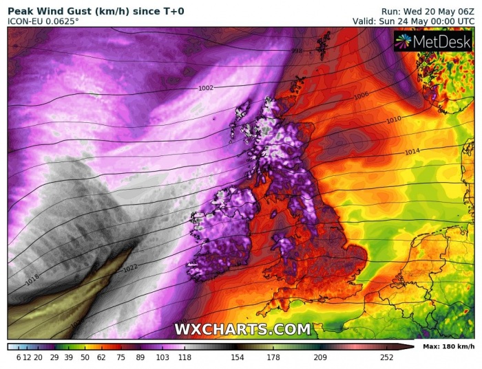
Close-up view of the windstorm over the UK and Ireland. Peak gusts could reach 100-120 km/h in some areas, above 150 km/h over the Highlands. Violent wind gusts are likely near the surface low while being to the southwest approach towards western Europe on Thursday.
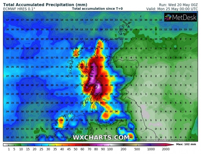
Strong southwest flow will also result in a lot of orographic rainfall over the Scottish Highlands. Up to around 100 mm of rain is likely until Sunday.
See also a related connection with the cooling of the Gulf Stream in the Northwest North Atlantic:

