Welcome to Severe Weather Europe page!
Welcome to our Severe Weather Europe page – an online resource of weather forecasts, outlooks, long-range trends, severe weather, and more. Our mission is to …
We didn't find the posts for that URL.
Welcome to our Severe Weather Europe page – an online resource of weather forecasts, outlooks, long-range trends, severe weather, and more. Our mission is to …

Meteorological Autumn starts in September, but we are already tracking the large-scale factors at work that will impact the coming weather seasons. Looking ahead, we …
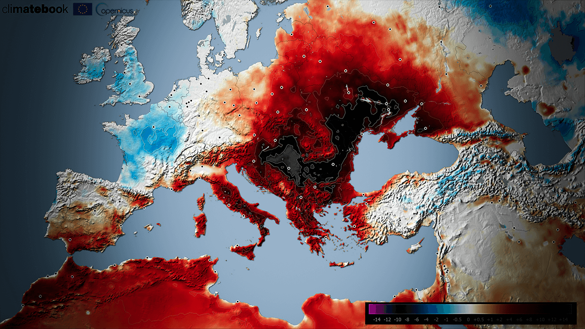
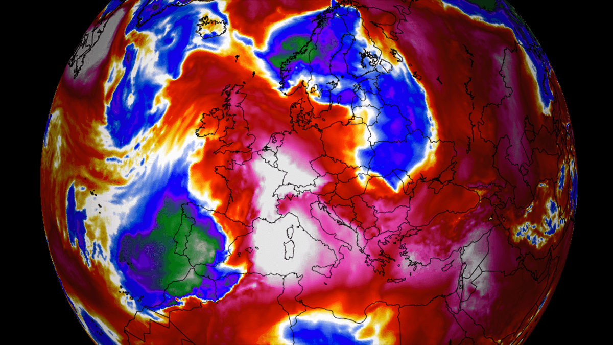
Parts of Europe have been under a prolonged heatwave since early July, and the heat is forecast to extend for another two weeks. Historic heatwaves …
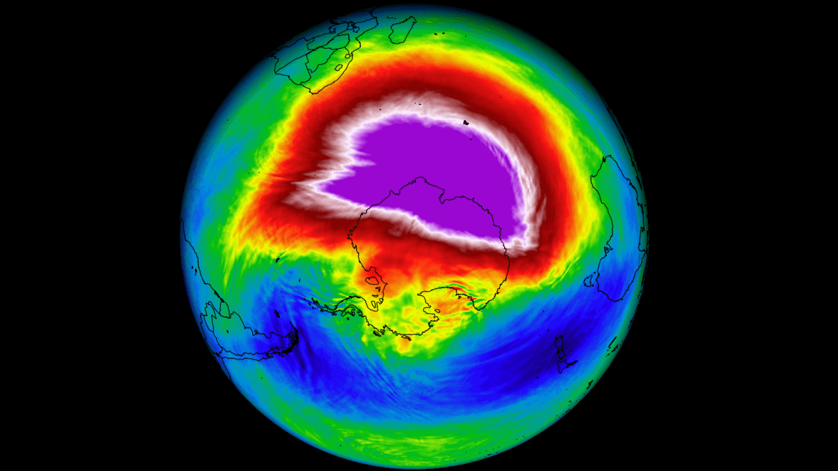
The Southern Hemisphere is currently in its Winter season, and dynamic weather patterns will initiate a strong warming event in the Stratosphere above the South …
Through mid-July, much warmer weather than average returns to the eastern and southern half of Europe; temperatures will surpass 40 °C in some areas. A …
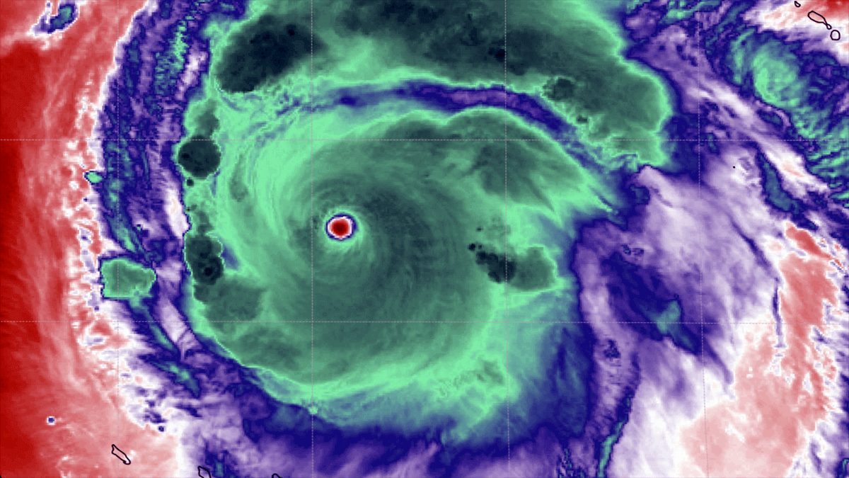
Hurricane Beryl made a devastating CAT 4 landfall in the Windwards Islands on Monday and continued strengthening into the earliest Category 5 on record for …
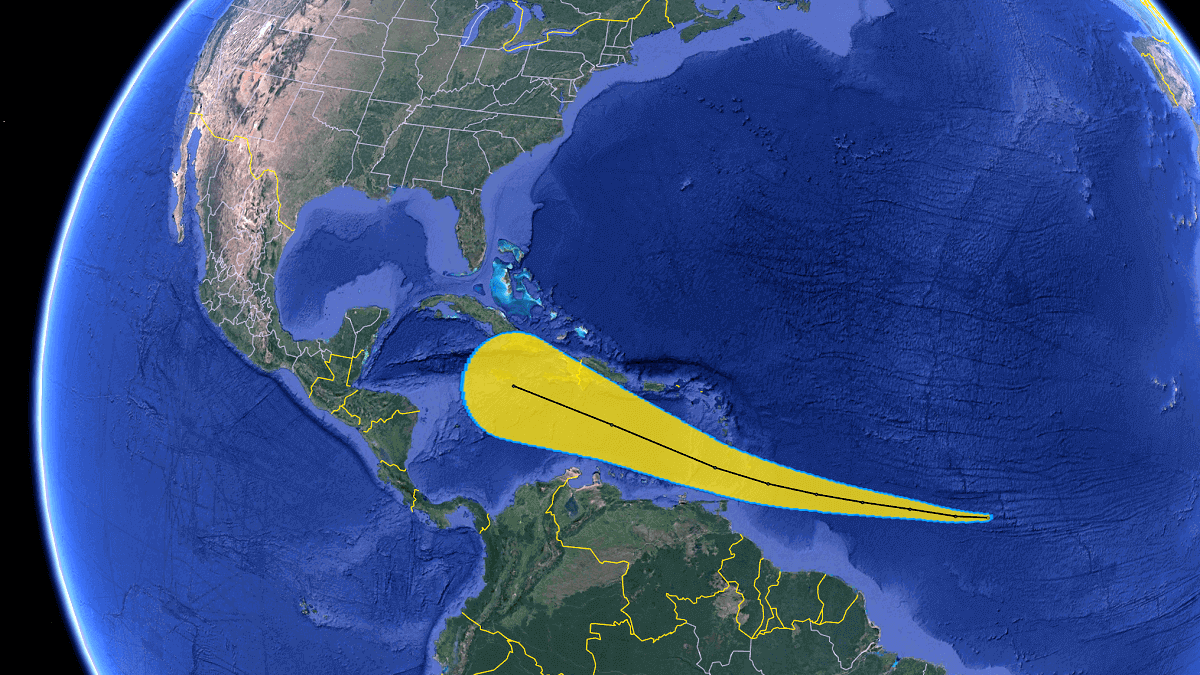
The Atlantic Hurricane Season 2024 will again take advantage of the record-high water temperatures. These conditions could lead to cyclones strengthening faster than usual and …

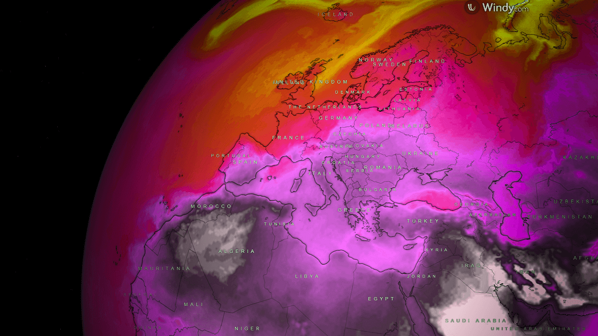
Early data shows that the Polar Vortex is likely to be weaker than normal in the Winter of 2024/2025. A weaker Polar Vortex usually means …
The first month of meteorological summer 2024 started with wet and cool weather across much of Europe; the only region receiving more summertime-like weather was …