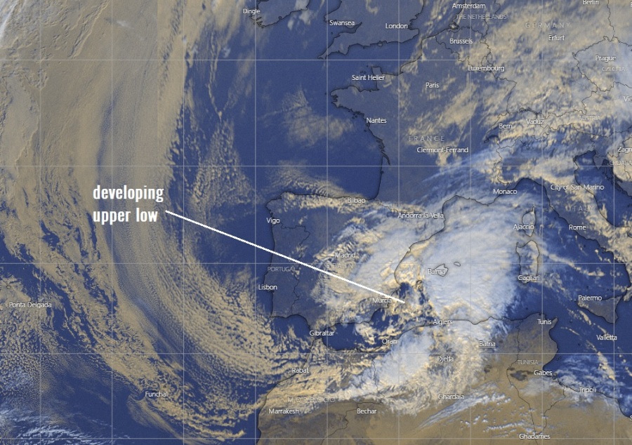
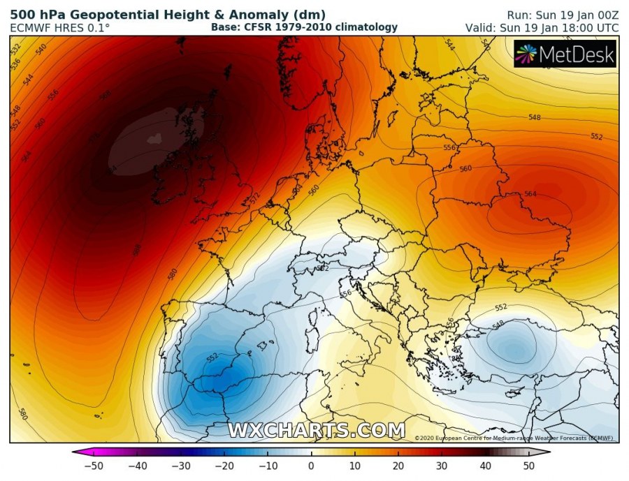
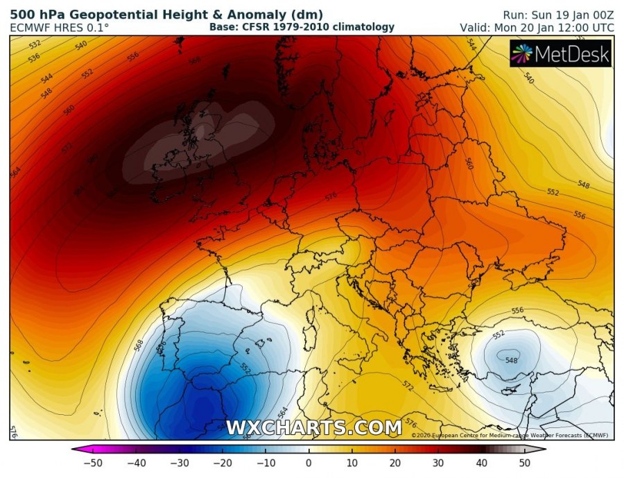
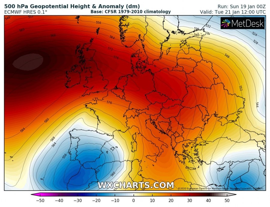
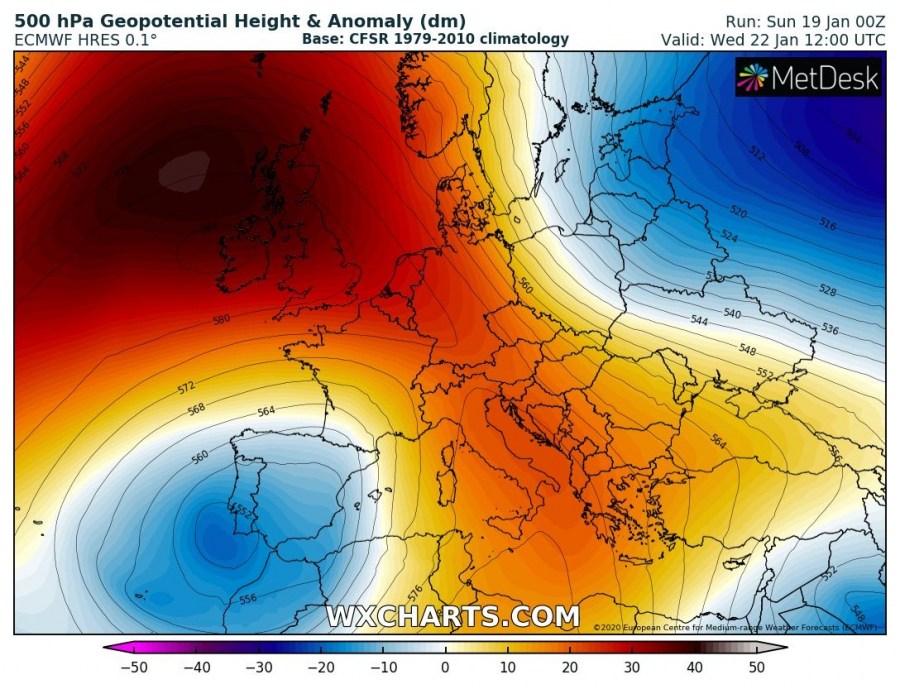
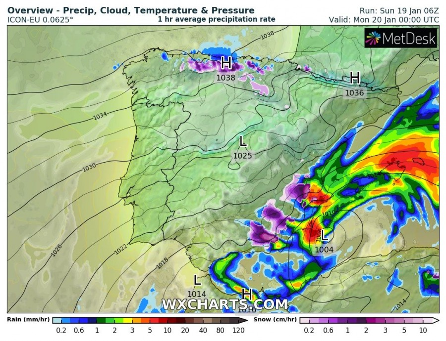
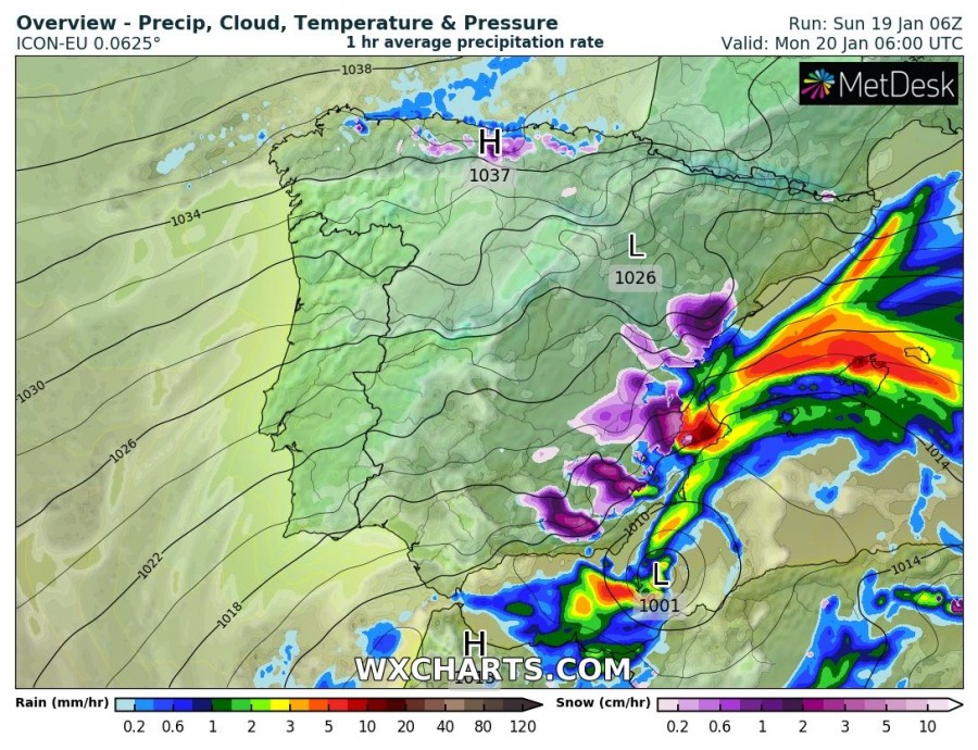
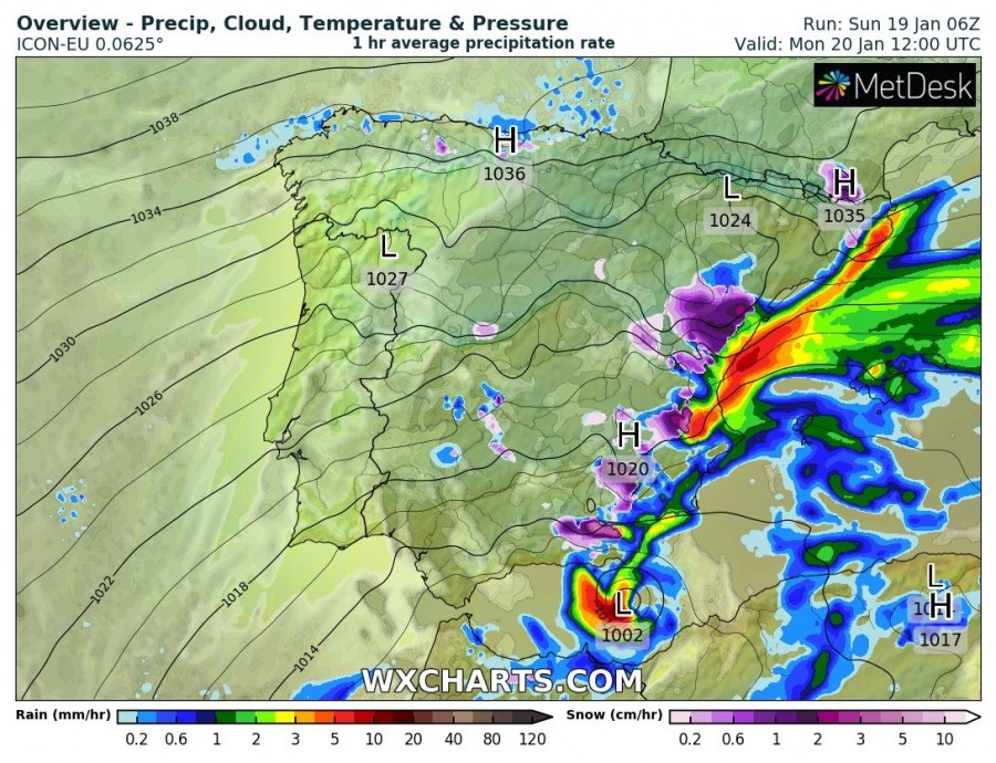
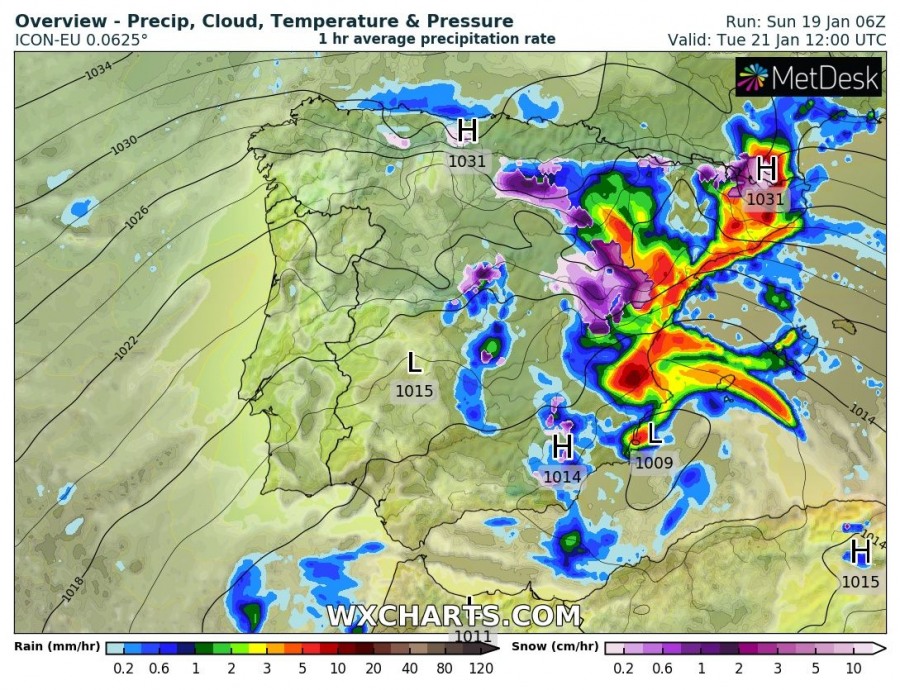
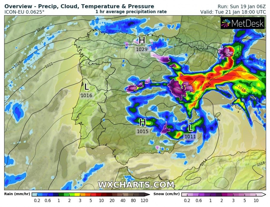
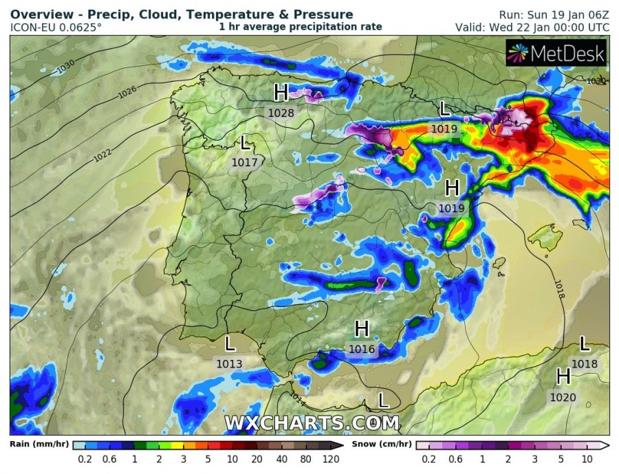
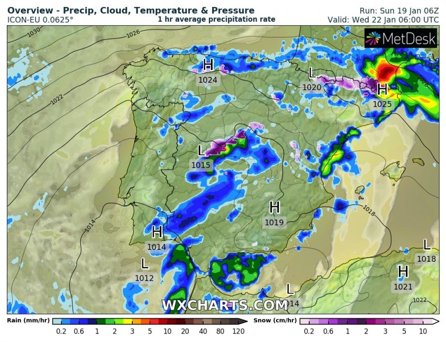
While a large part of Europe is expecting an extremely high-pressure system with pressure readings 1045-1050 mbar until Thursday, there is a very interesting but dangerous feature developing – a deep upper-level low over the Iberian peninsula. It was re-developed from the North Atlantic wave we have been monitoring on Friday – the cyclone was very photogenic on the satellite imagery. With an additional advection of cold mid-levels along the eastern flank of the strengthening west European upper ridge, upper low is intensifying and building up a surface Lee cyclone. This system will develop a warm-core tonight and result in worsening weather conditions, delivering excessive rainfall, dangerous winds and major waves threats towards the coast of east-southeastern Spain until Thursday!
Note: The ‘Rex Block’ is a blocking pattern that has two main features, the ridge and the low. The most of Rex Blocks have a strong low-pressure system next to a strong high pressure where the high pressure is usually located to the immediate north of the low pressure. The upper low associated with the Rex Block is not completely cut-off from the upper-level flow and has a trend towards the east-west movement.
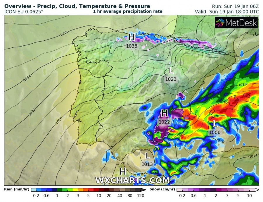
The upper-level pattern building over Europe will become a so-called Rex block pattern, as a very strong upper ridge is located to the immediate north of the surface cyclone. There is a powerful upper ridge over western Europe while an upper core / surface cyclone is located over the SW Mediterranean and Spain. It appears likely the upper core/surface low will be somehow trapped over the Iberian peninsula for several days, resulting in dangerous flooding conditions along the east-northeast Spain.
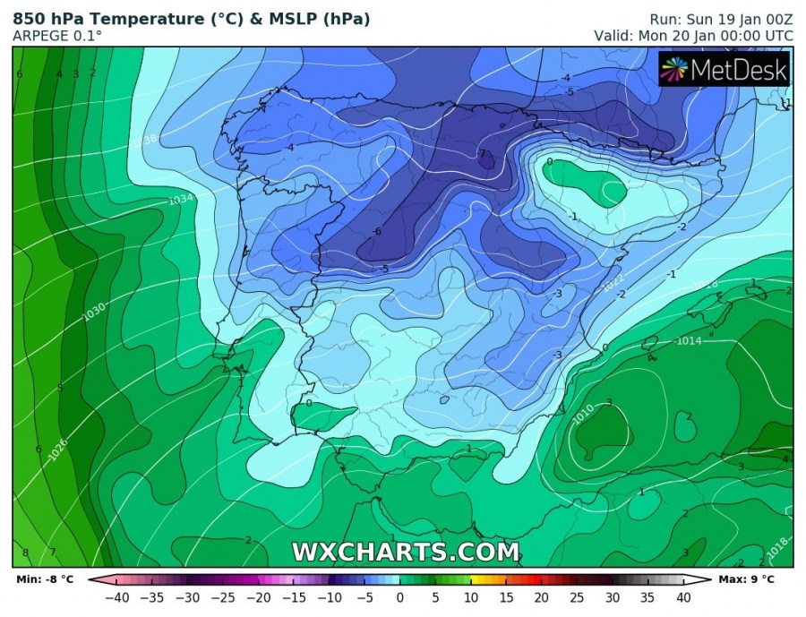
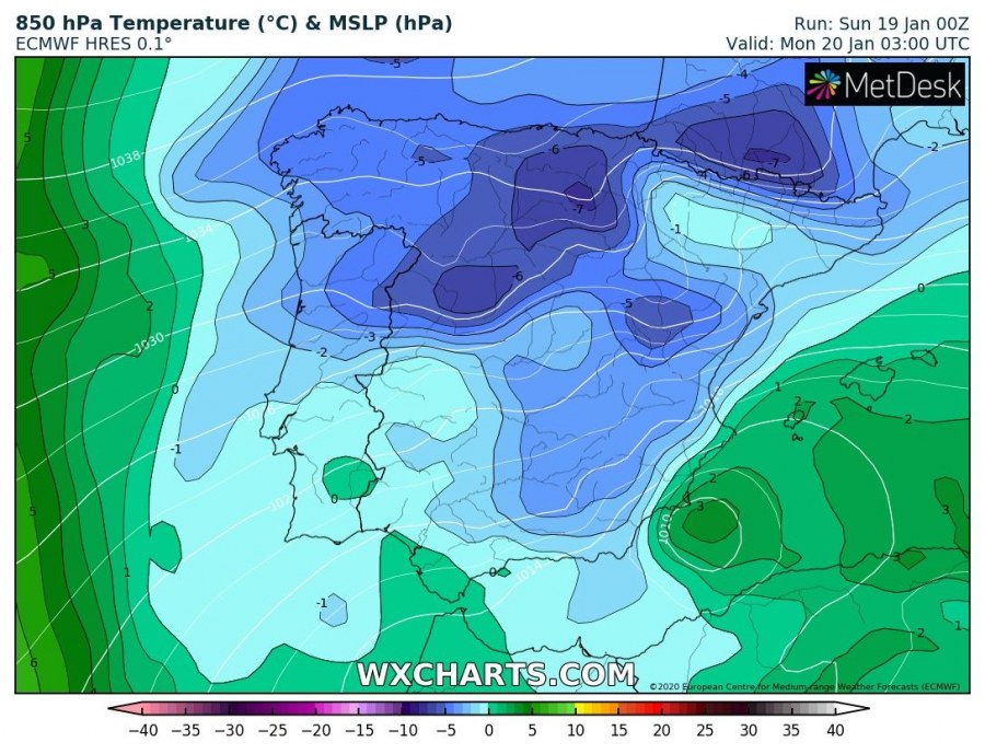
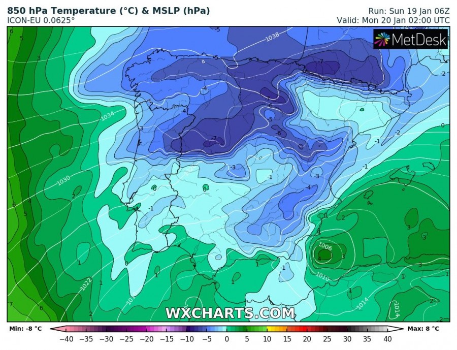
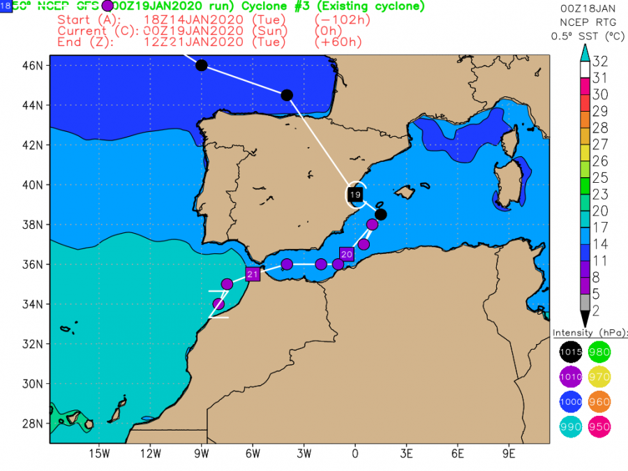
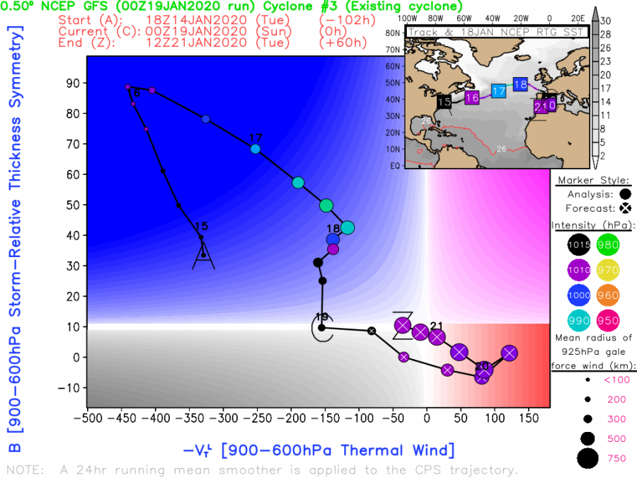
What is an interesting feature seen with this upper low and broad surface cyclone, is the quite likely developing warm-core cyclone / medicane (tropical-like Mediterranean cyclone) tonight, overnight to Monday in the southwest Mediterranean. Basically all models are hinting the warm-core forming (notice the warmer center of the low at 850 mbar temperature chart) along the southeast coast of Spain, moving southwest through the morning hours with deep central pressure. GFS phase diagrams also confirm cyclone develops symmetric warm-core tonight.
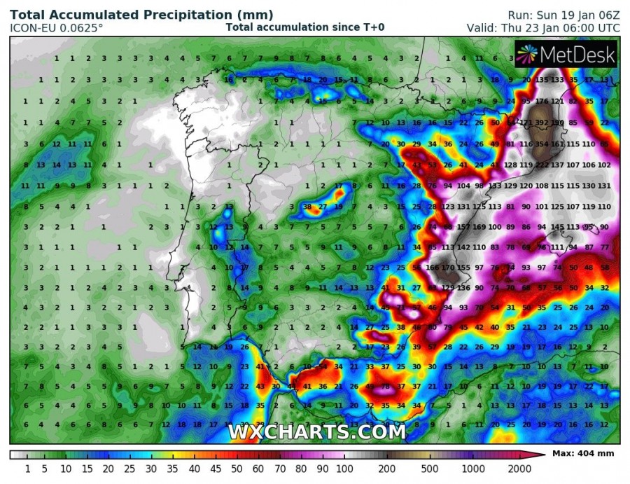
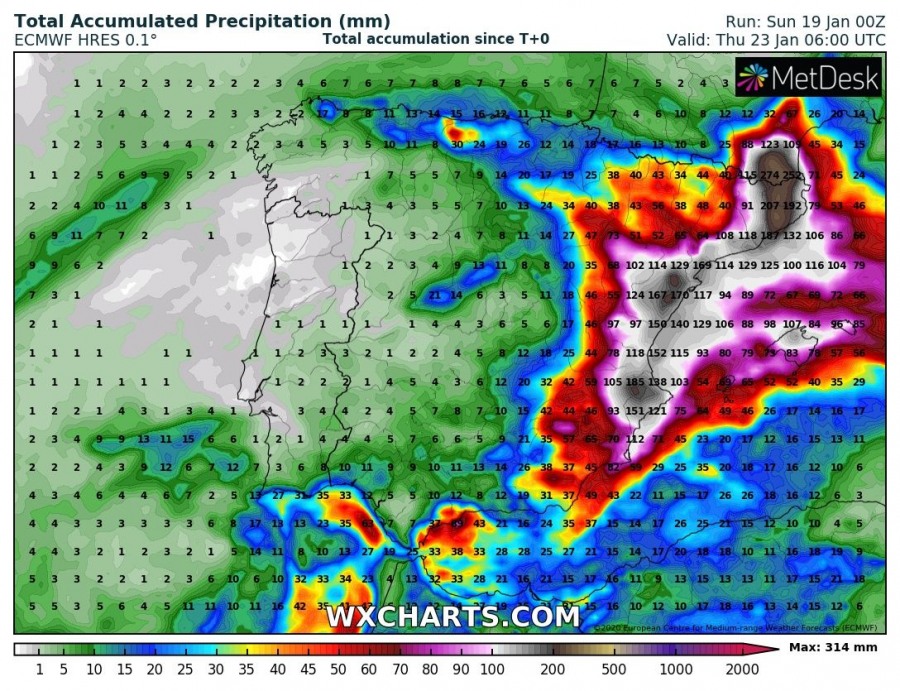
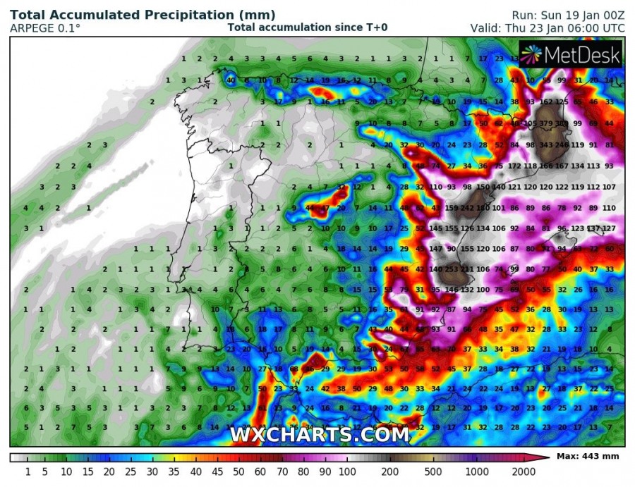
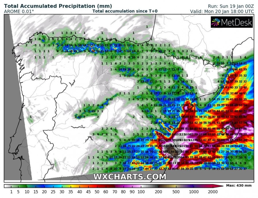
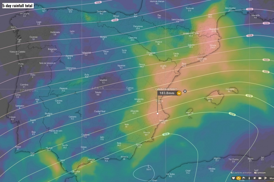
A huge amount of rainfall is then expected across eastern-northeastern Spain due to a strong and persisting easterly to northeasterly near-surface flow from the Mediterranean. An intense orographic rainfall event will develop in two rounds, resulting in 200-400 mm of rainfall locally by Thursday.
The first round is expected with more northeasterly flow related to the southwestwards moving #medicane through Monday. Strong orographic rainfall will be ongoing along the SE Spain, heavy snowfall over the Sierra Nevada mountain range. Lots of rain will accumulate across the Valencia region, likely 150-300 mm in some areas and bring a significantly enhanced flooding threat! Notice the warm-core surface low drifting southwest along the southeast Spanish coast.
The second round then develops further northeast across the Catalonia region through mid-week as the surface low establishes more easterly flow over the western Mediterranean. A prolific orographic rainfall will be occurring across the Catalonia region with strong easterly winds advecting lots of moisture directly west into the eastern Pyrenees. An extreme amount of precipitation is likely, probably reaching 300-400 mm in a 48-72 hours period, where the strongest precipitation will develop.
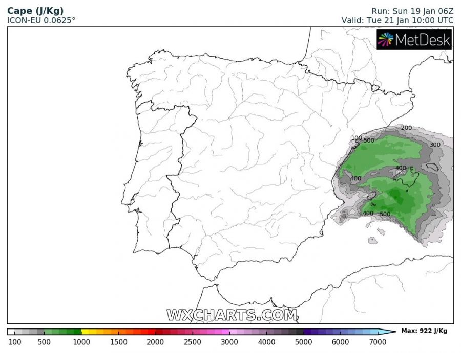
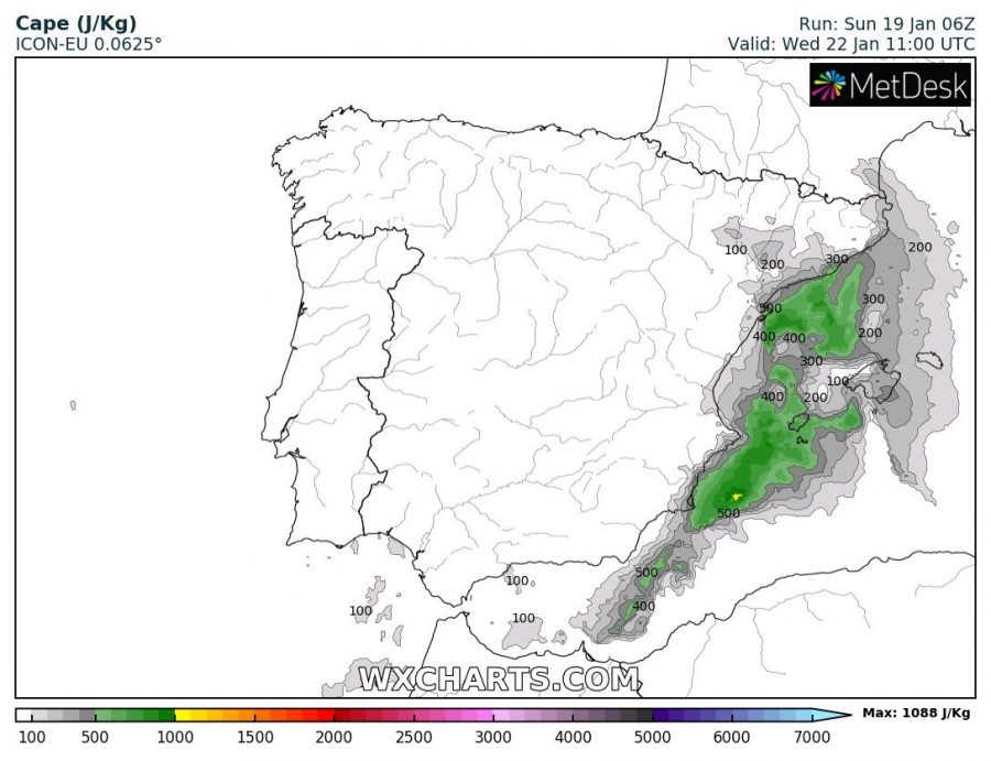
Once the much colder airmass arrives over the western Mediterranean, likely through Tuesday and Wednesday, convective storms will also enhance over the sea towards the coastal areas. Models are hinting 500-800 J/kg of MLCAPE will be fueling these storms. This should locally result in intense/torrential rainfall as well, rising the potential for flash floods due to training-cells or a convective cluster possible.
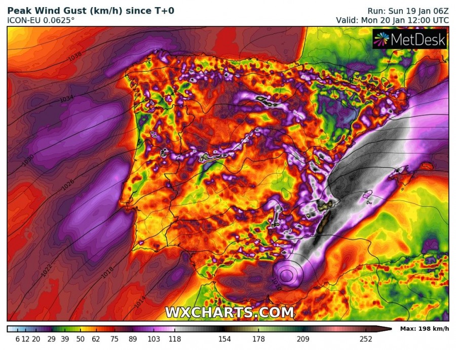
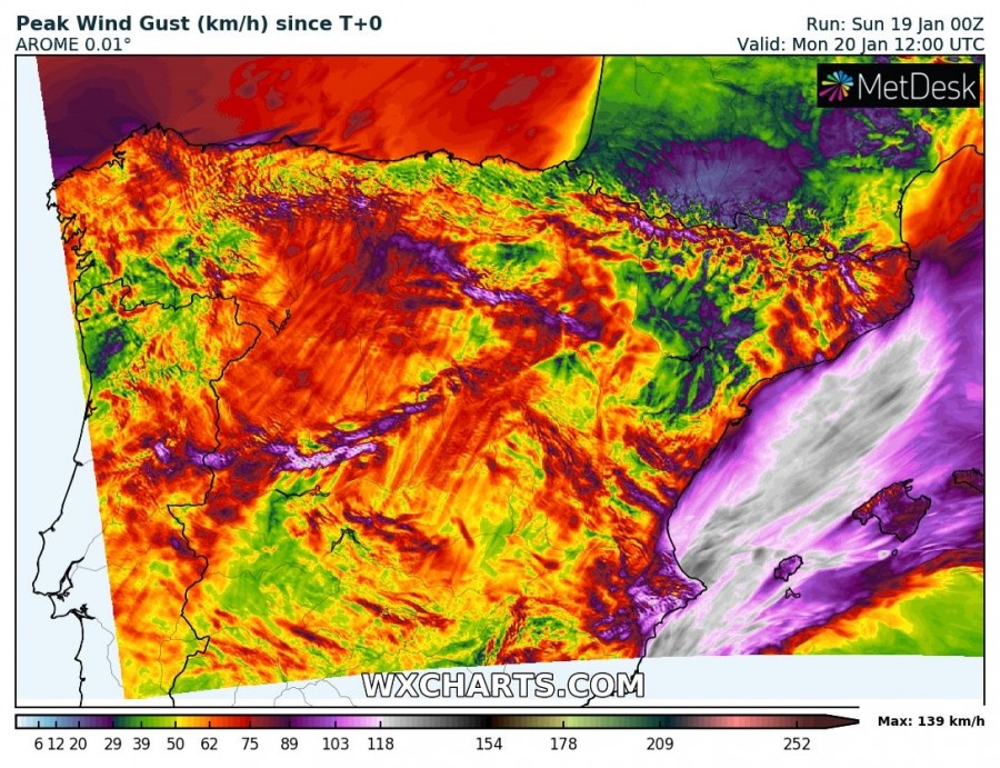
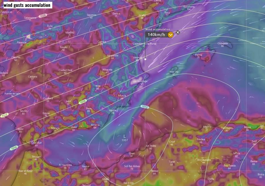
The additional result of a tight pressure gradient between the powerful high-pressure system over western Europe and cyclone over the western Mediterranean, will be severe to extremely severe winds along the eastern and southeastern Spanish coast. Models are hinting peak gusts could reach 120-150 km/h. Especially due to a very strong pressure gradient against the shallow warm-core low moving just off the SE of Murcia coast – a swath of the strongest winds is well-visible, brushing the coastal areas of Valencia region. Higher gusts will result in the mountains.
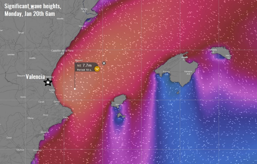
Significant wave heights will also develop along the eastern Spanish coast (Valencia region), likely reaching 7-8 meters in front of Valencia city.
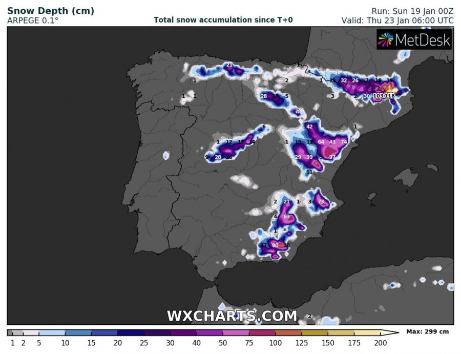
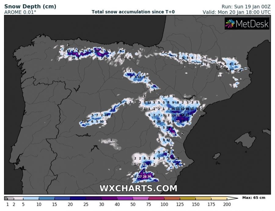
And also, the cold air mass advection spreading over the Iberian peninsula will create enough low temperatures for snowfall across the higher elevations of the eastern half of Spain. Some areas could receive 30-60 cm of fresh snow until Thursday, indeed even higher amounts 100-150 cm are expected over the Sierra Nevada and the eastern Pyrenees.
Stay alert for dangerous conditions with strongly enhanced threat for flooding, damaging winds and major waves along the coastal areas of Valencia and Catalonia regions in the coming days! We will keep you updated – stay tuned!
See also – the powerful high-pressure system over western Europe:
The origin of this upper core over Iberian peninsula was a very photogenic cyclone traveling across the North Atlantic on Friday:
North Atlantic today – a small but very photogenic cyclone delivers a spectacular satellite show
