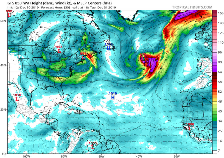
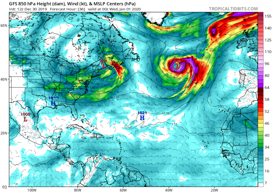
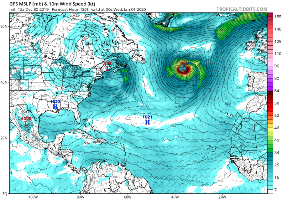
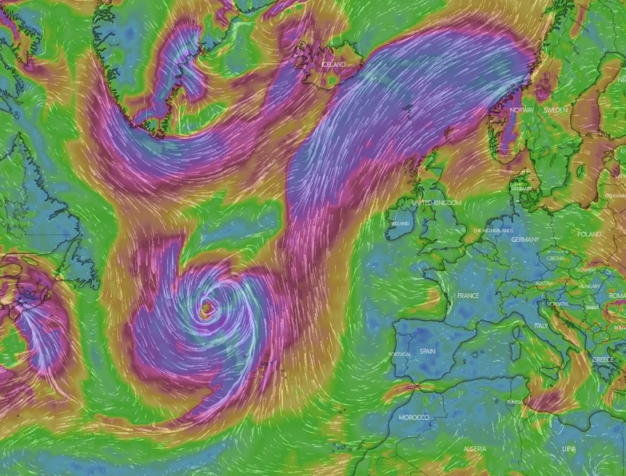
Looks like we will finish the year 2019 and start the new year 2020 with an intense extra-tropical cyclone over the North Atlantic. Models are in fairly good agreement a rapid intensification of a surface cyclone is expected later today over the Atlantic, just east of Newfoundland. The cyclone will be ongoing through New Years’ Eve into January 1st, then gradually weakening while pushing towards western Europe (Ireland).
*********************************************
*********************************************
500 mbar geopotential heights guidance across the North Atlantic reveals two Rossby waves are moving from North America into the Atlantic. The eastern wave will significantly deepen and start cyclogenesis as it arrives over the North Atlantic Current in the afternoon hours.
Here is a sequence of a developing extra-tropical cyclone over the North Atlantic today’s evening after 18 UTC. Cyclone soon forms a very intense core and wind field with hurricane-force winds around it. Central pressure is expected to fall very rapidly from around 980 mbar into low 960s, therefore likely resulting in a 12-18 hour period of rapid intensification through the New Years’ Eve and the morning of January 1st. The system will mature through the day, then begin its gradual weakening trend overnight to Tuesday while continuing towards WNW Europe.
Dec 31st 2019, 18 UTC
Jan 1st 2020, 00 UTC
Jan 1st 2020, 06 UTC
Jan 1st 2020, 12 UTC
Jan 1st 2020, 18 UTC
A look on the wind gusts based on the ECMWF model:
Cyclone will reach western Europe on Thursday, Jan 2nd but will be already significantly weaker than a day before, so severe threat is unlikely over Ireland and UK.
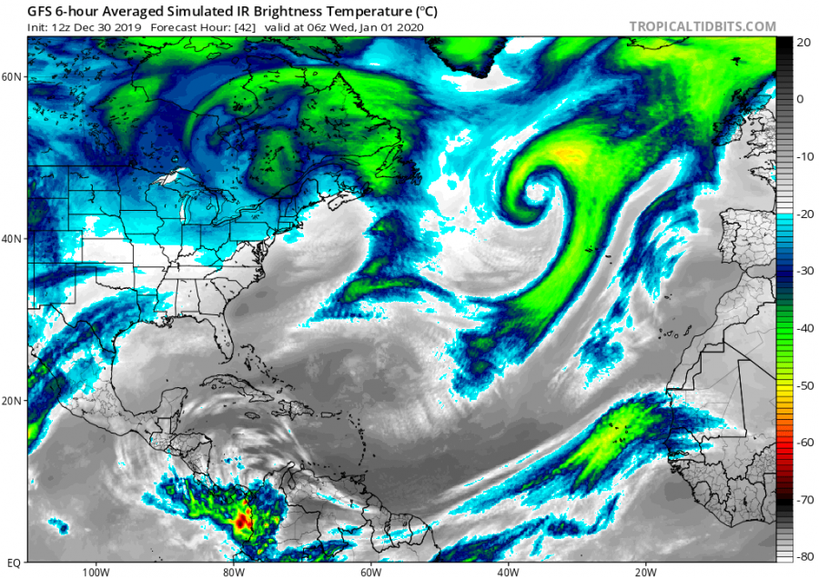
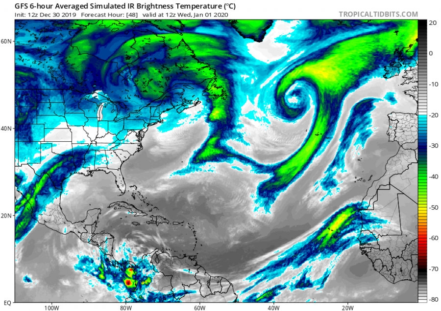
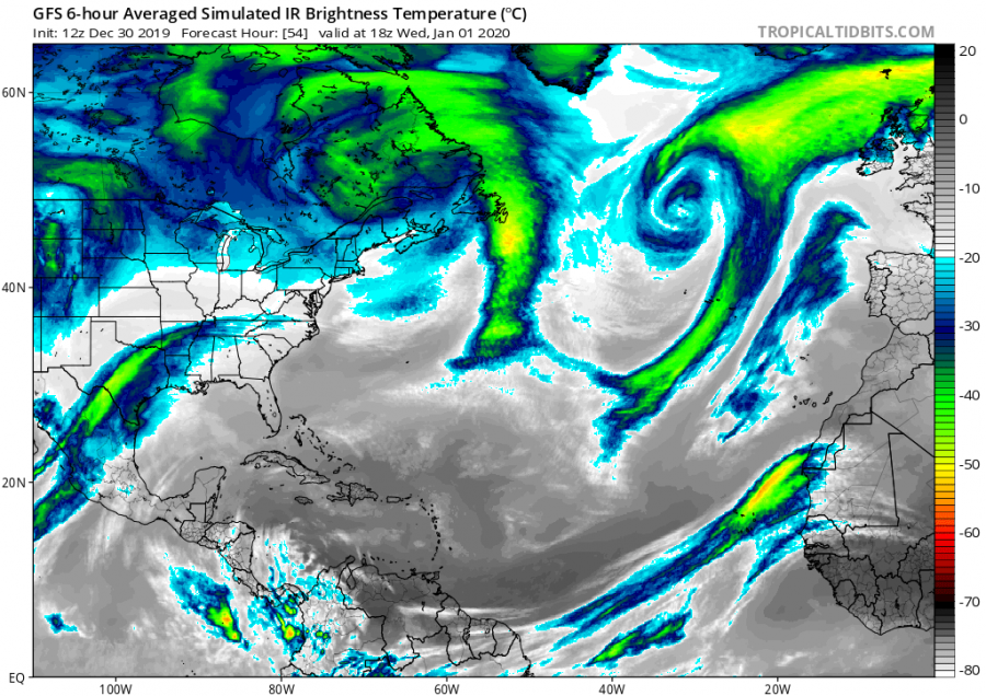
There is also an interesting GFS model simulation of IR brightness temperature, in other words – how the system would look on the satellites (IR channel). Undoubtedly, this will be an impressive system to watch on the first day of 2020!
Stay tuned for updates with live satellite images of the system tomorrow.
Interested in our calendar? We are proud to present and promote the best weather photographers in Europe – see details:

