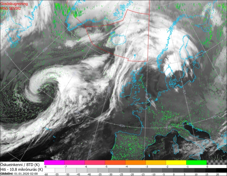
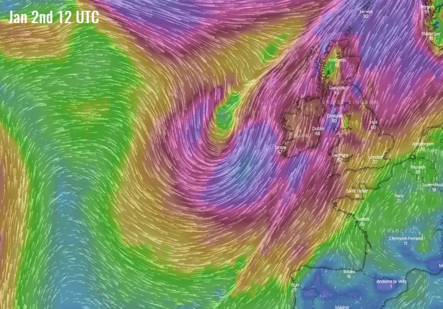
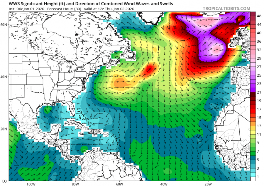
The model guidance we have discussed on Monday, has verified and an intense extra-tropical cyclone developed over the North Atlantic. The satellite presentation is impressive. The system will be moving towards the northeast Atlantic today and begin its weakening trend tonight.
Below are some very impressive satellite images in various channels. Notice the textbook shape of the cyclone with a large coma cloud shape, likely resulting in a sting-jet wind maximum across the SW quadrant of the storm!
This morning surface pressure analysis by NOAA Ocean Prediction Center indicated a rapidly intensifying cyclone with developing hurricane-force winds around its core. The cyclone has reached the lowest pressure around 960 mbar in its center earlier, while it’s already weakening now. A very impressive pressure gradient is likely resulting in a sting-jet along the west and south parts of the cyclone. The oceanic buoy #4401580 is located very near the center, notice the more than 22 mbar pressure drop since midnight today (10 hours) – a proper rapid inensification!
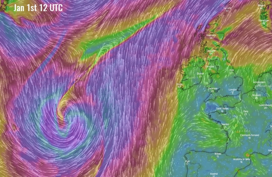
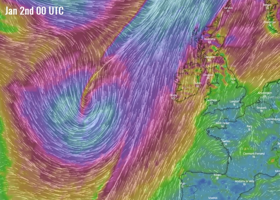
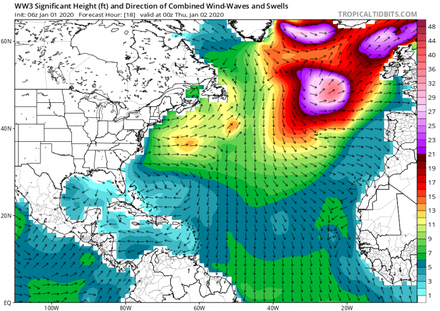
The cyclone will be moving towards the northeast Atlantic and west-northwest Europe today through tonight, but should begin weakening and loosing its extreme winds. So, therefore, any significant wind threat to the land areas in western Europe are unlikely tomorrow when it comes closer. However, a broad wind field should still deliver huge waves towards the coasts of Ireland and Scotland. Here is the sequence from today 12 UTC until tomorrow 12 UTC:
Stay tuned for further updates!
See also:
Interested in our calendar? We are proud to present and promote the best weather photographers in Europe – see details:

