Post-tropical cyclone Ophelia is rapidly approaching Ireland for landfall over the southern part of the island within the next few hours. Expect a very severe and damaging windstorm with winds gusting at 130-160 km/h, up to 190 km/h at higher elevations and in exposed areas. This is a potentially very dangerous situation!
Update [9:47 UTC]: 170 km/h gust already reported at Fastnet lighthouse!
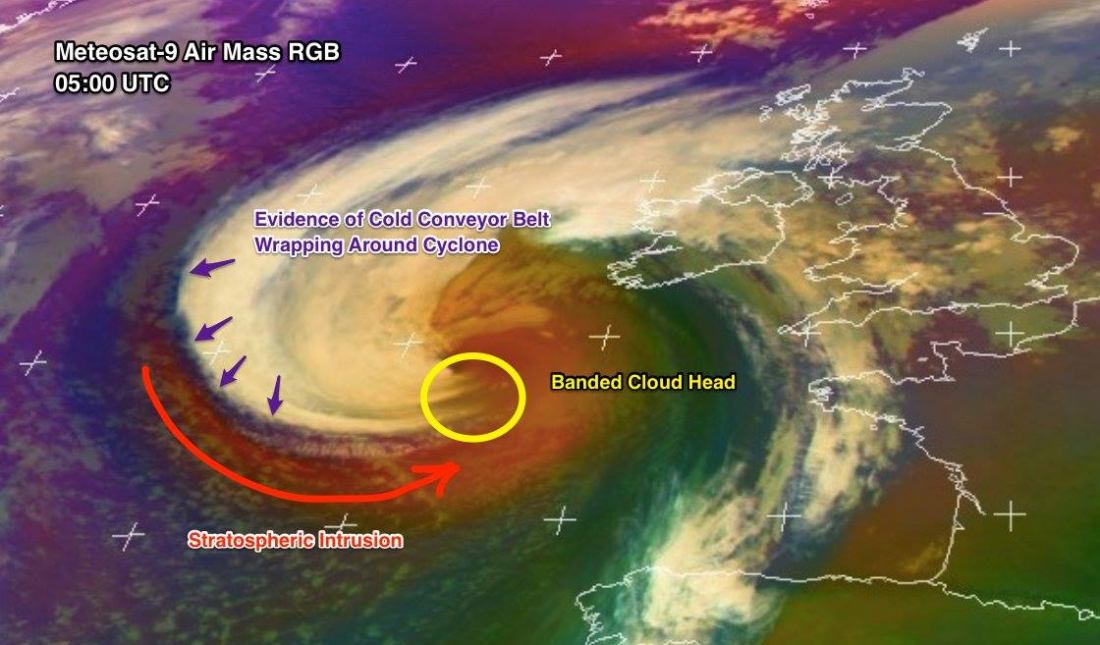
Satellite analysis of post-tropical storm Ophelia rapidly approaching Ireland this morning. Notice the “banded cloud head” pushed towards the SW Ireland, indicating a sting jet structure likely – this will pose threat for very damaging extremely severe winds with locally above 150 km/h gusts. Image: EUMETSAT.
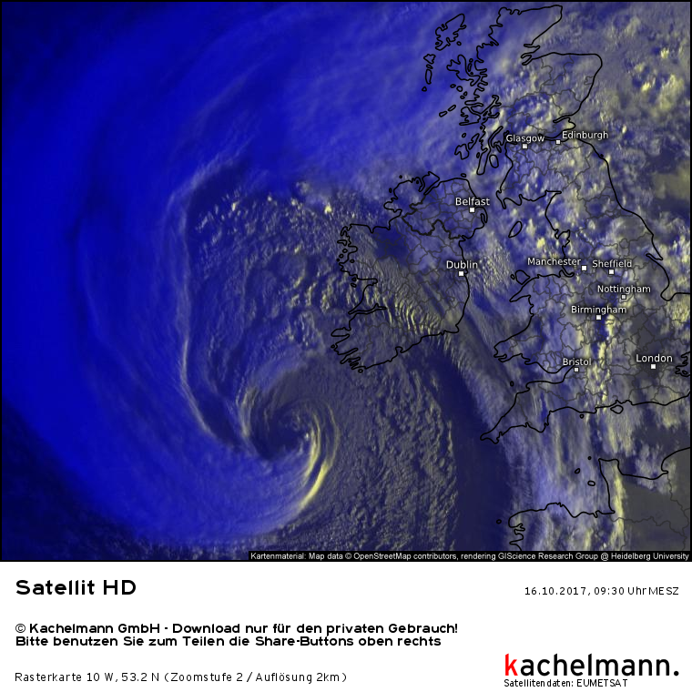
Ophelia has transitioned into a post-tropical cyclone, still packing hurricane-force winds. Central pressure is 974 mbar and the system is tracking NNE towards landfall in southern Ireland within the next several hours.
Early morning view of Ophelia approaching Ireland. Image: EUMETSAT / Kachelmannwetter.com.
Various high-resolution models are still in good agreement: widespread severe to very severe winds across Ireland, Wales and Northern Ireland gusting at 120-150 km/h, locally up to 160 km/h. Expect winds gusting up to 180-190 km/h at higher elevations and in exposed areas. Some high-res models indicate a sting jet possibly forming: if that happens, gusts may be even stronger and approach 200 km/h at higher elevations and exposed areas.
[fb_plugin post href=https://www.facebook.com/severeweatherEU/videos/2099446283611795/]
[fb_plugin post href=https://www.facebook.com/severeweatherEU/videos/2099442770278813/]
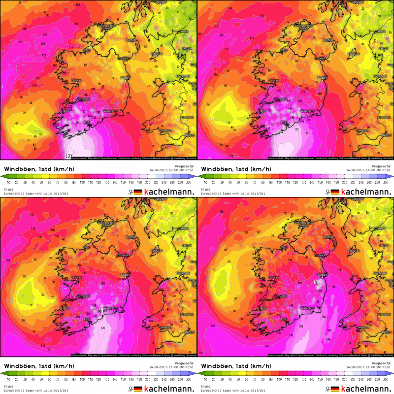
Latest Kachelmann Europa HD model guidance: powerful winds gusting at 170-190 km/h at higher elevations, widespread winds gusting up to 130-160 km/h. Note the 180+ km/h gusts near Dublin! Click on map to enlarge. Maps: Kachelmannwetter.com
Expect the southern parts of Ireland to be hit first, with strong storm to hurricane-force winds late in the morning to early afternoon. As the system tracks NNE-wards, strong storm to locally hurricane-force winds will spread across much of the region.
This is a potentially very dangerous situation, that may result in damage in property and loss of life. Follow any instructions given by your national weather service. Check back for regular updates!


