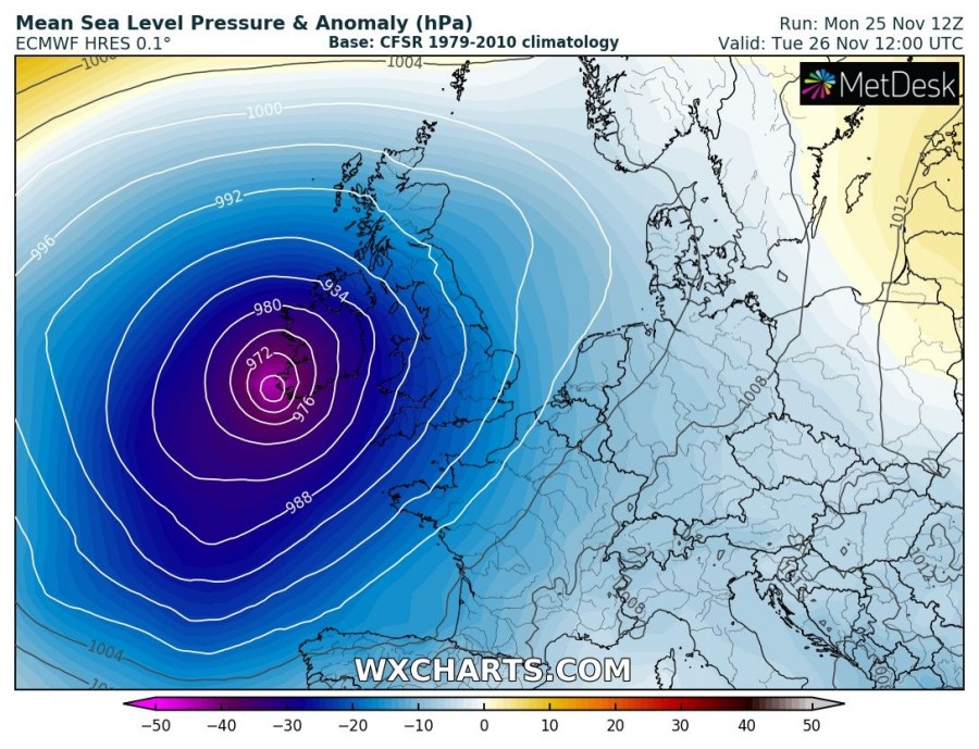
Extra-tropical storm #SEBASTIEN continues moving NE at the acceleration rate and is now having central pressure near 980 mbar. It continues deepening and is likely to reached slightly below 970 mbar by tomorrow late morning when it touches the SW Ireland.
Satellite imagery indicate cyclone is driven by a large scale / broad cyclonic circulation to its northwest, while a pronounced dry intrusion has introduced cyclone’s additional, more sigificant strengthening this evening. The classic curvature of cloud bands is visible on infrared and water vapour images.
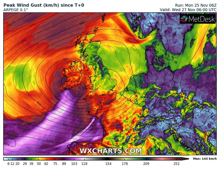
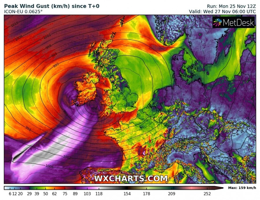
Peak wind gusts overview indicates models are on track with the previous simulations, suggesting 100-120 km/h gusts are likely towards S Ireland and extreme SW tip of England (Cornwall) in the morning hours through midday tomorrow, Tuesday, Nov 26th.
Major waves with significant wave height 7-10 meters are also expected over the open waters of the Bay of Biscay, while 6-8 meters are likely close to the coastal areas of S Ireland, SW England and W France. Later in the evening and overnight hours to Wednesday, another wave pushes across the southern parts of Bay of Biscay and delivers extremely severe winds with gusts 120-140 km/h across the Galicia region, NW Spain – refer to the forecast map above.
Stay alert for dangerous conditions!
Previous discussions:
Interested in our calendar? We are proud to present and promote the best weather photographers in Europe – see details:


