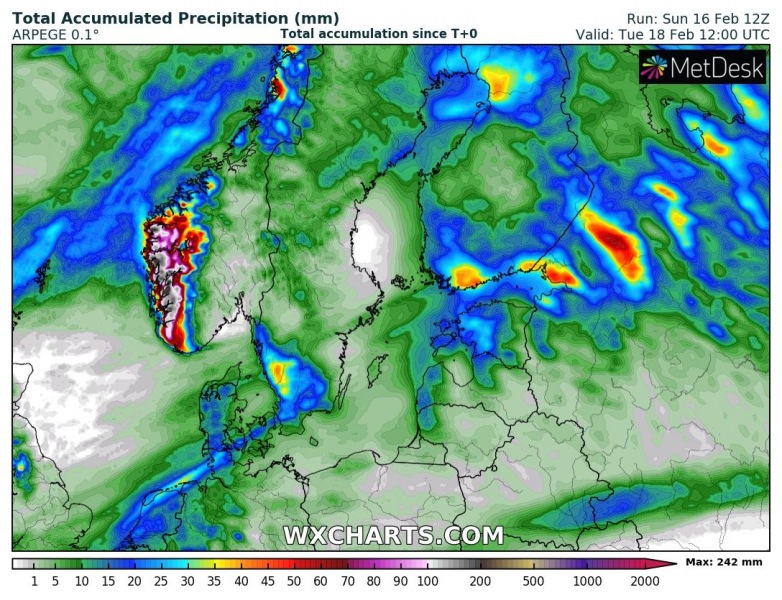
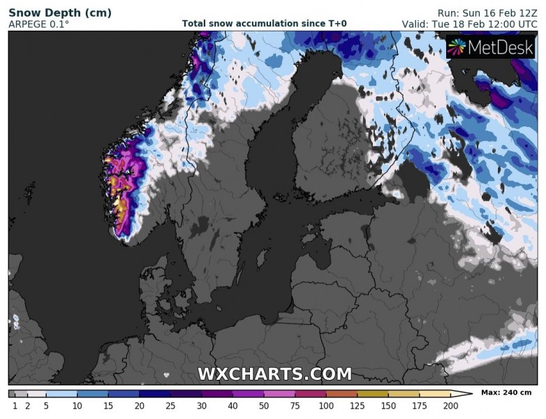
We are at the final stage of large cyclone #Dennis tonight through Monday. While it continues moving east into northern Europe, it is weakening and delivering severe winds into SW Scandinavia. Also, lots of rain and snow into SW Norway, increasing the avalanche threat.
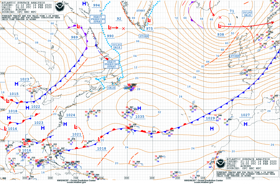
18 UTC analysis today revealed Dennis’ center has the minimum central pressure of 938 mbar while moving towards Scandinavia. A broad wind field is developed south of the core, resulting in severe windstorms across UK and Ireland.
These are the official minimum central pressure values by NOAA analysis since the cyclone’s Dennis birth along the northeast US on Thursday afternoon:
- 938 mbar at 18 UTC, Feb 16th
- 930 mbar at 12 UTC, Feb 16th
- 925 mbar at 06 UTC, Feb 16th
- 922 mbar at 00 UTC, Feb 16th
- 920 mbar at 18 UTC, Feb 15th
- 925 mbar at 12 UTC, Feb 15th
- 936 mbar at 06 UTC, Feb 15th
- 944 mbar at 00 UTC, Feb 15th
- 956 mbar at 18 UTC, Feb 14th
- 972 mbar at 12 UTC, Feb 14th
- 987 mbar at 06 UTC, Feb 14th
- 994 mbar at 00 UTC, Feb 14th
- 996 mbar at 18 UTC, Feb 13th
- 1004 mbar at 12 UTC, Feb 13th
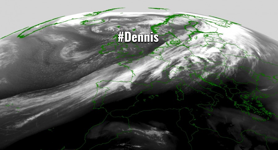
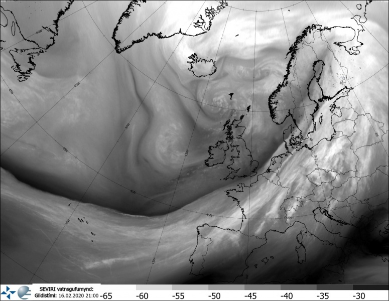
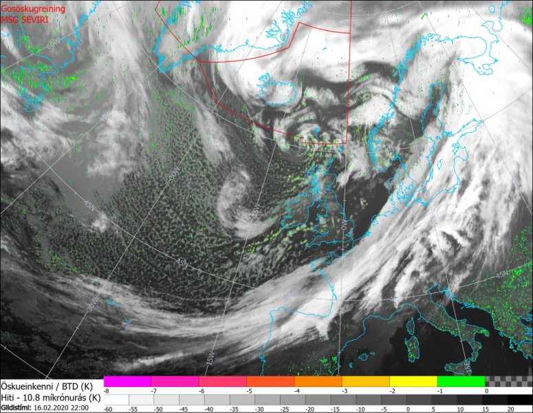
Satellite imagery clearly show how big the extra-tropical cyclone Dennis became, although we can also see its fully occluded now. Its main cold front is moving across western Europe:
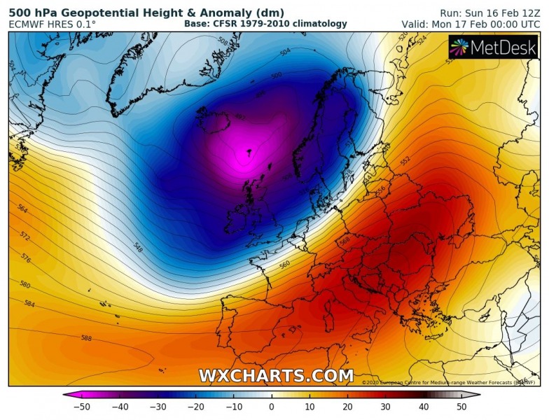
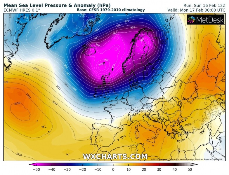
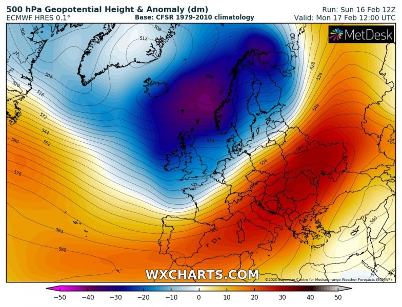
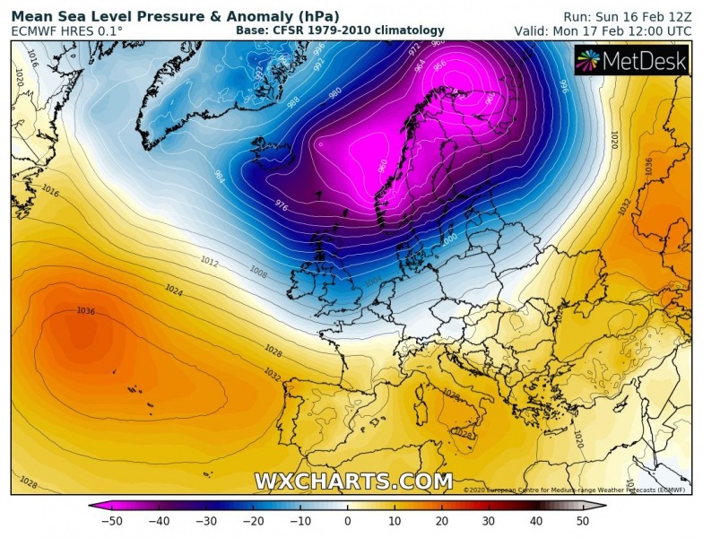
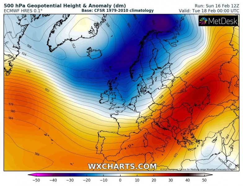
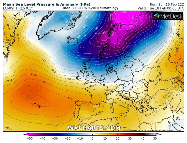
The large trough and an associated very large surface cyclone will be gradually weakening while drifting east into northern Europe and Scandinavia within the next 24 hours – cyclone’s center is currently moving over the Faroe Islands and will be reaching Norway tomorrow during the day:
Monday, Feb 17th, 00 UTC
Monday, Feb 17th, 12 UTC
Tuesday, Feb 18th 00 UTC
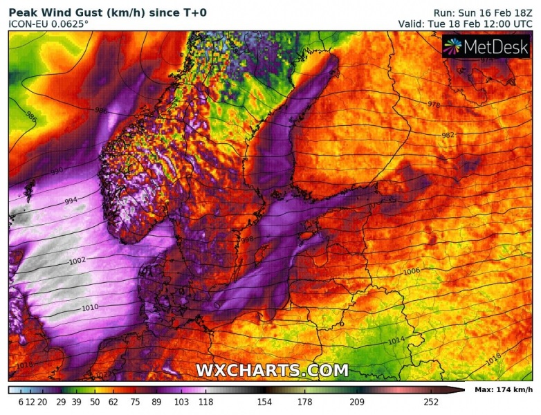
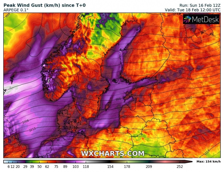
Peak gusts are expected to reach severe criteria across the North Sea tonight, also reaching also Denmark, southern Sweden, and SW Norway on Monday’s morning. Maximum winds should push well above 150 km/h over the higher terrain of SW Scandinavia.
Persistent and intense westerly flow associated with Dennis will also introduce an intense orographic snowfall into SW Norway, extreme amounts of snow are possible. Locally more than 200 cm of fresh snow is possible by Tuesday, enhancing avalanche threat significantly!
See also:
