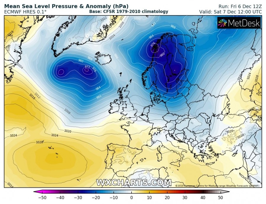
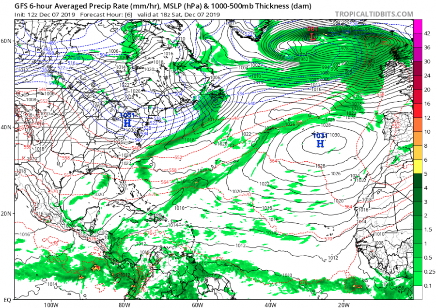
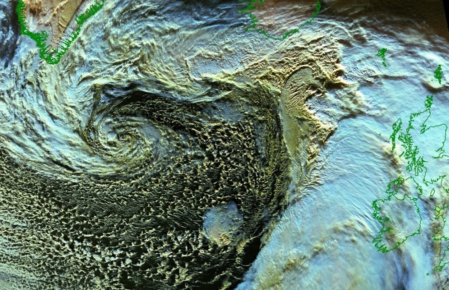
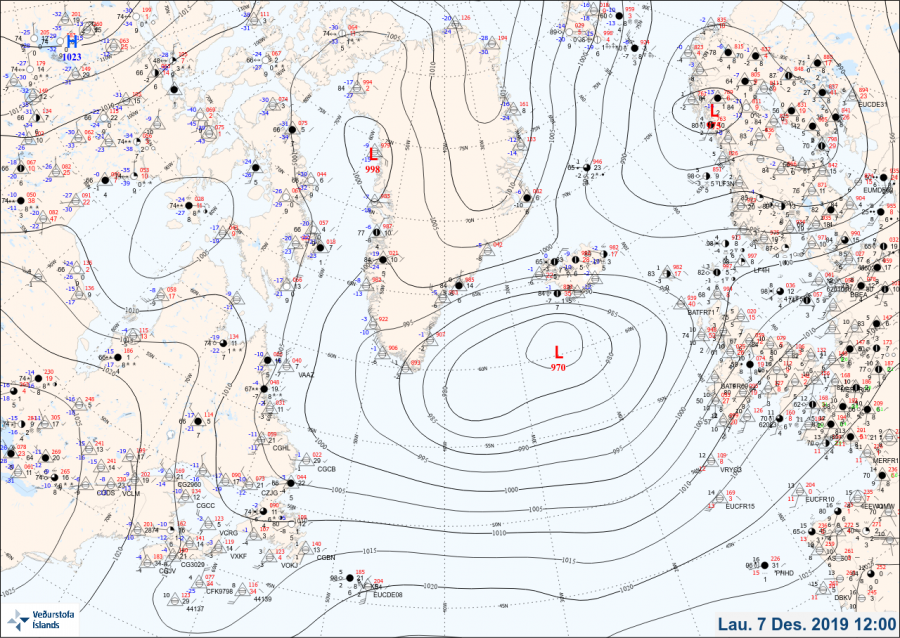
North Atlantic is becoming very active again as several very deep cyclones are in development and more of them are scheduled to form in the coming days. One very intense cyclone has developed last night, revealing an impressive structure today on the satellite images. Central pressure has dropped below 970 mbar while the center of the cyclone is located WSW of Iceland. An intense windstorm will develop around the cyclone, affecting Iceland and western Europe tomorrow, Sunday, Dec 8th (more on this later).
The pattern supporting this evolution consists of a stronger Azores high and indeed stronger North Atlantic upper trough. In between, enhanced zonal flow develops. Once the Arctic airmass over the Labrador Sea and Greenland arrives onto the warmer sea on North Atlantic, the intense cyclogenesis process begins.
A couple of satellite images in various spectrum revealing an impressive cyclonic structure of the low, with widespread cold maritime airmass south of the main core. While a lot of cold air is advected behind the main cold front, being pushed east towards Faroe islands and the UK.
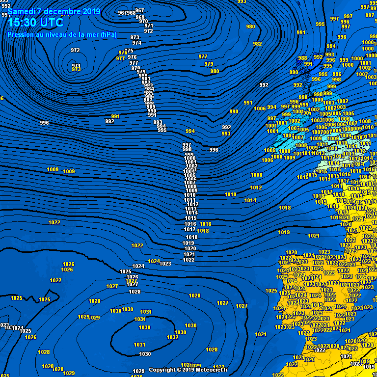
Based on the model reanalysis and METAR / SYNOP observations, we can see the broad tight pressure gradient between the Azores and the far North Atlantic, around 65-70 mbar difference. This is resulting in powerful westerly zonal winds and therefore a developing windstorm towards WNW Europe.
We are closely monitoring the evolution of this deep cyclone as it leads into development of an intense windstorm towards western Europe tomorrow – stay tuned for details soon!
Interested in our calendar? We are proud to present and promote the best weather photographers in Europe – see details:
