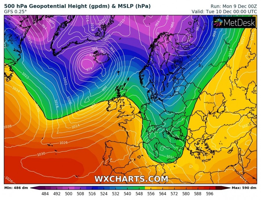
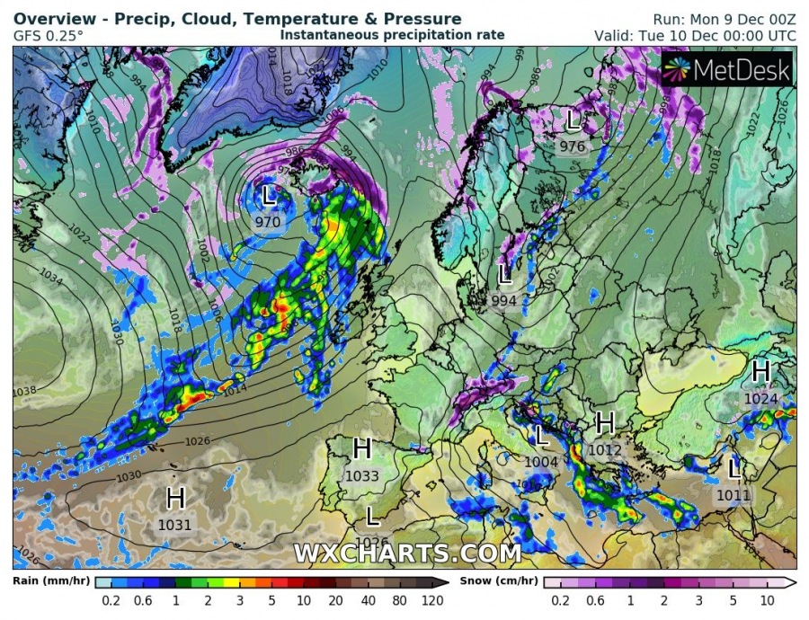
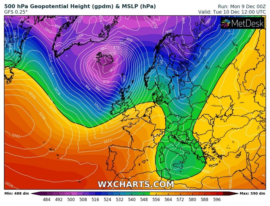
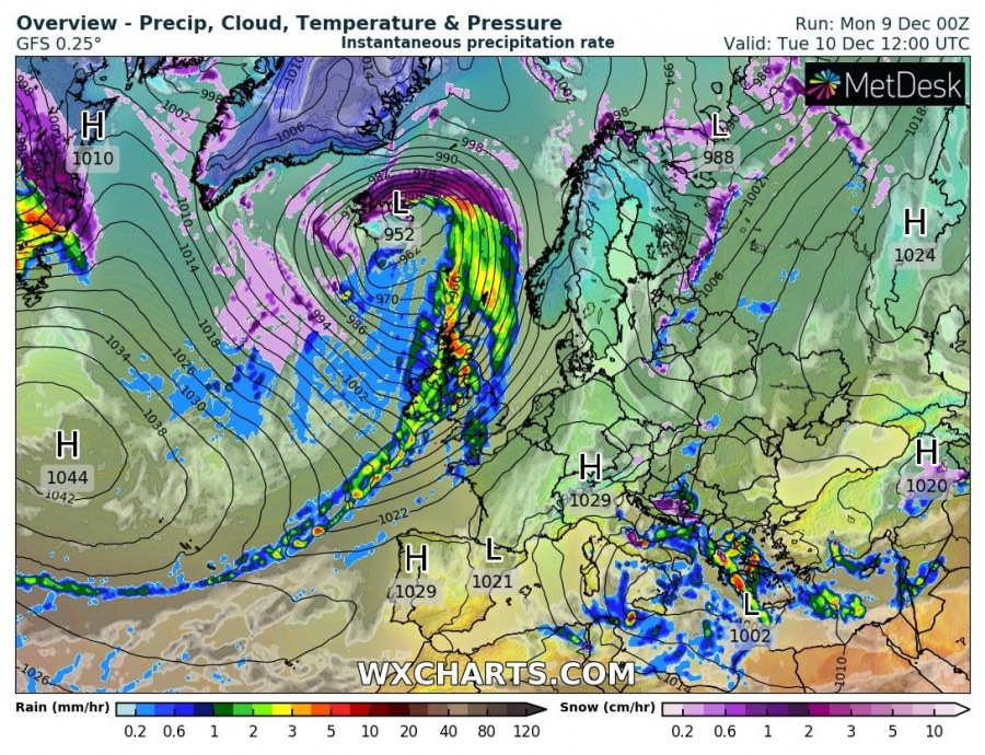
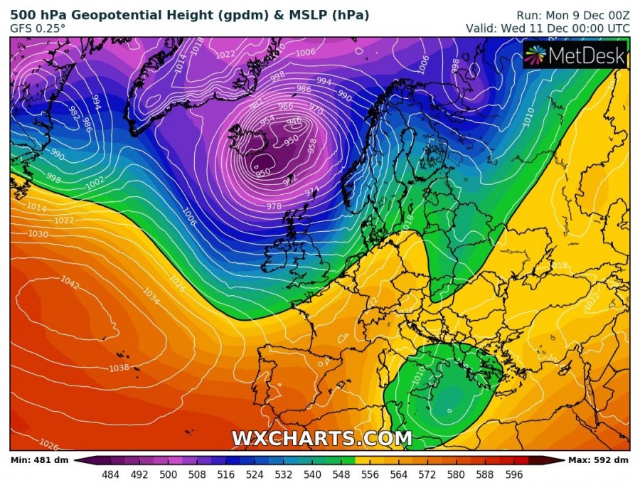
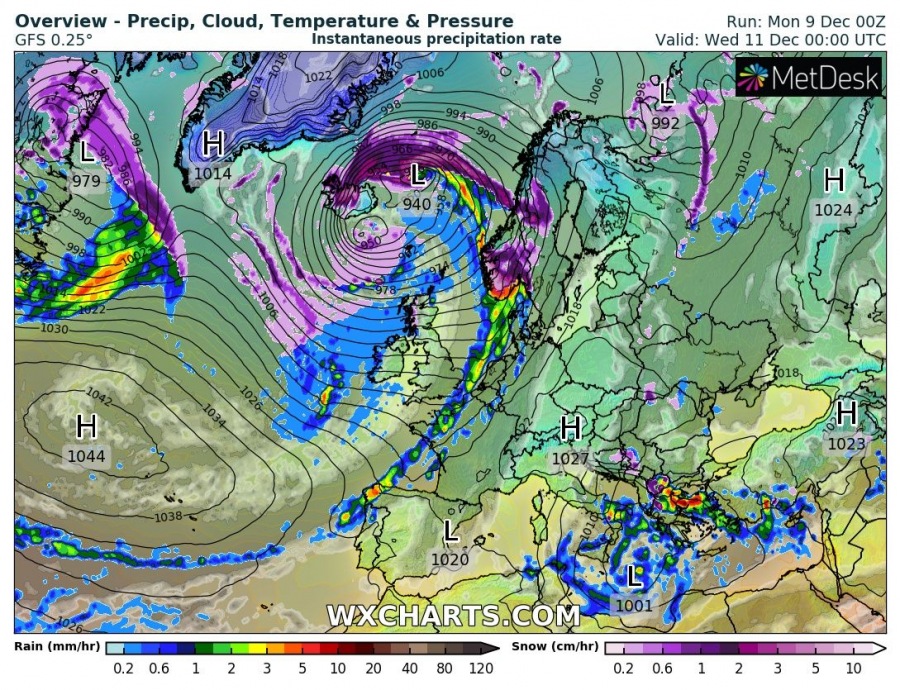
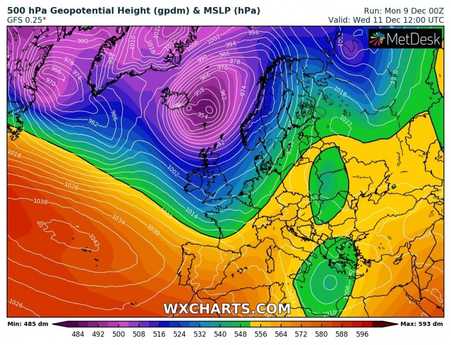
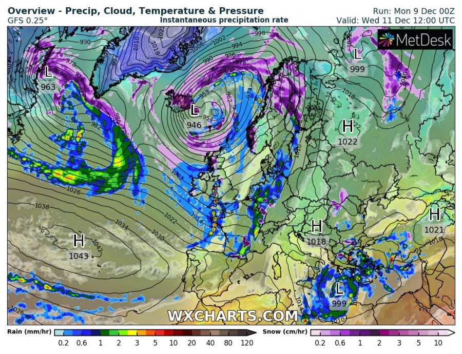
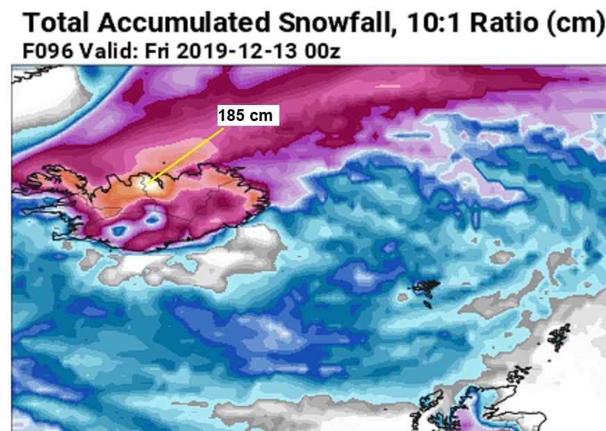
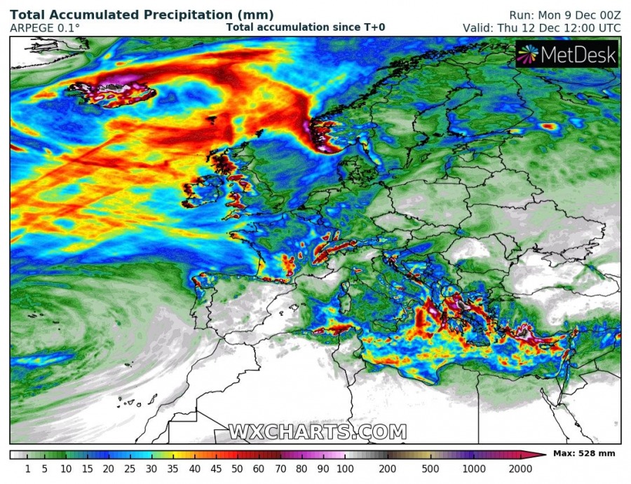
As we discussed earlier – an active pattern across the North Atlantic – continues this week. A monster cyclone with pressure near or below 940 mbar will develop over Iceland and significantly enhance severe weather threat as an extreme amount of snow, dangerous winds and major snowdrifts develop. The result will be many impassable roads and significantly disturbed travels through Tuesday and Wednesday. Various models are hinting 100-200 cm of fresh snow in only two (2) days, together with hurricane-force winds!
*********************************
*********************************
Severe Weather Outlook – violent winterstorm develops over Iceland (valid: 10/12/2019 – 12/12/2019)
*********************************
Cyclone begins its rapid intensification tonight, located west of Iceland. Central pressure should rapidly drop from 975 mbar to near 950 mbar. The wind field will be intensifying while the cyclone moves across Iceland tomorrow, Tuesday, Dec 10th. It is increasingly likely central pressure will drop below 940 mbar while cyclone slows down to the ESE parts of Iceland. This will significantly intensify orographic snowfall on its wake across northern Iceland. Intense blizzard conditions will develop! Through late Wednesday, Dec 11th, cyclone begins weakening while drifting east towards the Norwegian sea.
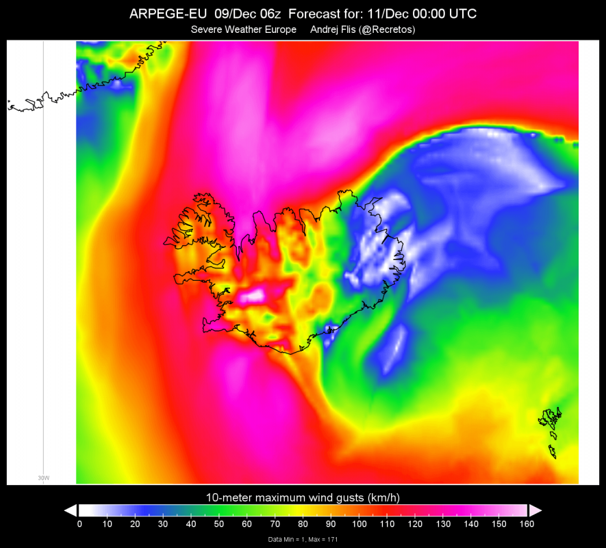
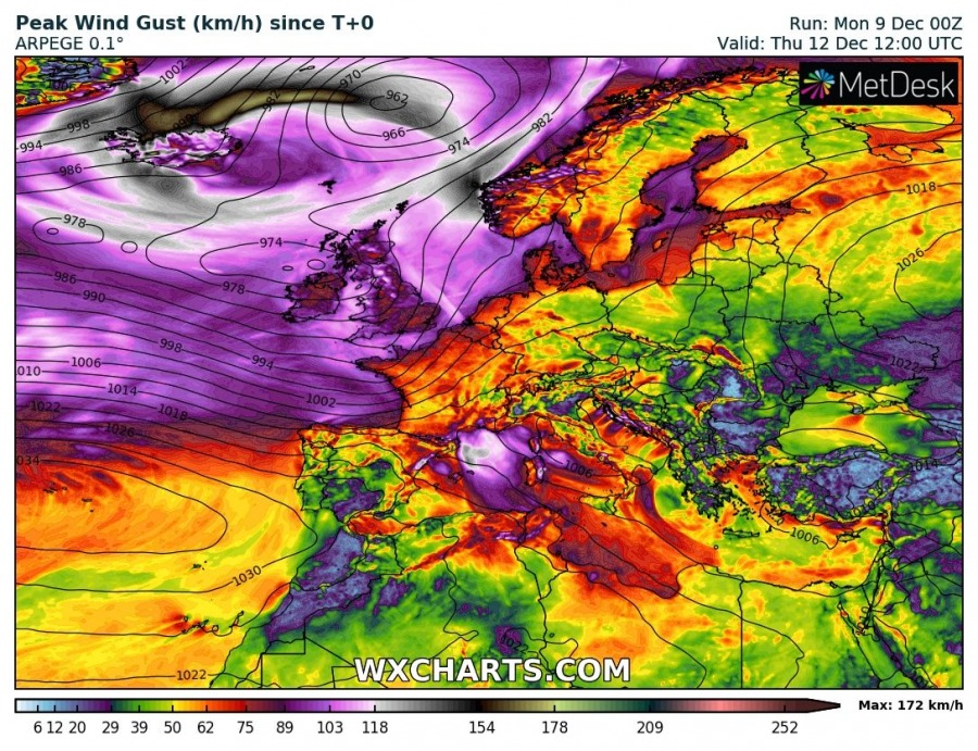
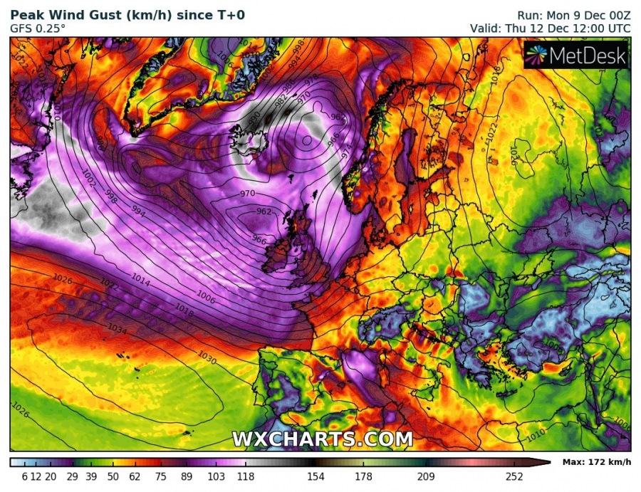
An extremely deep cyclone, the central pressure will likely push below 940 mbar, will introduce violent winds on the northern side of the system, likely with hurricane-force speeds above 150 km/h, even above 200 km/h across the mountainous terrain in North Iceland! Attached are ARPEGE, ICON-EU and GFS forecasts.
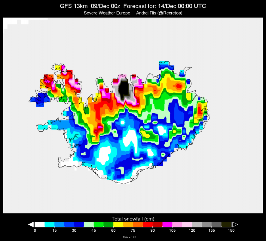
The position of the cyclonic jet on the rear side of this deep cyclone will introduce an extremely intense orographic precipitation/snowfall across northern Iceland, combined with severe to extremely severe winds in excess of 100-120 km/h. Models are is a fairly good agreement in the extreme amount of snow through Tuesday and Wednesday (48 hours period), resulting in 100-200 cm of fresh snow in many areas! Extremely dangerous and life-threatening conditions will develop as intense blizzard is expected with major snowdrifts. Most of the roads will be blocked!
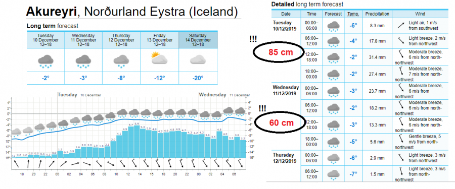
The highest amounts of snow are expected near Akureyri, the city in N Iceland and especially over the mountain range to the west where orographic features will be maximized. Attached is a detailed ECMWF model forecast for Akureyri, indicating the snowfall will be very intense and could result in around 85 cm of snow on Tuesday and an additional near 60 cm on the next day, Wednesday, Dec 11th. Snowfall diminishes on Thursday.
We are closely monitoring the evolution of this life-threatening situation and will keep you updated tonight!
See also:
Interested in our calendar? We are proud to present and promote the best weather photographers in Europe – see details:
