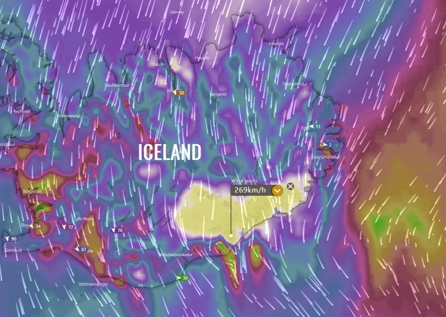
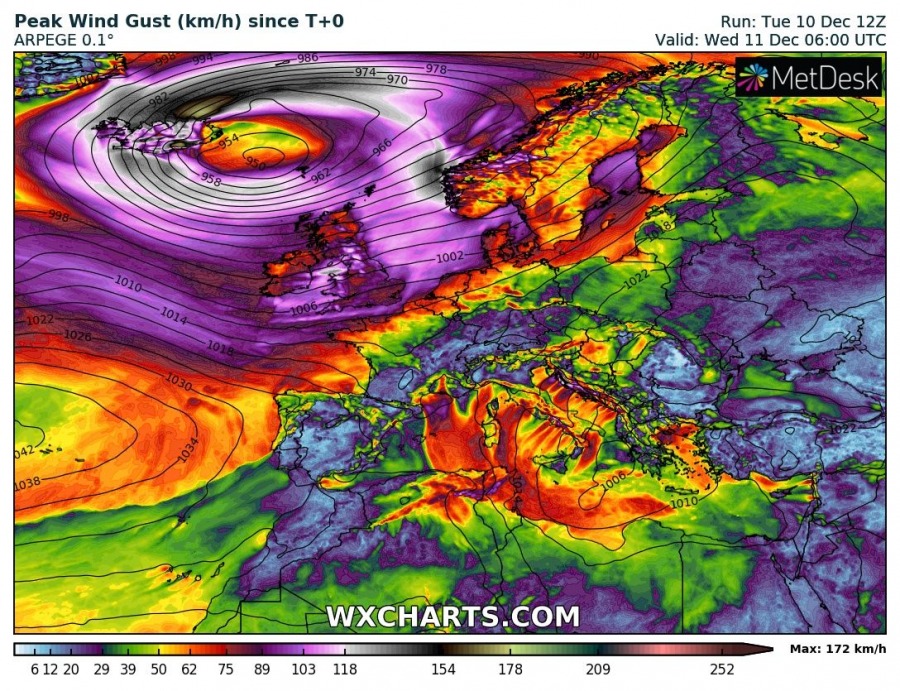
Extremely windy conditions and life-threatening conditions are unfolding across the western half of Iceland as bombogenesis cyclone is sitting along the SE parts of the island. Central pressure is already below 950 mbar, cyclone continues deepening. As the cyclone is expected to drift further east tonight, extreme wind threat will worsen and spread across much of the country. Models are still in a very good agreement developing a violent windstorm with wind gusts 200-250 km/h across the SE parts of Iceland, possibly even more locally! Intense snowfall with violent blizzard conditions are worsening across northern Iceland as well, as snowfall rates are still intensifying within 140-170 km/h wind gusts. Hurricane-force winds and heavy snowfall will continue overnight and tomorrow.
Here are exceptionally impressive satellite images of a very deep cyclone, centered over Iceland. Notice the textbook coma shape of the cloud pattern across the western half of the country where the highest, hurricane-force winds are ongoing. Cyclone is gradually moving east tonight.
Pressure analysis reveals a very large surface cyclone located along the SE coast of Iceland this evening, with central pressure around 948-949 mbar and falling. Notice the incredible pressure gradient across the western half of Iceland – undoubtedly this is the perfect example of a violent windstorm there! Numerous weather stations are reporting wind gusts above 150 km/h, some of them are already pushing close to 190 km/h. Conditions are intensifying!
Icelandic Met Office has upgraded the northwestern parts of Iceland into red warning as well, similar conditions to the far northern parts are now also expected further west. Extreme blizzard is ongoing and worsening tonight as excessive snowfall and hurricane-force winds will continue – possibly even strengthen!
Accumulated snowfall forecast is on track with the previous simulations, expecting more than 150 cm of fresh snow until tomorrow across the northern parts of Iceland! Quite a lot of snow is likely across the whole northern half of country while Foehn winds should mostly preclude snowfall to spread into SSW parts of Iceland.
Tomorrow late morning and afternoon, Dec 11th, *VIOLENT* hurricane-force wind gusts are expected by all the models across the SE parts of Iceland – the ICON-EU model is the most aggressive and hinting almost up to 270 km/h peak gusts locally!
Extreme winter storm with violent windstorm and intense snowfall/blizzard will continue overnight and tomorrow, even worsening locally. Stay alert for dangerous conditions and do NOT attempt to travel if not necessary!
We will be updating the post overnight and tomorrow – stay tuned!
See also – HIGH + SIG risks are in effect for Iceland!
Previous discussions:
Interested in our calendar? We are proud to present and promote the best weather photographers in Europe – see details:


