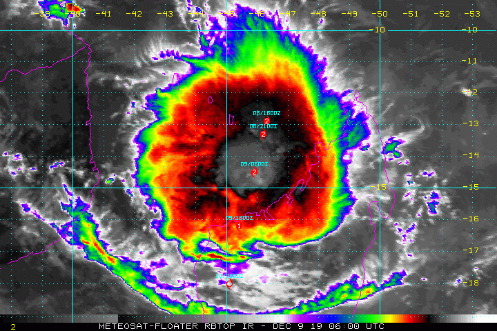
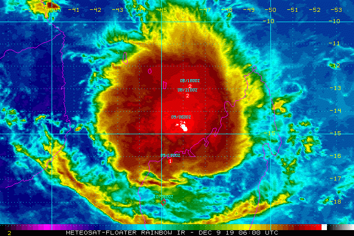
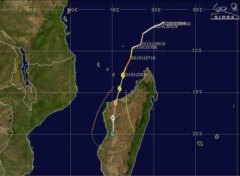
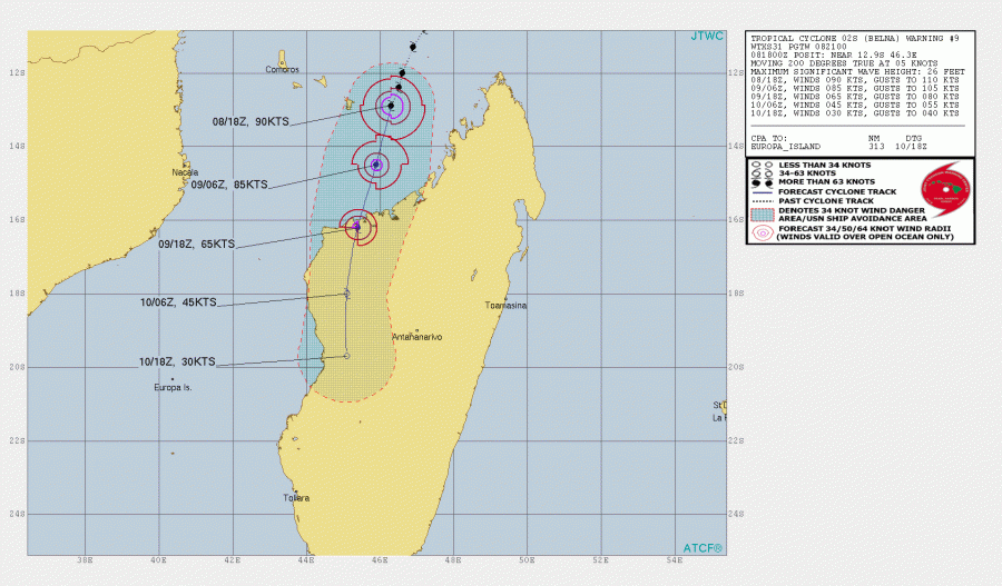
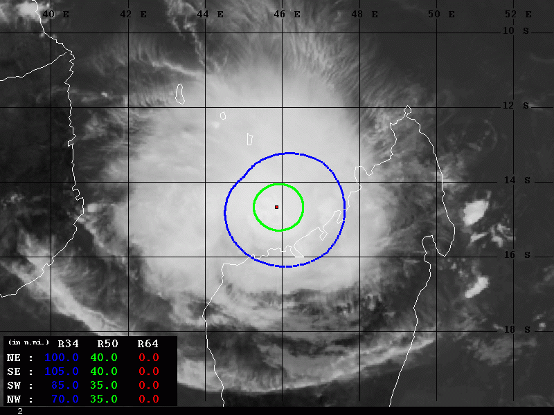
Although cyclone #Belna is already weakening, it remains a large tropical system with strong Category 1 strength, located just north of Madagascar. Belna is packing maximum sustained winds of 80 knots / 90 mph / 150 km/h with central pressure near 980 mbar and continues due south – the landfall is expected this evening local time. Cyclone’s outer bands are already producing severe winds and torrential rainfall on the NW parts of Madagascar.
Satellite imagery still indicates healthy outflow patterns in the upper-levels while cyclone continues its slowly weakening trend. However, very cold cloud tops are supporting intense storms within a large convective complex.
* #MADAGASCAR: #BelnaCYCLONE #Belna
– #Antananarivo #Mangaoka #Bobasakoa #Ambodibonara #Ambanja #Ambilobe #Andilana #Antonibe #Soanenga #Sohondra #Andranomavo #Soalala #Mitsinjo #Namakia #Antseza #Androhibe #Katsephy #Bekipay #Africa
-BLOG/MAPS/SATELLITEhttps://t.co/Y8YgxIEUjs pic.twitter.com/ddvDRI3ccs— Let's Talk Tropics (@RoshinRowjee) December 9, 2019
Images Meteosat Eumetsat 6H UTC.
Levé de soleil sur le #cyclone #Belna
Il va atterrir vers 17H UTC sur la pointe Nord-ouest de #Madagascar .
Mais très gros écarts entre différents modèles sur le point d'atterrissage.https://t.co/od6CKJ9zsH pic.twitter.com/4aBn2K6Liu— meteophile (@meteophile) December 9, 2019
https://twitter.com/HurricaneRiley5/status/1203718137088229376
Cyclone #Belna landfall is imminent for #Madagascar. https://t.co/nBGvWgIzR9 pic.twitter.com/N06qDRqDsT
— UW-Madison CIMSS (@UWCIMSS) December 9, 2019
First reports are already revealing flooding issues across a small island Mayotte located northwest of Madagascar, further flooding is likely over NW Madagascar (near Mahajanga) later today and tonight.
Le cyclone #Belna a déjà touché le nord de #Madagascar : Diego Suarez (photos). Mais l'inquiétude est encore plus forte pour les régions ouest (Majunga) de #Madagascar où le cyclone devrait être plus fort encore…#Europe1 @MattBelliard pic.twitter.com/T89aS1SWui
— Jean-Seb Desmarets (@_JeanSeb_) December 9, 2019
Belna continues moving SSW today with an expected landfall in NW Madagascar this evening, around 18 UTC, as a dangerous Category 1 cyclone.
80-100 miles wide 34-knot wind radii is already affecting NW Madagascar while the 35-40 miles wide 50-knot wind radii are approaching fast as well. Major storm surge is expected to push into coastal areas across the whole northwest part of the island in the coming hours, as well as hurricane-force winds and torrential rainfall with dangerous flash floods!
Stay alert for dangerous weather conditions with flooding this afternoon and tonight!
Previous discussions on cyclone Belna:
Interested in our calendar? We are proud to present and promote the best weather photographers in Europe – see details:
