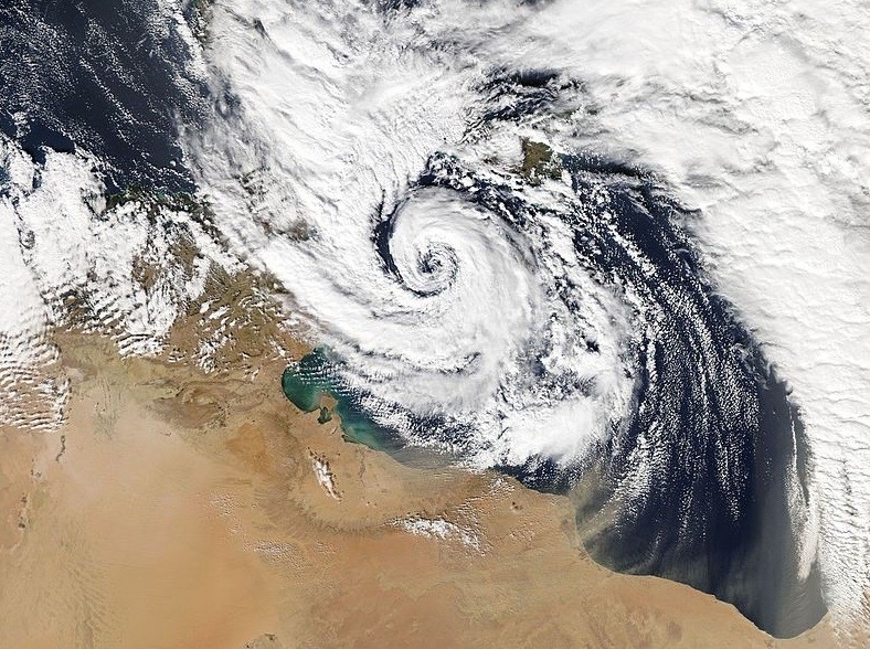
The unusually very warm Mediterranean sea this month is providing much higher potential for severe weather events across the region if appropriate conditions should come together. Later this week, a surface cyclone formation is expected over the Tyrrhenian. The potential for a Mediterranean tropical-like cyclone (TLC) or shortly – Medicane is enhanced as well. Medicanes often have warm core, similar to the hurricanes or typhoons.
The current sea surface temperatures across the Tyrrhenian sea and around south Italy are between 26 and 28 °C, even higher further south towards the coast of northern Africa. With such unusually high sea surface temperatures in place, the severe weather potential is much higher than normally expected. The very warm sea provides much higher moisture content in the air and therefore higher dew points, which provide more fuel for severe thunderstorms.
You can read about the potential for dangerous weather development due to much warmer sea surface temperatures below:
http://www.severe-weather.eu/mcd/very-warm-mediterranean-sea-and-what-that-means-for-severe-weather-in-the-autumn-2/
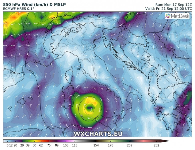
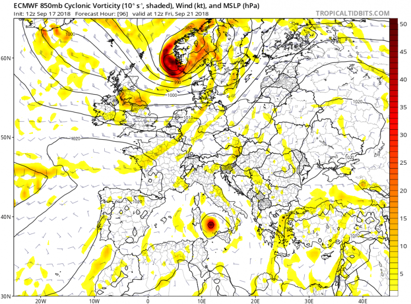
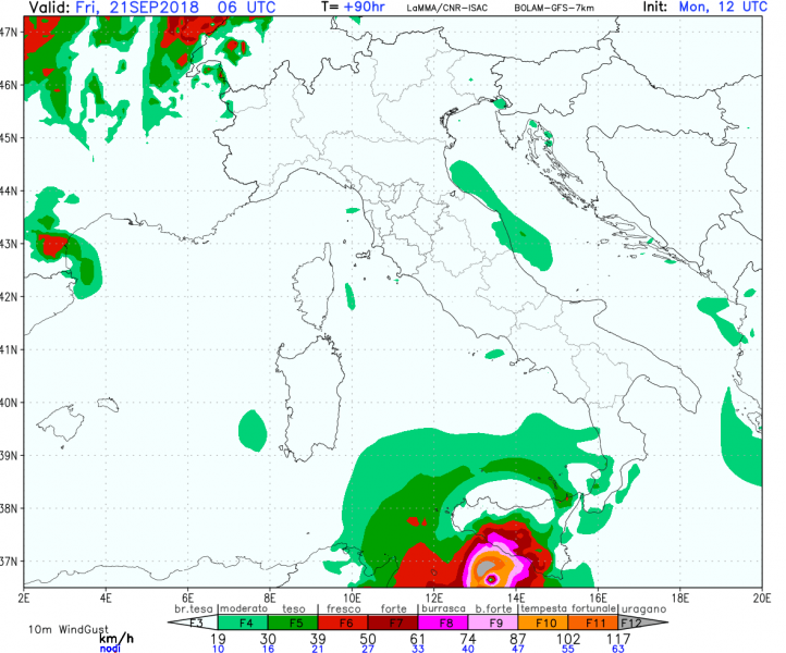
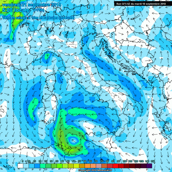
Various models in the past 24 hours are hinting at the formation of Medicane in the aforementioned region, although the exact location is not well defined right now. We are going through some global and high resolution models for now, which are showing the formation of a Medicane some time on Thursday or Friday. We will provide more detailed outlook once these uncertainties diminish.
WRF-NMM model, 18th Sept 00 UTC run:
ECMWF model, 17th Sept, 12 UTC run:
BOLAM-GFS model, 17th Sept, 12 UTC run:
GFS model, 18th Sept 00 UTC run:
ARW-GFS model, 18th Sept 00 UTC run:
Strong Medicanes have formed in the past, e.g. cyclone Qendresa approaching Malta in early November 2014. Satellite image revealed a very impressive cyclonic structure of the Medicane that day.
Another Medicane formed over the Ionian sea last year – Medicane Numa/Zenon headed for landfall along the western coast of Greece.
Stay tuned for further updates as soon as we get more model data available.


