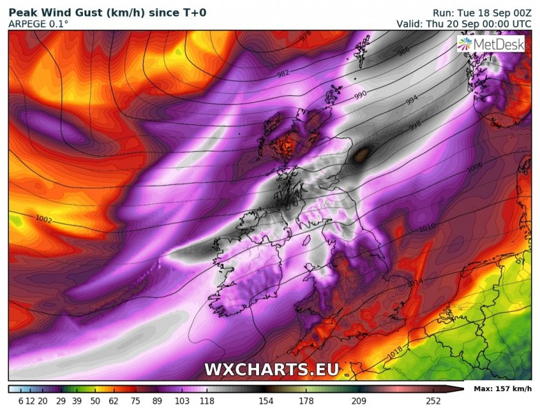
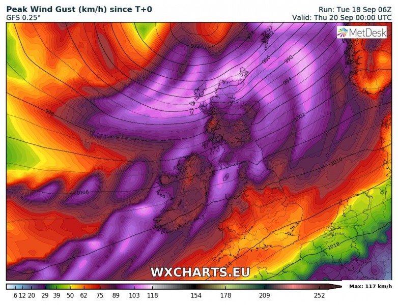
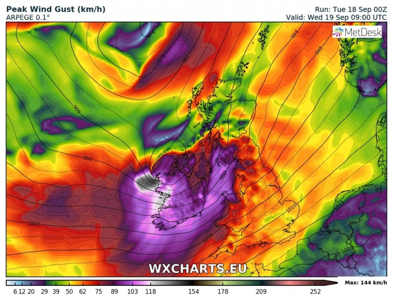
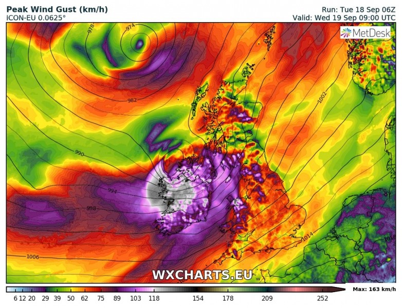
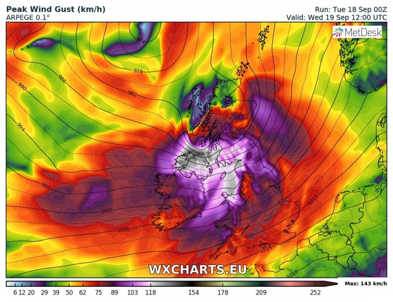
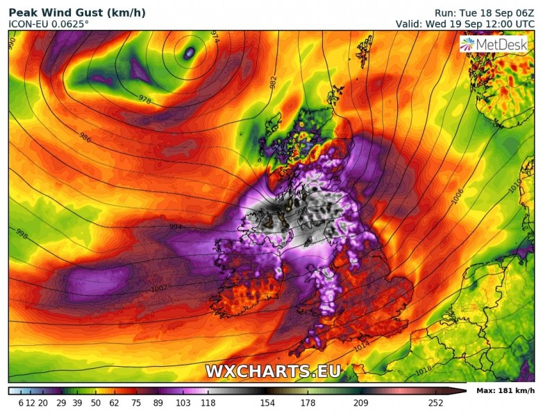
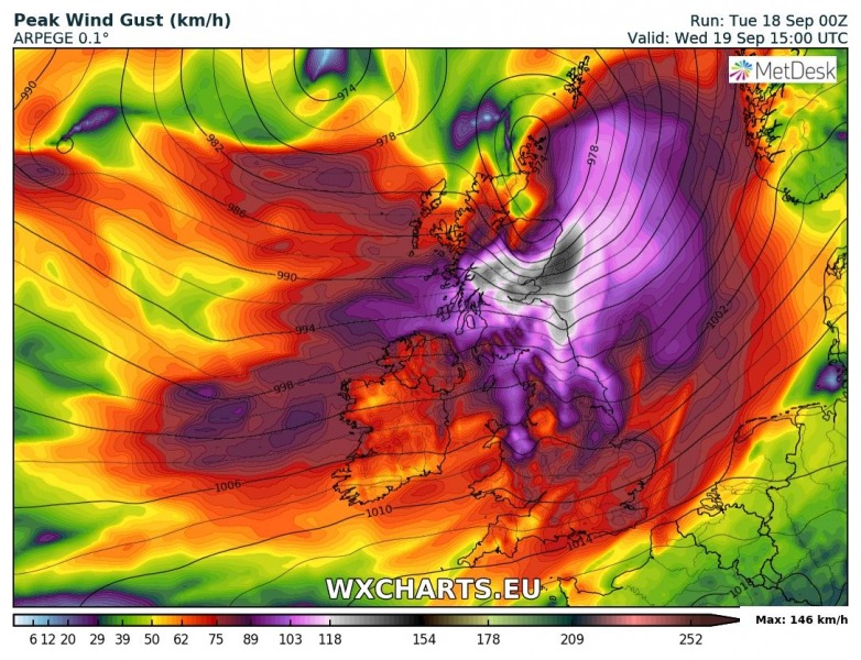
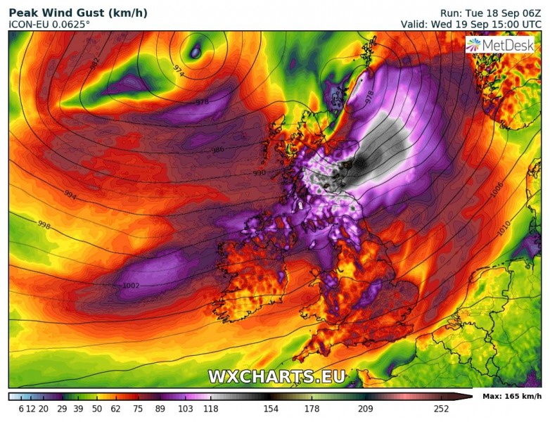
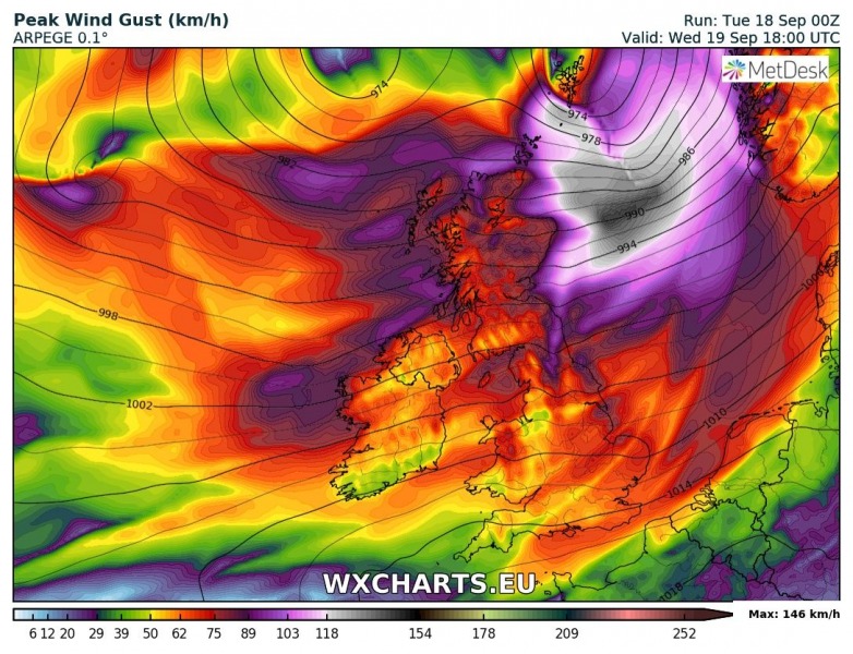
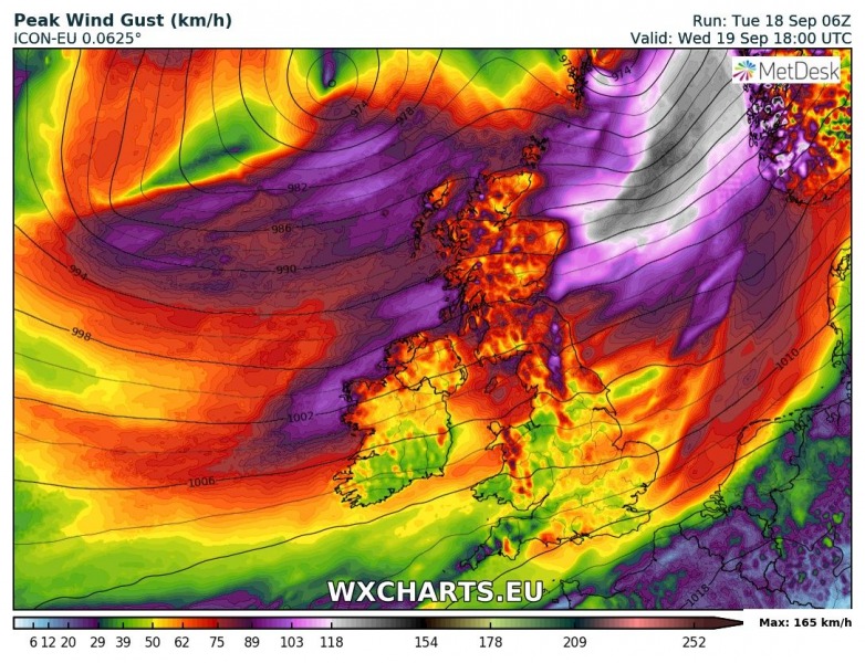
As noted yesterday, models are now in fairy good agreement for the development of an intense windstorm, now named ‘Ali’ across northern Ireland, Northern Ireland and Scotland tomorrow, Sept 19th. The windstorm will be caused by a rapidly deepening cyclone forming west of Ireland in the morning hours and then moving across Scotland, and finally ejecting into the North Sea through the afternoon and evening hours. The development of a sting-jet is possible as well, resulting in very intense winds in excess of 150 km/h locally.
Here is ARPEGE and GFS model comparison of peak wind gusts swath until 18 UTC tomorrow:
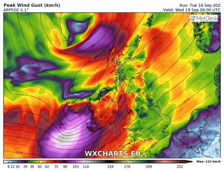
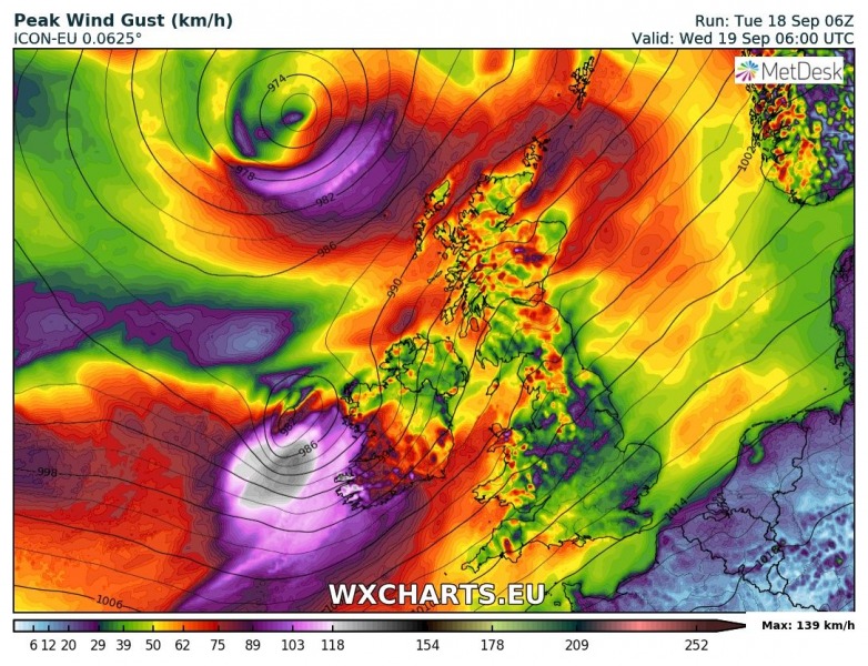
Here is side-by-side model comparison of ARPEGE and ICON-EU models from 06 UTC until 18 UTC in 3 hour steps. Both models are simulating an extremely severe winds possible across parts of western and northern Ireland and across south-central Scotland. Peak gusts could reach up to around 160 km/h, while the Cairngorms mountain range could see gusts to near 200 km/h!
Sept 19th, 06 UTC – 7am local time
Sept 19th, 09 UTC – 10am local time
Sept 19th, 12 UTC – 1pm local time
Sept 19th, 15 UTC – 4pm local time
Sept 19th, 18 UTC – 7pm local time
Stay tuned for further updates later today!
