Medicane Numa / Zenon is now moving southeastward across the Ionian sea for landfall along the western coast of Greece late in the day. We review various high-resolution models.
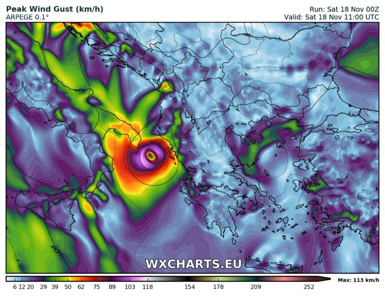
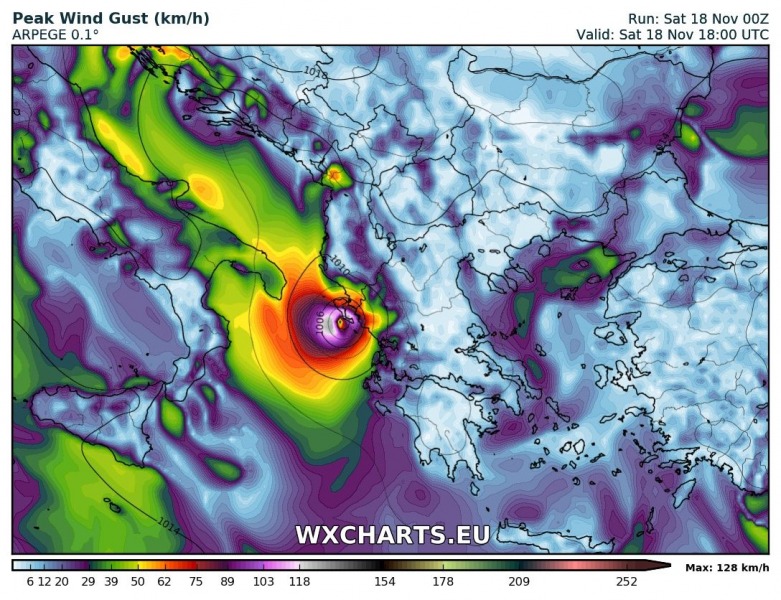
Latest ARPEGE model guidance indicates the system moving from its current position near the southern tip of Puglia, Italy across the northern Ionian sea towards ESE for landfall over southern Corfu island in the evening hours. The model also suggests the system will strengthen during the day, with peak wind gusts of 120-130 km/h in the second half of the day and at landfall.
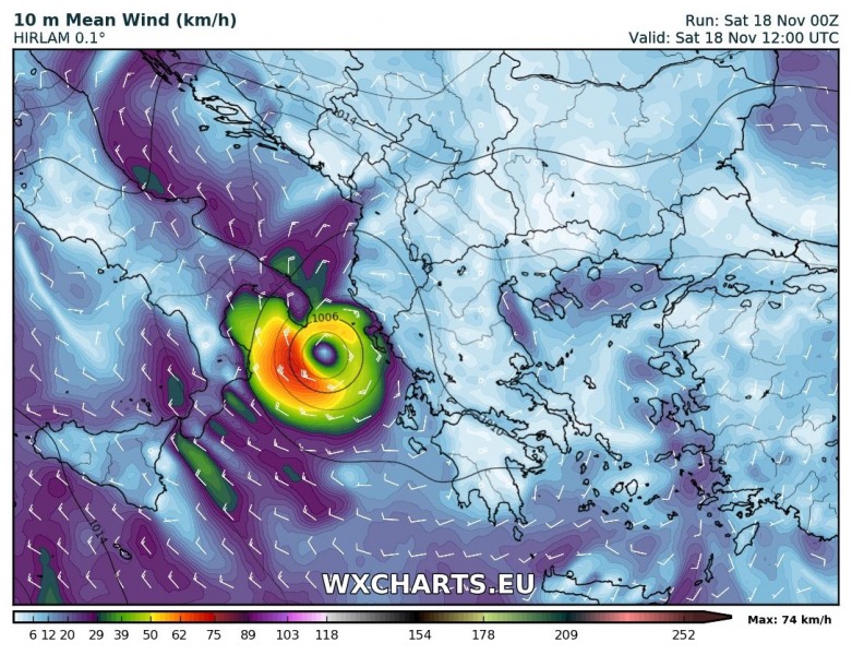
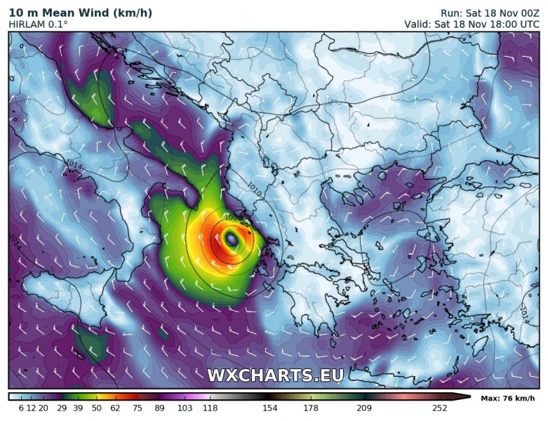
Current HIRLAM model guidance has the system moving southeast across the Ionian sea during the day, while remaining at current strength or slightly strengthening to maximum sustained winds of approximately 80 km/h.
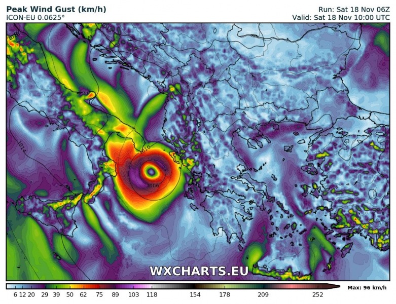
Latest ICON model guidance has the system moving southeast and strenghtening significantly during the day, with peak wind gusts up to 130 km/h during the second half of the day and at landfall over Lefkada and Kefalonia late in the evening.
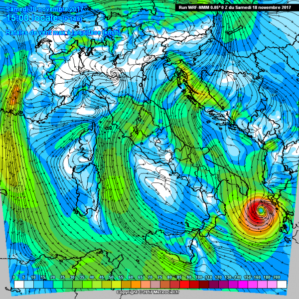
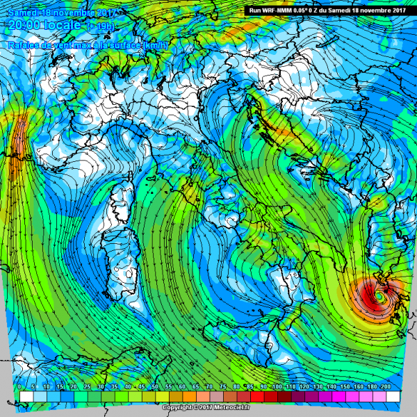
WRF-NMM also suggest a souteasterly track, with landfall in the evening just south of Corfu island. Peak wind gusts of approximately 100 km/h are indicated.
At this time high-resolution models are in good agreement for landfall of the system along the western coast of Greece between the islands Corfu and Zakynthos. Stay tuned for further updates!


