Overshooting tops develop on thunderstorms that have powerful updrafts.
Overshooting tops typically develop on Cumulonimbus capillatus incus clouds. The updraft punches through the equilibrium level (and thus the anvil), rising higher due to its momentum despite no longer being buoyant.
An overshooting top is usually short-lived, lasting tens of seconds to several minutes. In rare cases, it may persist much longer. This phenomenon is a dome-like protrusion above a thunderstorm anvil and represents a powerful thunderstorm’s updraft and hence a higher potential for severe weather with that particular storm.
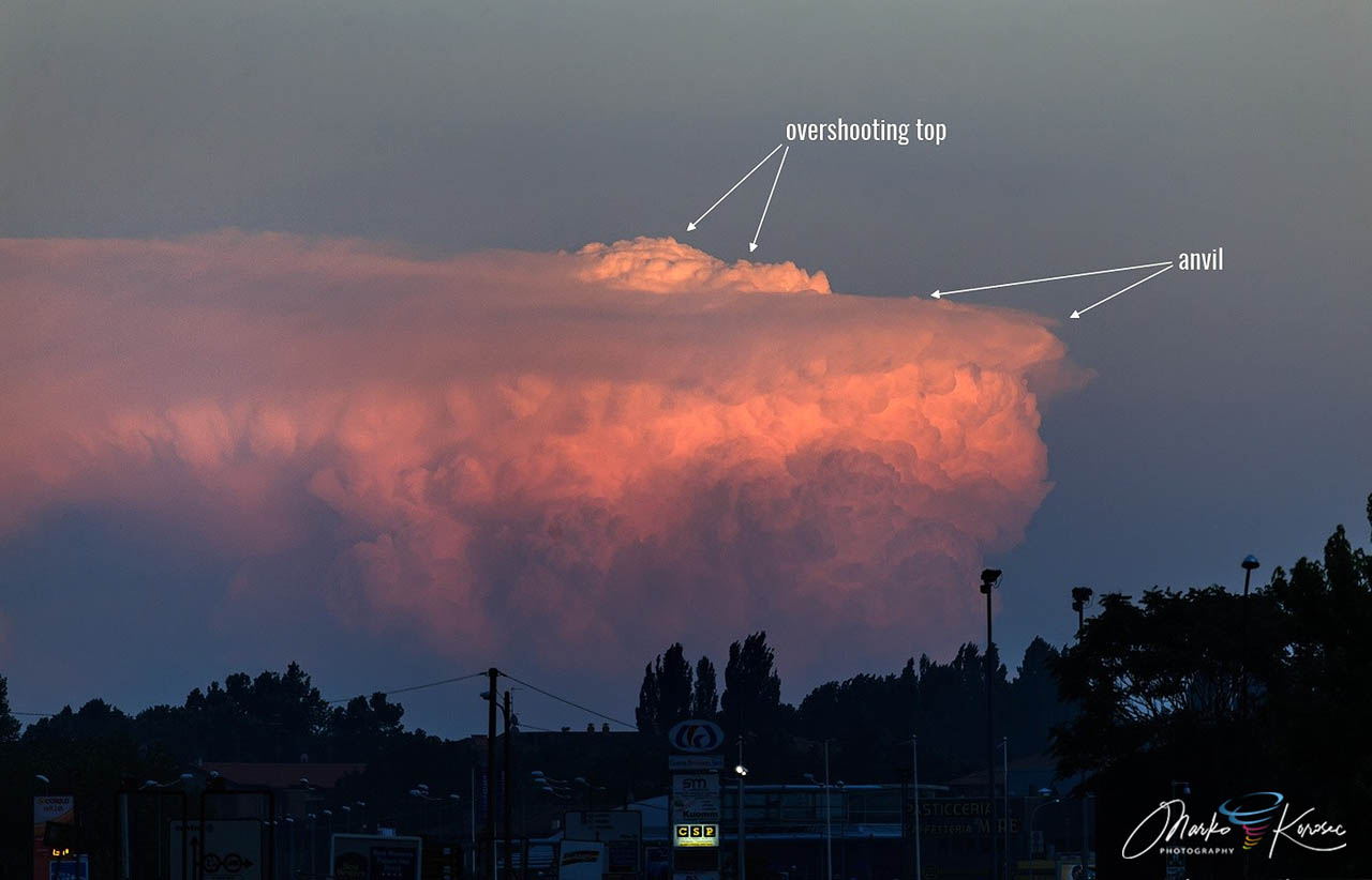
An Overshooting top on a severe thunderstorm near Ancona, north-central Italy, on June 26, 2016. Note the massive updraft! Photo by Marko Korošec
An overshooting top, particularly a persistent one, indicates a potentially severe thunderstorm.
An overshooting top is difficult to see and can only be seen in distant thunderstorms. However, it is readily apparent in satellite imagery, particularly at low Sun angles (i.e., morning and, more often, late afternoon).
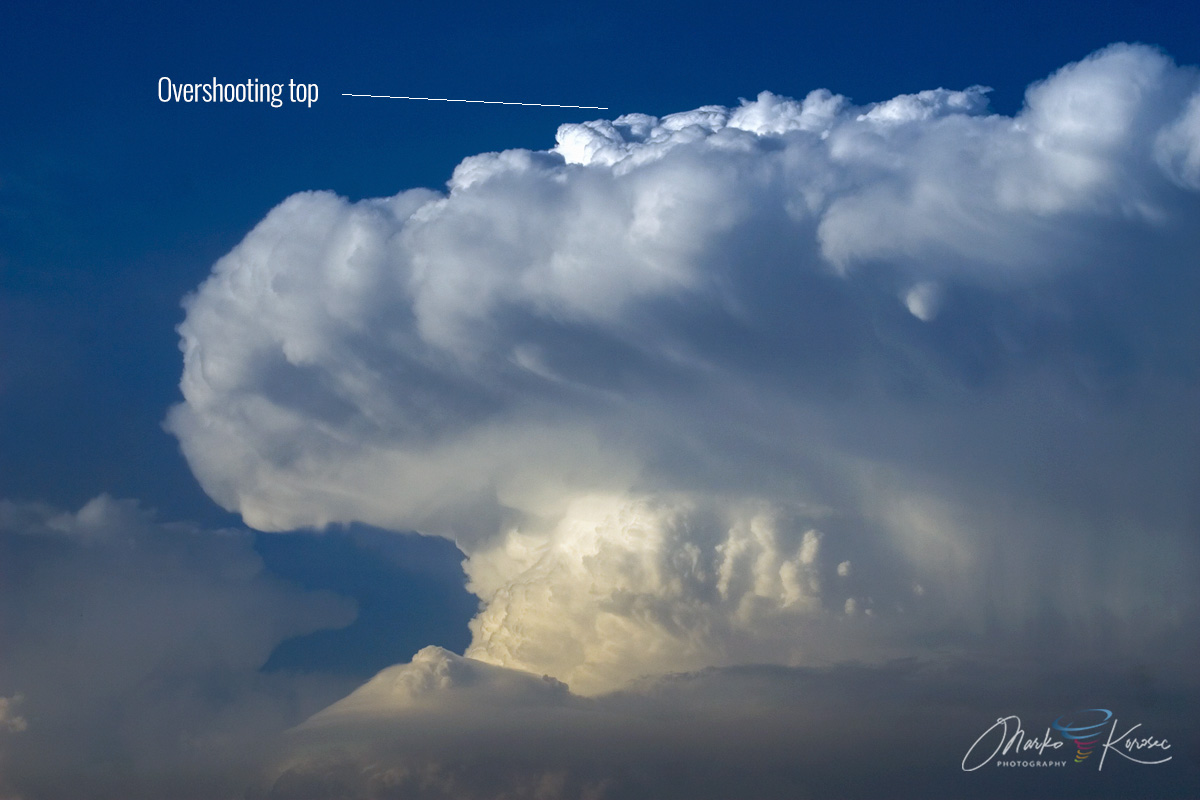
An Overshooting top on a severe thunderstorm over central Slovenia on June 28th, 2008. Photo by Marko Korošec
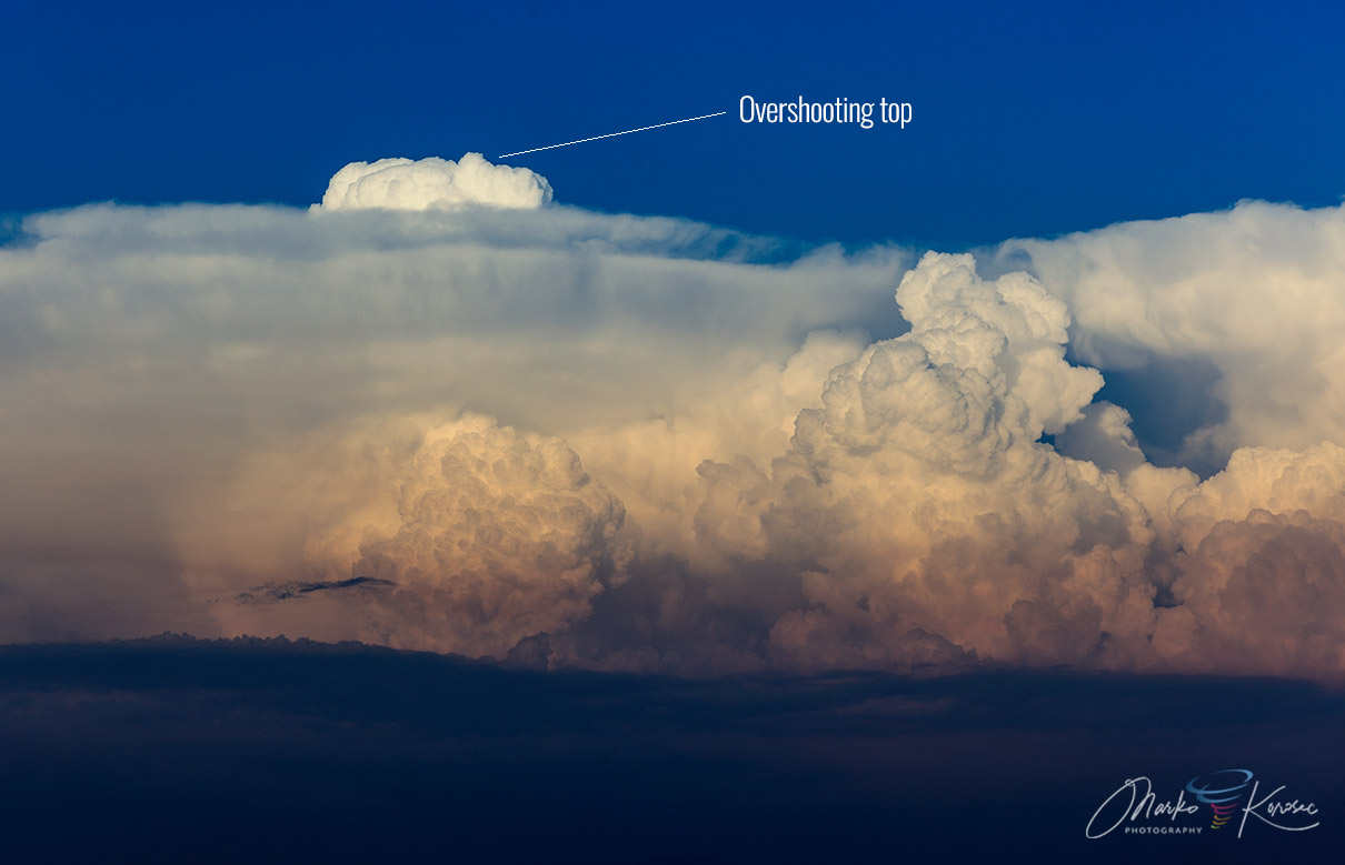
Below is another example of the overshooting top on the distant sunset storm over Slovenia, photographed from Villese, northeast Italy.
The overshooting tops can be easily visible on the satellite imagery. They cast shadows nearby if the sun is low in the sky. Therefore, they are best seen early in the morning or late in the afternoon.
The overshooting top takes up only a tiny portion of the entire area covered by the cirrus anvil.
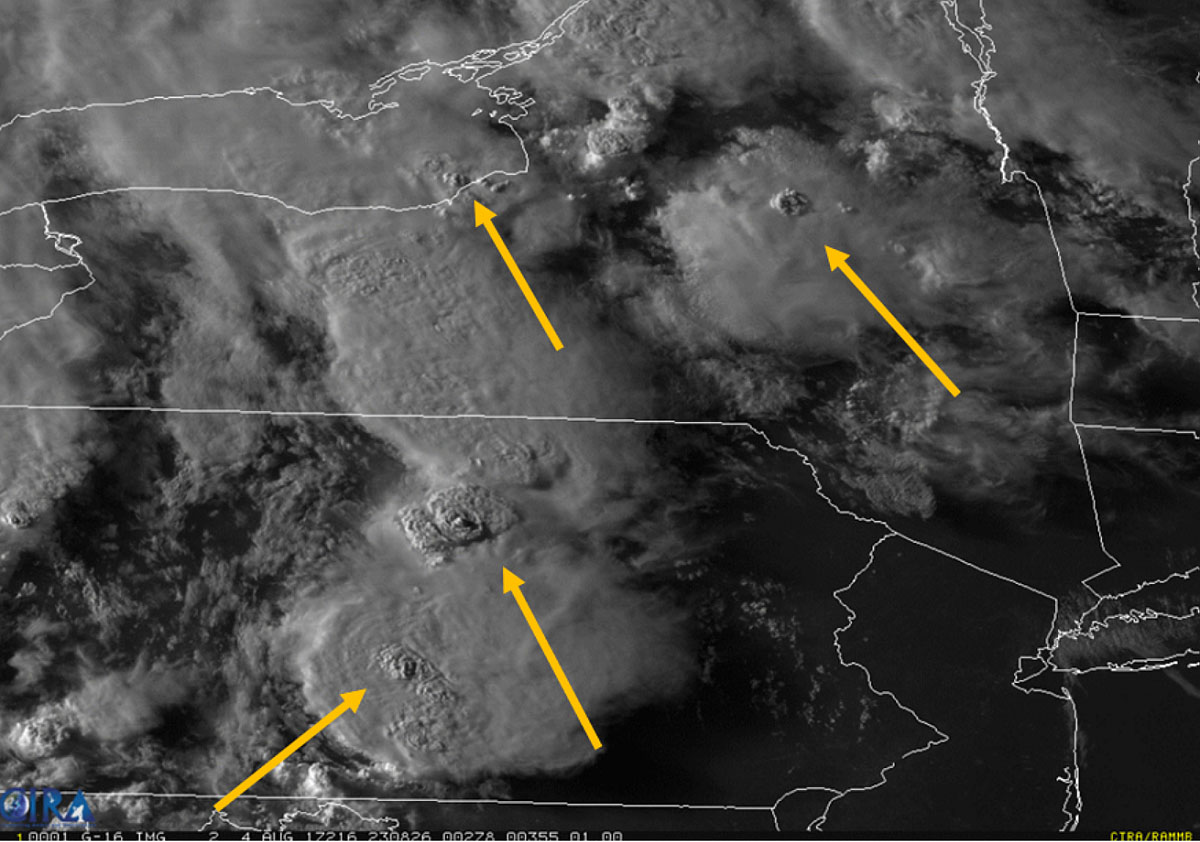
Above: Visible satellite image of multiple overshooting tops on severe thunderstorms. Image: NOAA CIRA