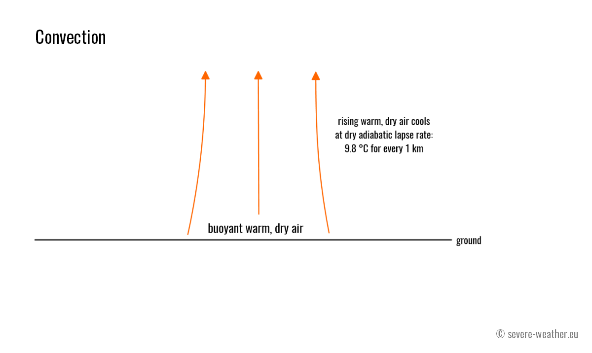
The warmer air has a lower density than the colder air, making it buoyant and causing it to rise. As the air parcels rise, the air’s moisture condenses and forms cumuliform clouds resulting from moist convection.
This is what makes hot air balloons rise. If we take a parcel of warm air and put it into the cold air, it will rise. If the warm rising air does not cool and the surrounding air does not warm, the parcel of warm air will rise indefinitely.
This is not the case. The rising warm air cools and eventually comes to the same temperature as the surrounding air. It then loses buoyancy and ceases to rise. How the rising air cools is a very important factor in meteorology.

As the warm air rises, it cools adiabatically. This means the air cools only due to pressure drop and expansion; the heat exchange with the surrounding air is negligible. A rising parcel of air cools by about ten °C (9.8 °C more precisely) for every kilometer it rises.
This value, 9.8 °C/km, is called the dry adiabatic lapse rate. It is a very rapid cooling rate, causing dry air to quickly reach the surrounding air temperature.
Moist convection
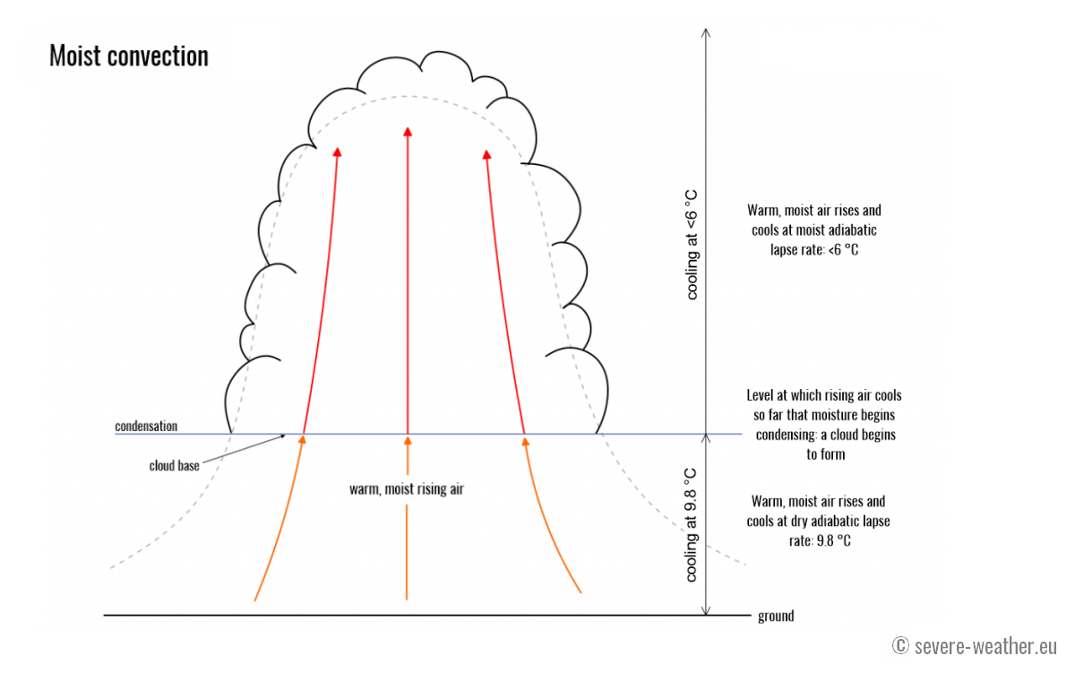
Warm, moist air, however, behaves somewhat differently. This difference is crucial for the formation of thunderstorms. As the parcel of warm, moist air rises, it initially cools by the dry adiabatic lapse rate, i.e., it cools by about 10 °C (9.8 °C) for every km it rises.
However, as it cools, the air’s moisture begins to condense. As you may recall, the water going from vapor to liquid (to water droplets) releases heat, warming the air. Therefore, moist warm air cools less quickly than dry warm air.
As it rises and cools, more and more moisture condenses into water droplets, releasing latent heat and warming the air. Additionally, water droplets freeze as the moist air rises, releasing latent heat and warming the air further.

The rate at which rising moist air in which moisture has already begun condensing cools with height is the moist adiabatic lapse rate: it cools on average by less than 6 °C (typically 5.5-6 °C) for every kilometer it rises. So, rising moist air cools about 2/3 as fast as dry air.
Interesting fact: The moist adiabatic lapse rate is not constant—it depends on temperature and pressure. At 1000 mbar and 20 °C, it is 4.3 °C/km; at 0 °C and 600 mbar pressure, it is 5.4 °C and -20 °C; and at 400 mbar pressure, it is 7.3 °C/km.
This allows moist, warm air to rise much longer and reach greater heights. Also, as the moist air cools more slowly, it keeps a bigger temperature difference with the surrounding air, making it more buoyant and rising faster.

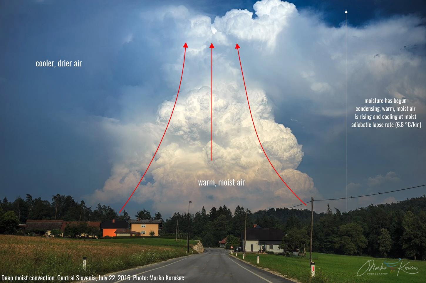
This is the perfect example of deep, moist convection. Central Slovenia on July 22nd, 2016, by Marko Korošec
The height at which the moisture condenses can be seen visually; this is the height of the bases of clouds (in thunderstorms, the base is usually called a rain-free base).
Recap: As the warm, moist air rises and cools, the moisture condenses into water droplets, releasing latent heat and warming the air. The air, therefore, cools less rapidly than it would if it did not contain moisture. This makes moist, warm air rise higher (and faster) than dry, warm air. As water droplets freeze, they release latent heat, warming the air further.