Every year, when we enter December, the speculation begins: what will the weather be like for Christmas and New Year? And on any given day, looking 3 or more weeks into the forecast is a very pointless task. But in recent years, tools and systems have been developed that at least allow us to look at the emerging trends and the basic likelihood of some areas being warmer/colder or drier/snowier.
The tools mentioned are the extended ensembles. It is basically a set of calculations, starting at the same time but with slightly different inputs. That enables the model to cover different atmospheric variations and go into longer forecast lengths.
With weekly weather trends, we don’t forecast what the temperature will be at 8 o’clock in the morning 20 days from now. We are only interested if the eastern United States or central Europe, for example, will be colder or warmer in a certain weekly period.
SNOWFALL DURING THE HOLIDAYS
Extended forecasting tools are only useful if you know what to look for. In this article, we are going to look at the early Christmas snow trends and what is the probability of snow during the holidays.
But before we look at the actual forecast trends, we need to know just how common it is to have a white Christmas across the United States and Europe.
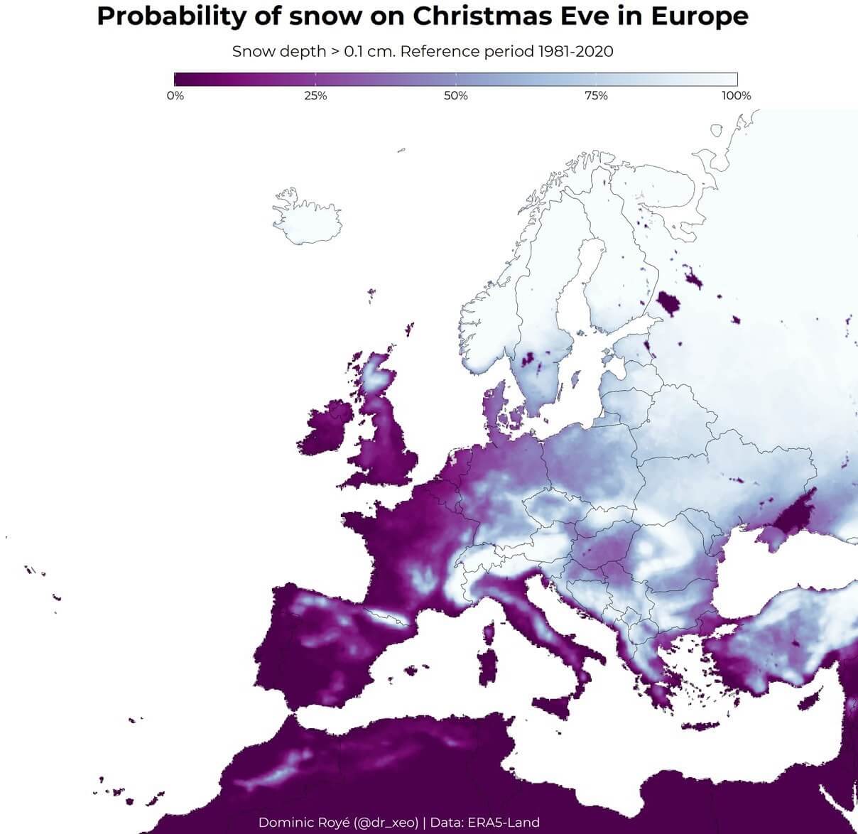
Starting in the latter, we have a map below by Dr. Dominic Royé that shows the probability of snow on Christmas Eve. We can see the highest probability over northern Europe, followed by the higher altitudes of central Europe and the Balkans. This is, of course, strongly connected to colder air, which is found in northern Europe and easily available at higher altitudes.
Over the United States, the story is quite the same. The biggest probability for a white Christmas is over the Rocky Mountains, the Midwest, and the northeastern United States. Probability quickly diminishes as we head towards the south. But these odds can be highly modified by existing weather patterns or large-scale events like the El Nino. Image by NOAA Climate.
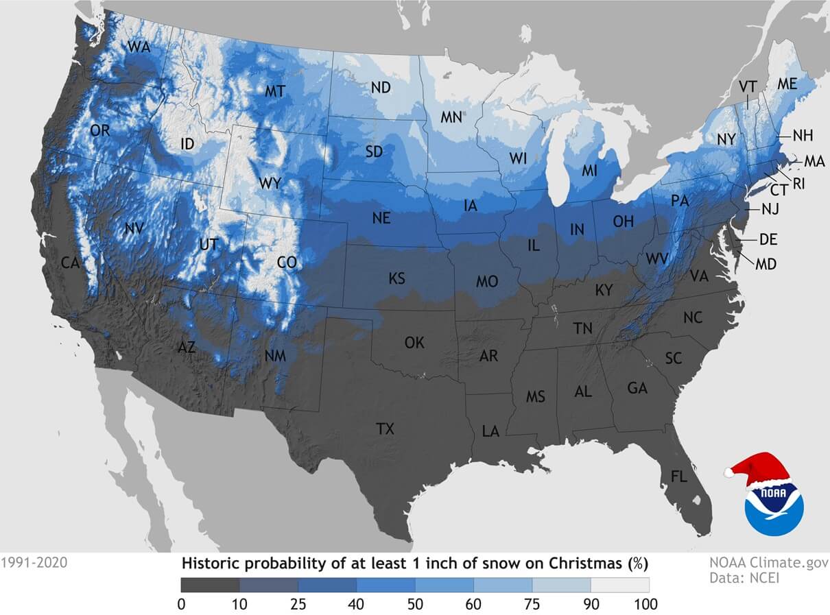
Historically, the Northeastern United States has a 50-60% chance of snow on Christmas Day, with higher probabilities in the northern areas like upstate New York and Maine. Over the Midwest, we have states like Minnesota and Wisconsin with a 60-70% historical probability of having a white Christmas.
Rocky Mountains and higher elevations have the highest likelihood of snow on Christmas Day, typically above 70%. The southern half of the country typically has below 20% chance of seeing snow on Christmas. But some El Nino years can raise that percentage.
EARLY WEATHER LOOK AT CHRISTMAS
As mentioned before, we use ensemble forecasting systems to monitor the developing trends in the extended range. The two main extended forecasting systems are the ECMWF from Europe and the GEFS from the National Center for Environmental Prediction in the United States.
The format of the outlook is rather simple. We will look at the weekly pressure anomalies around Christmas, the temperature pattern, and potential snow depth change where data is available.
We will start with the GEFS forecast system, as it has the snow depth data openly available. And, of course, that is the main thing that we are all interested in.
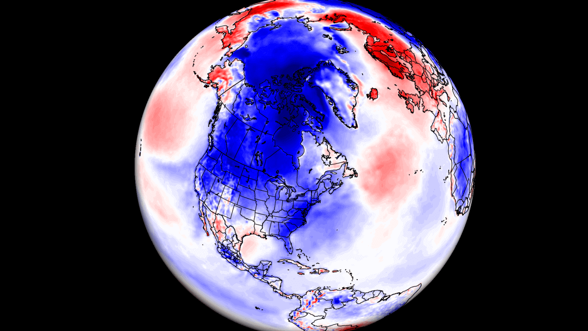
But first, looking at the pressure pattern centered around Christmas, we can see a high-pressure anomaly over Canada and over northern Europe. As a response, there is a low-pressure zone over the eastern United States, and that indicates an increased snowfall potential.

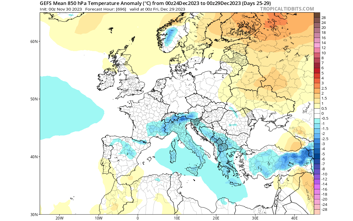
Looking at Europe first, the temperature forecast shows an area of colder than normal temperatures across the central parts. This is likely due to the higher pressure to the north, bringing a northerly/easterly flow into the central parts.
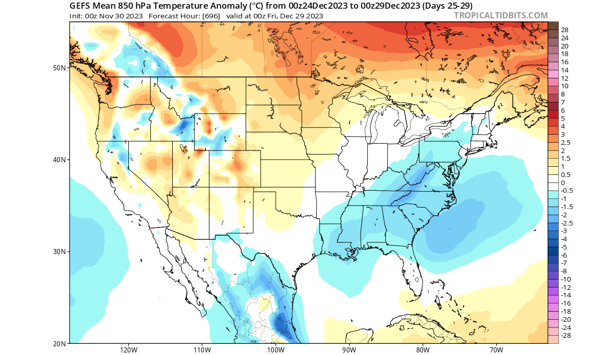
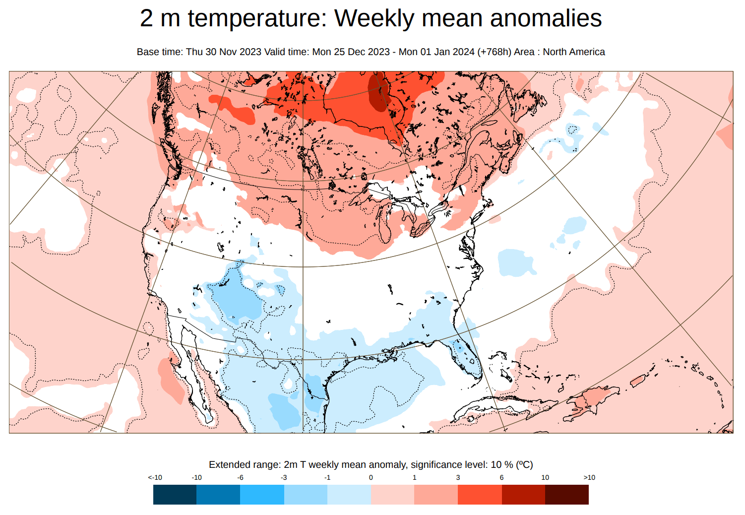
Over the United States, you can see the cold air anomaly across the east. This is the result of the low-pressure system over the eastern United States, bringing along a colder batch of air from the north. With the pressure rising in the west, that means temperatures will rise over the central and northern United States.
Going into the good stuff, we have the snow depth change forecast below. This forecast is a 5-day snow depth change from December 22nd to the 27th.
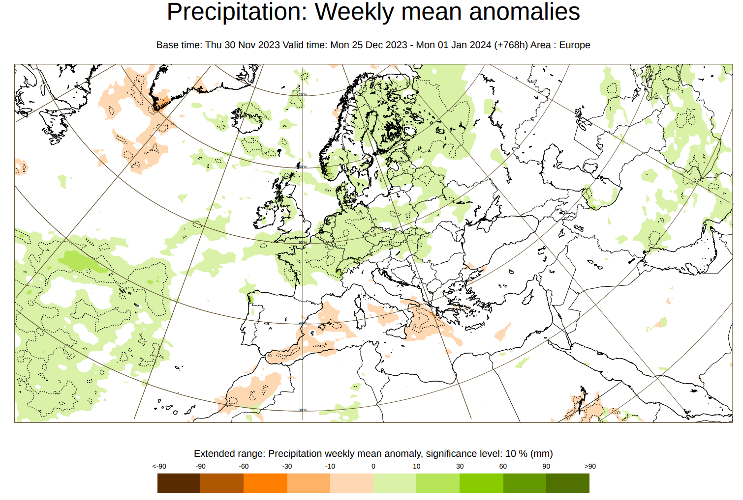
In this forecast range, we can’t look at individual days, so we usually look at changes over a certain period or a multi-day anomaly.The snow depth change for Europe shows an increase in snow depth across central and northern parts.
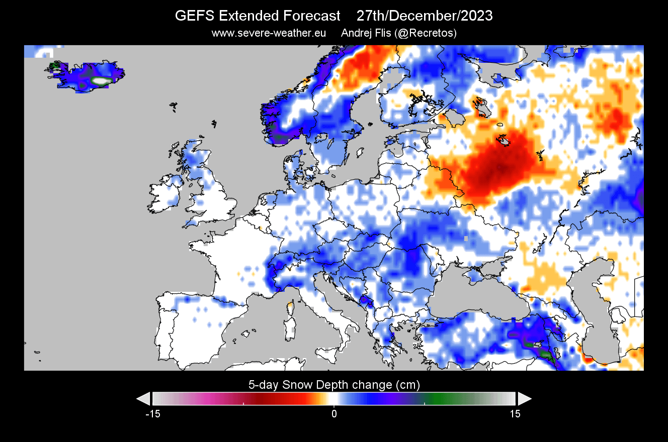
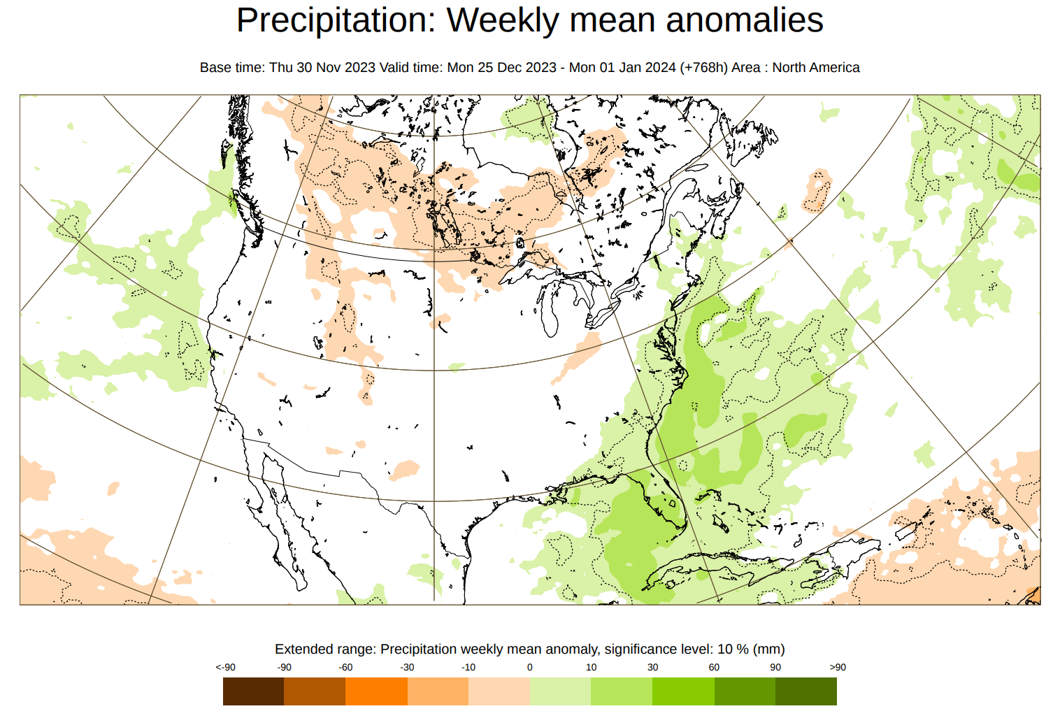
Looking at the United States, we see a good snow depth increase across the entire northeast, across the Rockies in the west, and also across the upper Midwest and the Appalachians. This pattern would be consistent with a low-pressure system over the eastern United States.

As this is a 5-day snow depth change, it can’t show us directly where you can see snow on the ground on Christmas. But it does show where the latest trends have the best snowfall potential around the 25th, thus increasing the chance of having snow on the ground for the holidays.
So, to summarize the GEFS system, it shows the best odds for a white Christmas across the northeastern United States, the upper Midwest, the Appalachians, and the Rockies in the west.
ECMWF CHRISTMAS WEATHER TRENDS
The ECMWF forecasting system does not have snow data openly available, so we will use a combination of temperature and precipitation data to try and figure out where you might see snow during the holidays.
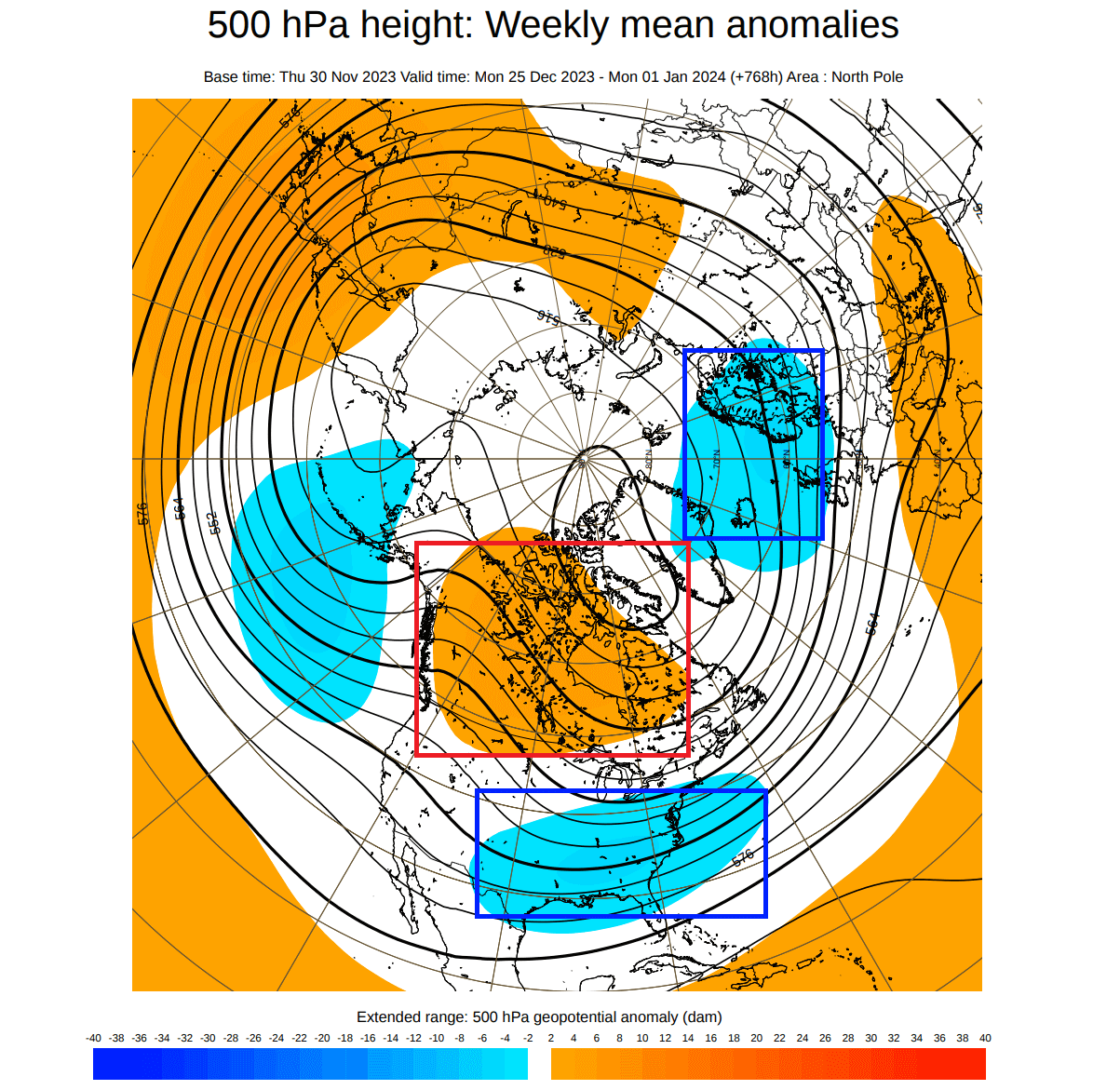
First, we have the pressure anomaly forecast below for the week from Christmas to New Year. It shows a high-pressure anomaly over Canada. This acts as a disturbance in the flow, helping to produce low-pressure areas over the eastern United States and northern Europe.
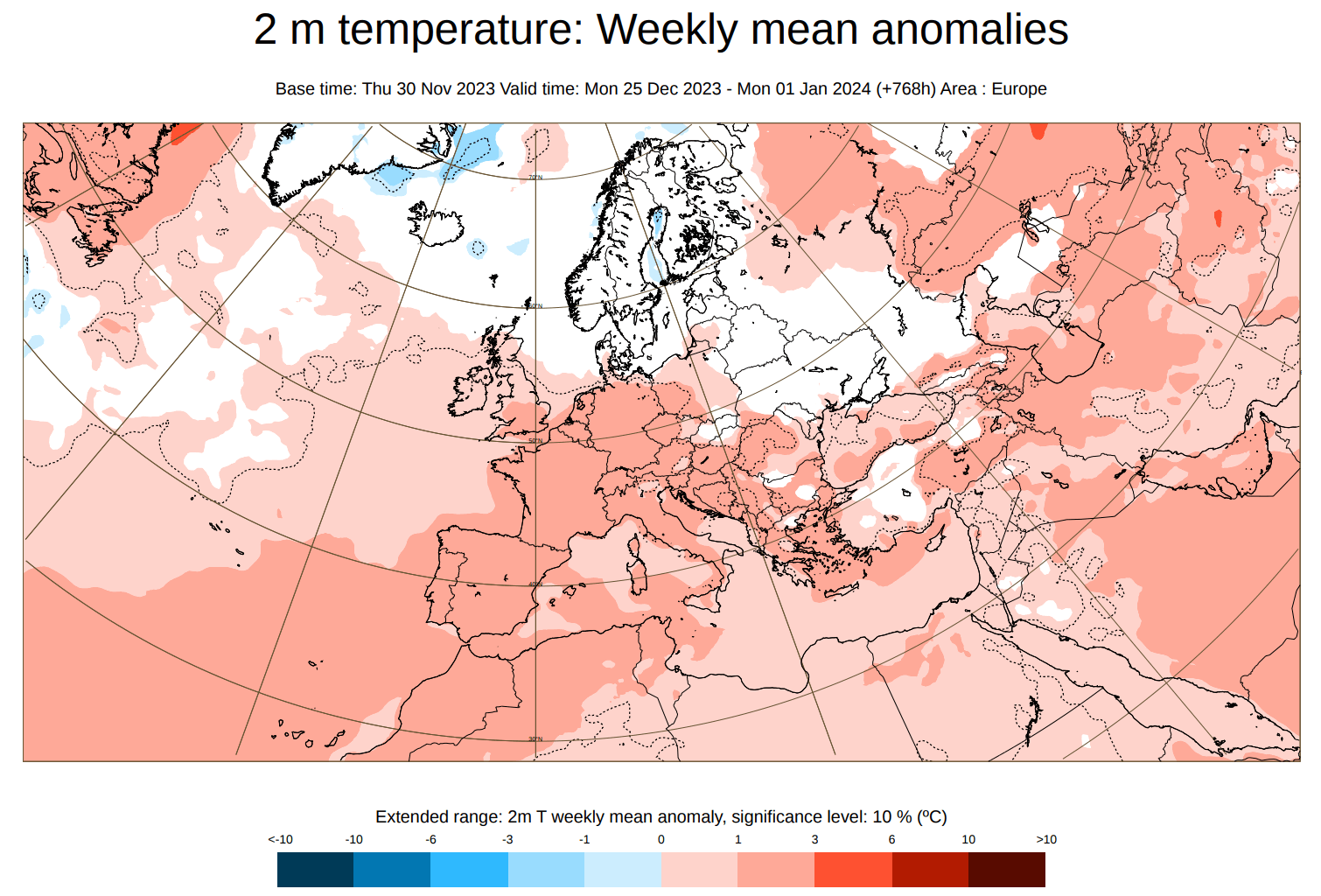
Below is the temperature forecast for the same period over Europe. You can see quite warmer temperatures over much of the continent. The exception is the far north because it is under the low-pressure anomaly. This pattern limits snowfall over Europe, as a northern low area means a warmer westerly flow over the mainland.
Over North America, things are looking almost the opposite. There is a warm anomaly to the north over Canada, as it sits under a large high-pressure system. But the temperatures there are still cold enough for snowfall, especially in the central and northern parts. It can be a limiting factor for the northern United States, especially the northern Plains.
The forecast shows cold anomalies across the western and southern parts of the United States. Despite a cold anomaly, the temperatures are not likely to be cold enough across the deep south. There are better odds for snowfall across the Appalachians and the eastern United States.
Looking at the precipitation forecast, you can see above-normal precipitation across much of central and northern Europe. That is due to the warmer westerly flow, also bringing more moisture from the Atlantic.
The precipitation forecast over North America shows drier conditions over much of Canada and the northern United States. That is mainly due to the presence of a broad high-pressure system. But there is more precipitation forecast over the southeastern United States and up the east coast.
We have no snowfall forecast data from this forecasting system, but the best odds for snowfall in this period are in the parts of the eastern and northeastern United States.
Given that the time period for the low-pressure system to cross into the eastern United States is similar to the GEFS forecast, this gives good confidence in this scenario and a higher white Christmas chance across parts of the eastern and especially the northeastern United States.
A lot depends on the availability of cold air, which is not seen broadly across the United States in the current data from this model. But the trends do show a likely cold air drop around Christmas. So we can definitely see some improvement in future updates.
One thing that will definitely play a major role is the stratospheric Polar Vortex.
STRATOSPHERIC DISTURBANCES
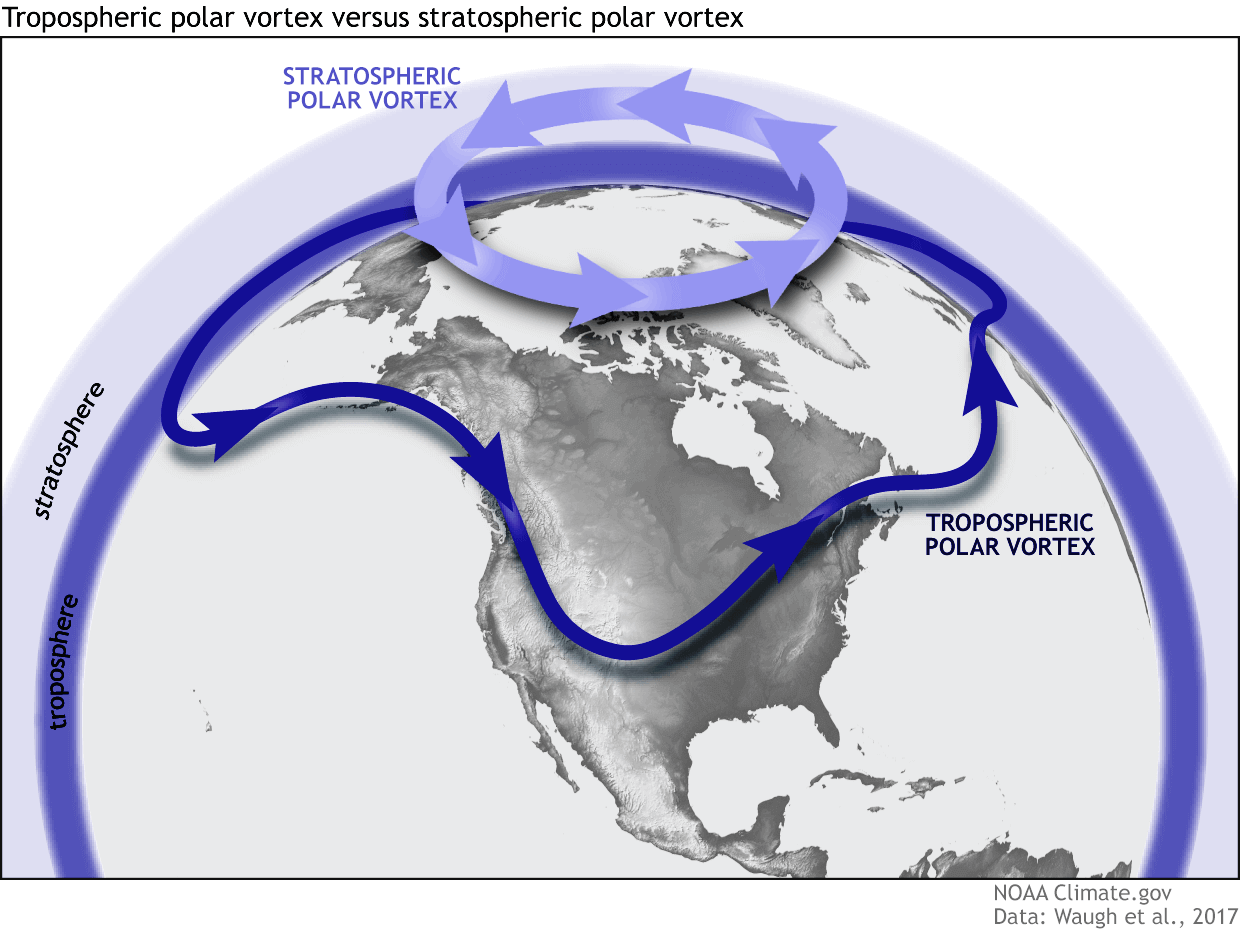
Polar Vortex is one of the large-scale aspects of every winter. In simple terms, this is what we use to explain the atmospheric circulation over the northern (southern) hemisphere, and is a major source of weather pattern changes.
We separate the entire Polar Vortex into an upper (stratospheric) and a lower (tropospheric) part. They both play their role differently, so we monitor them separately. But it is also very important if they are properly connected. Image by NOAA
To put the Polar Vortex into perspective, we produced a high-resolution video below, which shows the Polar Vortex in 3D, giving you a better idea of what it actually looks like. But note that the vertical size of the vortex was greatly enhanced for visual purposes.
The main takeaway from the video should be that the Polar Vortex is not just one winter storm or a cold outbreak that moves from the Midwest into the northeastern United States. It is the entire weather circulation over the Northern Hemisphere.
And because it is so large and because it is connected with the lower and upper atmosphere, it is very important that we monitor all its activity during winter. What we usually look for are signs of warming anomalies in the stratosphere.
Below is the ECMWF forecast for the stratosphere, and it shows a large warming anomaly around the Polar Vortex in the next 10-18 days. This is one way that the dynamics of the Polar Vortex can change, also impacting the weather pattern in the lower levels.
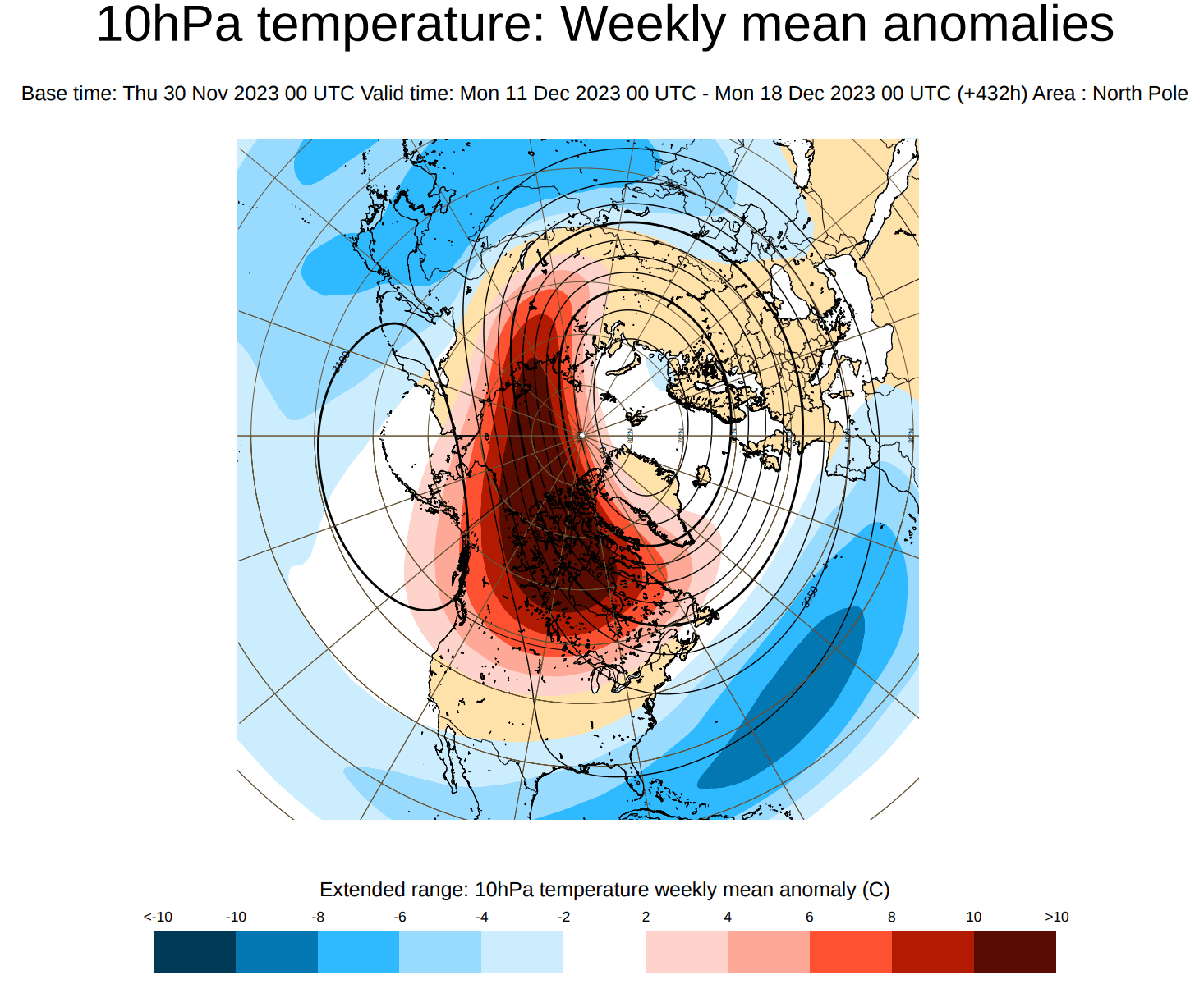
The forecast above is for the week before Christmas, so it is a good time window for any potential surface impacts.
Looking at the medium range, we have the vertical temperature forecast below. It basically shows the temperature from the surface up to the stratosphere. Marked with a red box is a warming anomaly forecast to develop in the stratosphere in the first half of December.
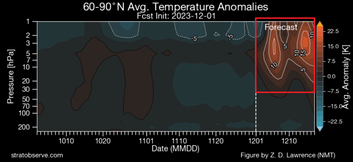
This is something that we will take a closer look at in one of our future articles, as it is not only relevant for Christmas but especially for the start of 2024.
We will keep you updated on the global weather pattern development, so make sure to bookmark our page. Also, if you have seen this article in the Google App (Discover) feed, click the like and follow button there to see more of our forecasts and our latest articles on weather and nature in general.