A strong Stratospheric Warming event is starting to appear in the forecast for February. It shows a weakening and a split of the Polar Vortex. This usually creates “daughter vortices” in the stratosphere, of which one is forecast to move over North America, impacting the weather pattern over the United States and Canada.
We recently wrote about the February weather patterns. But now we will look at a major event that could bring strong weather pattern impacts across the Northern Hemisphere as we head deeper into late Winter and Spring.
First, we will look at what the stratospheric Polar Vortex really is and why it matters. Then, we will focus on the upcoming stratospheric warming event and the Polar Vortex split, with potential winter weather outcomes to follow in February and beyond.
THE NORTHERN POLAR VORTEX
The best way to understand the Polar Vortex is to visualize it. To keep it simple, the Polar Vortex is just a name that describes the broad winter circulation over the northern (and southern) hemispheres.
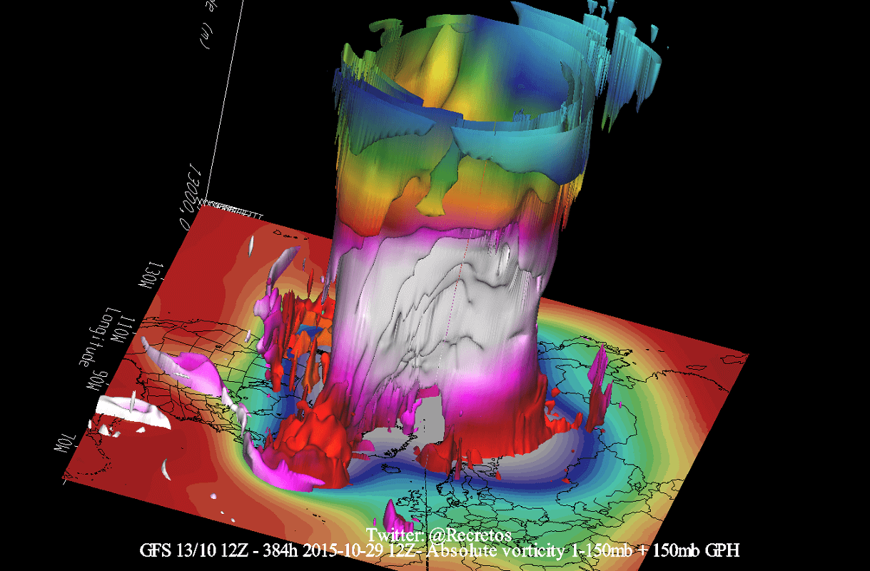
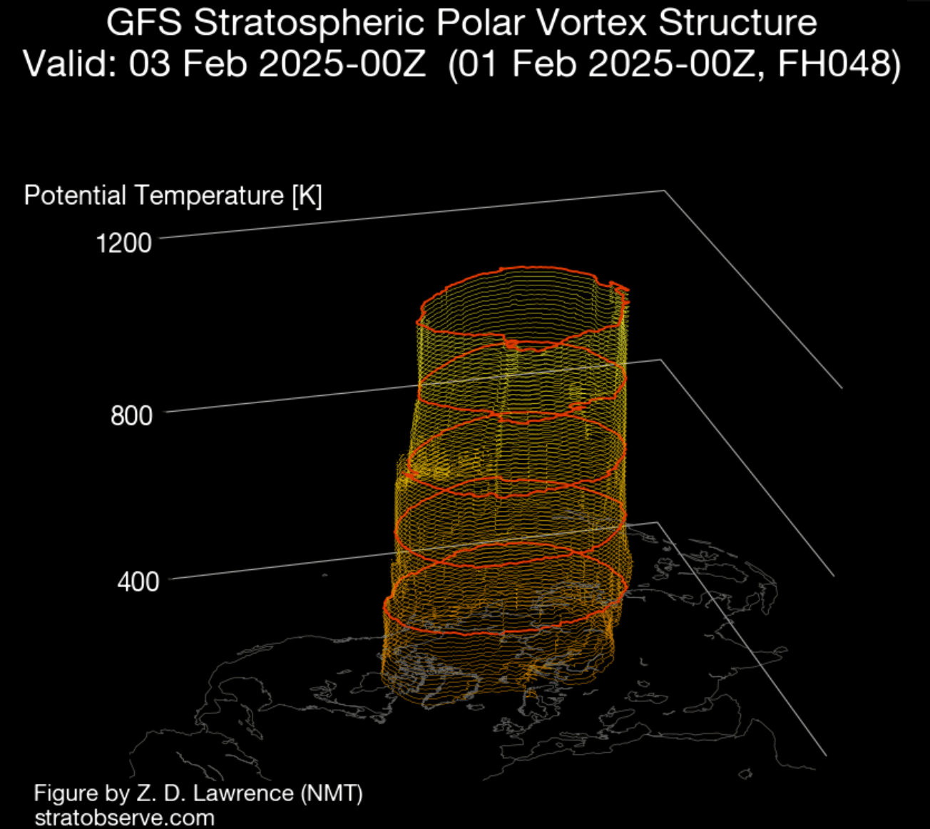
Below, you can see a 3-dimensional image of the Polar Vortex. The vertical axis is greatly enhanced for better visual presentation. It basically shows the actual structure of the Polar Vortex across the atmosphere, connecting to the lower levels and the weather patterns below.
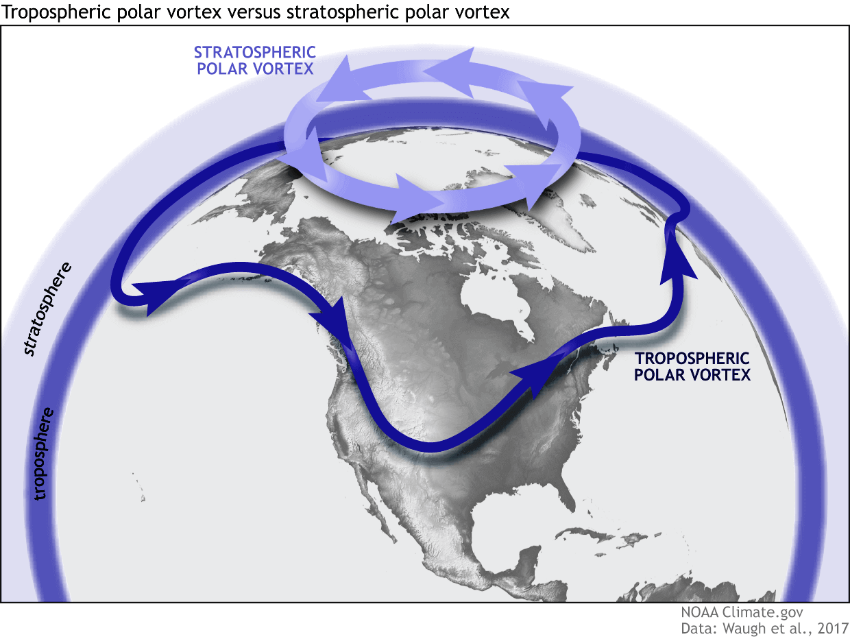
The Polar Vortex extends high up into the atmosphere. The lowest level of the atmosphere is called the troposphere, where all the weather events are. But above that, we have the stratosphere, a deeper and drier layer, and the home of the ozone layer.
For this reason, we separate the entire Polar Vortex into an upper (stratospheric) and a lower (tropospheric) part. They both play their role differently, so we monitor them separately. But both parts together form the winter circulation across the Northern Hemisphere and the resulting weather patterns.
To put the Polar Vortex into perspective, we produced a high-resolution video below, which shows the Polar Vortex in 3D, giving you a better idea of what it actually looks like. But note that the vertical size of the vortex was greatly enhanced for visual purposes.
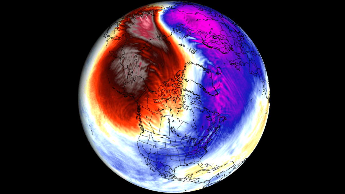
The main takeaway from the video should be that the Polar Vortex is not just one winter storm or a cold outbreak that moves from the Midwest into the eastern United States. It is the entire weather circulation over the Northern Hemisphere.
Now that we know what the polar vortex is, we will look at the latest analysis, the forecast for the near future, and also at the extended-range forecast of weather patterns.
THE STRATOSPHERIC BEHEMOTH
The Polar Vortex is currently normal to above normal in size and running stronger than normal. The image below shows geopotential height and temperature in the mid-stratosphere at the 10mb level (30km/18.5miles). The Polar Vortex looks like a “cyclone” with a cold core near its low-pressure center. Image by weatheriscool.com
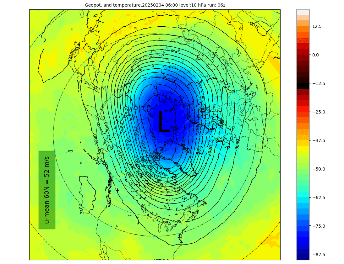
In the image below, you can see the temperature anomaly at the same level, which shows that the main core of the Polar Vortex is quite colder than normal. That usually indicates a stronger Polar Vortex with faster circulation.
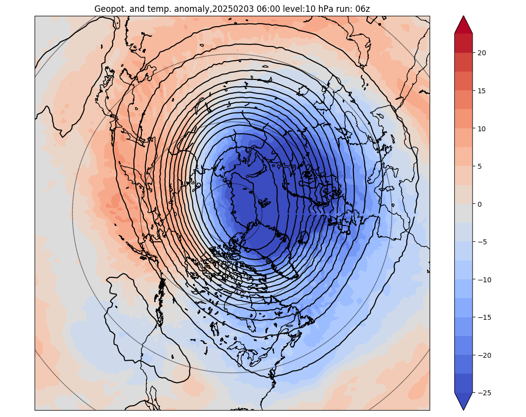
You can also see that in the pressure anomaly for the same level. Below, you can see that the Polar Vortex is running with much lower pressure than usual at this mid-stratosphere level. So, without a doubt, the current state of the Polar Vortex shows a very robust and organized circulation in the stratosphere.
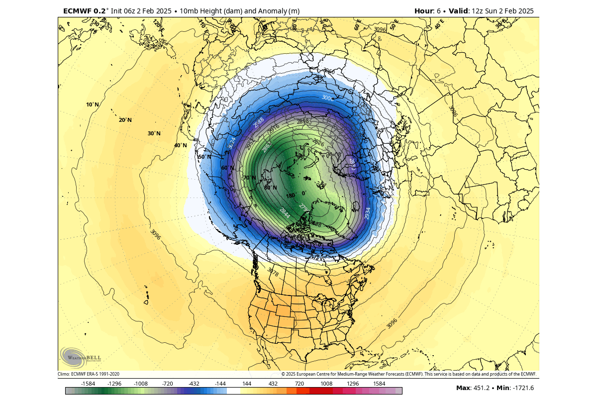
If we look at the 3D analysis of the whole Polar Vortex, we can fully see its current compact structure. It has a nicely circular shape and a very strong and stable vertical structure. That is because it currently has no real high-pressure zones in the stratosphere that would deform its structure.
But how do we measure the strength of the stratospheric Polar Vortex? The simple answer is the winds. The more organized the stratospheric Polar Vortex is, the stronger the winds around its core, which means it can have a stronger influence on the surface.
Below is the latest analysis and forecast of the stratospheric winds around the Polar Vortex. You can see that currently we see very high values. But looking ahead at the forecast, you can see a rapid deceleration, and each line goes lower. That means that each new forecast run shows a weaker Polar Vortex.
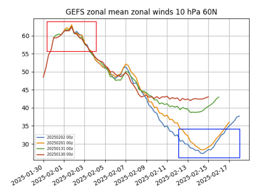
But what can cause such a rapid deceleration and breakdown of a strong Polar Vortex? To slow down such a strong and large circulation takes a lot of energy. There is one event called Sudden Stratospheric Warming (SSW), which is as strong as it sounds and can bring down such a behemoth of a Polar Vortex.
2025 STRATOSPHERIC WARMING EVENT
The image below shows the wind plus temperature analysis and forecast for the next two weeks in the mid-stratosphere. You can see the strong current state of the Polar Vortex in the blue box. But notice the upcoming weakening with a rapid slowdown and a temperature rise in the stratosphere.
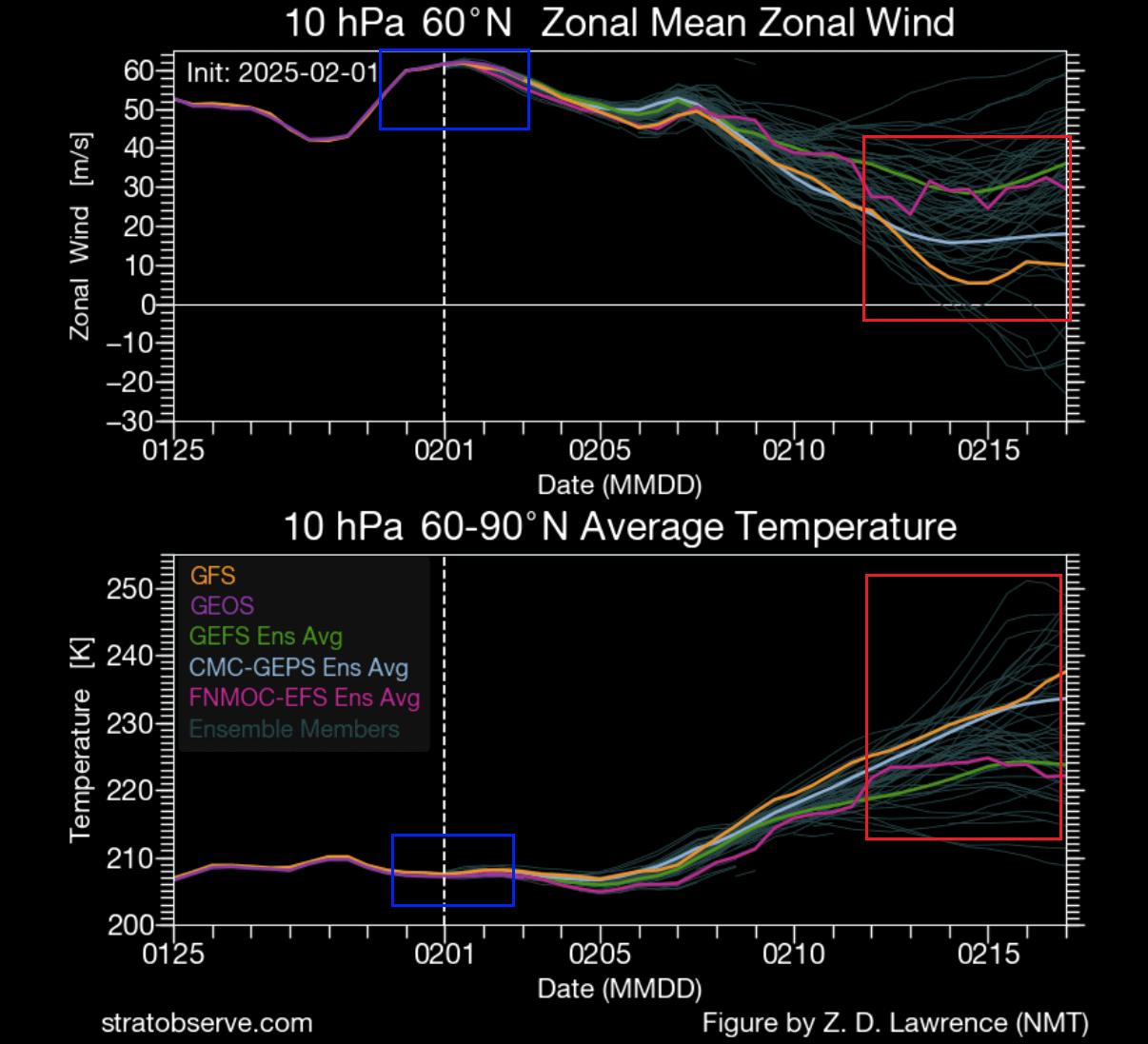
This signals a disruption or even a breakdown of the stratospheric polar vortex, known as the Sudden Stratospheric Warming event. These effects usually transfer down to the lower levels, with some delay, heavily altering the weather patterns.
It all begins with very strong pressure waves and anomalies in the lower levels, which you can see below on the 5-day forecast. Two strong high-pressure systems are going to appear, creating massive pressure waves in the lower levels.
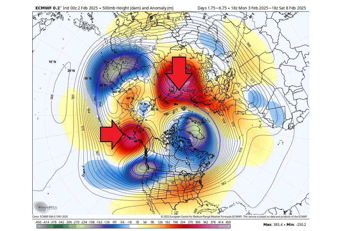
Such strong waves send a lot of energy upwards into the stratosphere, manifesting as a rise in pressure and temperature. That helps to destabilize the Polar Vortex top-down.
If we look at the polar vortex forecast in mid-February, we can see two very strong high-pressure areas in the stratosphere (H), sometimes called the “anti-vortex”. You can see a very strong warming wave occurring where they come together, splitting the main Polar Vortex into two separate low-pressure cores (L).
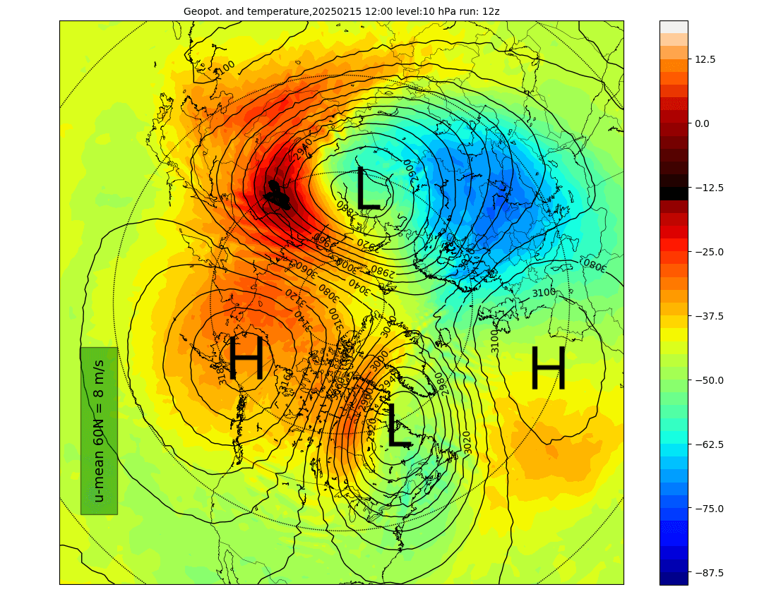
That starts a substantial stratospheric warming event and an important weakening for this time of year. Any large-scale pressure changes in the stratosphere, especially of this magnitude, can mean substantial weather impacts down the line.
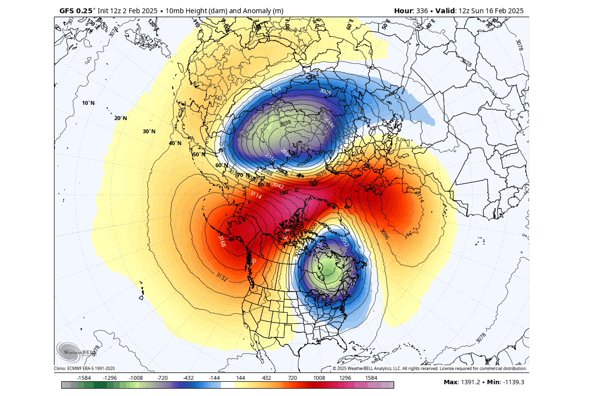
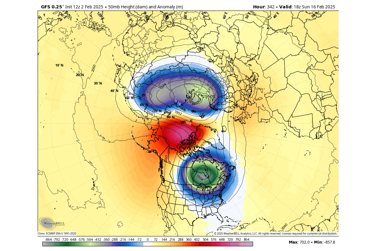
Below is the mid-stratosphere pressure anomaly forecast for the same period. In this image, you can better see the two low-pressure cores of a split Polar Vortex, also called “daughter vortices”. One of these cores will move over North America and impact weather in the lower levels.
Going further down into the lower stratosphere at around 50mb pressure level (20km/12.5miles), you can still see the impact of the stratospheric warming and the split of the Polar Vortex. These are just current forecasts, but all show a prevailing trend of a split polar vortex core moving into North America.
Such a split of the Polar Vortex usually means a high-pressure area will build over the polar circle. As the Polar Vortex is split, the remaining cores and the cold air move towards the mid-latitudes. In this case, we see one core move over Asia and one over Canada and the United States.
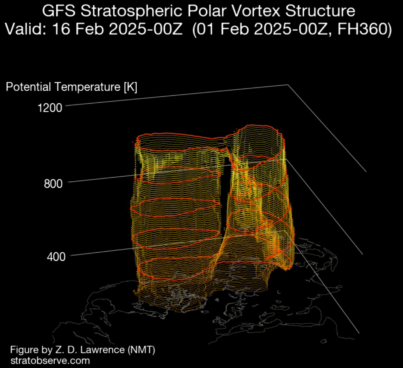
Below is also a 3D structure forecast of the Polar Vortex for around mid-Febraury. You can clearly see the split structure, with one core moving towards North America. This indicates regional impacts for the United States and Canada, as the Polar Vortex core usually brings along a large supply of cold air.
So, what will be the impacts of this stratospheric warming event and the Polar Vortex Split? For this, we will look at the lower levels using the latest forecasts.
WEATHER IMPACT FROM THE STRATOSPHERE
Sudden Stratospheric Warming (SSW) basically means a strong temperature and pressure rise in the Stratosphere. That causes a major disturbance in the circulation and, as a result, starts a collapse of the Polar Vortex.
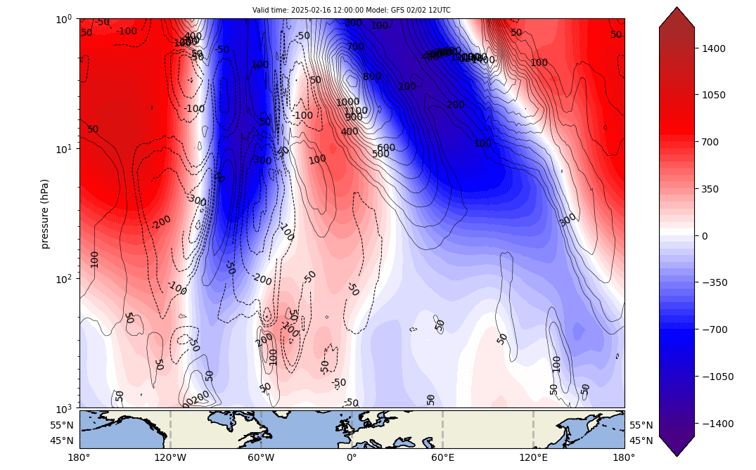
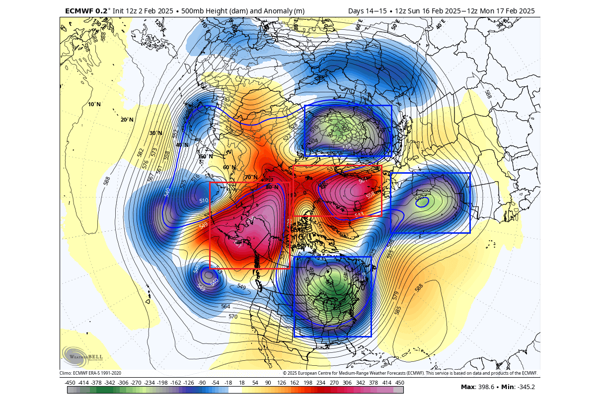
The mid-month forecast image below shows the pressure anomaly by altitude from the surface to the top of the stratosphere. You can nicely see how the Polar Vortex is split in half, with one core connecting directly down into Canada and the United States.
Below is the lower-level pressure anomaly following the stratospheric warming, as forecasted by the GFS model. Note that this is just one forecast. It serves as an indication of a trend or to show a possible scenario that can come from such a strong disruption.
You can see the high-pressure over the pole and low-pressure areas dispersed around, also like being split apart. A strong pressure wave is seen over the United States and Canada and another over the European sector.
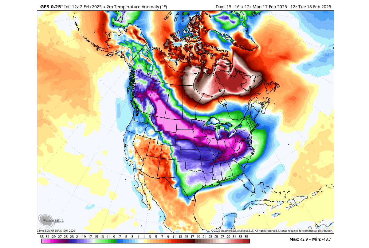
The surface temperature forecast for this period shows a strong cold polar air outbreak across the northern, central, and eastern United States. Despite being just a single forecast, this is exactly what we usually expect following rapid and strong Polar Vortex split events in the stratosphere.
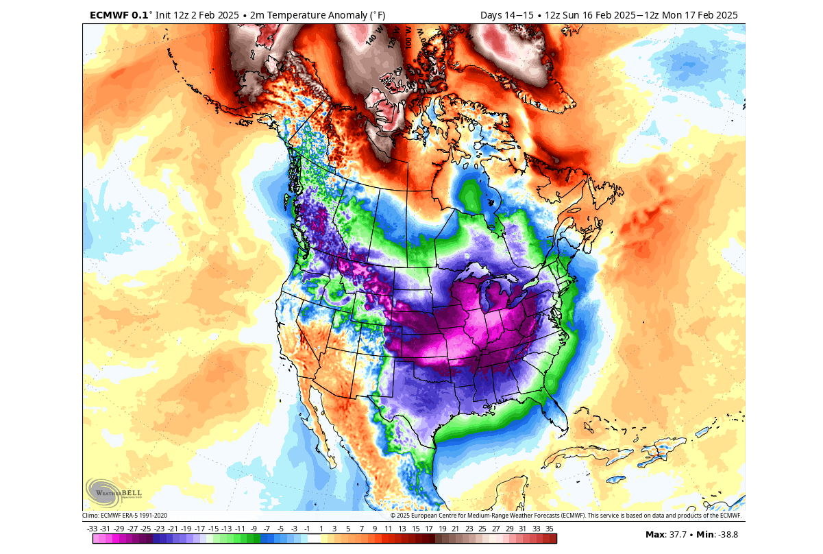
Below is the pressure anomaly forecast for the same mid-month period but from another model (ECMWF). We tend to look at different forecasts because if more models agree on a similar pattern, it usually means that it is a more likely scenario.
This model also shows a strong high-pressure area over the polar regions, displacing the low-pressure anomalies and cold polar air across the United States, Canada, and also towards Europe. In a way, this reflects the anomalies in the stratosphere, with the large Polar Vortex core moving into North America.
The surface temperature from this model shows strong polar cold anomalies over the United States and southern Canada. You can also see the warm anomalies over the polar circle, which replaced the cold air that was pushed out and down into the United States and Canada.
It is too early to talk specifics, as this is the extended forecasting range, so we are only looking at trends. But with everything considered, the stratospheric warming event is currently forecast to play a major role in creating a powerful cold air outbreak across the United States around Valentine’s Day.
This model also shows a cold airmass starting to move for Europe in the same period. This results from a residual low-pressure system over the northeast, creating a strong northerly flow into the continent.
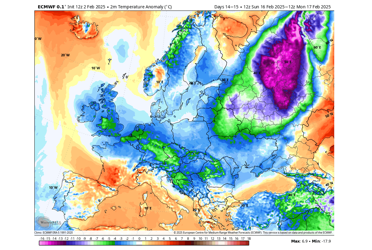
The main area for the coldest air looks to be over North America, where one of the split Polar Vortex cores will directly move over and impact the regional weather patterns. On the other hand, over Europe we do not see any proper fixed outcome yet, due to less direct influence of these changes. But we will have a better understanding of the resulting weather over regions outside North America as the period gets closer in the forecast.
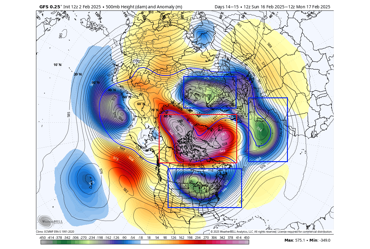
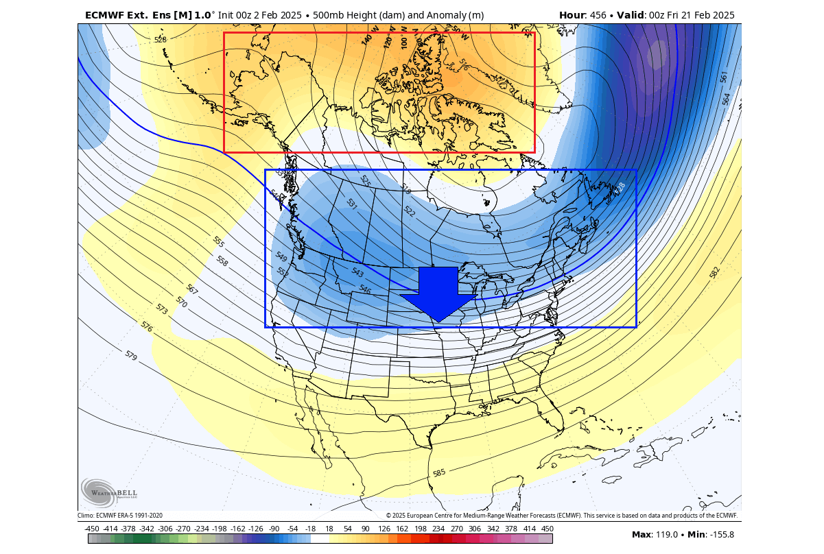
Below is the extended-range ensemble forecast going into the second half of February. It shows the continued presence of the low-pressure zone over the United States and Canada. While a high-pressure zone remains over the pole, this indicates a continued presence of the Polar Vortex core over North America and a sustained northerly flow.
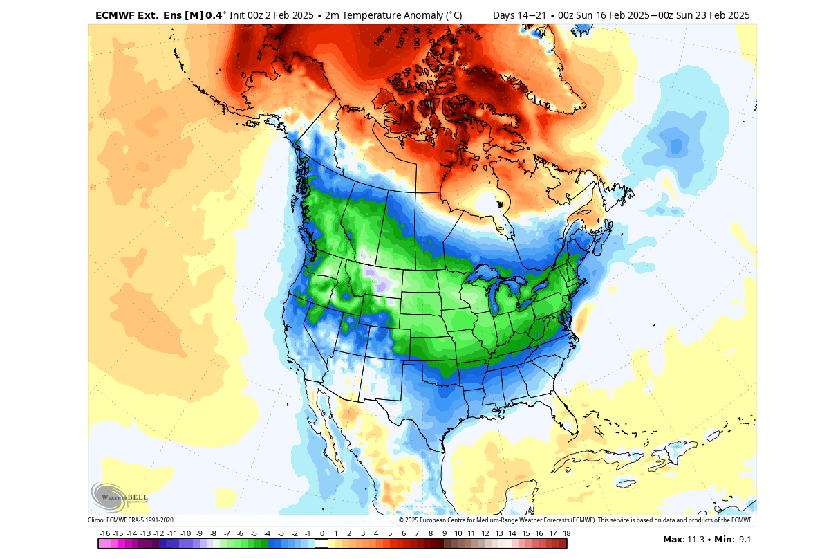
The temperature forecast for the same period also shows a strong cold airmass spreading across the United States and southern Canada. This is exactly what is usually expected to see in the days following a strong Polar Vortex split event, and the models are also starting to forecast it.
We will keep you updated on the global weather pattern development, so don’t forget to bookmark our page. Also, if you have seen this article in the Google App (Discover) feed, click the like button (♥) there to see more of our forecasts and our latest articles on weather and nature in general.
The main forecast images in this article are from weatherbell, using a commercial forecaster license.
Don’t miss: