The atmosphere is currently undergoing a significant transition as a deep upper-level trough moves through the heart of the European continent. Bringing much colder air masses deep south and extending the frosty morning potentials.
A large trough with an unseasonably cold air mass crashes into the warm, moisture-filled air mass over the Mediterranean. Establishing the stage for a multi-day severe weather event.
From northern Italy to the Adriatic coastlines of the western Balkans, a mix of moderate instability and strong wind shear threatens the areas with supercell storms, damaging hail, and localized flooding.
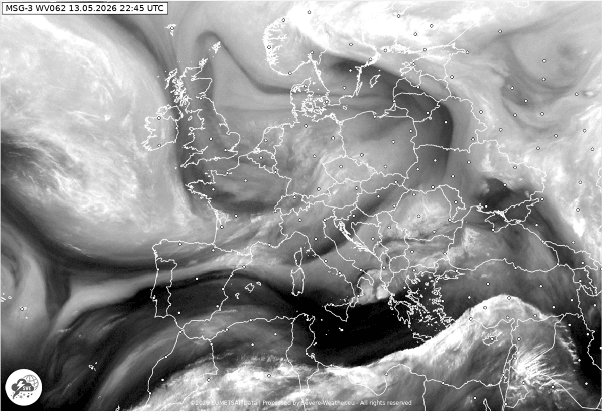
The ongoing changes in the pattern are well visible on the current satellite imagery, especially in the air mass and water vapor channels.
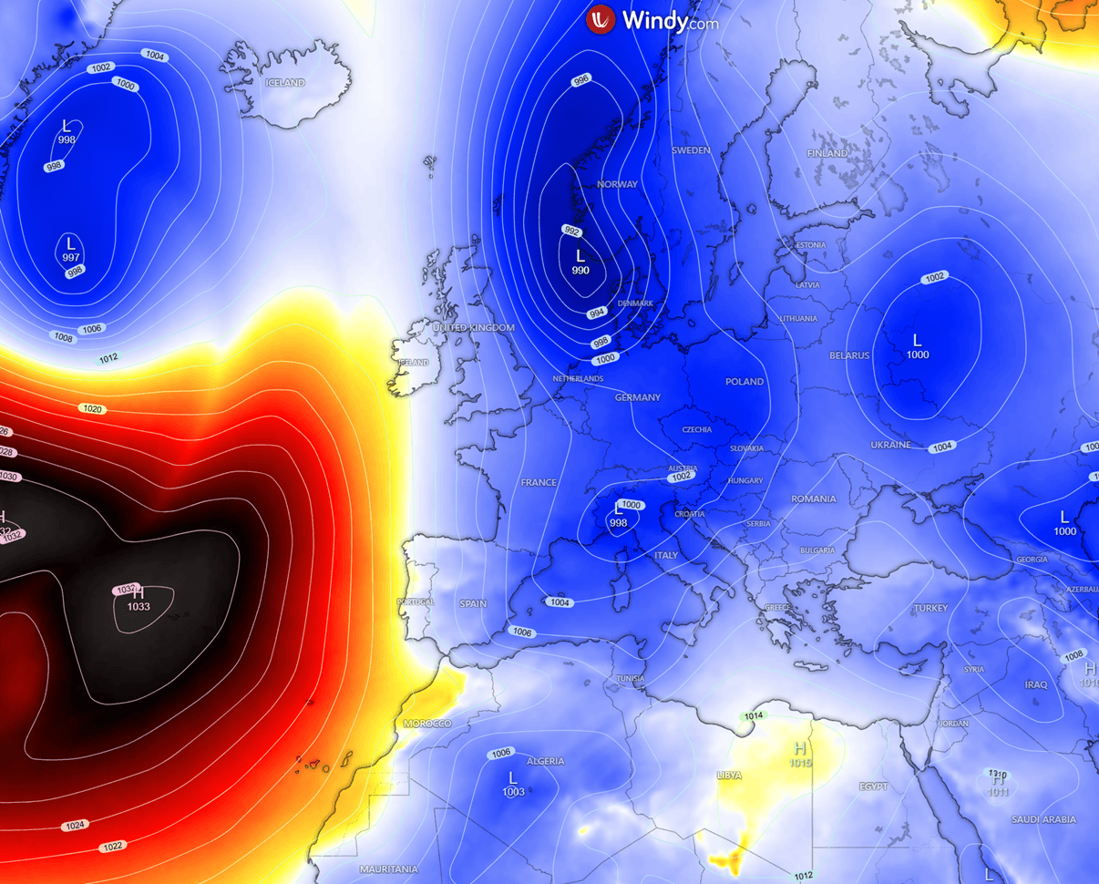
The Thursday morning picture reveals a large low-pressure system established over the continent, while the ridging is building up over the North Atlantic and northwest Africa.
The following video animation reveals the powerful, deep trough dominating the European continent this week, with active weather across the Mediterranean, while an unseasonal cold front spreads across western and central Europe.
Going into next week, the weather pattern flips and brings warmer trends from the west.
Let’s dig into the details about the evolution over the coming 7 days in Europe.
A major deep trough establishes over Europe through mid-May
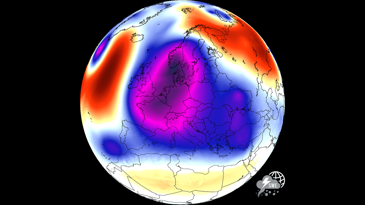
The significant changes in the weather pattern across Europe have begun recently, with a strong blocking established over the North Atlantic. This allowed a more meridional flow into the continent from the north. Currently, there’s a new, particularly powerful low emerging over the core of Europe.
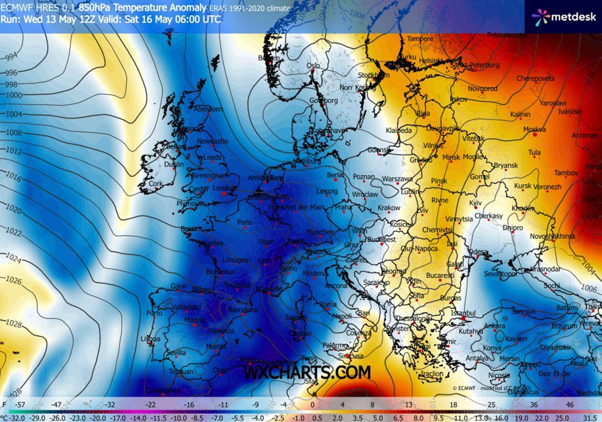
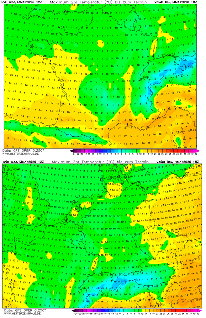
This brings a much colder air mass that will expand from Thursday through Sunday across a large part of the continent, thanks to a locked-in pattern and a large, deep trough stalled for a few days.
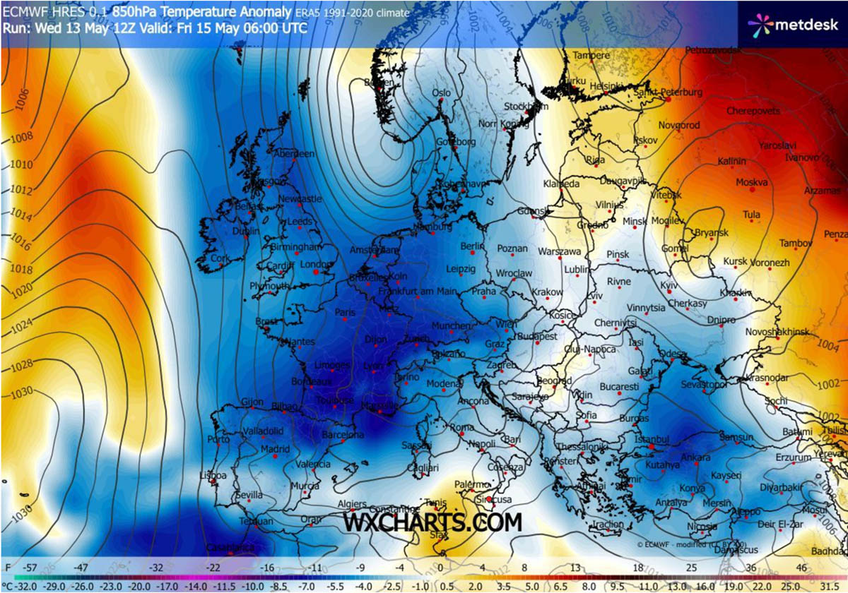
The most significant temperature anomalies will spread across western and central Europe on Thursday, then further south, reaching central Europe and the Mediterranean by Friday.
Such a large and deep trough also affects the surface pressure patterns, thereby establishing a large low-pressure system over most of continental Europe.
While on the North Atlantic and Azores, a strong high-pressure area remains.
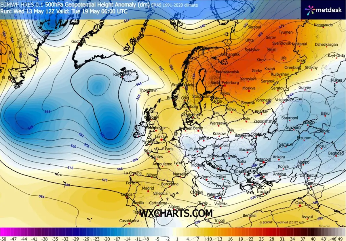
Coming into the weekend, the major upper trough begins gradually weakening but remains large and digs further south. While ridging over the North Atlantic is disrupted, it hints at a possible pattern flip for next week.
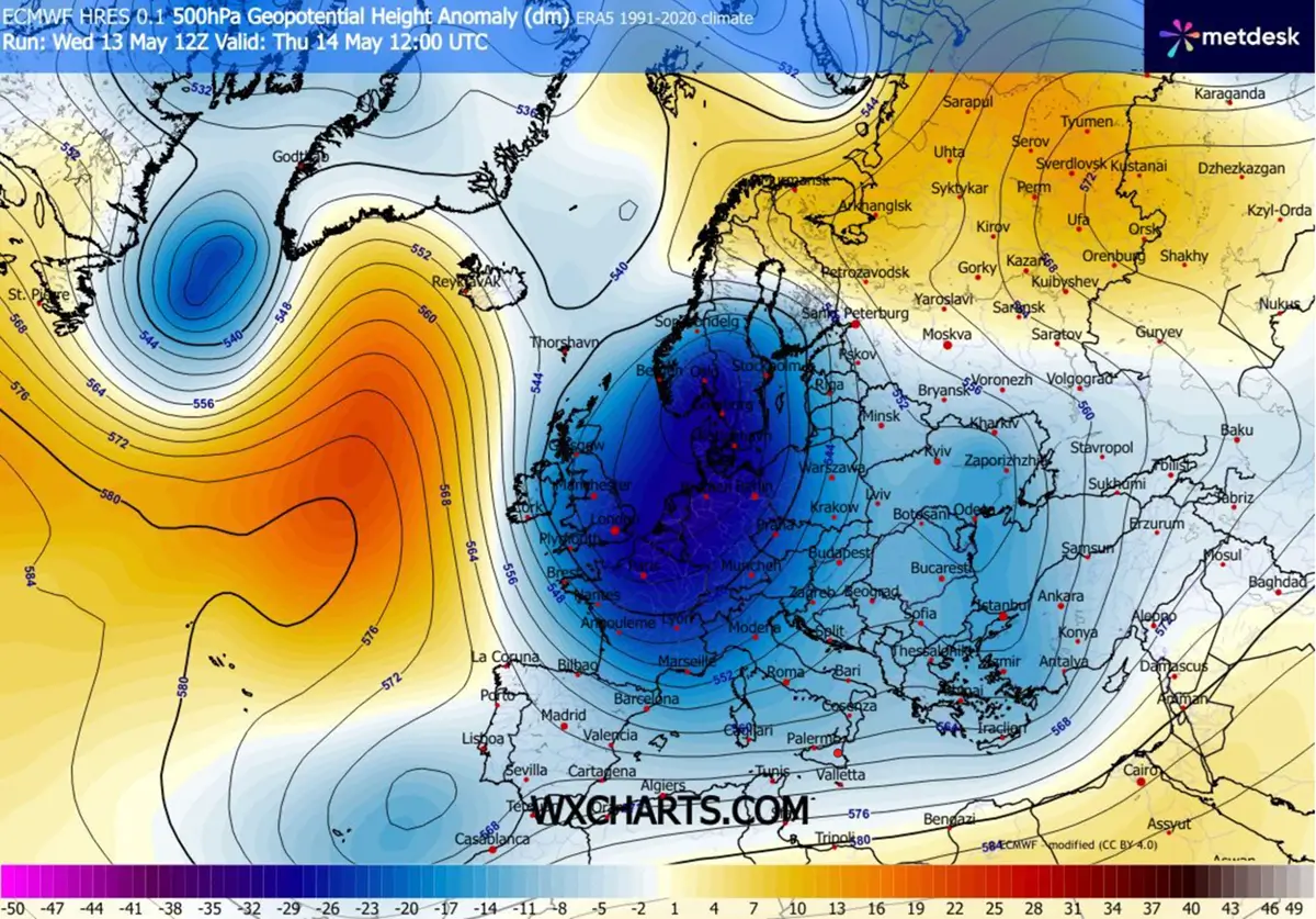
The locked-in pattern is well seen on the 500 mbar chart for Friday night, with the upper low still dominating while blocking Highs are over the Atlantic nd northern Russia.
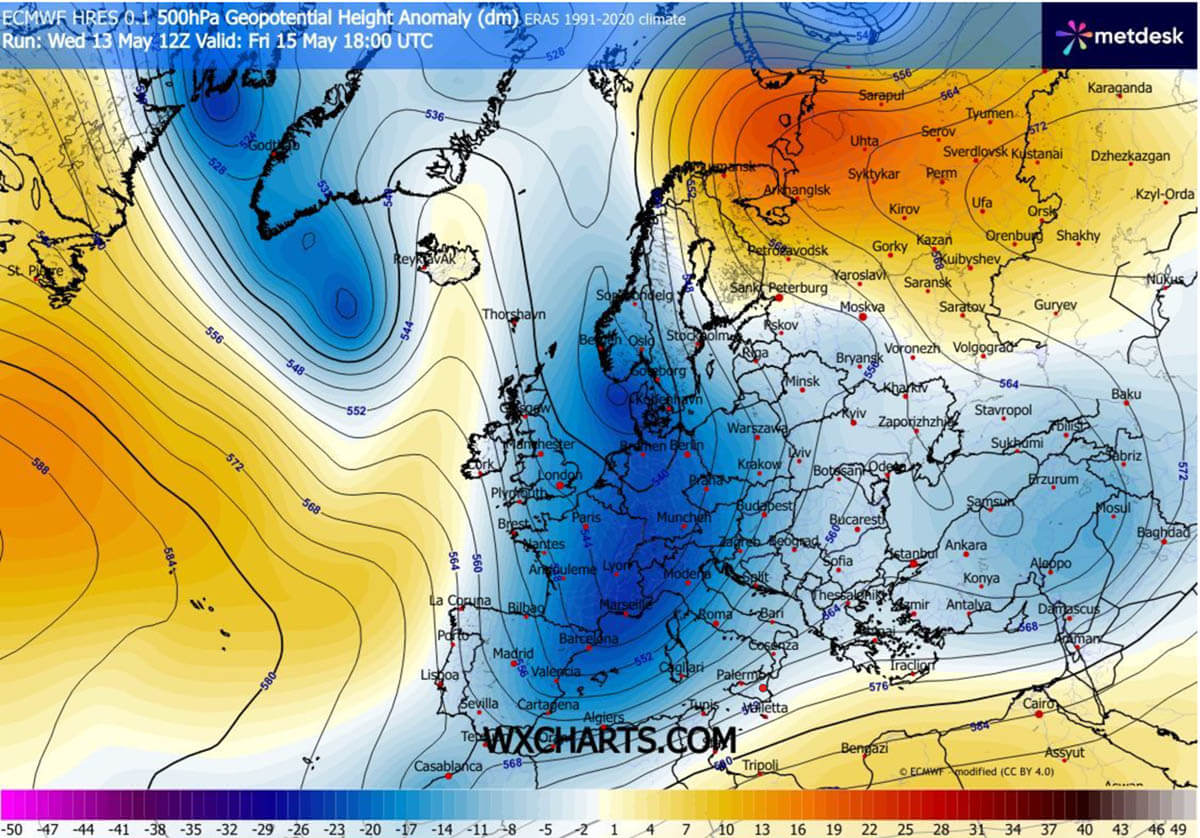
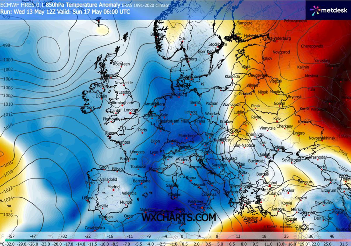
With the main trough digging further south, going from Friday into the weekend, so is the significant cold anomaly spreading towards the Mediterranean.
The 10-14 °C colder-than-normal temperatures remain over western and southwestern Europe, including Morocco and Algeria.
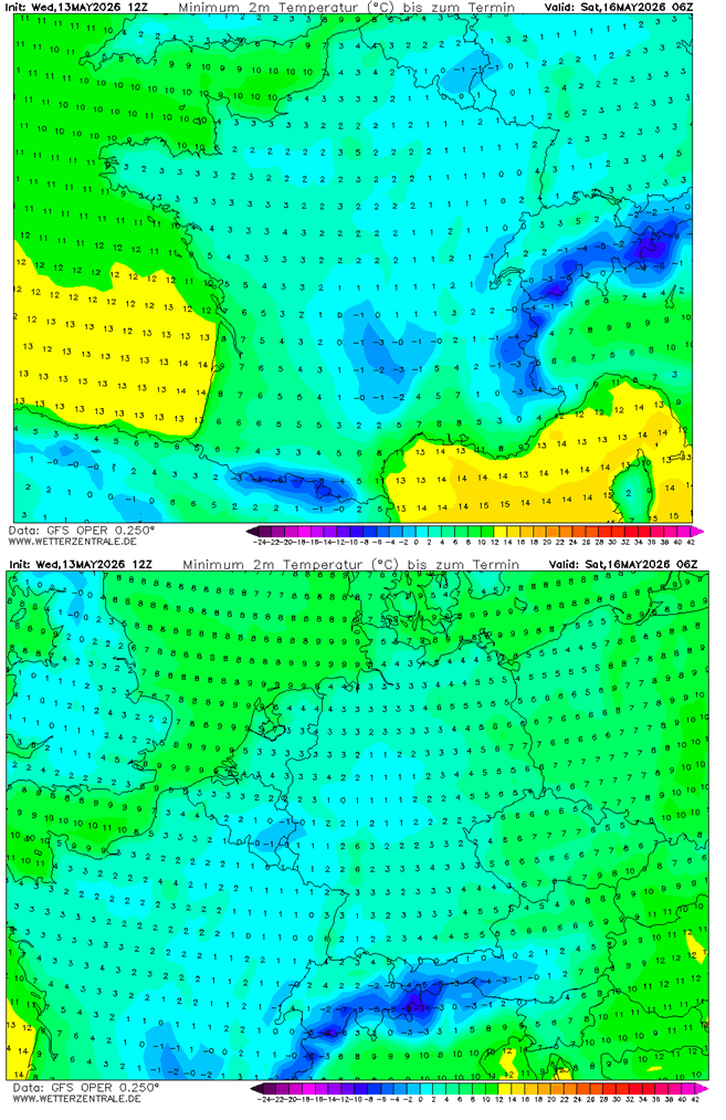
This sends the morning temperatures again pretty low for mid-May, likely into near-freezing levels.
The following charts show the morning lows on Saturday, when the cold will be most intense, and on Friday, when winds will be at their weakest. So Saturday lows will likely be the lowest in many regions, and the risk of frosts will remain.
Daytime high temperatures will also remain significantly lower than normal for this time of year, with 10-15 °C at most, and in some regions even below 10 °C on Thursday and Friday.
This is quite low for mid-May, about 15 degrees below the long-term normal.
Towards the end of the weekend, the dominant upper wave will finally vanish, while its effects at lower levels will persist, with cold temperatures continuing to spread south-east, especially over the Mediterranean region.
But conditions will gradually improve compared to before.
A multi-day severe weather potential for the Mediterranean and the Balkans
The significant upper wave clashing with warmer air masses to the south will amplify the subtropical jet stream over the Mediterranean region. This will allow strong winds through the mid and upper levels, providing strong shear for organized storms.
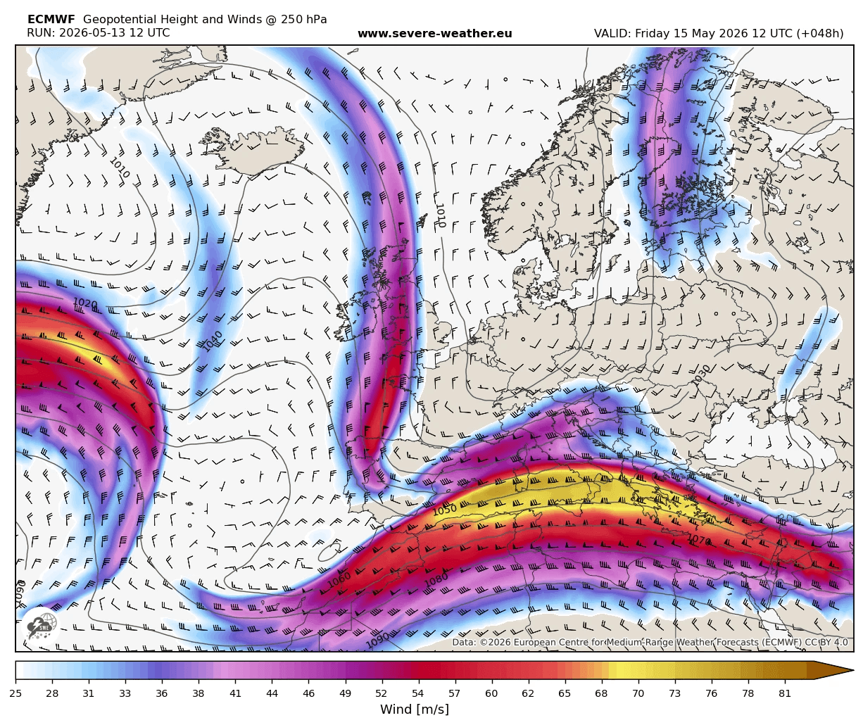
The gradually warming Mediterranean Sea also provides marginal-to-locally moderate instability, which will overlap with strong winds and shear aloft.
Thus, severe weather, including multicell and supercell storms, will likely develop from Thursday through Friday and Saturday over parts of Italy, the Adriatic region, and across the west-central Balkans.
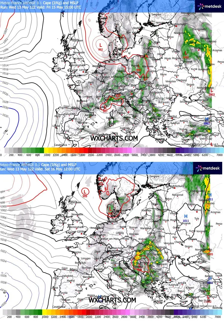
Thunderstorms should provide quite a bit of rainfall where organized systems develop.
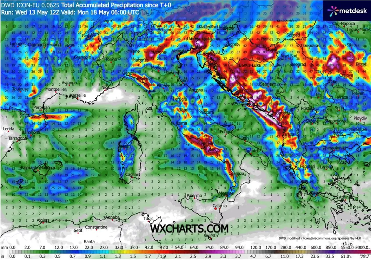
While with persistent southwesterly jet stream winds aloft, significant rainfall accumulations are also expected along the mountain ranges, the south-central Apennines, the Dinaric Alps, and the Carpathians.
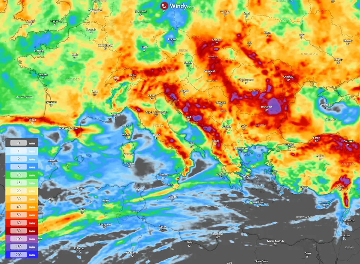
Close-up view of the high-resolution model hints at where peak rainfall will accumulate, with local rain sums exceeding 100-150 mm possible.
Especially when both convective and stratiform frontal rainfall will combine along the orographic features.
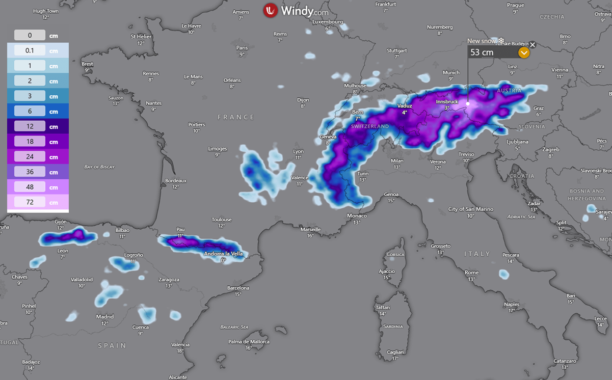
A much colder air mass than normal will also be cold enough to bring more snow to the Alps, with local totals close to 50 cm by next Monday.
Some fresh snow will also fall over the central Pyrenees in the coming days.
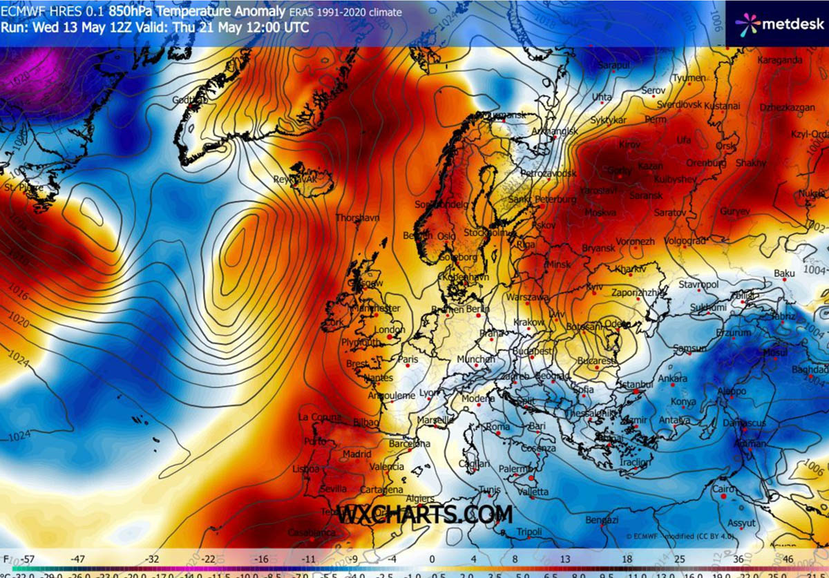
General weather pattern finally flips next week, warmer weather returns
Looking ahead into the following week, the weather pattern is likely to flip. This means the blocking High over the North Atlantic will collapse and be replaced by deep troughs and surface lows.
This will lead to more stable weather and ridge build-up in Europe through the remainder of May 2026.
Temperatures are also forecast to return to normal and above-normal levels, and could soon peak into heatwave conditions.
Warmer weather next week will first spread into western and southwestern Europe, then gradually move eastward as the week progresses.
***
You can follow the severe weather evolution on our dedicated page with satellite, radar, and lightning products:
See also:
Atmospheric Code Red: 2026 Super El Niño Now Trending Toward Record-Breaking Intensity