The hurricane season continues, and we are already monitoring new areas of potential development. Models are hinting at quick hurricane development, while the first thunderstorms are deep in Africa. This gives us a unique opportunity to follow hurricane formation live, from first thunderstorms to a major hurricane.
One very special region has emerged, just off the coast of Africa. It is associated with a tropical wave that is currently still deep in Africa. What is interesting, is that major weather models are already developing this region of storms into a major hurricane later in the Atlantic, while there are only scattered thunderstorms currently in Africa. This truly is a great chance to witness hurricane formation and also model accuracy. Below we see the current satellite imagery over west Africa we can see thunderstorm activity with tropical waves. We have marked the area of potential development, and as you can see there are only scattered storms currently. this area is forecast to become a major hurricane later in the Atlantic.
IR satellite imagery of west Africa. Image by Tropical Tidbits.
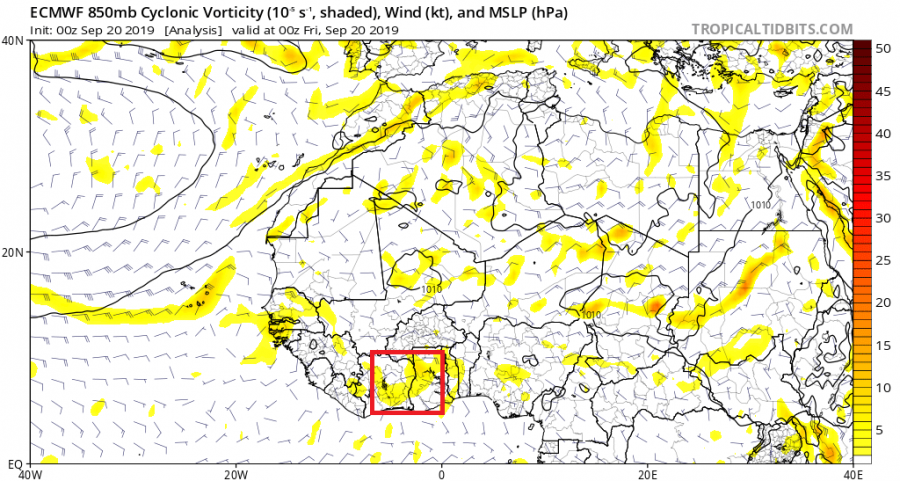
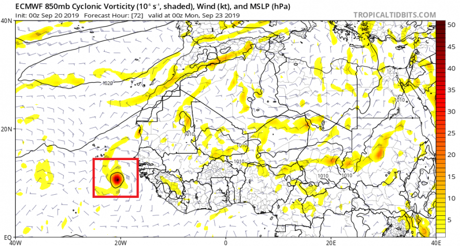
These are the model forecasts from ECMWF global model, which show the development from a pack of thunderstorm, to a major hurricane. The storm pack is already forming, and will be more defined tonight as it moves west towards the Atlantic. This model was already predicting this event one week ago, when there was not even a single thunderstorm in existence of those today. Tropical waves are very hard to predict far in advance, but somehow this one was “predictable” well ahead in the future, that we are currently witnessing in the present.
ECMWF model forecast. Image by Tropical Tidbits.
ECMWF model forecast. Image by Tropical Tidbits.
ECMWF model forecast. Image by Tropical Tidbits.
ECMWF model forecast. Image by Tropical Tidbits.
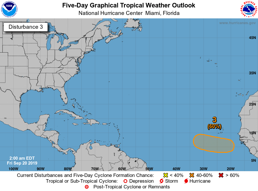
The national hurricane center has already issued a potential development zone for the next 5 days, as they also monitor this same region for fast development. The current forecasts take this hurricane out into the Atlantic. But some ensemble system calculations do take it further west and affecting some of the islands. As the storm develops, the calculations will get more accurate.
Stay tuned as we follow this pack of storm developing into a major hurricane!


