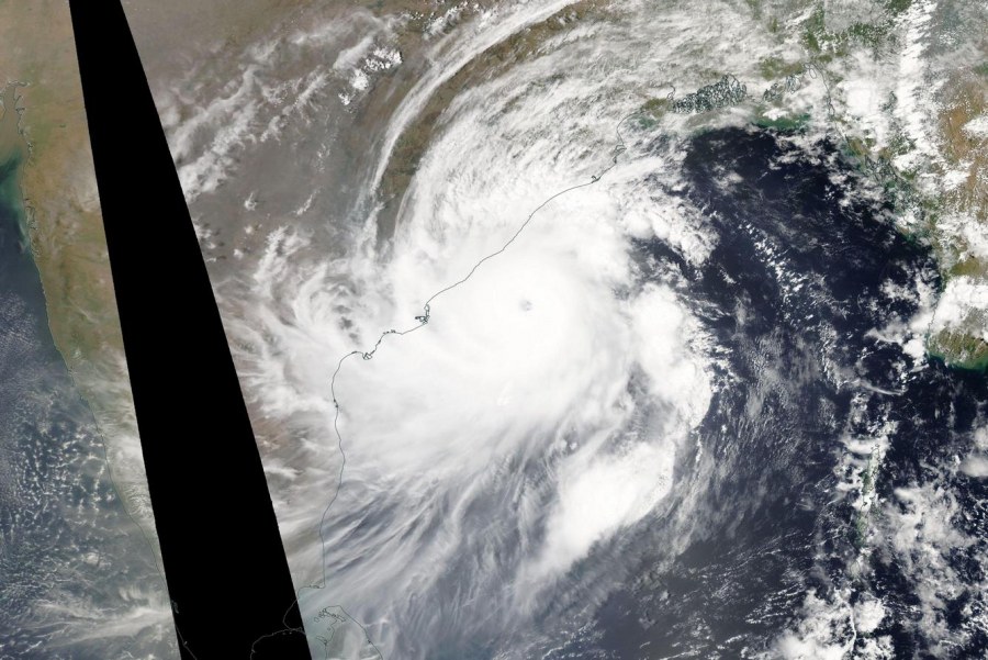
Extremely severe tropical cyclone Fani is now equivalent to Category 4 strength as it heads for landfall in eastern India. The system packs maximum sustained winds of 249 km/h (155 mph), gusting up to 306 km/h (190 mph)! This is a potentially devastating system.
Extremely severe tropical cyclone Fani around local noon today (May 2, 2019), as imaged by NASA Aqua satellite. Image: NASA WorldView.
Fani is heading towards landfall on early Friday along the heavily populated Odisha coast near Puri likely as an equivalent Category 3 or 4 system. It may become the worst tropical cyclone to hit the area since 1999, when a cyclone caused 10 000 fatalities and widespread damage.
Himawari AHI Full Disk IR imagery of tropical cyclone Fani as it nears landfall. May 2, 13:30 UTC. Note the tight eye and very symmetric shape, indicative of a very strong system. Image: SSEC Real Time Imagery.
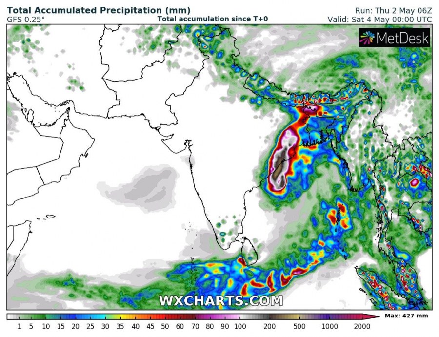
In addition to extremely severe winds, torrential rainfall is expected, with up to 400-500 mm of rain within the next 36-48 hours. Major flooding is expected.
Total accumulated rainfall in the next 48 hours. GFS model guidance. Map: Wxcharts.com.

