SYNOPSIS
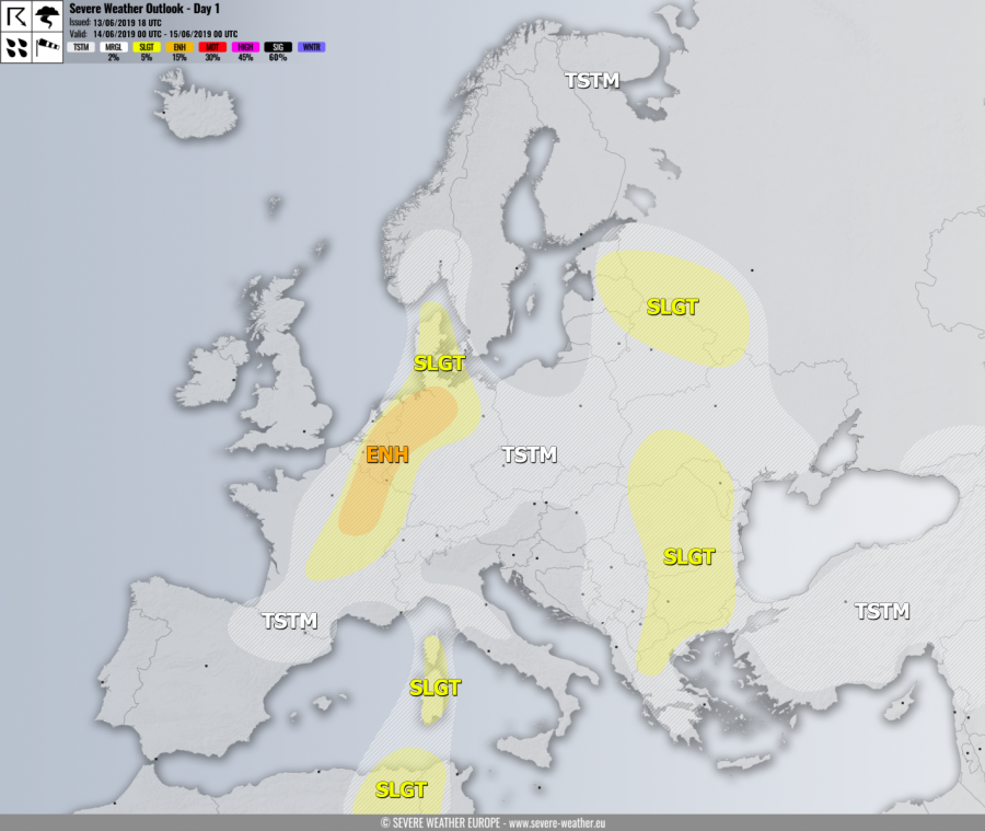
Strong ridge continues strengthening across the eastern half of Europe while deep trough with two deep cores remains over WSW Europe and N Atlantic. Short-wave trough crosses France towards Benelux with a northwards moving surface front.
DISCUSSION
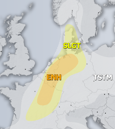
ENH risk has been issued for NE France into E Benelux and NNW Germany with threat for severe storms, capable of producing severe winds, torrential / excessive rainfall and large hail. Organized storms are expected to develop along the northwards retreating frontal boundary by the late afternoon under moderate strong shear but marginal MLCAPE. Supercells are likely to develop as well, bringing large hail and severe winds as primary threats.
SLGT risk has been issued for areas surrounding the ENH risk including central France, W/N Germany and Denmark with mode isolated threat for severe storms, capable of producing severe winds, torrential rainfall and marginally large hail.
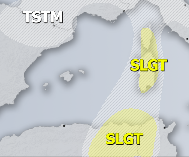
SLGT risk has been issued for Sardinia, Corsica and NE Algeria / N Tunisia with threat for isolated severe storms, capable of producing severe winds, torrential rainfall and large hail.
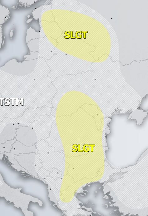
SLGT risk has been issued for E Baltic region, NE Belarus into NW Russia with threat for severe storms, capable of producing severe winds, torrential rainfall and large hail.
SLGT risk has been issued for E/S Balkans with threat for severe storms capable of producing severe winds, torrential / excessive rainfall and large hail. Flash floods and hail accumulation are possible with slow-moving storms.
TSTM risk areas have been placed where convective storms are likely to occur but should remain sub-severe.


