SYNOPSIS
Large trough with two cores sits over WSW Europe while ridge is established over S and E Europe. In between, a short-wave trough with a frontal boundary is located from the Alps towards the Baltic region. Upper low remains over E Mediterranean and the Middle East.
DISCUSSION
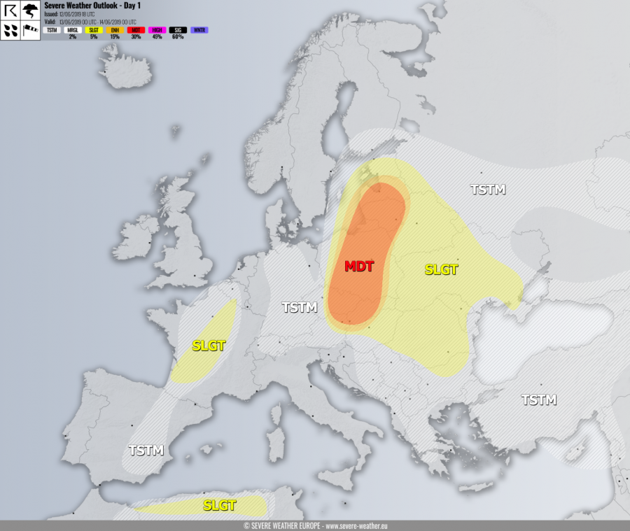
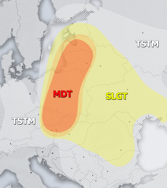
MDT / ENH risks have been issued for NE Austria, W-CNTRL Slovakia, E Czech Republic across E-CNTRL Poland into the Baltic countries with threat for severe storms, capable of producing severe winds, torrential rainfall and large to very large hail. Rather widespread activity is expected of strongly organized severe storms, including supercells and bowing segments with damaging winds and a very large hail threat. A cluster of storms is likely to develop towards the evening hours, where severe damaging winds and hail will be possible along the leading squall-line across the northern half of the risk areas.
SLGT risk has been issued for areas surrounding the MDT / ENH risks into E Europe and E Balkans with isolated threat for severe storms, capable of producing severe winds, torrential / excessive rainfall and large hail. Flash floods and hail accumulation possible with slow-moving storms.
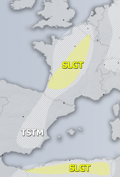
SLGT risk has been issued for central France with isolated threat for severe storms, capable of producing severe winds, torrential rainfall and marginally large hail.
SLGT risk has been issued for N Algeria with isolated threat for severe storms, capable of producing severe winds, torrential rainfall and large hail.
TSTM risk areas have been placed where convective storms are likely to occur but should remain sub-severe.


