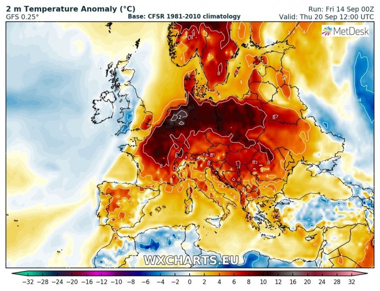
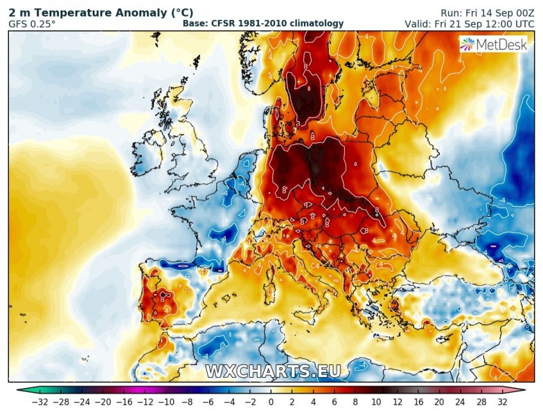
Mid-range model trends are confirming a new heat wave across Europe next: temperatures will likely be 8-10 °C higher than average for mid to late-September in central, western, eastern and southeastern Europe. This means temperatures in the upper 20s and low 30s again!
The heat wave comes as a response to a pattern change across much of Europe: a strong ridge develops over much of the continent, with deep troughs and lows – including the expected post-tropical storm Helen – forcing warm air advection ahead of them, a Spanish Plume setup over western Europe and a strong ridge elsewhere. Models agree on very high temperature anomaly: daytime highs will likely pushing as far as 30 °C as far north as northern Germany and parts of Benelux. Parts of France, Italy and the plains of Pannonian basin may well push above 30 °C!
GFS model guidance for 2 m temperature anomaly – the difference between the expected temperature and long-term average temperature for this period. The more positive the anomaly, the warmer the weather. Charts span from Monday to Friday next week. Maps: Wxcharts.eu
Such temperatures may not sound extremely high after a long, warm summer. But the same temperature anomaly would push temperatures into the upper 30s and locally lower 40s!
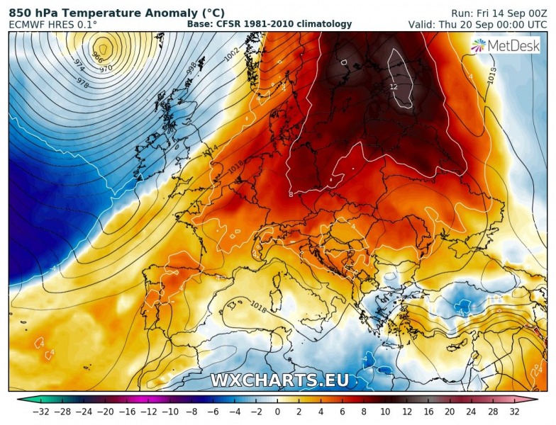
Both GFS and ECMWF models still agree, with the latter pushing for even warmer weather.
GFS and ECMWF model guidance for 850 mbar level (~1500 m) temperature anomaly. The models agree very well. Maps: Wxcharts.eu


