Western France and the Bay of Biscay will be hit by a deep cyclone and associated windstorm today. Severe storm force winds are expected, producing a potentially dangerous situation. We take a closer look.
At 07h UTC on Tuesday the cyclone was located west of Brittany, France with central surface pressure at 997 mbar.
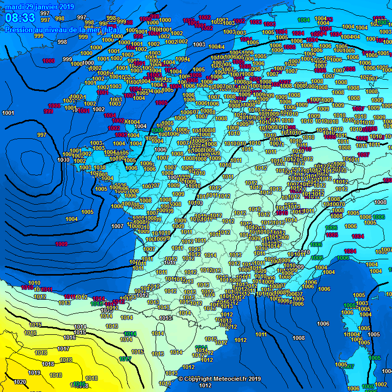
Surface pressure analysis at 7:00 UTC, January 29. The cyclone is at central MSL pressure of 997 mbar. Map: Metecentre.fr
Surface pressure analysis at 7:33 UTC, January 29. The cyclone is west of Brittany at 998 mbar. Map: Meteociel.fr
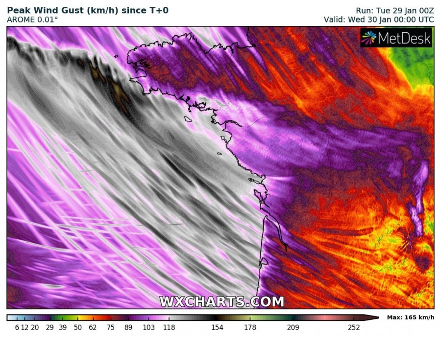
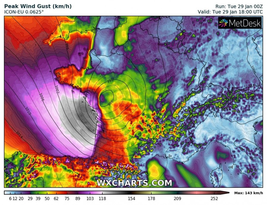
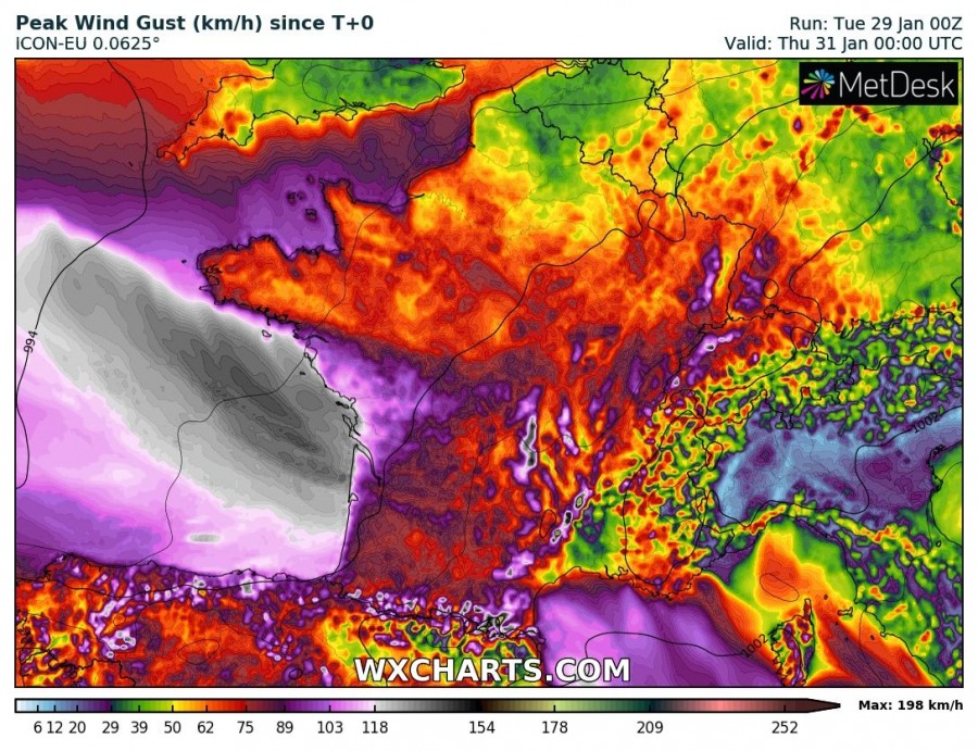
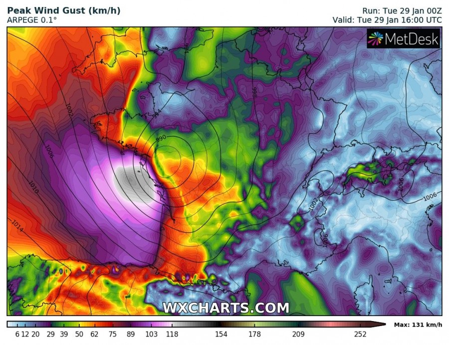
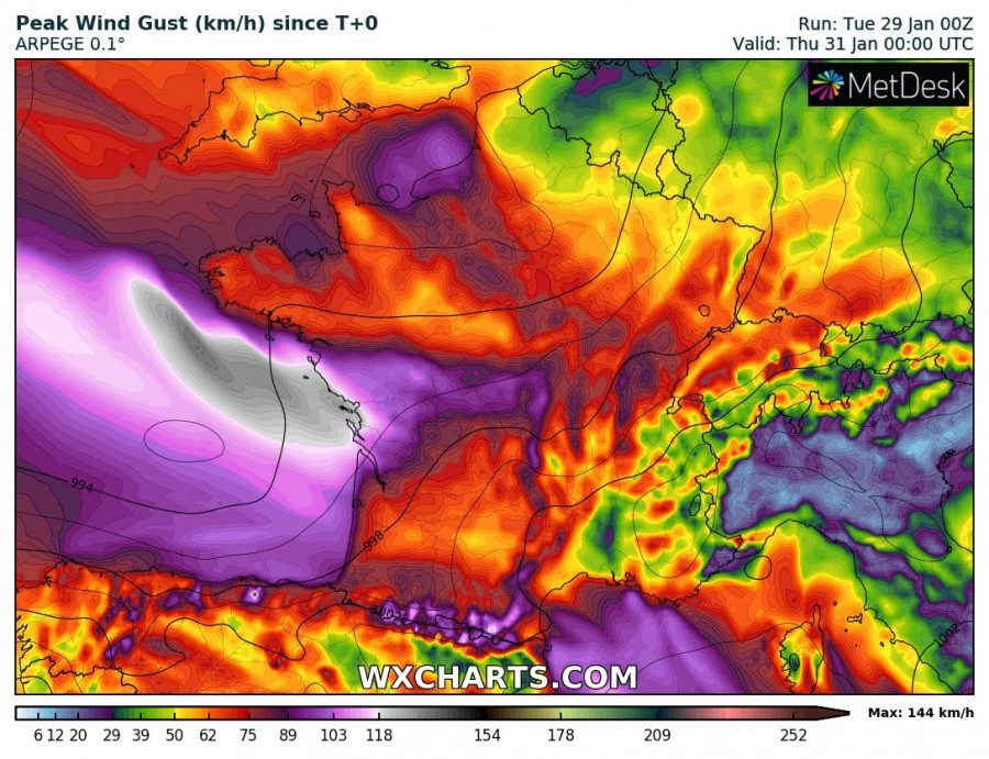
Latest model guidance consistently indicates the cyclone will rapidly deepen to 980-990 mbar central MSL pressure by late afternoon when it makes landfall in northern Aquitaine and Pays de la Loire. Expect a powerful windstorm across the western coast of France, including Brittany, Pays de la Loire and Aquitaine. Peak wind gusts will reach 120-140 km/h along the coast. Several models indicate peak wind gusts in 150-170 km/h range just off the coast. Peak winds are expected to diminish quite rapidly once the cyclone moves inland. Consult the maps below for details.
Peak wind gusts across the region until early on Wednesday. Extremely high-resolution AROME model guidance. Map: Wxcharts.eu.
Peak wind gusts at 18h UTC (19h CET) and maximum wind gusts across the region until early on Thursday. ICON-EU model guidance. Map: Wxcharts.eu.
Peak wind gusts at 16h UTC (17h CET) and maximum wind gusts across the region until early on Thursday. ARPEGE model guidance. Map: Wxcharts.eu.
Also expect large waves along the coast of the Bay of Biscay (W France, N Spain), with maximum wave height in 6-9 m range until early on Wednesday, when the waves diminish somewhat.
This is a potentially dangerous situation! Keep alert for flying debris, falling trees and other hazards. Keep clear of the coast, major waves and dangerously rough seas.
