Latest model guidance confirms large amounts of mostly rainfall across NW Spain and N Portugal over the next 3-4 days. Rainfall totals will exceed 100 mm, enhancing flood threat in these areas.
Several successive lows will affect the Iberian peninsula in the next 3-4 days, bringing intense precipitation to parts of the region. In particular NW Spain and W Portugal are looking at high rainfall cumulatives, with high-res models indicating up to 150-250 mm of rainfall until early on Saturday. Flooding, locally strong, is expected.
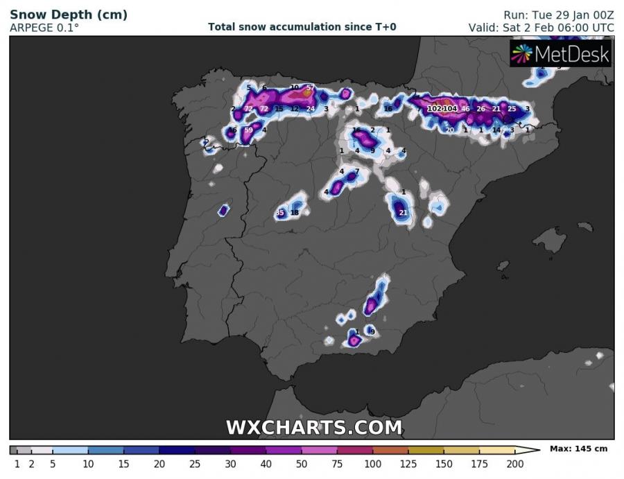
Also expect snowfall, locally very intense – in the Pyrenees (up to ~50-100 cm), Picos de Europa (20-50 cm) and isolated higher elevations across central and southern Spain.
Total precipitation until Saturday morning. ARPEGE model guidance. Map: Wxcharts.eu.
Total precipitation until Sunday morning. ICON-EU model guidance. Map: Wxcharts.eu.
Total snowfall until Saturday morning. ARPEGE model guidance. Map: Wxcharts.eu.
Snow depth on Sunday morning. ICON-EU model guidance. Map: Wxcharts.eu.
See also:
Large amounts of rainfall (and snow) for parts of the Iberian Peninsula this week


