A classic, but unusually extremely intense cold outbreak is developing over the southern Canada today where 70-80F below zero windchills have been observed! The outbreak is on its way towards the northern United States tonight. It will spread across the Midwest and the Great Lakes region through the next 3 days. Arctic cold temperatures will support brutally cold days, where strong to severe winds on both Wednesday and Thursday will bring extremely low windchills with very dangerous life-threatening situation. Temperatures will locally push close to -40F / -40 °C with windchills towards -65F or -50 °C! These are very rare, extreme and possibly even historic values in some areas!
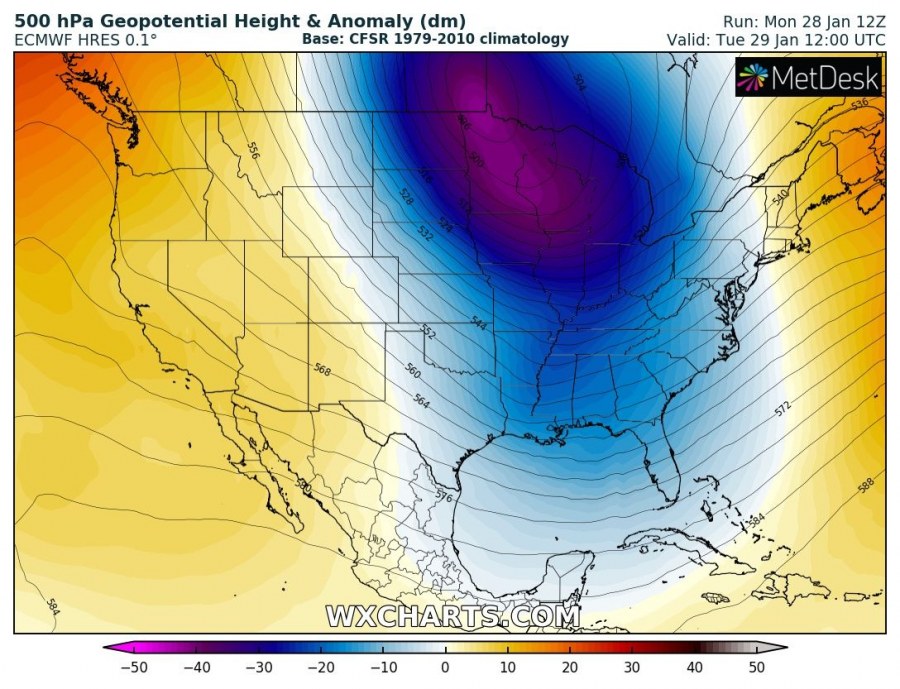
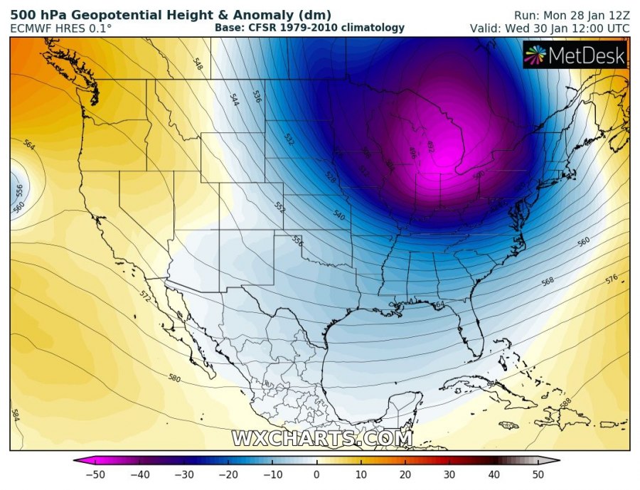
The 500 mbar pattern supporting this extreme event indicates a very deep upper-level trough/low pushed into the Great Lakes region tomorrow, Tuesday 29th and spreading into the Northeast US and the East Coast by Thursday.
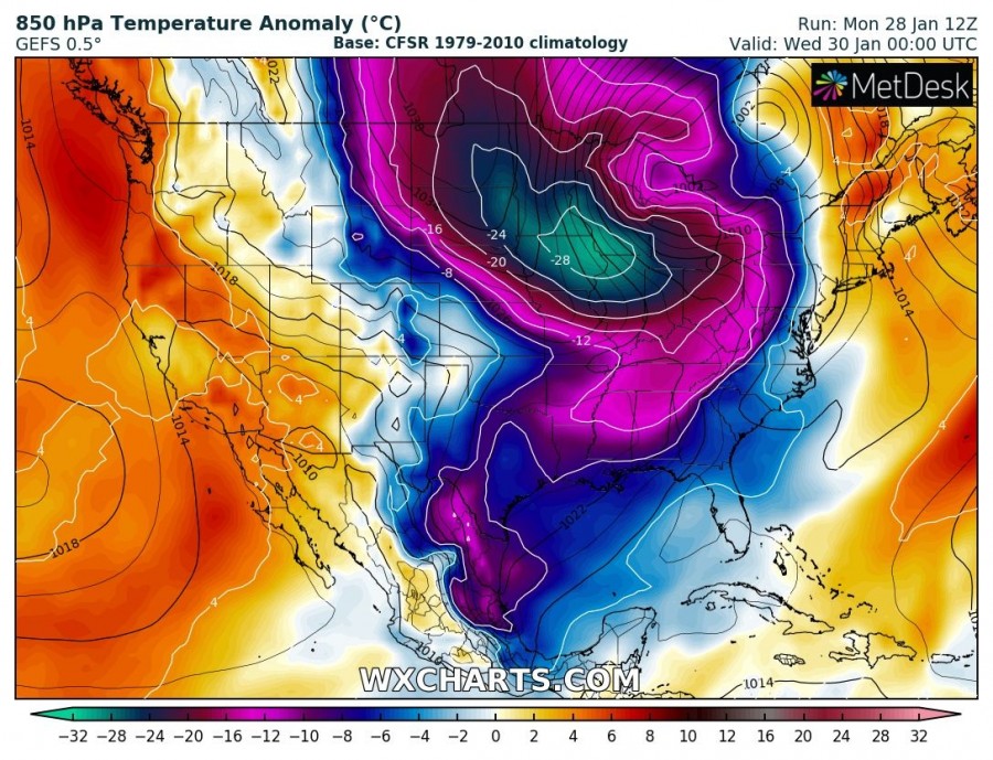
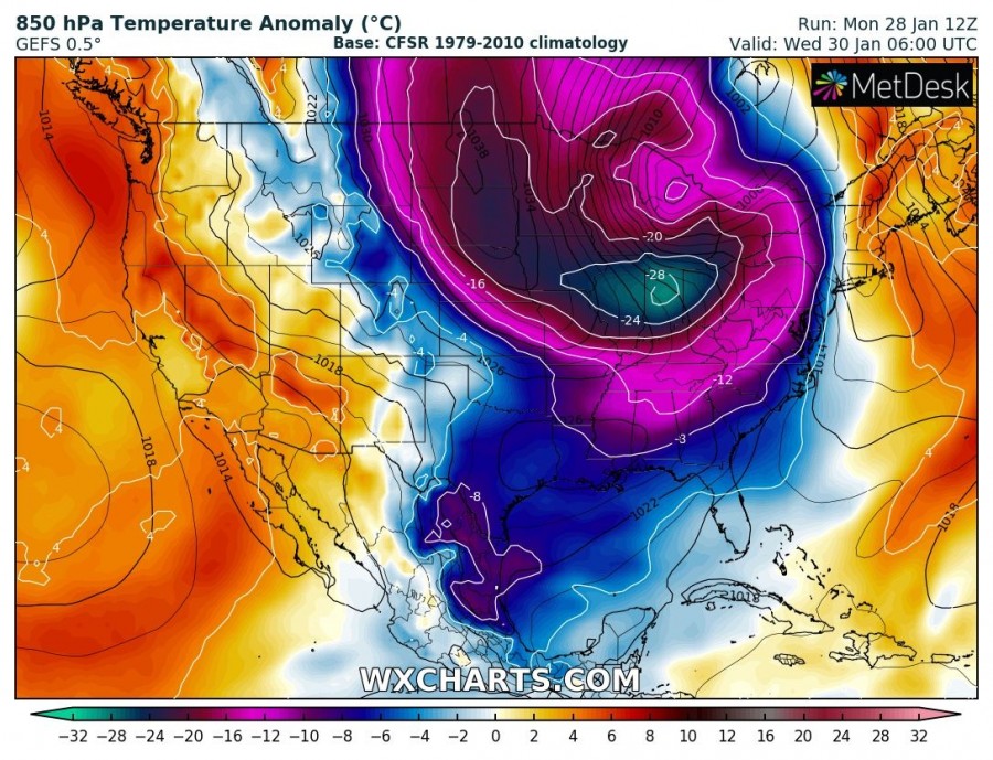
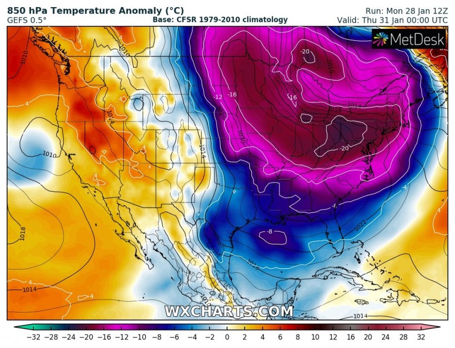
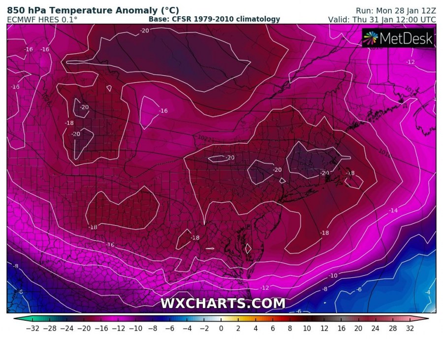
Here is the 850 mbar temperature sequence of the outbreak evolution from the southern Manitoba (CA) tonight, spreading into the North and South Dakota, Minnesota, Iowa, Winconsin on Tuesday (Jan 29th) and continuing towards the Illinois, Indiana and Ohio through Wednesday (Jan 30th) and Thursday (Jan 31st).
Let us take a look over the 850 mb zoomed maps for the Great lakes region – one can see the anomaly for Wednesday across parts of Illinois and Indiana will be near 30 °C below normal at this height for end of January (Chicago will for example experience near -25 °C below normal at 850 mbar), while the East Coast will still see near normal values. But on Thursday, this extremely cold airmass also spreads across the East Coast, including New York, Washington and other major cities.
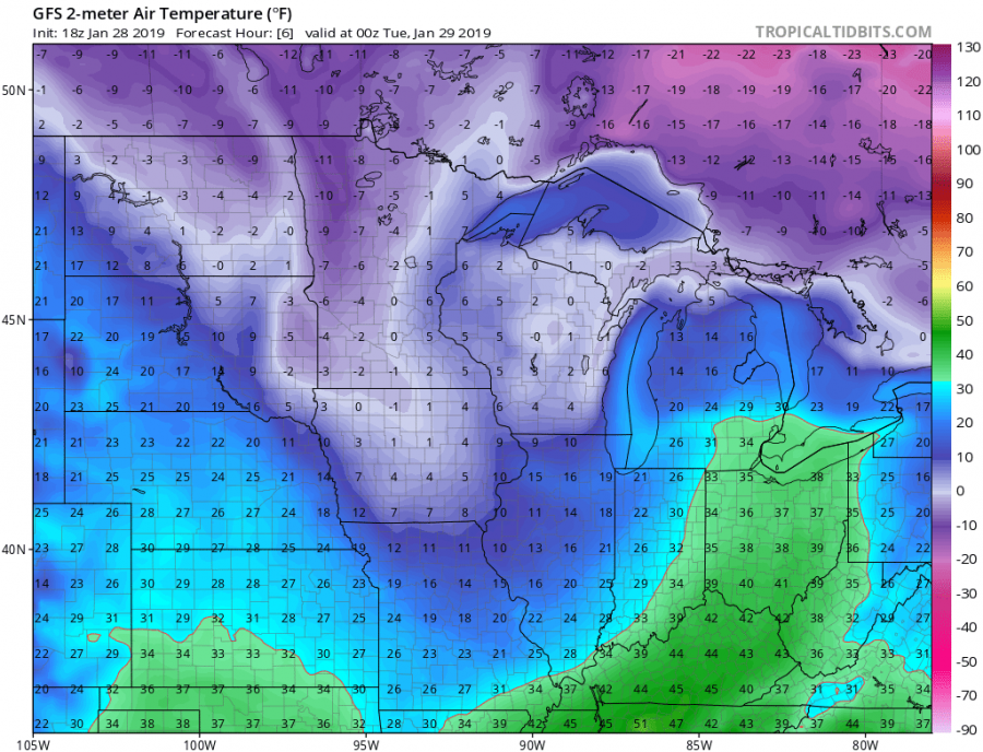
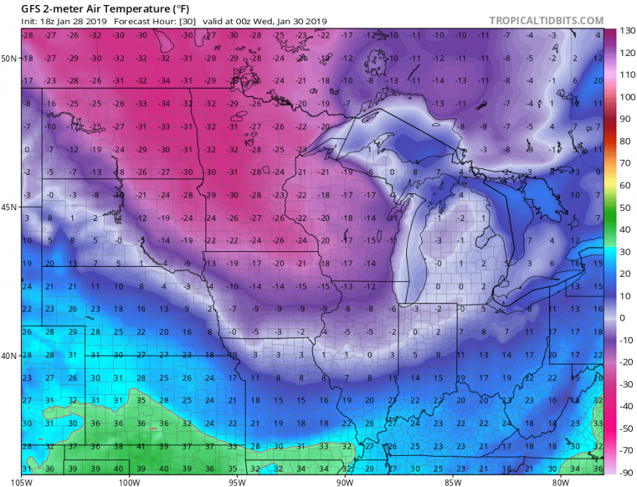
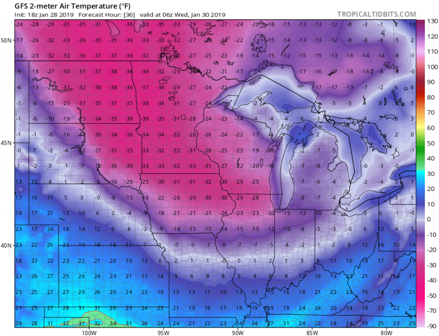
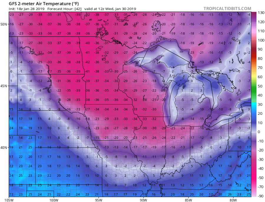
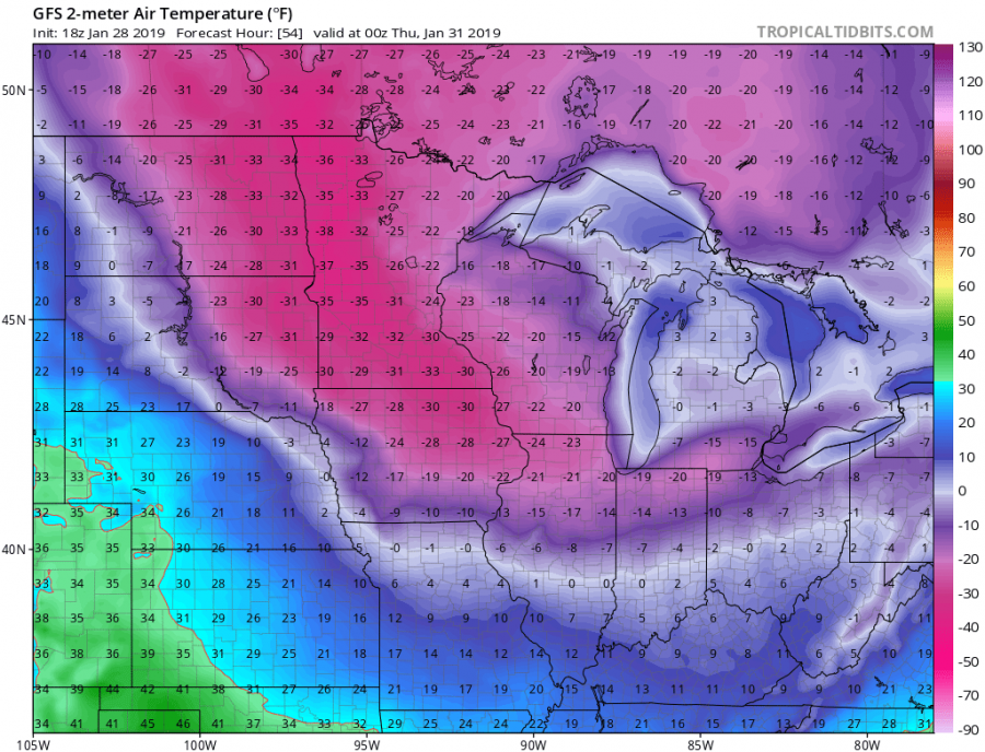
The sequence of 2 m temperature (in Fahrenheit) from early Tuesday (Jan 29th) until Thursday (Jan 31st) morning local time – 5-10F below zero starts tonight across the North Dakota and the NW Minnesota while it rapidly intensifies tomorrow when temperature plunges below -30F for the following 12-18 hours over the same region. Very cold airmass with near -20F temperatures then reaches northern Iowa and southern Illinois by tomorrow evening local time. Through the next 12 hours, rapid intensification of the airmass pushes temperatures into near -35F in these areas while near -30F already reaches the northern Illinois (Chicago area as well) by the morning hours on Wednesday. Meanwhile, brutally low temperatures with near or even below -40F (-40 °C) develop over the eastern Dakotas and the western Minnesota! Advection then continues east into Indiana and Ohio, reaching near -20F until the evening hours. The extreme cold with temperatures around -35F will maintain over the much of Midwest while it finally starts dissipating from the west (cental Dakotas) on Thursday.
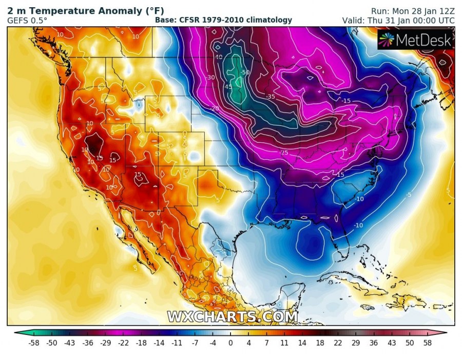
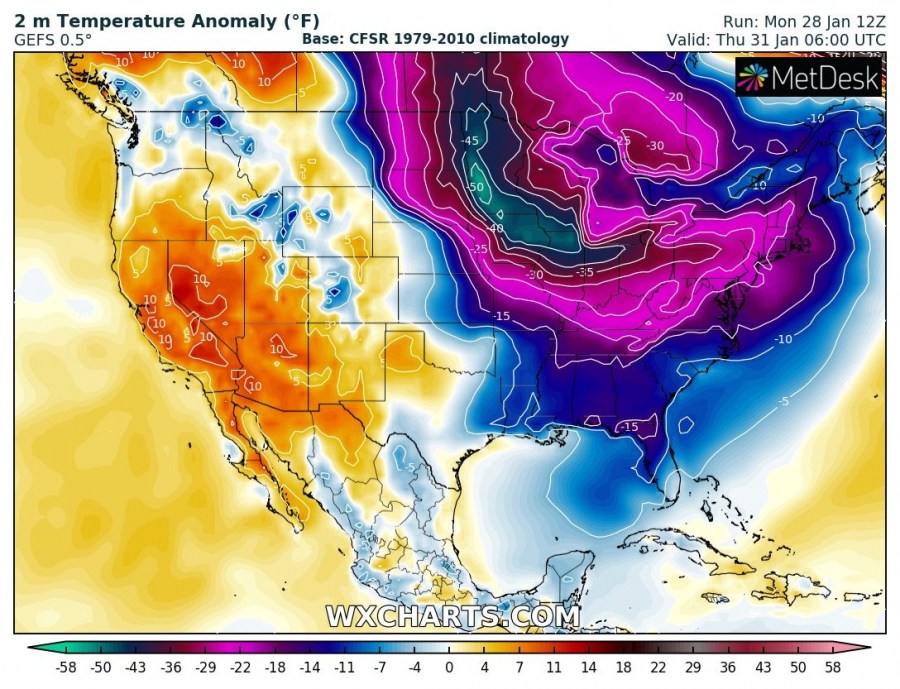
Looking over the 2 m temperature anomaly we can see an incredibly impressive and rare anomaly for the near-surface airmass. Parts of eastern Dakotas, Minnesota, Iowa and northern Illinois will experience daily temperatures nearly 50F lower than average for the end of January. This is beyond EXTREME and both Wednesday and Thursday will be brutally cold with very dangerous life-threatening conditions.
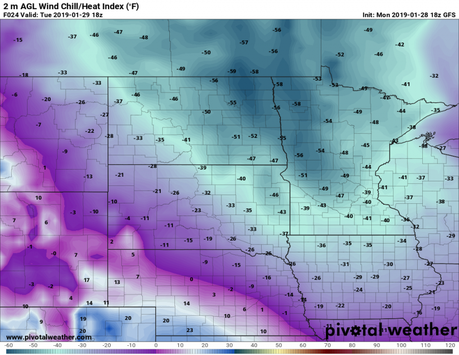
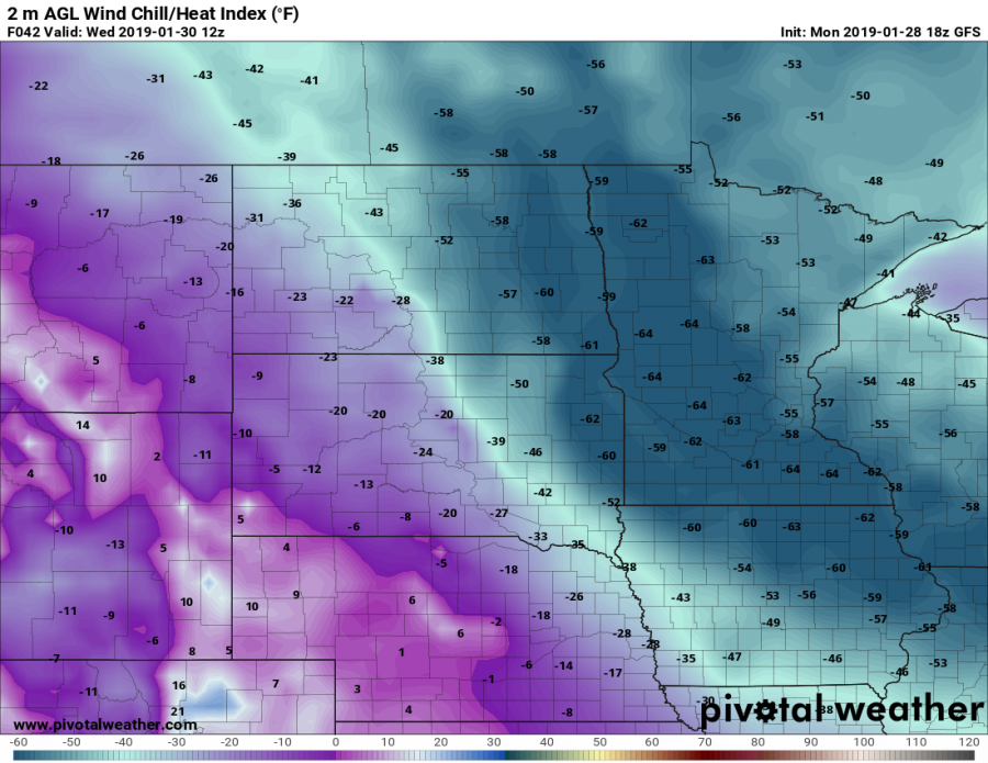
A sharp temperature/pressure gradient will also develop very powerful winds on the wake of the low (as strong high pressure system builds up across the north US) which will result in very extreme windchill temperatures. The real feel of this brutally cold airmass will be well below -60F or -50 °C!
Official graphics of the National Weather Service (NWS) from Duluth, Minnesot and Grand Forks, North Dakota regarding the extreme and possibly historic windchill temperatures on Wednesday.
We are closely monitoring the evolution of this life-threatening weather situation and will keep you updated through Tuesday and Wednesday – stay tuned!
