Category 5 Hurricane Dorian is tracking across the northern Bahamas.It has weakened very slightly over the past several hours, but remains an extremely powerful hurricane. There is still uncertainty on the effects it will bring to Florida as it approaches.
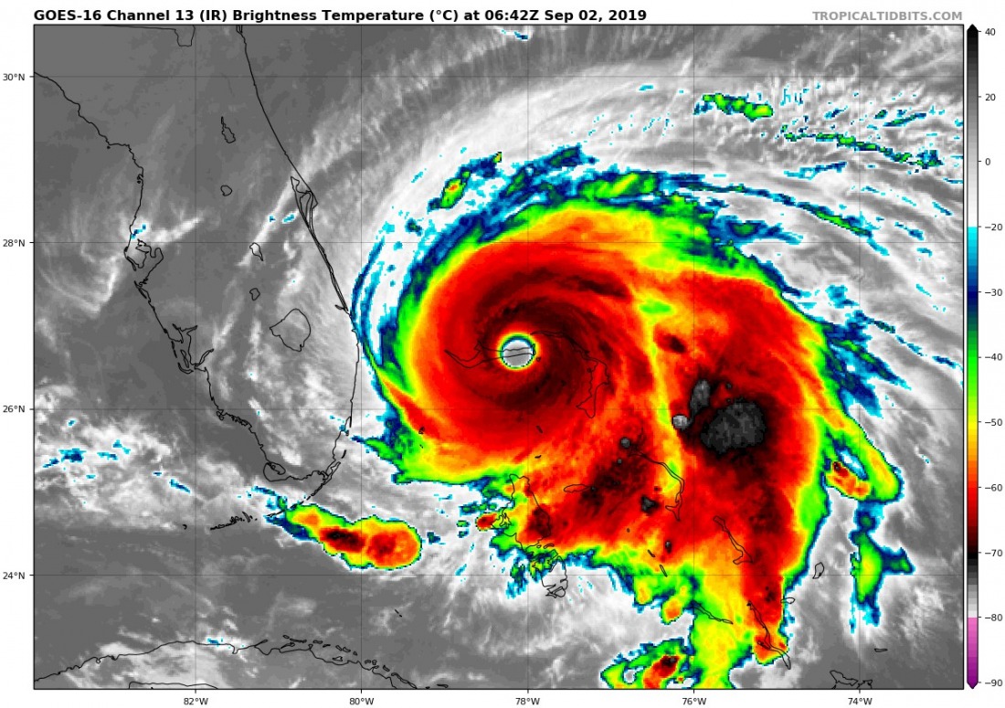
Hurricane Dorian over the eastern half of Grand Bahama at 6:42 UTC this morning, September 2nd. The CDO cloud top temperature has increased from nearly -80 °C to about -70 °C, likely indicating slight weakening of the hurricane. The eye remains well-defined and round. EDIT [10:58 UTC] – latest imagery shows reintensifying convection and cloud tops again reaching -80 °C. Image: GOES-16 IR / Tropical Tidbits.
Latest recon data indicates hurricane Dorian has weakened very slightly as it very slowly pushes west across the northern Bahamas. At 165 mph (265 km/h) peak sustained winds and 916 mbar central pressure as of 5h UTC, it is still an extremely powerful Category 5 hurricane.
Awestruck by Hurricane Dorian.
Extraordinary visuals of lightning in a powerful, powerful storm. pic.twitter.com/534EzvgI8H
— Dakota Smith (@weatherdak) September 2, 2019
After making first landfall over Abaco island in the NE Bahamas it has been very slowly moving across the Grand Bahama island, tracking west and coming to a virtual standstill late in the morning (UTC). The direction is the worst possible for Grand Bahama, as it takes Dorian’s eyewall with the most intense winds straight along the island. Widespread catastrophic damage is expected, further enhanced by the extremely slow motion – only 1 mph (1-2 km/h), virtually stationary – and prolonged severe wind and storm surge action for locations along its track. Some locations along the track have been under the eyewall for many hours.
Super CAT. V. #Hurricane #Dorian Obliterating Grand Bahama Island From East to West. Max. Sustained Winds 180MPH. #LaborDay #GrandBahamaIsland #GreatAbaco #Bahamas #HurricaneDorian #FLwx #GAwx #SCwx #NCwx pic.twitter.com/4s4j58v9bH
— William Scherer (@WilliamScherer3) September 2, 2019
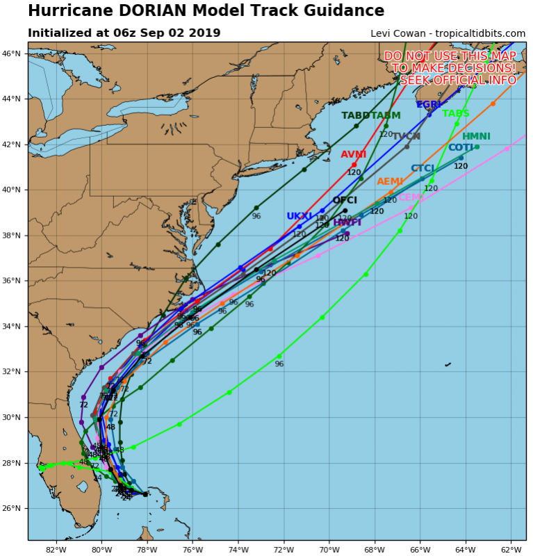
Dorian is now just over 150 km due east of West Palm Beach, Florida. A northward pivot is expected in the hurricane’s track, however, latest model guidance has been pushing it westwards towards Florida. Most tracks are still approximately 50-100 km offshore, with some indicating a closer approach and possibly landfall along the central part of the eastern coast of Florida in the next 24 to 48 hours.
Hurricane Dorian model track guidance as of 06h UTC, September 2nd. Maps: / Tropical Tidbits.
Further slight weakening is expected, with Dorian remaining a category 5 or a high-end category 4 hurricane. Still an extremely dangerous system! A NHC-issued hurricane warning is in effect for much of the Bahamas and eastern Florida coast between approximately Boca Raton and Titusville.
Stay tuned for further updates!

