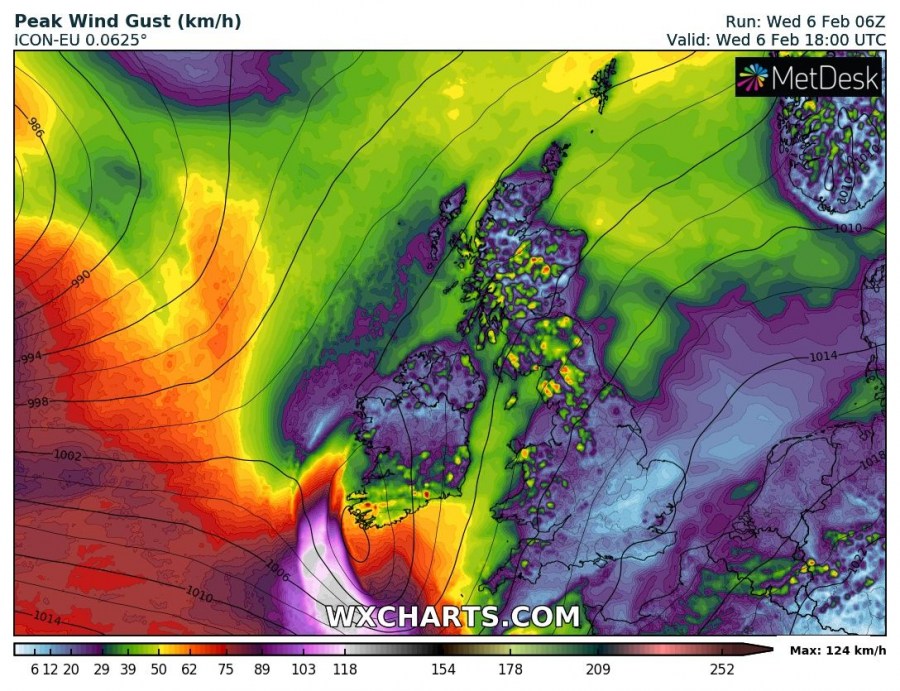
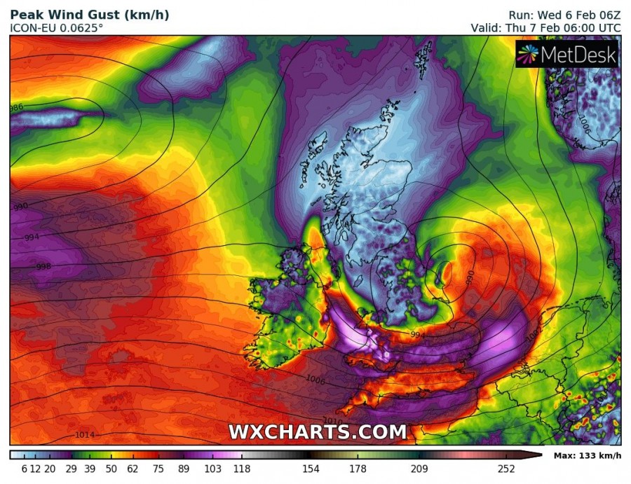
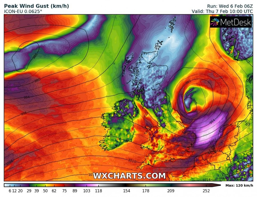
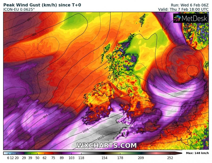
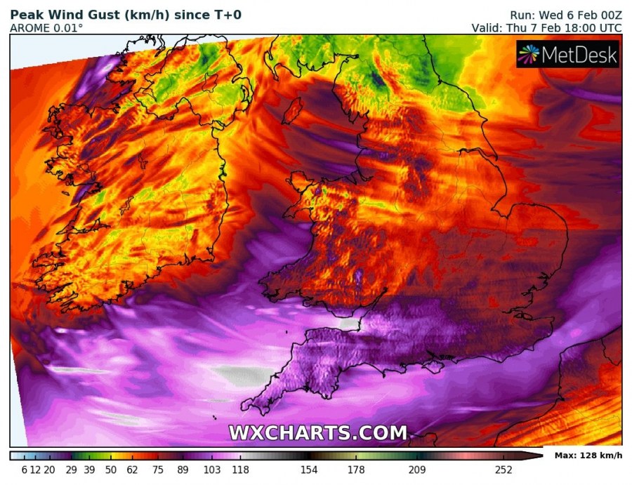
A shortwave trough rounds the southern end of a broad low over the northern Atlantic and forms a rapidly moving surface low, which will cause windy weather over southern UK (south England, parts of Wales) and into the north Sea and the coast of the Netherlands.
The surface low will gradually deepen from about 1005 mbar in the late morning on Wednesday to probably around 995 mbar by midnight as it tracks across central UK and will continue deepening as it tracks across the North Sea on Thursday. It may reach between 985 and 990 mbar before it reaches Denmark and southern Sweden, before beginning to fill as it tracks across Finland on Friday.
Strong gale to storm force winds will develop on the southern part of the UK, in particular southwest England and parts of Wales – largely depending on the exact track of the system. Expect winds gusting up to 90-130 km/h.
Wind gusts across the British Isles and Ireland until Thursday evening. ICON-EU model guidance. Map: Wxcharts.eu.
Wind gusts across the British Isles and Ireland until Thursday mid-afternoon. ARPEGE model guidance. Map: Wxcharts.eu.
Wind gusts across the British Isles and Ireland until Thursday evening. AROME high-res model guidance. Map: Wxcharts.eu.
