An impressive deep cyclone is moving across the northern Atlantic today, central pressure is below 960 mbar. It is gradually moving east/northeast and will make the closest approach near Iceland this afternoon. The tight pressure gradient will result in very intense winds, locally exceeding 160 km/h and could result in flying debris and tree damage.
Here is the morning analysis from the satellite and pressure data readings:
An impressive core of the deep N Atlantic cyclone yesterday afternoon, Feb 4th. Notice the perfect cyclonic structure where also mesovortices are visible. Image via @Vedur pic.twitter.com/AzWRbx4SuK
— severe-weather.EU (@severeweatherEU) February 5, 2019
An impressive deep cyclone is moving across the north Altantic, approaching Iceland from the SW where sevre to extremely severe wind gusts are expected later this afternoon. Central pressuer is below 960 mbar! Maps by @vedur / @meteociel pic.twitter.com/70PuBbi70h
— severe-weather.EU (@severeweatherEU) February 5, 2019
The pattern evolving early this week indicates a deep trough over the north Atlantic with an associated deep cyclone SW of Iceland. The cyclone’s track will push it towards the east today and tomorrow, with a close approach to south Iceland this afternoon.
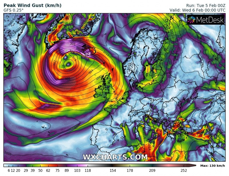
Here is the GFS model sequence through the afternoon and evening hours: cyclone will be gradually moving east just south of Iceland and result in a tightening pressure gradient near the southern coast. Peak gusts suggested by this global model are up to 135 km/h.
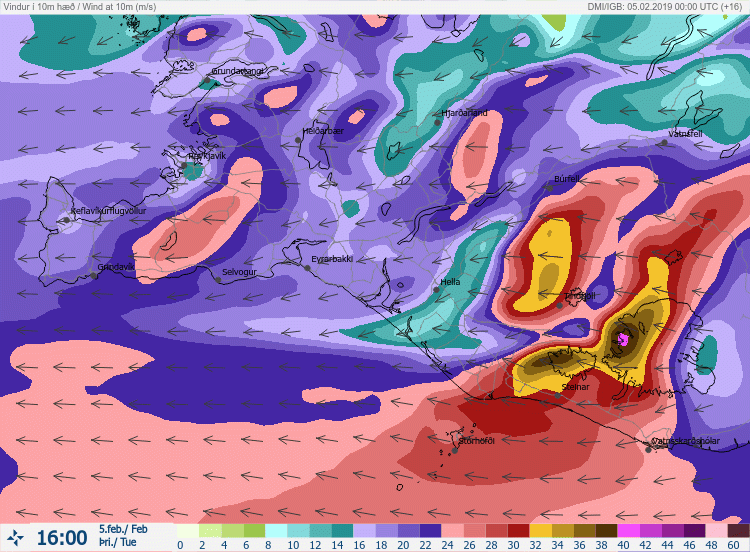
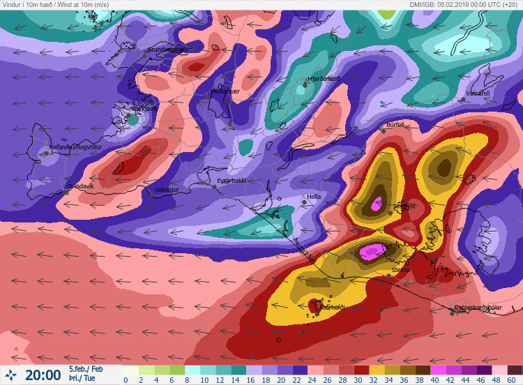
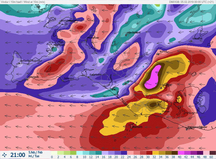
Peak wind gusts will likely form along the WNW slopes of mountainous terrain in the SSW Iceland where powerful downslope winds will develop due to the wind flow from the east/southeast. Local high resolution model by Icelandic meteorological service suggests peak gusts could locally reach around 42-45 m/s = 150-160 km/h.
High-resolution model ARPEGE peak gusts until late Monday night, indicating peak gusts could locally reach more than 160 km/h.


