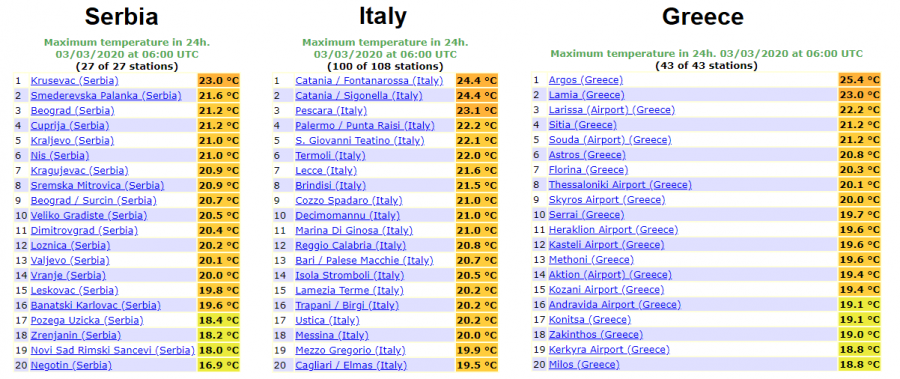
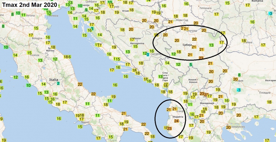
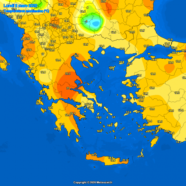
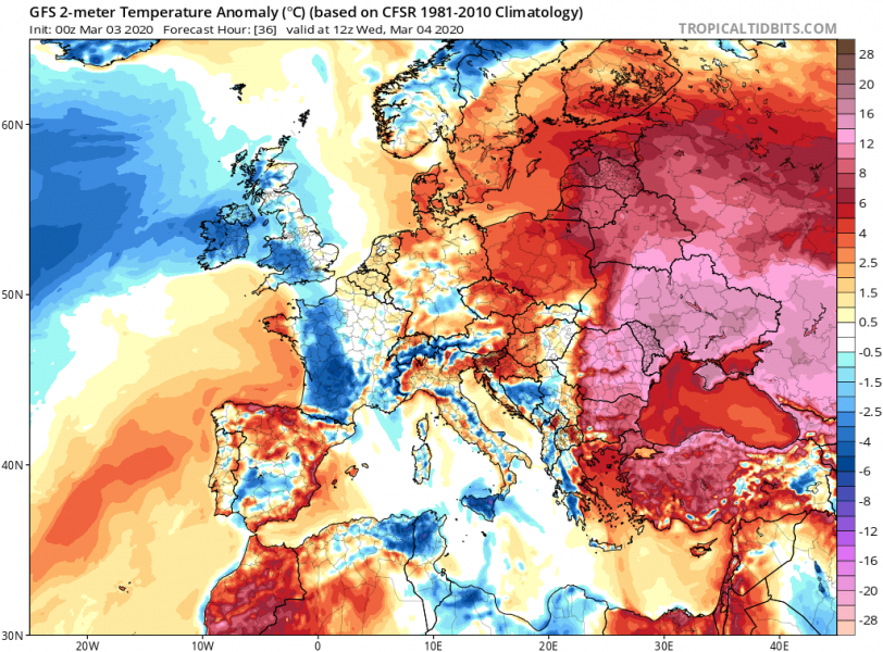
As discussed yesterday, a significant warmth develops over the Balkan peninsula this week, in response to a favorable pattern over southern Europe. A deep trough over the Mediterranean is resulting in strong warm advection to the east of it, into the Balkans. Ahead of the eastward-moving surface front, a very warm day with around 23-25 °C has developed over western countries – Serbia, Albania and Greece precisely. Much warmer airmass develops today and through Thursday as stronger warm advection arrives.
The highest temperatures were observed in Greece, south Italy, Serbia and Albania, locally 23-25 °C has been reported. The northern areas have resulted in high temperatures due to dry foehn winds from the central Dynaric mountain range into the plains (eastern Bosnia & Herzegovina, Serbia).
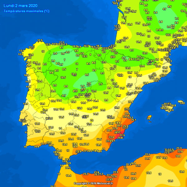
There was also a very warm day in parts of east-southeast Spain, in response to west-northwest flow and therefore foehn dry downslope winds into Valencia and Murcia regions – locally up to +28 °C!
As warm advection strengthens into the Balkans today, much warmer weather is expected across central and eastern parts. Locally temperatures should even exceed 25 °C. Anomalies are impressive!
See the primary forecast discussion:

