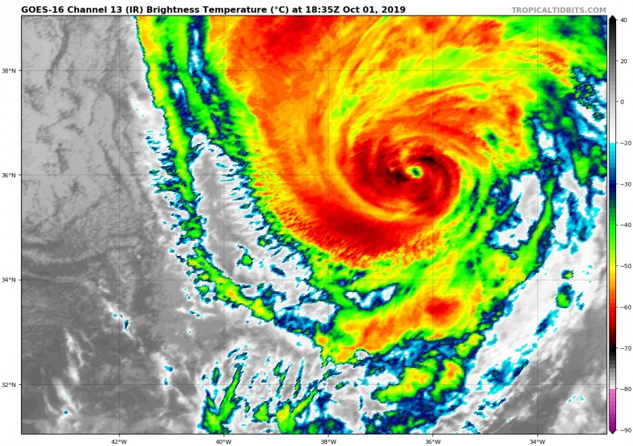
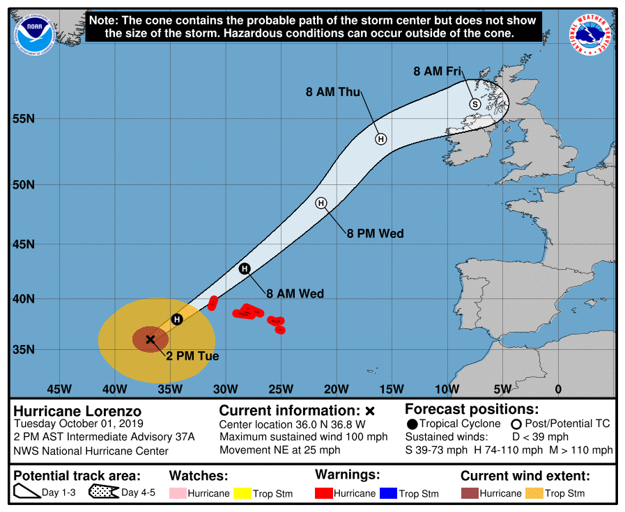
Lorenzo is currently a category 2 hurricane, and is forecast to remain at this strength until landfall in the early morning, when it will start weakening as it heads further northeast, away from the Azores. Main threat will be severe wind gusts, over 170 km/h are likely (over 200 km/h in higher altitudes) and high ocean waves and swell, over 15 meter in height!
The hurricane which we were monitoring all this time, since the very first storms in Africa, is now nearing land for the first time since it started to spin in the Atlantic. It is forecast to make landfall in the early morning in the Azores as a strong hurricane, on border between category 1 and 2.
Official outlook from the National Hurricane Center, has Lorenzo currently at category 2, with maximum sustained winds at 160 km/h. The Azores are under a hurricane warning since yesterday. The official forecast is for Lorenzo to make landfall on Wednesday morning, between 3:00 and 6:00 UTC.
Main impact of Lorenzo will be on the western half of the islands, where models are forecasting wind gusts in range of 160-180 km/h, with stronger individual gusts possible! Below is a forecast from the ICON model, showing the wind field of Lorenzo at the time of landfall.
Also an important threat will be high ocean swell and waves, which are forecast to reach over 15 meters in height. Individual waves can reach over 20-24 meters in height!
Lorenzo is currently forecast to continue its path towards northeast, impacting Ireland on Thursday evening as an extratopical system, with gusts over 140 km/h possible on the west coast, and ocean waves over 10-12 meters high!
Stay tuned as we closely monitor the landfall of hurricane Lorenzo and its further evolution!


