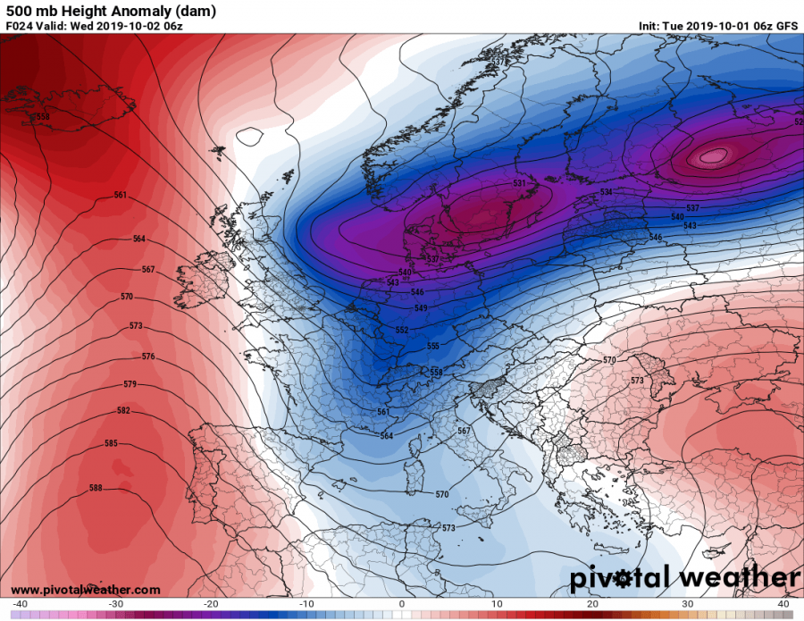
An upper low pushing across western Europe transforms into a long wave trough, moving over central Europe and the northern and central Mediterranean on Wednesday and Thursday. It will push as far south as the southern Mediterranean and north Africa on Thursday. It brings unsettled weather to the region with strong cold air advection from the north in its wake.
500 mbar height anomaly maps for early Wednesday and early Thursday. GFS model guidance. Map: Pivotal Weather.
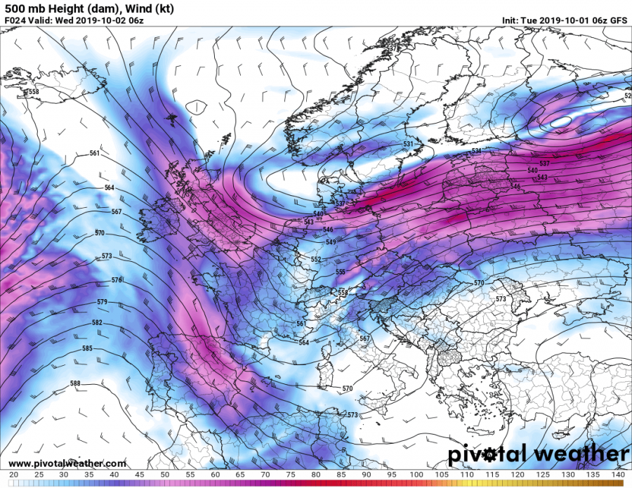
The trough will be rounded by a strong 30-50 kt mid-level (500 mbar) jetstreak.
500 mbar wind speed early on Wednesday. GFS model guidance. Map: Pivotal Weather.
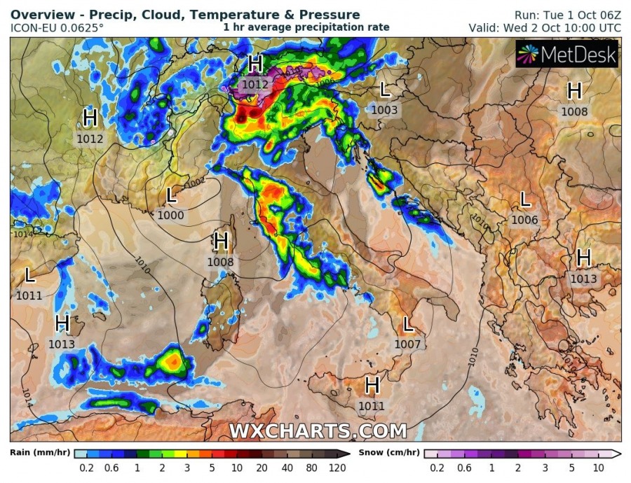
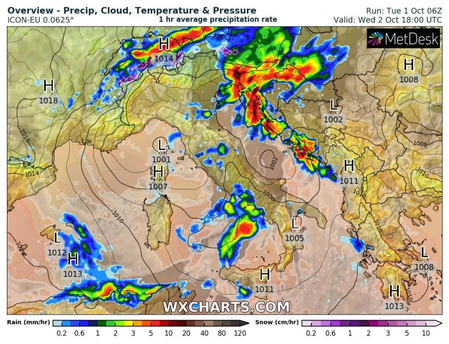
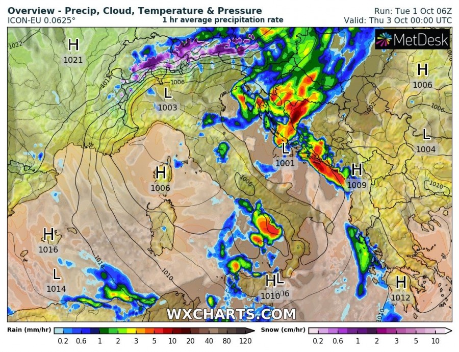
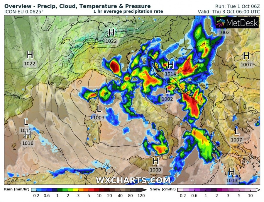
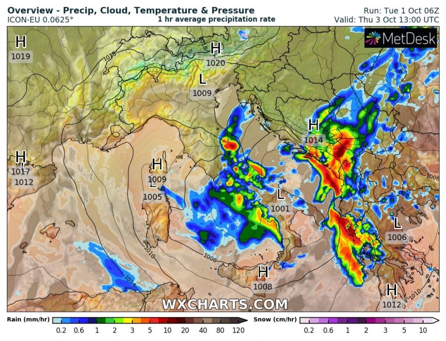
A Genoa surface low will have formed over the Ligurian sea by early on Wednesday, pushing southeast into the southern Adriatic by late on Thursday. It will be accompanied by thunderstorms, locally severe, and torrential rainfall.
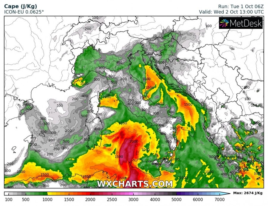
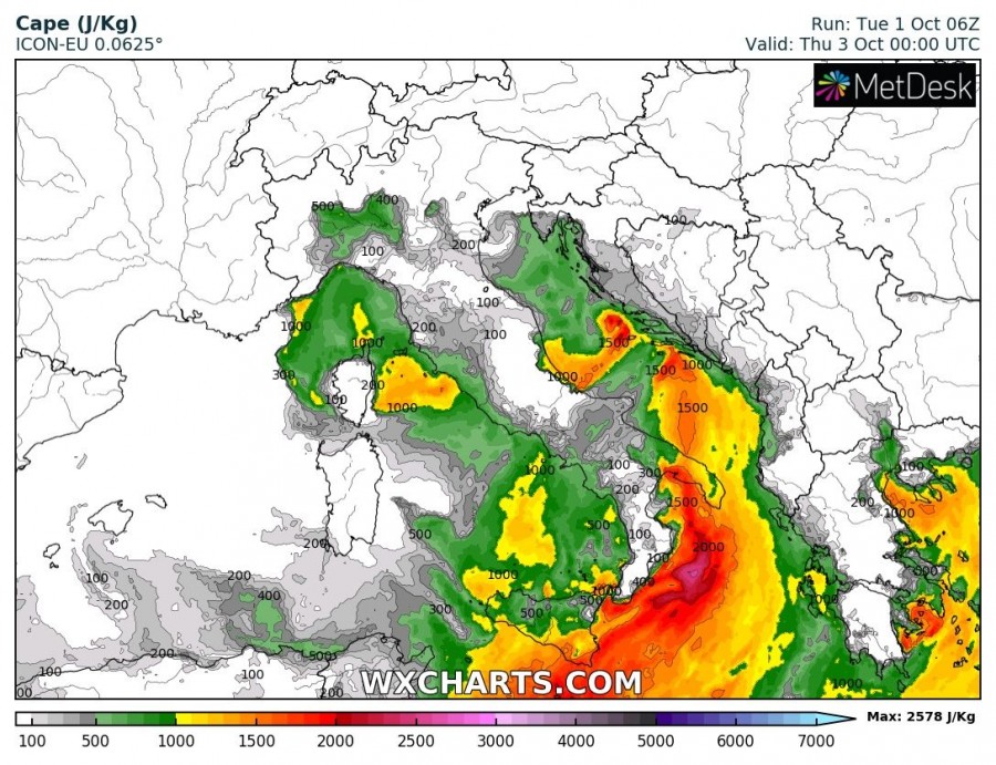
Very considerable instability will be in place, particularly considering it is early October. High-res models indicate up to 1000-2000 J/kg MLCAPE in place across the northern Adriatic, increasing to over 2000 J/kg MLCAPE in the central and southern Adriatic.
Expect locally severe thunderstorms along the eastern coast of the the Adriatic sea, and to a lesser extent along the eastern coasts of the Ligurian and Tyrrhenian seas and inland over Italy.
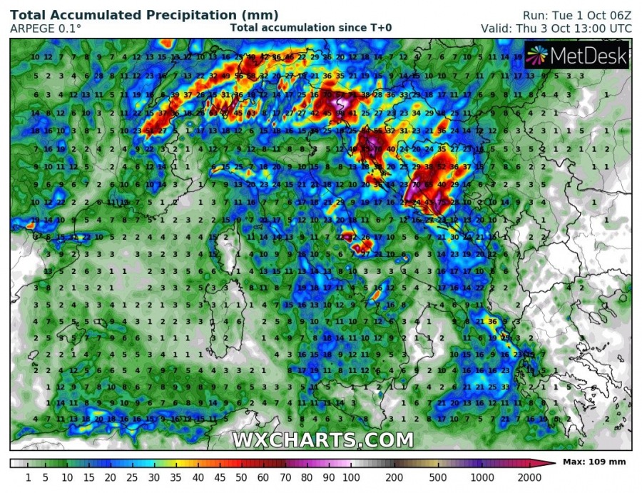
Large amounts of rainfall are expected.
Up to 100-150 mm of rainfall is expected locally. Expect local flooding in areas where torrential downpours deliver much of this amount in a short time.
With the still warm Adriatic sea and significant low level instability in place, mostly above 150-200 J/kg (0-3km) CAPE, locally spiking to 400 J/kg, waterspouts will be possible with any storm developing in the region. Mesocyclonic waterspouts will particularly be possible earlier in the day, with strong deep-layer shear in place, but with shear rapidly diminishing later in the day, non-mesocyclonic waterspouts will be more likely.
