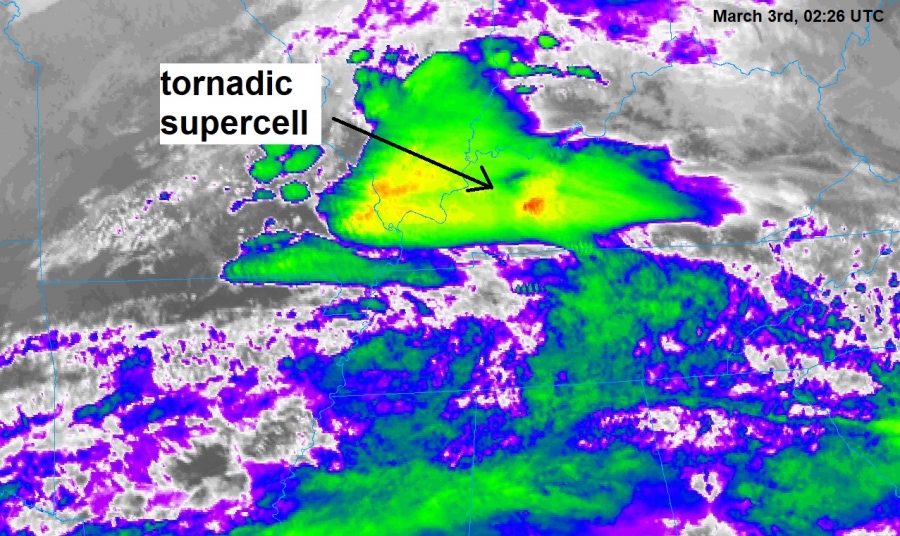
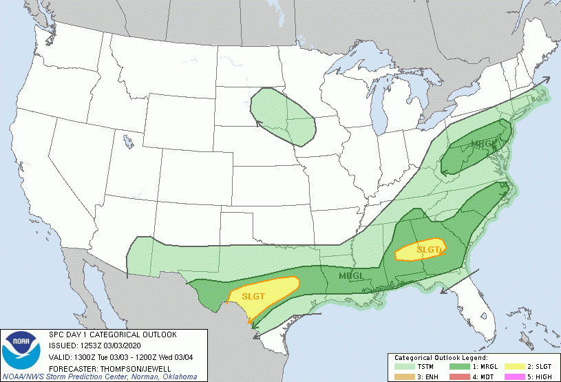
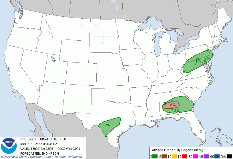
A powerful and deadly supercell storms moved through Middle Tennessee last night, with a destructive tornado through Georgetown, downtown Nashville early Tuesday morning March 3rd (last night), cutting a swath of destruction that stretched through the city for several miles. Unfortunately, at least 23 fatalities have been reported across Tennessee so far (East Nashville, Davidson county; Cookeville, Putnam county).
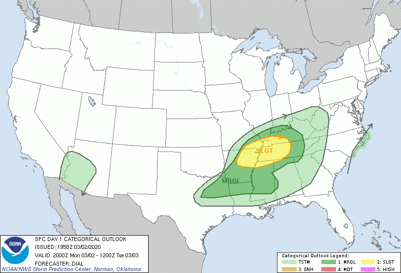
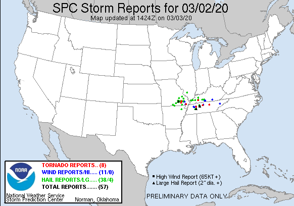
The event occurred in the area which was under the severe threat yesterday, SLGT risk was in place across the Tennessee valley. At least 8 tornado reports so far.
Numerous power flashes have been visible in the downtown Nashville while the tornado was ripping trough. Looking closely one can see the large cone of tornado as well:
https://twitter.com/NashWX/status/1234769568981307398
https://twitter.com/Daniel_Alley/status/1234733638085902342
Just filmed a #tornado pass north of my building and just north of the state capital! Wow! pic.twitter.com/HUd40rvdsD
— Sam Shamburger (@shamnadoes) March 3, 2020
https://twitter.com/jackiecas1/status/1234738893498519560
https://twitter.com/AshleyMatte/status/1234748169537413121
https://twitter.com/ohheyynina/status/1234761842649636864
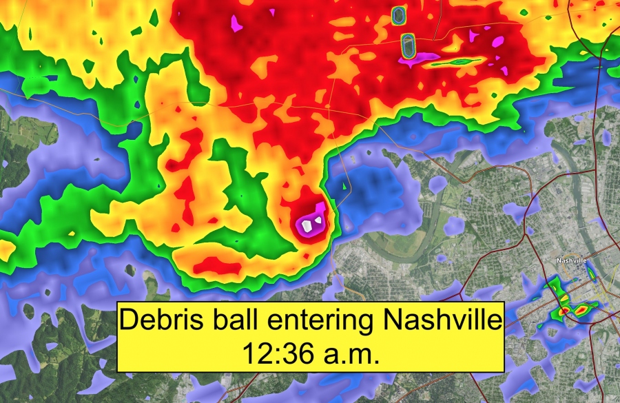
Here are radar images and animations of the event while the deadly tornado was going through downtown Nashville. A well-defined debris ball signature has been registered on the radar scans – those are the flying debris within the tornado circulation:
Last night, a deadly #tornado impacted portions of Middle Tennessee…
Here’s a Doppler radar & velocity breakdown of the storm as it moved through #Nashville. The tornado would loft debris high enough to be picked up on local radar, creating a “Debris Ball” radar signature! pic.twitter.com/TNo600X3uN
— Nash Rhodes (@NashWX) March 3, 2020
Good grief! Another closer look at the #NASHVILLE tornado just before 2am this morning. This radar is known as LEVEL 2 Reflectivity and it's rather revealing with this tornado strike. Gives me goose bumps. @FOX35ORLANDO @GoodDayOrlando pic.twitter.com/W5cijYhNT4
— FOX 35 Storm Team (@fox35stormteam) March 3, 2020
The first sign of debris with the #Nashville #tornado occurred at 12:36 a.m.
I saw evidence of debris with every radar scan until 1:36 a.m – exactly 1 hour later. Map is to scale.
Distance between the points is 56.5 miles. Awaiting NWS survey for final path length. pic.twitter.com/uPe7WsB2gm
— Matthew Cappucci (@MatthewCappucci) March 3, 2020
As the #tornado-producing storm approached #Nashville #tnwx pic.twitter.com/Efqf30NgPx
— Stu Ostro (@StuOstro) March 3, 2020
#Tornado Warning now for Southeastern Overton, Northern Cumberland County, East central Putnam County, & Southwestern Fentress County in Middle Tennessee! TAKE COVER NOW!!!! #TNWX pic.twitter.com/ZyjMItwx5n
— Eric Green II (@ChessEricOU) March 3, 2020
Absolutely horrifying images on radar in/around #Nashville tonight. A violent tornado has hit the city in the late night hours, which is always a less than ideal scenario. pic.twitter.com/t5ngFLGSc0
— Jarod Floyd (@jarodfloyd) March 3, 2020
Long-track highly tornadic supercell went right through #Nashville early this morning, and continues eastward. The rotation track is shown below between 12:30-1:30am Tuesday. Seeing lots of damage reports. Hopefully no injuries or worse. #TNwx #tornado pic.twitter.com/K7PReVCswS
— Beth Carpenter | TDS Weather (@B_Carp01) March 3, 2020
Significant damage has been reported across downtown Nashville, from the Georgetown. More than 40 buildings weres significantly damaged. Attached are aerial and ground reports:
Breaking: Video shows extensive damage in Nashville area after a tornado struck overnight. At least 9 people were killed. pic.twitter.com/olLpgQ0cXU
— PM Breaking News (@PMBreakingNews) March 3, 2020
Absolutely devastating pictures coming out of #Nashville, #Tennessee this morning, as a large tornado ripped through the downtown area. Looks like the hardest hit was #Germantown. This is going to be a high-rated #tornado. Hoping for no injuries or worse. #TNwx pic.twitter.com/sW26ZnrFrz
— Beth Carpenter | TDS Weather (@B_Carp01) March 3, 2020
https://twitter.com/ASBreakingNews/status/1234739943752294400
https://twitter.com/CedarPosts/status/1234776480791646210
Praying for #Nashville this morning with the devastating news of a Tornado hitting Davidson County. #NashvilleStrong pic.twitter.com/6IvGvaEnGz
— ChattTenn Sports (@ChattTennSports) March 3, 2020
A 360 view of Donelson Christian Academy. @WSMV #Nashville pic.twitter.com/dhnk6qqc8i
— Shelby Sansone Stephens (@shelbyasansone) March 3, 2020
https://twitter.com/Breaking911/status/1234744298773585920
Also today, severe storms with dangerous tornado threat are possible again. The threat is further southeast across east-central Alabama and west-central Georgia where best conditions are present. Storm Prediction Center has issued a SLGT risk for today and tonight, March 3rd/4th.
Note: This is the first review report as we are still collecting data and will be updating further – stay tuned!
