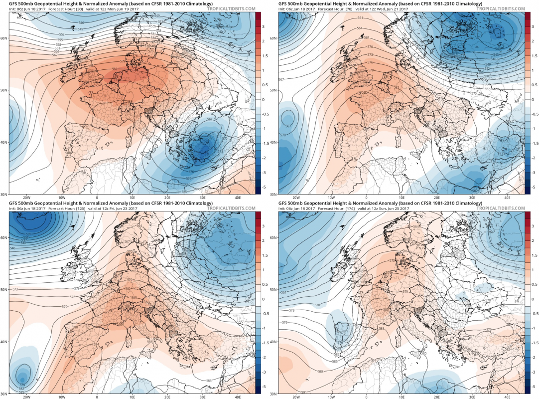
An intense heat wave will hit W-CNTRL Europe, and parts of S-SE Europe. Very high temperatures already this past weekend over the Iberian peninsula, peaking at 43-44 °C!
https://www.facebook.com/severeweatherEU/videos/2027783277444763/
A large anticyclone has established over a large part of Europe, with stable, sunny weather and warm to hot temperatures across large parts of the the continent. Expect the anticyclone to persist through the entire week.
Maps: Tropical Tidbits.
Outlook by region (latest GFS model guidance)*
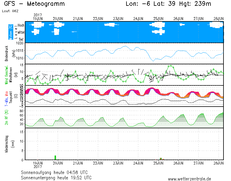
Spain, Portugal: extremely hot weather with daytime highs in the high 30s and locally in 40-45 °C range (!!) is set to continue across the Iberian peninsula at least until June 25.
Meteogram for S Spain. Map: Wetterzentrale.de
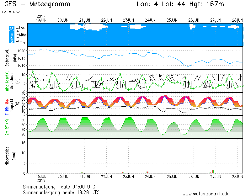
France: set to keep getting hotter every successive day. Northern France will reach above 30-32 °C by June 22, with a brief cooling following it. Central France will be reaching 32-33 °C by June 23, with a brief cooling after that. Southern France will be getting hotter until June 24, with temperatures above 35-38 °C then.
Meteogram for S France. Map: Wetterzentrale.de
Germany: more unsettled weather in Germany, but still a distinct warming trend until June 23 with temperatures approaching or locally exceeding 30 °C on that day, followed by a significant cooling.
Meteogram for CNTRL Germany. Map: Wetterzentrale.de
North Italy: very hot weather over the next week, with temperatures likely exceeding 35 °C by late next week.
Meteogram for N Italy. Map: Wetterzentrale.de
Pannonian basin (E Croatia, Hungary, E Slovenia, N Serbia, NW Romania): increasingly high temperatures, approaching and locally likely exceeding 35 °C by late in the week.
Meteogram for E Croatia. Map: Wetterzentrale.de
* – mid to long-range outlook may change significantly with newer model runs.


