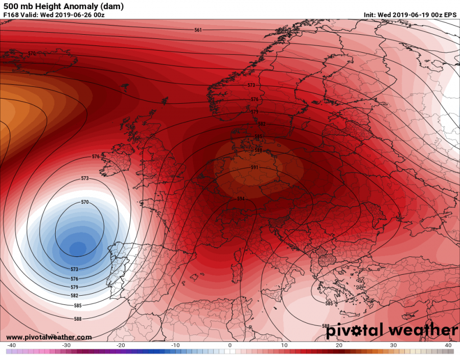
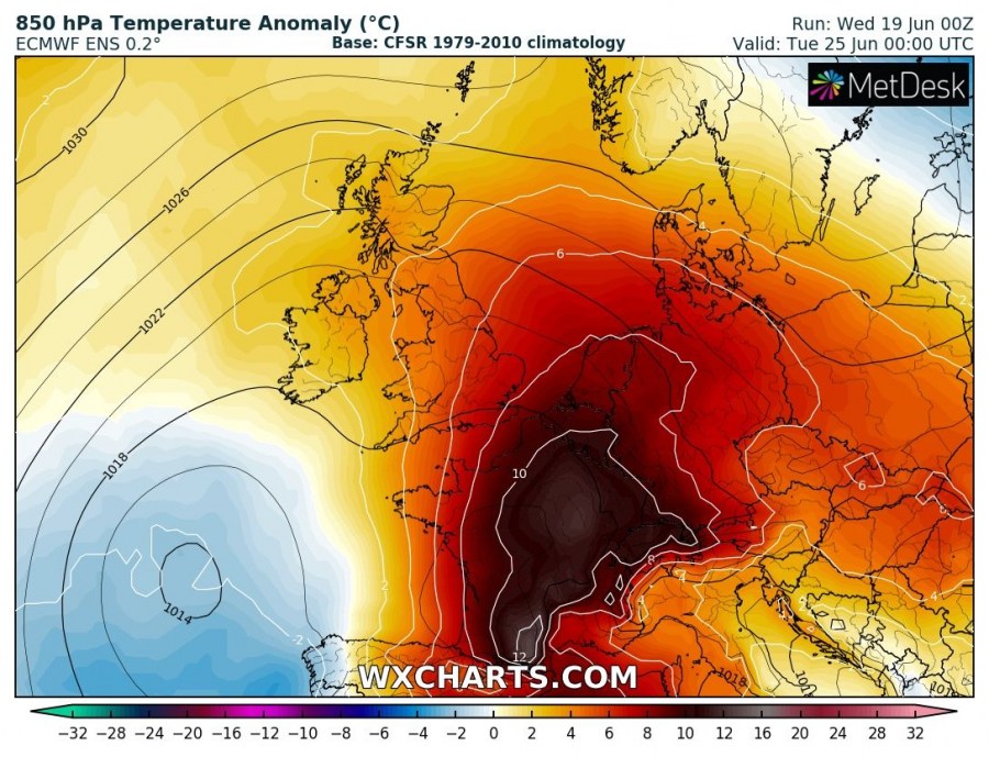
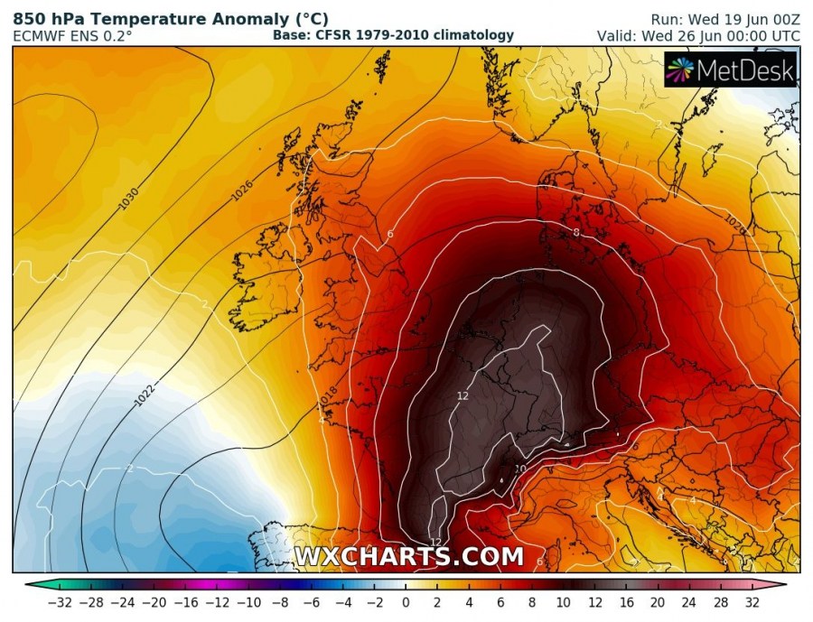
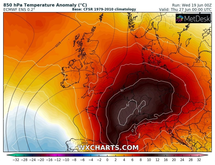
Models are is a good agreement for the development of an intense heat wave across a large part of west-central Europe, starting on Monday next week and likely extending until the weekend. Both global models GFS and ECMWF are hinting at peak afternoon temperatures in excess of 35-38 °C in some areas next week! Let us take a look at some details.
The pattern evolution seems to be trending towards an extensive omega blocking ridge developing over Europe through mid next week, with two upper lows on the edge – one over the N Atlantic and another one over SE Europe.
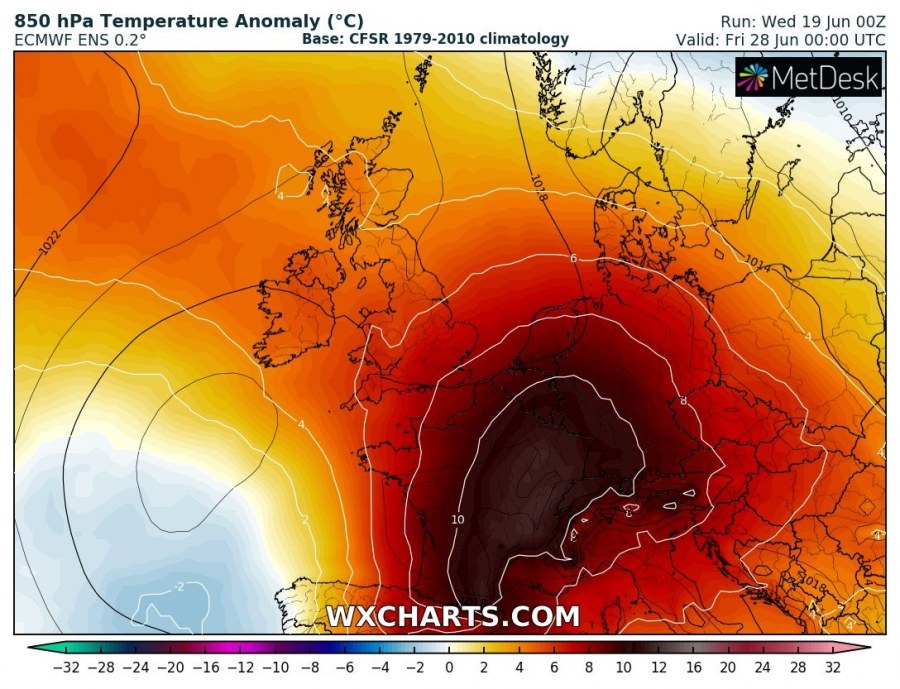
The heat wave starts after Sunday when a powerful upper ridge develops over our continent. As soon as the omega pattern establishes, strong warm advection should take place with a ‘Spanish plume’ from SW Europe. Models are trending with very extreme temperature anomaly for the near-surface layers, locally reaching 12-16 °C above normal for late June!
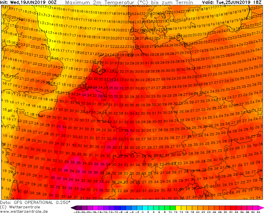
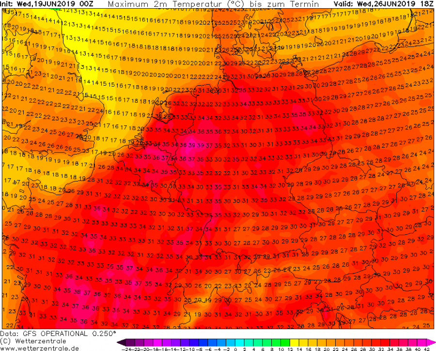
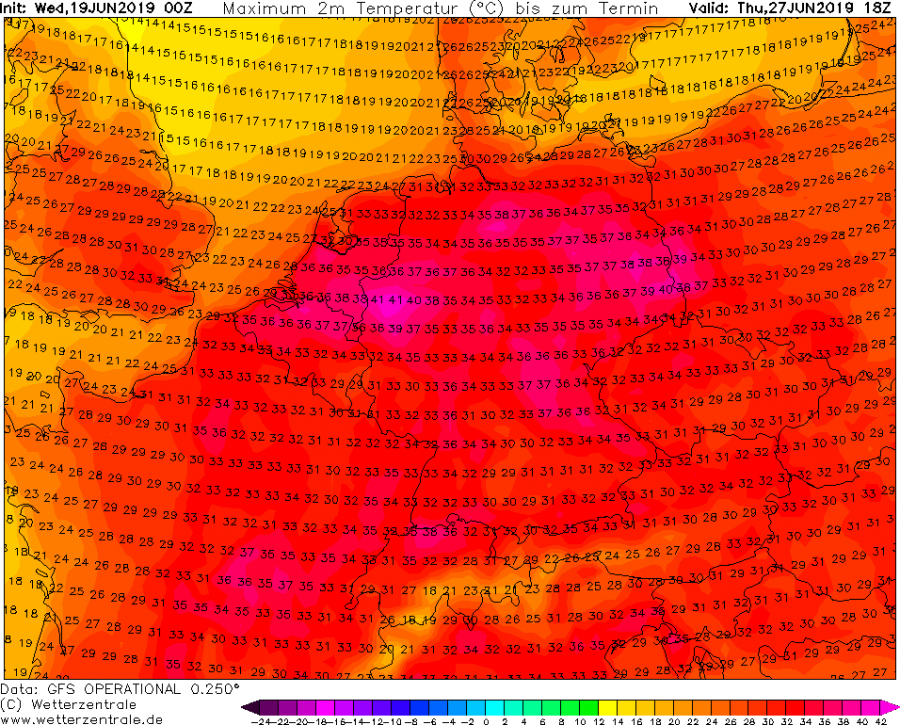
GFS model is hinting the peak afternoon temperatures will climb well above 35 °C in some areas. Starting with near this threshold on Tuesday across E France and Benelux, then intensifying on Wednesday also over NW Germany and central France. On Thursday, the heat wave would eventually peak over Germany with local temperatures ever approaching 40 °C in NW and NE Germany while on Friday, a cold front might push from the west and finish the heat wave, but the excessive heat would then push towards the Alpine region and Poland / Czechia as well.
It looks like Europe is heading for a very significant heat wave through the remainder of June. Extreme heat could develop over some areas, locally reaching 35-40 °C in the afternoons next week. Such anomalous temperatures would likely break June records in some areas – stay tuned for additional details in the coming days!
