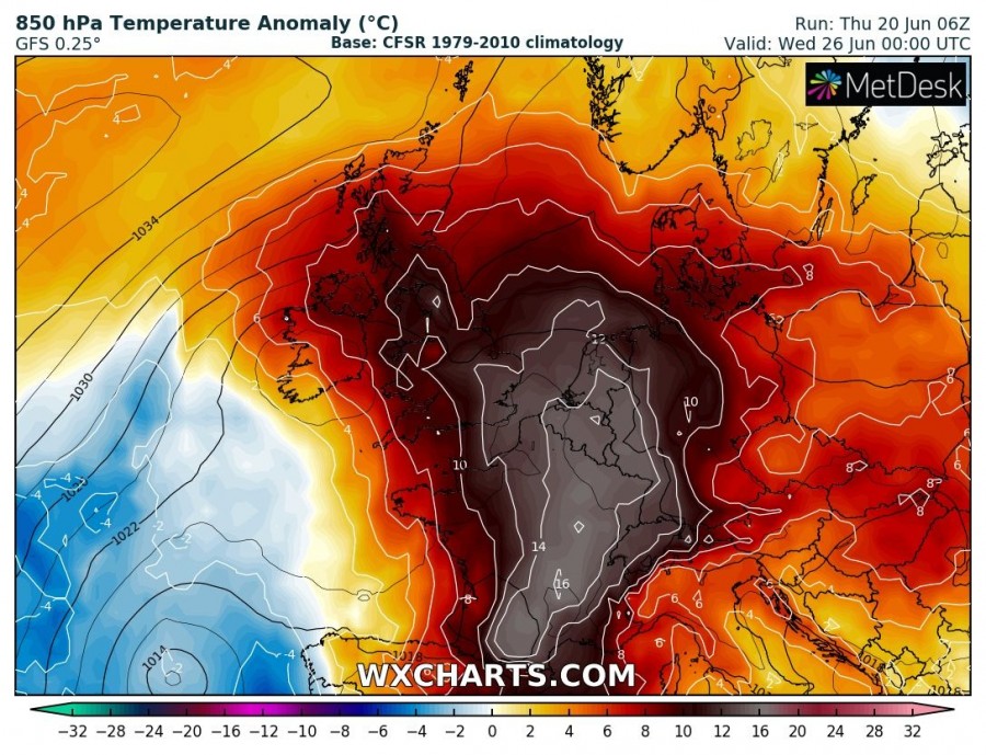
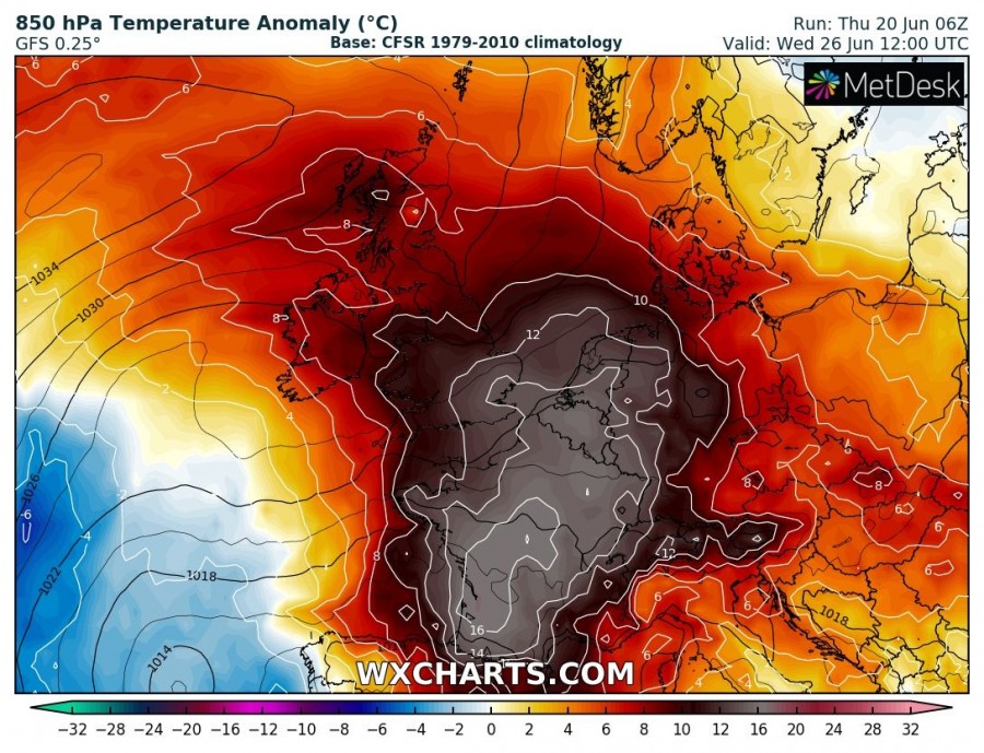
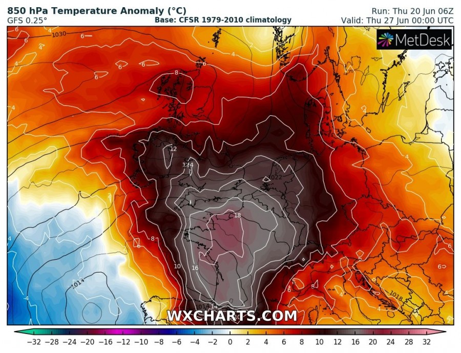
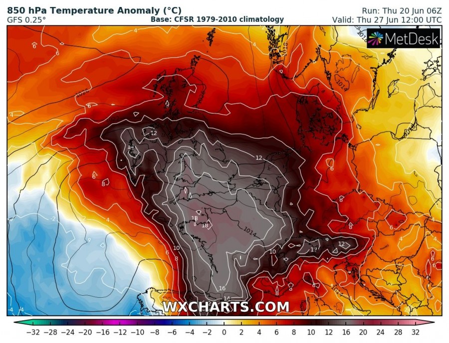
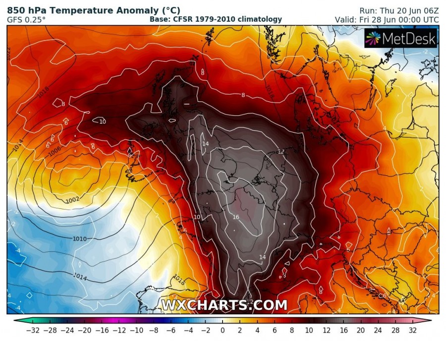
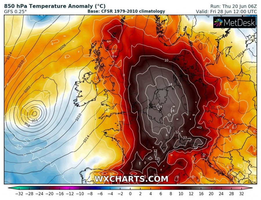
The latest model guidance by both GFS and ECMWF is in quite good agreement in the development of a very intense heat wave early next week, with 16 to almost 20 °C warmer temperatures than average at 850 mbar level lasting until the weekend. This could possibly push near-surface peak afternoon temperatures into low 30s across S England and upper 30s (36-40 °C) across parts of France, Benelux and Germany from Tuesday through Saturday! Let us take a look over the latest trends based on the GFS model across western Europe.
The 850 mbar temperature anomaly sequence indicates the heat wave will significantly intensify by Tuesday over France, expanding into UK and Ireland on Wednesday and continue across Benelux and Germany until Saturday. It appears more likely now that heat will develop also across England while pretty warm days are also increasingly likely over Ireland and Scotland.
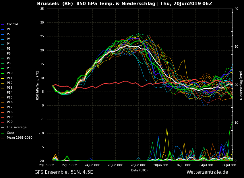
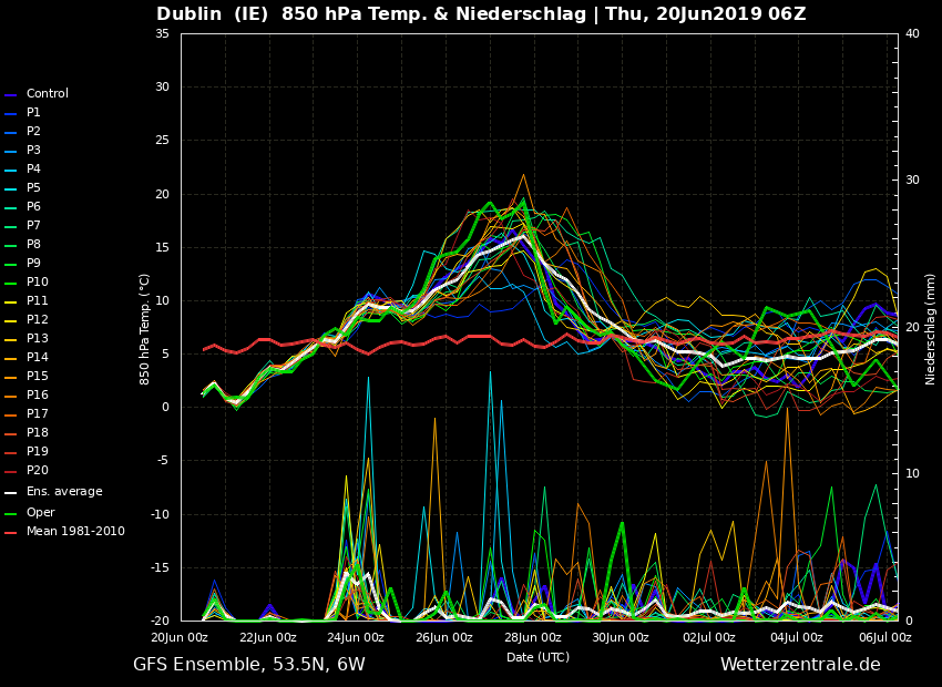
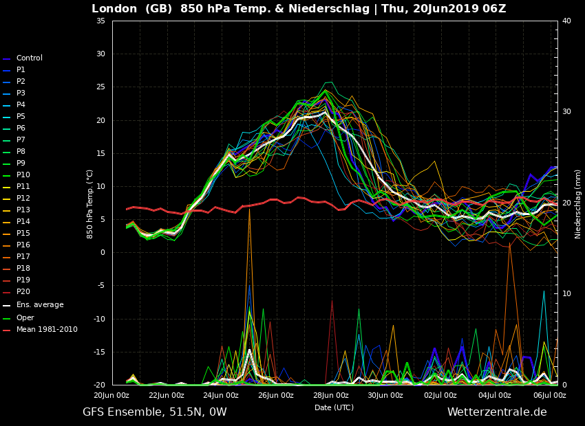
How *intense* the heat wave actually will be, is best seen on the ensemble forecast for certain points across the western Europe. Attached are ensembles for major cities / capitals of France, England, Belgium and Ireland.
Ensemble forecast for Paris, France – about 16-18 °C warmer than average
Ensemble forecast for Brussels, Belgium – about 15-17 °C warmer than average
Ensemble forecast for Dublin, Ireland – about 10-12 °C warmer than average
Ensemble forecast for London, England – about 15-17 °C warmer than average
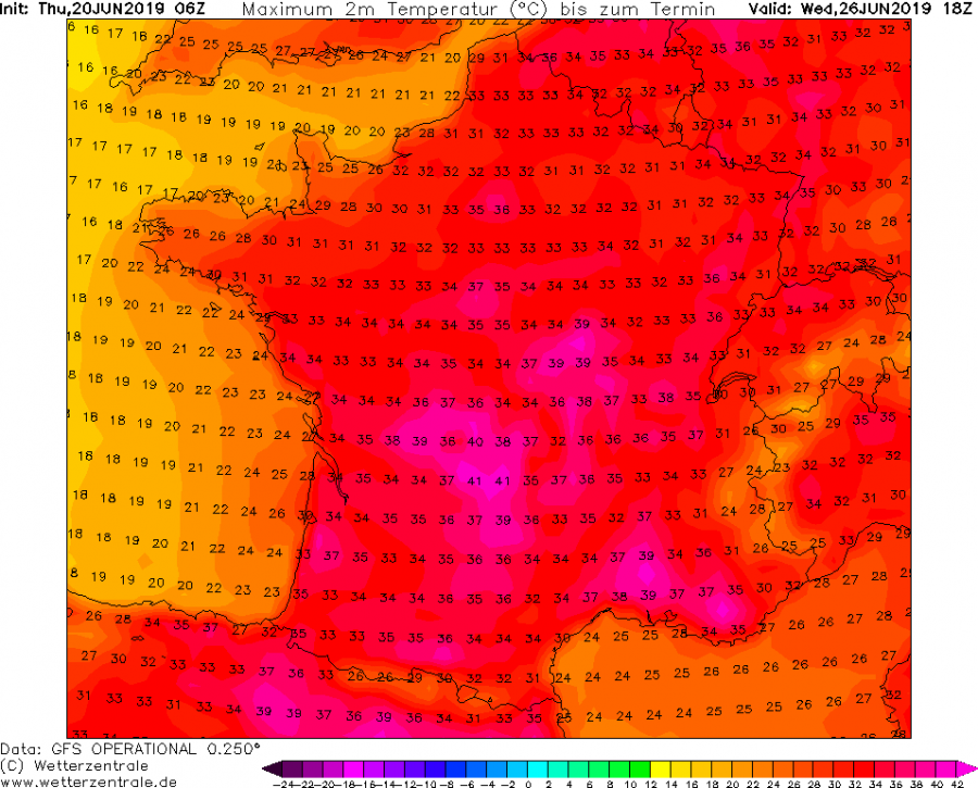
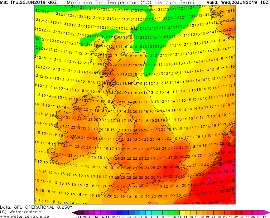
Peak temperatures across UK, Ireland and France on Wednesday, June 26th – even up to +41 °C in south-central France, up to +32 in SE England!
Stay tuned for further updates – we will refresh model data when additional details will be available.
