SYNOPSIS
A deep trough is located over N Europe while the N Atlantic trough pushes into W Europe with an intense cyclone across the Bay of Biscay into France. A short-wave trough over Balkan peninsula moves into SE Europe with an active cold front to its east. Upper ridge over Iberia expands into W Mediterranean.
DISCUSSION
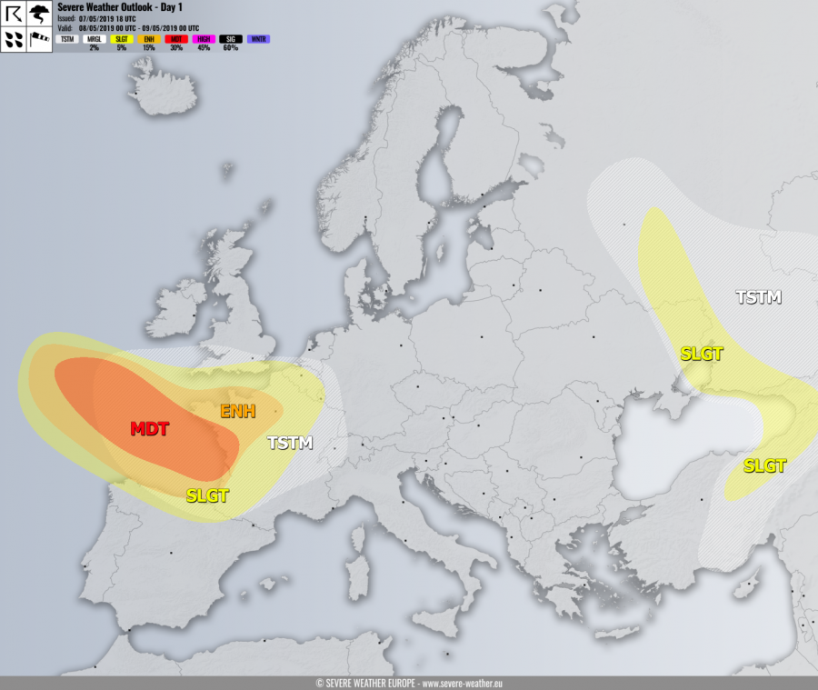
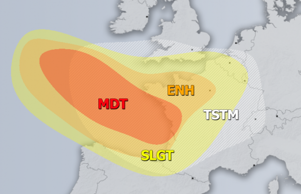
MDT risk has been issued for the Bay of Biscay into W France with threat for severe to extremely severe winds, locally in excess of 120 km/h, associated with a deep cyclone moving into France. Major swell is also expected along the coasts.
ENH risk has been issued for areas surrounding the MDT risk including the Bay of Biscay, extreme NW Spain into NW France with threat for severe severe winds, locally in excess of 100 km/h. ENH risk has also been expanded into N France where convective storms are likely along the front, as good shear and marginal instability should support organized storms including supercells with marginal hail, severe winds and torrential rainfall.
SLGT risk has been issued for areas surrounding the MDT / ENH risks including N Spain into north-central France, Belgium and S England with threat for isolated severe storms, capable of producing marginal hail, severe winds and torrential rainfall.
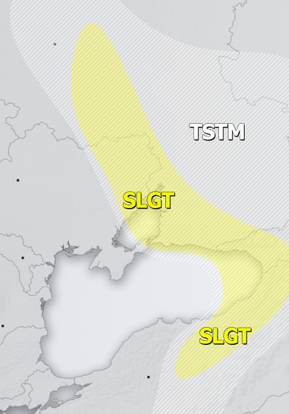
SLGT risk has been issued for SW Russia, W Georgia into NE Turkey with threat for severe storms, capable of producing large hail, severe winds and torrential rainfall. Some tornado threat also exists where LL helicity and shear will be enhanced (E Ukraine and north).
TSTM risk areas have been placed where convective storms are likely to occur but should remain sub-severe.
Mesoscale Discussion:
Deep low and windy weather for the Bay of Biscay, western France and northern Spain – May 7-8, 2019


