It is almost like a game. First we have a cold front coming this week from the north, bringing colder air into central and eastern Europe, aided by the strengthening blocking ridge over the Atlantic. Next week that ridge will move over Europe, replacing the cold north air, with warmth from the southwest.
As we wrote on Saturday, there is a cold front sweeping over the central and eastern Europe from the north this week, reducing air temperature by up to 10°C in some places. It is already descending down from Scandinavia as we write this article, and is forecast to sweep over central and eastern Europe on Tuesday night and on Wednesday, cooling the temperatures to quite below normal for this time of year.
850mb temperature anomaly forecast. Image by Tropical Tidbits.
2-meter temperature anomaly forecast. Image by Tropical Tidbits.
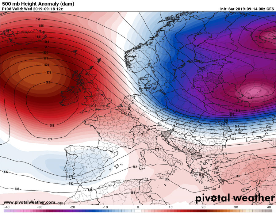
A strong blocking ridge is developing over the Atlantic, that will also power this cold front, as it promotes north flow on its east side. The main driver is the strong trough coming down from Scandinavia, moving into eastern Europe and Russia.
500mb geopotential height forecast from GFS. Image by Pivotalweather.
But that same ridge will move towards east over Europe, and will replace this cold wave with a warm wave early next week.
500mb geopotential height forecast from GFS. Image by Pivotalweather.
Temperatures will raise again across much of Europe, except the eastern parts, where the colder air will persist for a day or two longer, before it is replaced by the warmer airmass.
850mb temperature anomaly forecast. Image by Tropical Tidbits.
2-meter temperature anomaly forecast. Image by Tropical Tidbits.
Interesting development is ahead, and a great display of early autumn weather dynamics.


